|
Telpyn Point
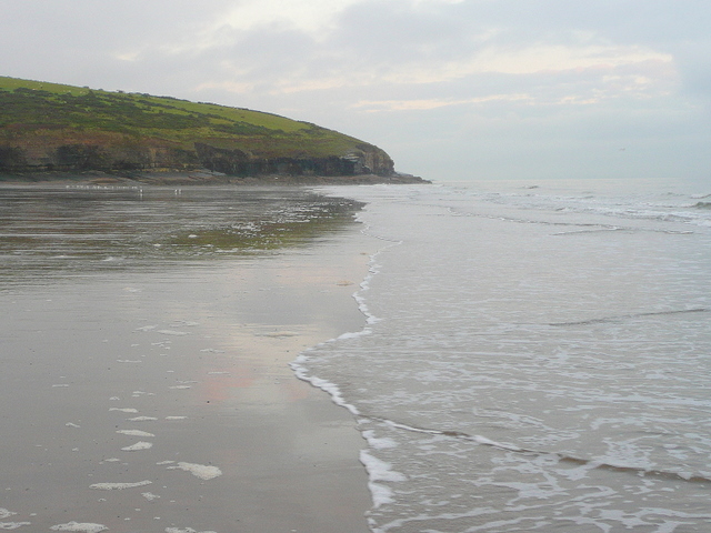
Telpyn Point is a headland on the Carmarthenshire coast, Wales. Set at the back of Carmarthen Bay, to its east are Marros Sands and to the west a beach which stretches in front of the Pembrokeshire village of Amroth. There are numerous sea caves in the quartzitic sandstone cliffs here. A path around the headland carries the Wales Coast Path. The Marros-Pendine Coast is protected as a 'mixed' Site of Special Scientific Interest, i.e. for its biological and geological interest. The good geological exposure of Carboniferous age rock strata at Telpyn Point has led to its name being given to the Telpyn Point Sandstone Formation, a sub-unit of the Marros Group The Marros Group is the name given to a suite of rocks of Namurian age laid down during the Carboniferous Period in South Wales. These rocks were formerly known as the Millstone Grit Series but are now distinguished from the similar but geogra ..., the modern scientific name for the Millstone Grit series of South Wales. ... [...More Info...] [...Related Items...] OR: [Wikipedia] [Google] [Baidu] |
Carmarthenshire
Carmarthenshire ( cy, Sir Gaerfyrddin; or informally ') is a county in the south-west of Wales. The three largest towns are Llanelli, Carmarthen and Ammanford. Carmarthen is the county town and administrative centre. The county is known as the "Garden of Wales" and is also home to the National Botanic Garden of Wales. Carmarthenshire has been inhabited since prehistoric times. The county town was founded by the Romans, and the region was part of the Kingdom of Deheubarth in the High Middle Ages. After invasion by the Normans in the 12th and 13th centuries it was subjugated, along with other parts of Wales, by Edward I of England. There was further unrest in the early 15th century, when the Welsh rebelled under Owain Glyndŵr, and during the English Civil War. Carmarthenshire is mainly an agricultural county, apart from the southeastern part which was once heavily industrialised with coal mining, steel-making and tin-plating. In the north of the county, the woollen in ... [...More Info...] [...Related Items...] OR: [Wikipedia] [Google] [Baidu] |
Wales
Wales ( cy, Cymru ) is a Countries of the United Kingdom, country that is part of the United Kingdom. It is bordered by England to the Wales–England border, east, the Irish Sea to the north and west, the Celtic Sea to the south west and the Bristol Channel to the south. It had a population in 2021 of 3,107,500 and has a total area of . Wales has over of coastline and is largely mountainous with its higher peaks in the north and central areas, including Snowdon (), its highest summit. The country lies within the Temperateness, north temperate zone and has a changeable, maritime climate. The capital and largest city is Cardiff. Welsh national identity emerged among the Celtic Britons after the Roman withdrawal from Britain in the 5th century, and Wales was formed as a Kingdom of Wales, kingdom under Gruffydd ap Llywelyn in 1055. Wales is regarded as one of the Celtic nations. The Conquest of Wales by Edward I, conquest of Wales by Edward I of England was completed by 1283, th ... [...More Info...] [...Related Items...] OR: [Wikipedia] [Google] [Baidu] |
Carmarthen Bay
Carmarthen Bay ( cy, Bae Caerfyrddin) is an inlet of the South Wales coast, including notable beaches such as Pendine Sands and Cefn Sidan sands. Carmarthen Bay is partially within the Pembrokeshire Coast National Park. The Joint Nature Conservation Committee list Carmarthen Bay and Estuaries as a Special Area of Conservation. Geography The River Loughor flows into the bay at the Burry estuary, and the rivers Tywi, Taf and Gwendraeth flow into the bay at the Three Rivers Estuary. Caldey Island lies in the bay near Tenby. The northwestern corner of the bay is separately named as Saundersfoot Bay. Towns and villages in the bay include, from east to west: Llanelli, Burry Port (''Porth Tywyn''), Pembrey (''Penbre''), Kidwelly (''Cydweli''), Ferryside (''Glanyfferi''), Llansteffan, Laugharne (''Talacharn''), Pendine (''Pentywyn''), Amroth, Wisemans Bridge (''Pont-yr-ŵrddoeth''), Saundersfoot and Tenby (''Dinbych y Pysgod''). There are fine beaches at Pendine Sands, Cefn Sidan, ... [...More Info...] [...Related Items...] OR: [Wikipedia] [Google] [Baidu] |
Marros Sands
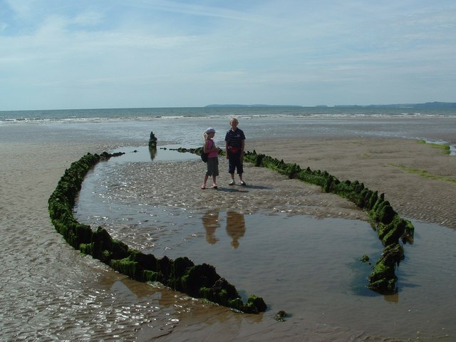
Marros Sands is a beach in Carmarthenshire between Amroth and Pendine and to the south of the small settlement of Marros. The beach is separated from Amroth beach to the west by Telpyn Point and from Morfabychan beach to the east by Ragwen Point. The land to the north of the beach is formed from cliffs and hillside that slopes steeply up towards Marros Beacon. There are caves towards the western end. The beach is mostly a storm bank of stones and gravel above Mean High Water with a large mostly sandy beach appearing when the tide is lower. It was described in 1844 as "a fine sandy beach, a few miles in length, and well-adapted for sea-bathing from the shallowness of the water for a considerable distance from the shore" and more recently as "relatively unspoilt" when compared to the tourist honeypots nearby. An area of submerged alder, oak and willow forest 100 m wide and 2 km long and dating from 4000/6000 years ago can be seen at low tides. It was particularly visible in 197 ... [...More Info...] [...Related Items...] OR: [Wikipedia] [Google] [Baidu] |
Pembrokeshire
Pembrokeshire ( ; cy, Sir Benfro ) is a county in the south-west of Wales. It is bordered by Carmarthenshire to the east, Ceredigion to the northeast, and the rest by sea. The county is home to Pembrokeshire Coast National Park. The Park occupies more than a third of the area of the county and includes the Preseli Hills in the north as well as the Pembrokeshire Coast Path. Historically, mining and fishing were important activities, while industry nowadays is focused on agriculture (86 per cent of land use), oil and gas, and tourism; Pembrokeshire's beaches have won many awards. The county has a diverse geography with a wide range of geological features, habitats and wildlife. Its prehistory and modern history have been extensively studied, from tribal occupation, through Roman times, to Welsh, Irish, Norman, English, Scandinavian and Flemish influences. Pembrokeshire County Council's headquarters are in the county town of Haverfordwest. The council has a majority of Independ ... [...More Info...] [...Related Items...] OR: [Wikipedia] [Google] [Baidu] |
Amroth
Amroth is both a village, a parish and a Community (Wales), community northeast of Tenby, Pembrokeshire, Wales. Located on Carmarthen Bay, Amroth is noted for its long sandy beach which stretches the length of the village. It regularly earns a Blue Flag beach, Blue Flag award. and is the south-to-north start of the Pembrokeshire Coast Path. Amroth is within the Pembrokeshire Coast National Park. The name is Welsh language, Welsh, and probably means "on (the brook called) Rhath". History The beach stretches the whole length of the village and at extreme low tide, the petrified forest, destroyed when sea levels rose 7,000 years ago, can still be seen. Fossilised antlers, nuts and animal bones and Neolithic flints have been discovered. The parish, which appeared as ''Amrath'' on a 1578 parish map of Pembrokeshire, was an important anthracite coal mining area until the end of the 19th century. Slight remains of mines and tramways are still visible. Ruins of Amroth Castle still rem ... [...More Info...] [...Related Items...] OR: [Wikipedia] [Google] [Baidu] |
Quartzite
Quartzite is a hard, non- foliated metamorphic rock which was originally pure quartz sandstone.Essentials of Geology, 3rd Edition, Stephen Marshak, p 182 Sandstone is converted into quartzite through heating and pressure usually related to tectonic compression within orogenic belts. Pure quartzite is usually white to grey, though quartzites often occur in various shades of pink and red due to varying amounts of hematite. Other colors, such as yellow, green, blue and orange, are due to other minerals. The term ''quartzite'' is also sometimes used for very hard but unmetamorphosed sandstones that are composed of quartz grains thoroughly cemented with additional quartz. Such sedimentary rock has come to be described as orthoquartzite to distinguish it from metamorphic quartzite, which is sometimes called metaquartzite to emphasize its metamorphic origins. Quartzite is very resistant to chemical weathering and often forms ridges and resistant hilltops. The nearly pure silica co ... [...More Info...] [...Related Items...] OR: [Wikipedia] [Google] [Baidu] |
Sandstone
Sandstone is a clastic sedimentary rock composed mainly of sand-sized (0.0625 to 2 mm) silicate grains. Sandstones comprise about 20–25% of all sedimentary rocks. Most sandstone is composed of quartz or feldspar (both silicates) because they are the most resistant minerals to weathering processes at the Earth's surface. Like uncemented sand, sandstone may be any color due to impurities within the minerals, but the most common colors are tan, brown, yellow, red, grey, pink, white, and black. Since sandstone beds often form highly visible cliffs and other topographic features, certain colors of sandstone have been strongly identified with certain regions. Rock formations that are primarily composed of sandstone usually allow the percolation of water and other fluids and are porous enough to store large quantities, making them valuable aquifers and petroleum reservoirs. Quartz-bearing sandstone can be changed into quartzite through metamorphism, usually r ... [...More Info...] [...Related Items...] OR: [Wikipedia] [Google] [Baidu] |
Wales Coast Path
The Wales Coast Path ( cy, Llwybr Arfordir Cymru) is a designated long-distance trail which follows, or runs close to, the coastline of Wales. Launched in 2012, the footpath is long and was heralded as the first dedicated coast path in the world to cover the entire length of a country's coastline. The Wales Coast Path runs through eleven national nature reserves and other nature reserves such as those managed by the Royal Society for the Protection of Birds and The Wildlife Trusts.www.firstnature.com - wales Coast Path . Retrieved 2 January 2012. 
[...More Info...] [...Related Items...] OR: [Wikipedia] [Google] [Baidu] |
Site Of Special Scientific Interest
A Site of Special Scientific Interest (SSSI) in Great Britain or an Area of Special Scientific Interest (ASSI) in the Isle of Man and Northern Ireland is a conservation designation denoting a protected area in the United Kingdom and Isle of Man. SSSI/ASSIs are the basic building block of site-based nature conservation legislation and most other legal nature/geological conservation designations in the United Kingdom are based upon them, including national nature reserves, Ramsar sites, Special Protection Areas, and Special Areas of Conservation. The acronym "SSSI" is often pronounced "triple-S I". Selection and conservation Sites notified for their biological interest are known as Biological SSSIs (or ASSIs), and those notified for geological or physiographic interest are Geological SSSIs (or ASSIs). Sites may be divided into management units, with some areas including units that are noted for both biological and geological interest. Biological Biological SSSI/A ... [...More Info...] [...Related Items...] OR: [Wikipedia] [Google] [Baidu] |
Outcrop
An outcrop or rocky outcrop is a visible exposure of bedrock or ancient superficial deposits on the surface of the Earth. Features Outcrops do not cover the majority of the Earth's land surface because in most places the bedrock or superficial deposits are covered by soil and vegetation and cannot be seen or examined closely. However, in places where the overlying cover is removed through erosion or tectonic uplift, the rock may be exposed, or ''crop out''. Such exposure will happen most frequently in areas where erosion is rapid and exceeds the weathering rate such as on steep hillsides, mountain ridges and tops, river banks, and tectonically active areas. In Finland, glacial erosion during the last glacial maximum (ca. 11000 BC), followed by scouring by sea waves, followed by isostatic uplift has produced many smooth coastal and littoral outcrops. Bedrock and superficial deposits may also be exposed at the Earth's surface due to human excavations such as quarrying and bui ... [...More Info...] [...Related Items...] OR: [Wikipedia] [Google] [Baidu] |


.jpg)

Saunders_Quarry-1.jpg)
