|
Tegelen
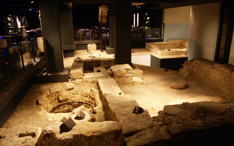
Tegelen ( li, Tegele) is a village in the municipality of Venlo, situated in the Netherlands. It was an independent municipality until 2001, when it was merged into the municipality of Venlo. Tiglian The name of the glacial stage of Tiglian (part of the Pleistocene) is derived from Tegelen because of the many fossils found there from this era in the local clay. History During excavations in Tegelen Roman pottery and tile ovens were found. The Sint-Martinus church is mentioned in diocesan and monasterial archives dating back to the year 800. Because of its strategic location, various castles and reinforced farms were soon established. The most important of these were the and the . During the Middle Ages, there were several battles in and around Tegelen, because of its proximity to the walled city of Venlo. Over time, a barracks was established in Venlo, and a fortification in neighbouring Blerick. As a result, from the 16th century until the 18th century Tegelen was regularl ... [...More Info...] [...Related Items...] OR: [Wikipedia] [Google] [Baidu] |
Venlo
Venlo () is a city and municipality in the southeastern Netherlands, close to the border with Germany. It is situated in the province of Limburg, about 50 km east of the city of Eindhoven, 65 km north east of the provincial capital Maastricht, and 45 km north west of Düsseldorf in Germany. The municipality of Venlo counted 101,578 inhabitants as of January 2019.Statistics Netherlands (CBS), Retrieved on 6 March 2019. History Early history Roman and Celtic coins have been found in Venlo; it was speculated to have been the settlement known as '' Sablones'' on the Roman road connecting Maastricht with Xanten, but the little evidence there is concerning the location of Sablones speaks against this thought while there is no evidence in support of it. Blerick, on the west bank, was known as ''Blariacum''. Documents from the 9th century mention Venlo as a trade post; it developed into one of the more important ones in the Meuse-Rhine area, receiving city rights in 1343, and beco ... [...More Info...] [...Related Items...] OR: [Wikipedia] [Google] [Baidu] |
Steyl
Steyl (; li, Sjteil ) is a village in the Tegelen district of the municipality of Venlo, the Netherlands. The village on the river Meuse is mainly known for its monasteries. In 2004, a section of the village including four monasteries was made a conservation area under protection of the Dutch heritage agency Rijksdienst voor het Cultureel Erfgoed (''beschermd dorpsgezicht Steyl'' or ''kloosterdorp Steyl''). Location Steyl is situated on the right bank of the river Meuse in the northern part of the province of Limburg. It is located close to the border with Germany. A ferry connects Steyl with Baarlo. Steyl is divided into two areas: # Old Steyl: The old village, located west of Roermondseweg, the main road in Tegelen. Most of the old village is a conservation area. # New Steyl: A newer area, located east of Roermondseweg. This area is locally known as Alland. In the past, Steyl often had to deal with floods when the river Meuse burst its banks. Major floods occurred in 1993 ... [...More Info...] [...Related Items...] OR: [Wikipedia] [Google] [Baidu] |
Tiglian
The Tiglian, also referred to as the Tegelen, is a temperate complex stage in the glacial history of Northern Europe. It is preceded by the Praetiglian (stage). The stage was introduced by Zagwijn in 1957 based on geological formations in Tegelen in southern Netherlands. Originally, it was thought to be part of a sequence of glacials and interglacials, namely Praetiglian (cold), Tiglian (warm), Eburonian (cold), Waalian (warm), Menapian (cold), and Bavelian (warm). The Praetiglian and Tiglian are today regarded as corresponding to the Biber stage in the glacial history of the Alps and to the Gelasian (2.6-1.8 million years ago) in the global division of the Quaternary period. Deep sea core samples have identified approximately 40 marine isotope stages (MIS 103 – MIS 64) during the Gelasian. Thus, there have probably been about 20 glacial cycles of varying intensity during Praetiglian and Tiglian. The dominant trigger is believed to be the 41 000 year Milankovitch cycles of ax ... [...More Info...] [...Related Items...] OR: [Wikipedia] [Google] [Baidu] |
Duchy Of Jülich
The Duchy of Jülich (german: Herzogtum Jülich; nl, Hertogdom Gulik; french: Duché de Juliers) comprised a state within the Holy Roman Empire from the 11th to the 18th centuries. The duchy lay west of the Rhine river and was bordered by the Electorate of Cologne to the east and the Duchy of Limburg to the west. It had territories on both sides of the river Rur, around its capital Jülich – the former Roman ''Iuliacum'' – in the lower Rhineland. The duchy amalgamated with the County of Berg beyond the Rhine in 1423, and from then on also became known as ''Jülich-Berg''. Later it became part of the United Duchies of Jülich-Cleves-Berg. Its territory lies in present-day Germany (part of North Rhine-Westphalia) and in the present-day Netherlands (part of the Limburg (Netherlands), Limburg province), its population sharing the same Limburgish dialect. History In the 9th century a certain Matfried was count of Jülich (pagus Juliacensis). The first count in the Gau ... [...More Info...] [...Related Items...] OR: [Wikipedia] [Google] [Baidu] |
Roer (department)
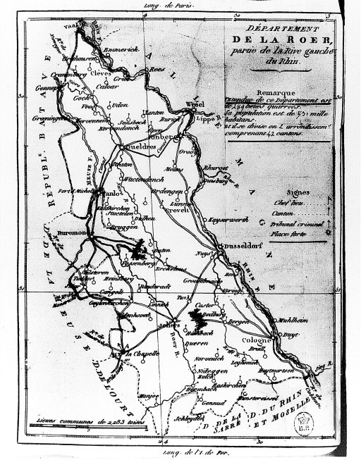
Roer was a department of the French First Republic and later First French Empire in present-day Germany and the Netherlands. It was named after the river Roer (Rur), which flows through the department. It was formed in 1797, when the left bank of the Rhine was occupied by the French. The department was formed from the duchies of Jülich and Cleves, the part of the Archbishopric of Cologne left of the Rhine, the Free City of Aachen, the Prussian part of the duchy of Guelders and some smaller territories. In 1805 the city of Wesel was added to the department. The capital was Aix-la-Chapelle (''Aachen''). The department was subdivided in the following arrondissements and cantons (situation in 1812):Almanach Impérial an bissextil MDCCCXII p. 458-9, accessed in [...More Info...] [...Related Items...] OR: [Wikipedia] [Google] [Baidu] |
List Of Sovereign States
The following is a list providing an overview of sovereign states around the world with information on their status and recognition of their sovereignty. The 206 listed states can be divided into three categories based on membership within the United Nations System: 193 member states of the United Nations, UN member states, 2 United Nations General Assembly observers#Present non-member observers, UN General Assembly non-member observer states, and 11 other states. The ''sovereignty dispute'' column indicates states having undisputed sovereignty (188 states, of which there are 187 UN member states and 1 UN General Assembly non-member observer state), states having disputed sovereignty (16 states, of which there are 6 UN member states, 1 UN General Assembly non-member observer state, and 9 de facto states), and states having a political status of the Cook Islands and Niue, special political status (2 states, both in associated state, free association with New Zealand). Compi ... [...More Info...] [...Related Items...] OR: [Wikipedia] [Google] [Baidu] |
Fortification
A fortification is a military construction or building designed for the defense of territories in warfare, and is also used to establish rule in a region during peacetime. The term is derived from Latin ''fortis'' ("strong") and ''facere'' ("to make"). From very early history to modern times, defensive walls have often been necessary for cities to survive in an ever-changing world of invasion and conquest. Some settlements in the Indus Valley civilization were the first small cities to be fortified. In ancient Greece, large stone walls had been built in Mycenaean Greece, such as the ancient site of Mycenae (famous for the huge stone blocks of its ' cyclopean' walls). A Greek '' phrourion'' was a fortified collection of buildings used as a military garrison, and is the equivalent of the Roman castellum or English fortress. These constructions mainly served the purpose of a watch tower, to guard certain roads, passes, and borders. Though smaller than a real fortress, th ... [...More Info...] [...Related Items...] OR: [Wikipedia] [Google] [Baidu] |
Maastricht
Maastricht ( , , ; li, Mestreech ; french: Maestricht ; es, Mastrique ) is a city and a municipality in the southeastern Netherlands. It is the capital and largest city of the province of Limburg. Maastricht is located on both sides of the Meuse ( nl, Maas), at the point where the Jeker joins it. Mount Saint Peter (''Sint-Pietersberg'') is largely situated within the city's municipal borders. Maastricht is about 175 km south east of the capital Amsterdam and 65 km from Eindhoven; it is adjacent to the border with Belgium and is part of the Meuse-Rhine Euroregion, an international metropolis with a population of about 3.9 million, which includes the nearby German and Belgian cities of Aachen, Liège and Hasselt. Maastricht developed from a Roman settlement (''Trajectum ad Mosam'') to a medieval religious centre. In the 16th century it became a garrison town and in the 19th century an early industrial centre. Today, the city is a thriving cultural and regional hub. It ... [...More Info...] [...Related Items...] OR: [Wikipedia] [Google] [Baidu] |
United Kingdom Of The Netherlands
The United Kingdom of the Netherlands ( nl, Verenigd Koninkrijk der Nederlanden; french: Royaume uni des Pays-Bas) is the unofficial name given to the Kingdom of the Netherlands as it existed between 1815 and 1839. The United Netherlands was created in the aftermath of the Napoleonic Wars through the fusion of territories that had belonged to the former Dutch Republic, Austrian Netherlands, and Prince-Bishopric of Liège in order to form a buffer state between the major European powers. The polity was a constitutional monarchy, ruled by William I of the House of Orange-Nassau. The polity collapsed in 1830 with the outbreak of the Belgian Revolution. With the ''de facto'' secession of Belgium, the Netherlands was left as a rump state and refused to recognise Belgian independence until 1839 when the Treaty of London was signed, fixing the border between the two states and guaranteeing Belgian independence and neutrality as the Kingdom of Belgium. Background Before the French R ... [...More Info...] [...Related Items...] OR: [Wikipedia] [Google] [Baidu] |
Napoleon Bonaparte
Napoleon Bonaparte ; it, Napoleone Bonaparte, ; co, Napulione Buonaparte. (born Napoleone Buonaparte; 15 August 1769 – 5 May 1821), later known by his regnal name Napoleon I, was a French military commander and political leader who rose to prominence during the French Revolution and led successful campaigns during the Revolutionary Wars. He was the ''de facto'' leader of the French Republic as First Consul from 1799 to 1804, then Emperor of the French from 1804 until 1814 and again in 1815. Napoleon's political and cultural legacy endures to this day, as a highly celebrated and controversial leader. He initiated many liberal reforms that have persisted in society, and is considered one of the greatest military commanders in history. His wars and campaigns are studied by militaries all over the world. Between three and six million civilians and soldiers perished in what became known as the Napoleonic Wars. Napoleon was born on the island of Corsica, not long a ... [...More Info...] [...Related Items...] OR: [Wikipedia] [Google] [Baidu] |
Sittard
Sittard (; ) is a city in the Netherlands, situated in the southernmost province of Limburg. The town is part of the municipality of Sittard-Geleen and has almost 37.500 inhabitants in 2016. In its east, Sittard borders the German municipality of Selfkant (in the state of North Rhine-Westphalia). The city centre is located at 45 m above sea level. History Archaeological discoveries have dated the first settlement in the Sittard area around 5000 B.C. Present day Sittard is assumed to have been founded around 850 A.D. and to have been built around a motte. Sittard was first mentioned in 1157. It was granted city rights by the Duke of Limburg in 1243. In 1400 it was sold to the Duchy of Jülich, and remained in its possession until 1794. The city was destroyed and rebuilt repeatedly, due to fires and various conflicts during the 15th-17th century. It was a stronghold until it was largely destroyed in 1677, during the Franco-Dutch War. Under French occupation (1794-1814), ... [...More Info...] [...Related Items...] OR: [Wikipedia] [Google] [Baidu] |
Urmond
Urmond is a village in the Dutch province of Limburg. It is located in the municipality of Stein. The village was first mentioned in 1153 as Ouermunte. The current name means "mouth of the Ur", however the Ur has later moved to village. Urmond developed on the higher bank of the Maas. In 1400, it became part of the Duchy of Jülich The Duchy of Jülich (german: Herzogtum Jülich; nl, Hertogdom Gulik; french: Duché de Juliers) comprised a state within the Holy Roman Empire from the 11th to the 18th centuries. The duchy lay west of the Rhine river and was bordered by th .... The Old St Martinus Church was built between 1791 and 1793. The medieval tower was placed in 1841. The cemetery is artificially heightened. In 1695, a Dutch Reformed church was built in Urmond which is exceptional in Limburg. Urmond was home to 600 people in 1840. Urmond was a separate municipality until 1982, when it was merged with Stein. Gallery File:Urmond-Kattekop (5).jpg, Apartment buildings ... [...More Info...] [...Related Items...] OR: [Wikipedia] [Google] [Baidu] |


