|
Te Afualiku
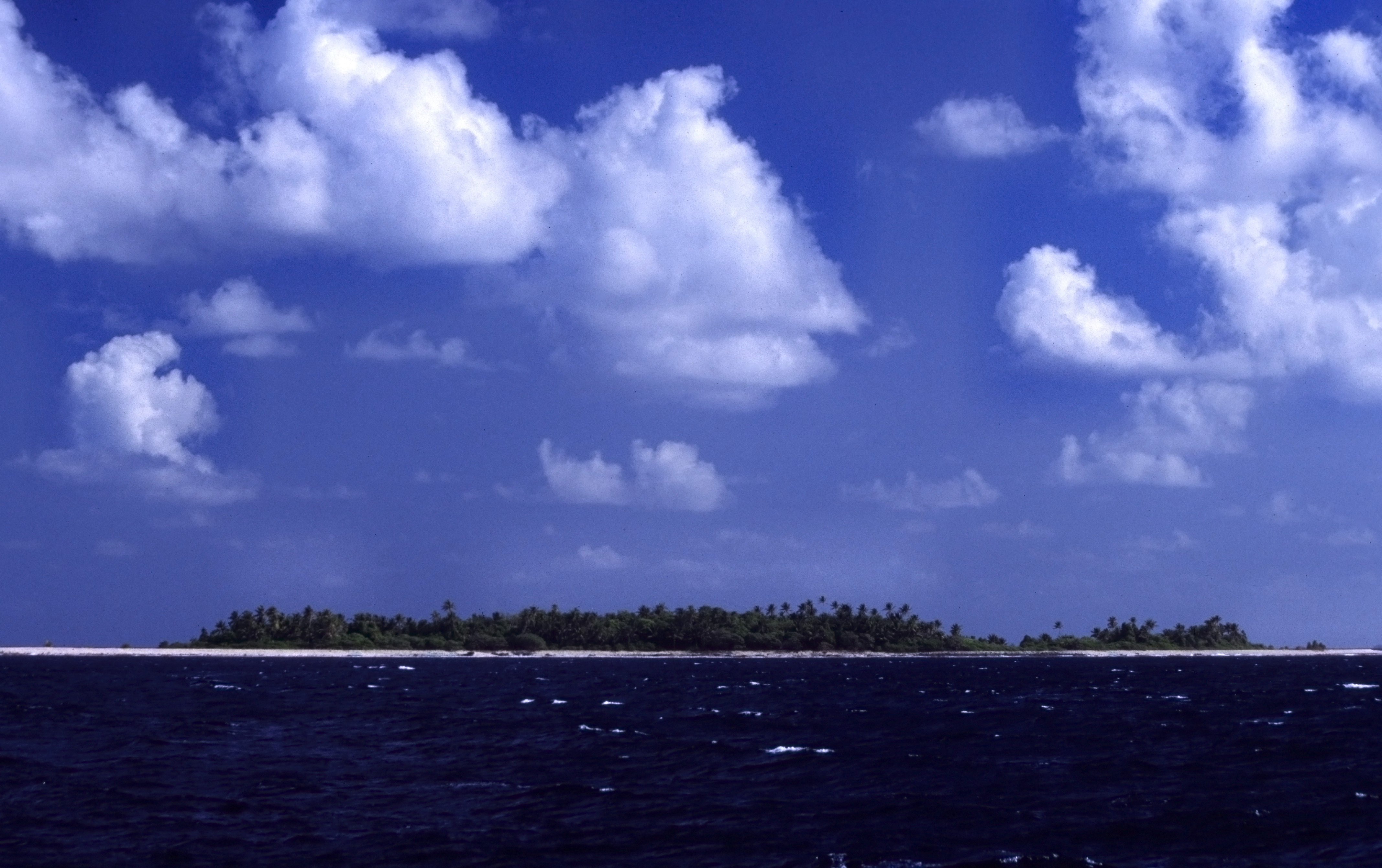
Te Afualiku is an Island, islet of Funafuti, Tuvalu. Te Ava Tepuka and Te Avua Sari are two neighbouring passages through Funafuti atoll in the northeast, between the islets of Te Afualiku to the northeast and Tepuka to the southwest. Te Ava i te Lape is the favoured entrance into the lagoon, although it has a depth of only 5.8 metres, and a width of barely 500 metres. It is in the north, between the islets of Pava to the east and Te Afualiku to the west. References Islands of Tuvalu Pacific islands claimed under the Guano Islands Act Funafuti {{tuvalu-geo-stub ... [...More Info...] [...Related Items...] OR: [Wikipedia] [Google] [Baidu] |
Island
An island or isle is a piece of subcontinental land completely surrounded by water. Very small islands such as emergent land features on atolls can be called islets, skerries, cays or keys. An island in a river or a lake island may be called an eyot or ait, and a small island off the coast may be called a holm. Sedimentary islands in the Ganges Delta are called chars. A grouping of geographically or geologically related islands, such as the Philippines, is referred to as an archipelago. There are two main types of islands in the sea: continental islands and oceanic islands. There are also artificial islands (man-made islands). There are about 900,000 official islands in the world. This number consists of all the officially-reported islands of each country. The total number of islands in the world is unknown. There may be hundreds of thousands of tiny islands that are unknown and uncounted. The number of sea islands in the world is estimated to be more than 200,000. ... [...More Info...] [...Related Items...] OR: [Wikipedia] [Google] [Baidu] |
Funafuti
Funafuti is the capital of the island nation of Tuvalu. It has a population of 6,320 people (2017 census), and so it has more people than the rest of Tuvalu combined, with approximately 60% of the population. It consists of a narrow sweep of land between wide, encircling a large lagoon (''Te Namo'') long and wide. The average depth of the Funafuti lagoon is about 20 fathoms (36.5 metres or 120 feet). With a surface area of , it is by far the largest lagoon in Tuvalu. The land area of the 33 islets around the atoll of Funafuti totals ; taken together, they constitute less than one percent of the total area of the atoll. Cargo ships can enter Funafuti's lagoon and dock at the port facilities on Fongafale. The capital of Tuvalu is sometimes said to be Fongafale or Vaiaku, but, officially, the entire atoll of Funafuti is its capital, since it has a single government that is responsible for the whole atoll. Fongafale The largest island is Fongafale. The island houses four vi ... [...More Info...] [...Related Items...] OR: [Wikipedia] [Google] [Baidu] |
Tuvalu
Tuvalu ( or ; formerly known as the Ellice Islands) is an island country and microstate in the Polynesian subregion of Oceania in the Pacific Ocean. Its islands are situated about midway between Hawaii and Australia. They lie east-northeast of the Santa Cruz Islands (which belong to the Solomon Islands), northeast of Vanuatu, southeast of Nauru, south of Kiribati, west of Tokelau, northwest of Samoa and Wallis and Futuna, and north of Fiji. Tuvalu is composed of three reef islands and six atolls. They are spread out between the latitude of 5° and 10° south and between the longitude of 176° and 180°. They lie west of the International Date Line. Tuvalu has a population of 10,507 (2017 census). The total land area of the islands of Tuvalu is . The first inhabitants of Tuvalu were Polynesians, according to well-established theories regarding a migration of Polynesians into the Pacific that began about three thousand years ago. Long before European contact with ... [...More Info...] [...Related Items...] OR: [Wikipedia] [Google] [Baidu] |
Tepuka
Tepuka is an island eighteen kilometers west of Fongafale, in the northwest of Funafuti, the main atoll of the Oceanian nation of Tuvalu. Te puka, or Pouka, is the name of a tree - ''Hernandia peltata''.There is a well-preserved underground bunker on the island, which was an American communications outpost built during the Pacific War, which was connected to the military airfield on Fongafale. The island lies between the smaller islet of Tepuka Vili Vili in the southwest, the smaller islet of Te Afualiku in the northeast, the Pacific Ocean on the west and the Funafuti lagoon called Te Namo on the east. In recent years the island has been majorly eroded. Te Ava Tepuka and Te Avua Sari are two neighbouring passages through Funafuti atoll in the northeast, between the islets of Te Afualiku to the northeast and Tepuka to the southwest. Tepuka is to the north of the Funafuti Conservation Area, which encompasses 33 square kilometers (12.74 square miles) of reef, lagoon and six ''mo ... [...More Info...] [...Related Items...] OR: [Wikipedia] [Google] [Baidu] |
Islands Of Tuvalu
Tuvalu consists of nine separate islands: six atolls and three reef islands. An atoll typically consists of several islets: Tuvalu has a total of 124 islands and islets. Each island is surrounded by a coral reef. Tuvalu's small, widely scattered atolls have poor soil and a total land area of only about making Tuvalu the fourth-smallest country in the world. The sea level at the Funafuti tide gauge has been rising at a rate of 3.9 mm per year, and it has been determined that rising sea levels are causing more wave energy to be transferred across reef surfaces, which has tended to push more sand onto island shorelines, increasing islands’ land area. Over a recent four-decade period, there was a net increase in the land area of the islets of 2.9% (73.5 ha), although the changes were not uniform: About 74% of them increased in size and about 27% decreased in size. Islands of Tuvalu The islands of Tuvalu are spread out between the latitude of 5° to 10° south and longitud ... [...More Info...] [...Related Items...] OR: [Wikipedia] [Google] [Baidu] |
Pacific Islands Claimed Under The Guano Islands Act
The Pacific Ocean is the largest and deepest of Earth's five oceanic divisions. It extends from the Arctic Ocean in the north to the Southern Ocean (or, depending on definition, to Antarctica) in the south, and is bounded by the continents of Asia and Oceania in the west and the Americas in the east. At in area (as defined with a southern Antarctic border), this largest division of the World Ocean—and, in turn, the hydrosphere—covers about 46% of Earth's water surface and about 32% of its total surface area, larger than Earth's entire land area combined .Pacific Ocean . '' Britannica Concise.'' 2008: Encyclopædia Britannica, Inc. The centers of both the [...More Info...] [...Related Items...] OR: [Wikipedia] [Google] [Baidu] |


.jpg)