|
Tawi-Tawi Island
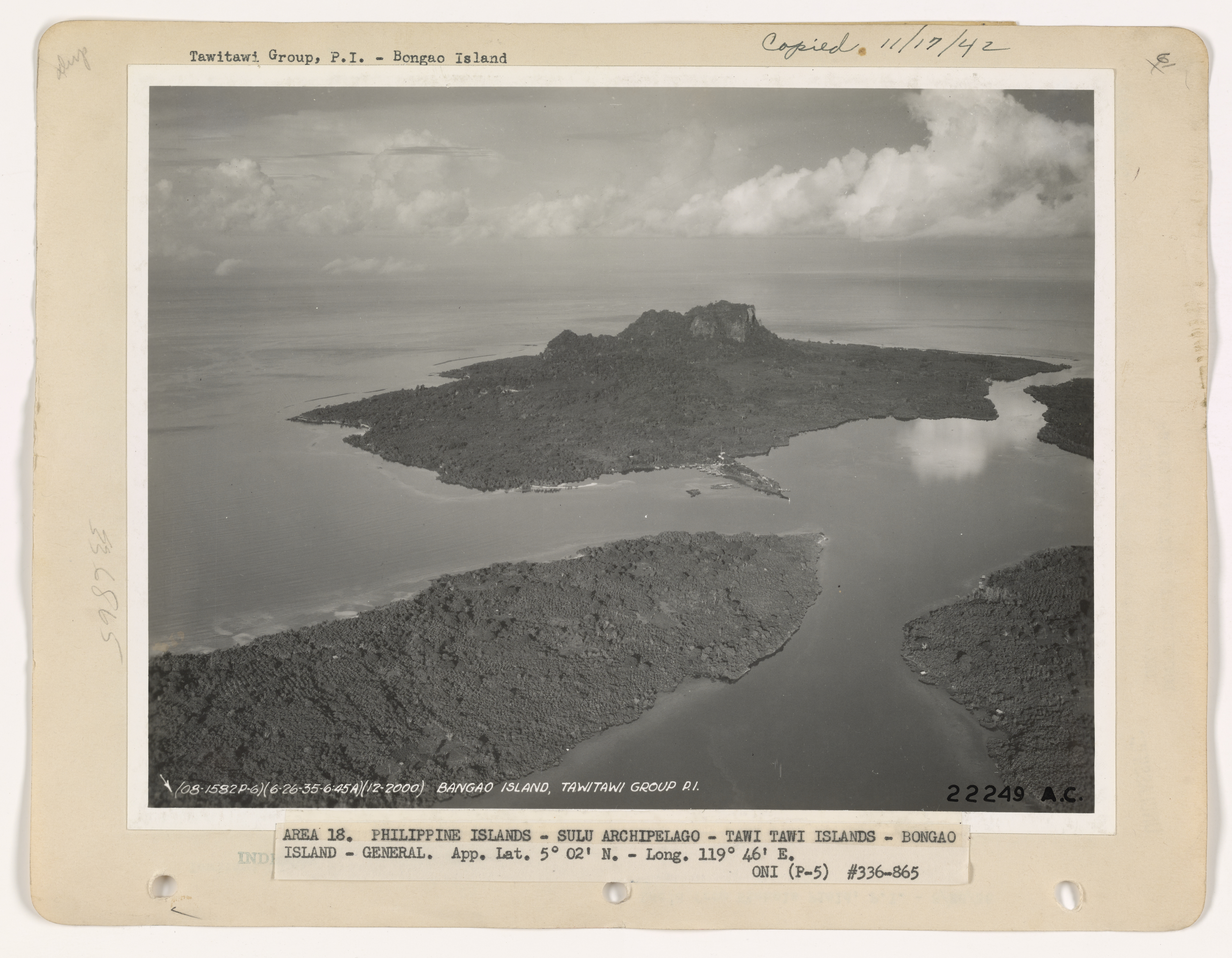
Tawitawi Island (also spelled Tawi Tawi or Tawi-Tawi) is a Philippine island in the Sulu Archipelago between the Sulu Sea and Celebes Sea, about east of Borneo. It is the main island of Tawi-Tawi Province, with a little more than half the province's 1,087.40 km2 (419.85 sq mi) land area. Tawitawi has an area of , making it the 21st-largest island of the Philippines, and the third-largest island in the Sulu Archipelago (after Basilan and Jolo). It has a shoreline length of , and a maximum elevation of . Tawitawi Island is of volcanic origin and irregular in shape, about long and between wide. It is hilly and heavily wooded, with both white sandy beaches and rocky coasts. The island is subdivided into four municipalities (Bongao, Languyan, Panglima Sugala, and Tandubas). The inhabitants are mostly Sama people, speaking Sama–Bajaw languages and of Muslim Muslims () are people who adhere to Islam, a Monotheism, monotheistic religion belonging to the Abrahamic reli ... [...More Info...] [...Related Items...] OR: [Wikipedia] [Google] [Baidu] |
Sulu Archipelago
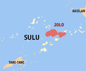
The Sulu Archipelago ( Tausug: Kapū'-pūan sin Sūg Sulat Sūg: , ) is a chain of islands in the Pacific Ocean, in the southwestern Philippines. The archipelago forms the northern limit of the Celebes Sea and southern limit of the Sulu Sea. The Sulu Archipelago islands are within the Mindanao island group, consisting of the Philippines provinces of Basilan, Sulu, and Tawi-Tawi; hence the archipelago is sometimes referred to as Basulta, derived from the first syllables of the three provinces. The archipelago is not, as is often supposed, the remains of a land bridge between Borneo and the Philippines. Rather, it is the exposed edge of small submarine ridges produced by tectonic tilting of the sea bottom. Basilan, Jolo, Tawi-Tawi and other islands in the group are extinct volcanic cones rising from the southernmost ridge. Tawi-Tawi, the southernmost island of the group, has a serpentine basement-complex core with a limestone covering. This island chain is an important ... [...More Info...] [...Related Items...] OR: [Wikipedia] [Google] [Baidu] |
Bongao
Bongao, officially the Municipality of Bongao (), is a municipality and capital of the province of Tawi-Tawi, Philippines. According to the 2020 census, it has a population of 116,118 people. History Evidence of human presence in Bongao was carbon-dated to be 8,810 to 5,190 years old, signifying one of the earliest known evidence of human presence in Southeast Asia. The bones, jars, shells, and other artifacts and fossils were found in the Bolobok Rock Shelter Cave Archaeological Site, which has been declared as an Important Cultural Treasure by the government in 2017. Much of the Bongao area was the center of Bajau culture and arts for hundreds of years. By the 14th century, Muslim missionaries from Arabia arrived and established the first ever mosque in the Philippines. The area was heavily converted to Islam, especially when the Sultanate of Sulu in nearby Sulu province was founded. The province of Tawi-Tawi was never officially controlled directly by the Spanish as t ... [...More Info...] [...Related Items...] OR: [Wikipedia] [Google] [Baidu] |
Muslim
Muslims () are people who adhere to Islam, a Monotheism, monotheistic religion belonging to the Abrahamic religions, Abrahamic tradition. They consider the Quran, the foundational religious text of Islam, to be the verbatim word of the God in Abrahamic religions, God of Abraham (or ''Allah'') as it was revealed to Muhammad, the last Islamic prophet. Alongside the Quran, Muslims also believe in previous Islamic holy books, revelations, such as the Tawrat (Torah), the Zabur (Psalms), and the Injeel (Gospel). These earlier revelations are associated with Judaism and Christianity, which are regarded by Muslims as earlier versions of Islam. The majority of Muslims also follow the teachings and practices attributed to Muhammad (''sunnah'') as recorded in traditional accounts (hadith). With an estimated population of almost 2 billion followers, Muslims comprise around 26% of the world's total population. In descending order, the percentage of people who identify as Muslims on each ... [...More Info...] [...Related Items...] OR: [Wikipedia] [Google] [Baidu] |
Sama–Bajaw Languages
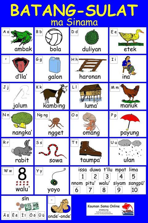
The Sama–Bajaw languages are a well-established group of languages spoken by the Sama-Bajau peoples (''A'a sama'') of the Philippines, Indonesia, and Malaysia. Languages Grimes (2003) identifies nine Sama–Bajaw languages. #Balangingi (Bangingi'; Northern Sama) #Central Sama (Siasa Sama) #Southern Sama (Sinama) #Pangutaran Sama language, Pangutaran Sama (Siyama) #Mapun (Kagayan) #Yakan language, Yakan #Abaknon language, Abaknon (Inabaknon) #Indonesian Bajau #West Coast Bajau The first six are spoken in the Sulu region of the southern Philippines. Indonesian Bajau is spoken mainly in Sulawesi and West Coast Bajau in Sabah, Borneo. Several dialects of the languages can be identified. Blust (2006) states that lexical evidence indicates that Sama–Bajaw originated in the Barito River, Barito region of southeast Borneo, although not from any established group of Barito languages. ''Ethnologue'' has followed, calling the resulting group 'Greater Barito'. Classification Palles ... [...More Info...] [...Related Items...] OR: [Wikipedia] [Google] [Baidu] |
Sama People
The Sama-Bajau include several Austronesian ethnic groups of Maritime Southeast Asia. The name collectively refers to related people who usually call themselves the Sama or Samah (formally A'a Sama, "Sama people"); or are known by the exonym Bajau (, also spelled Badjao, Bajaw, Badjau, Badjaw, Bajo or Bayao). They usually live a seaborne lifestyle and use small wooden sailing vessels such as the ''perahu'' (''layag'' in Maranao), ''djenging'' (''balutu''), '' lepa'', and ''vinta'' (''pilang''). They also use medium-sized vessels like the '' jungkung'', ''timbawan'' and small fishing vessels like ''biduk'' and '' bogo-katik''. Some Sama-Bajau groups native to Sabah are also known for their traditional horse culture. The Sama-Bajau are the dominant ethnic group of the islands of Tawi-Tawi. They are also found in other islands of the Sulu Archipelago, coastal areas of Mindanao and other islands in the southern Philippines; as well as northern and eastern Borneo, Sulawesi, and thr ... [...More Info...] [...Related Items...] OR: [Wikipedia] [Google] [Baidu] |
Jolo
Jolo () is a volcanic island in the southwest Philippines and the primary island of the province of Sulu, on which the capital of the same name is situated. It is located in the Sulu Archipelago, between Borneo and Mindanao, and has a population of approximately 500,000 people. The island is the location of the Jolo Group of Volcanoes, an active volcanic group, and contains numerous volcanic cones and craters, including the active Bud Dajo cinder cone. It has been the headquarters of militants from the terrorist group Abu Sayyaf. Etymology History After a series of less-than-successful attempts during the centuries of Spanish rule in the Philippines, Spanish forces captured the city of Jolo, the seat of the Sultan of Sulu, in 1876. On that year, the Spanish launched a massive campaign to occupy Jolo. Spurred by the need to curb slave raiding once and for all and worried about the presence of other Western powers in the south (the British had established trading cente ... [...More Info...] [...Related Items...] OR: [Wikipedia] [Google] [Baidu] |
Basilan
Basilan, officially the Province of Basilan (; ; ; ), is an island province of the Philippines located primarily in the Bangsamoro Autonomous Region. Basilan Island is the largest and northernmost of the major islands of the Sulu Archipelago. It is just off the southern coast of the geographic Zamboanga Peninsula. Isabela, the most populous city and the former capital, is a component city under the provincial government of Basilan but is administered as part of the Zamboanga Peninsula Region and is listed statistically independent. The provincial capital has since been transferred to Lamitan. Despite this, the provincial Capitol and government offices are still located at Isabela. Basilan is home to three main ethnolinguistic groups: the indigenous Yakans, and the later-arriving Tausugs and Chavacanos. The Yakans and Tausugs are predominantly Muslim, while the Chavacano are mainly Christian. There are also a number of smaller ethnic groups. Although the official lang ... [...More Info...] [...Related Items...] OR: [Wikipedia] [Google] [Baidu] |
List Of Islands Of The Philippines
As an archipelago, the Philippines comprises about 7,641 islands clustered into Island groups of the Philippines, three major island groups: Luzon, the Visayas, and Mindanao. Only about 2,000 islands are inhabited,Magical Islands , Philippine Tourism, retrieved 2012 and more than 5,000 are yet to be officially named. The following list breaks the islands down by Regions of the Philippines, region and smaller Island groups of the Philippines, island group for easier reference. Luzon Babuyan group * Babuyan Island * Balintang Islands * Barit Island * Calayan Island * Camiguin de Babuyanes, Camiguin Island * Dalupiri Island (Cagayan), Dalupiri Island * Didicas Volcano, Didicas Island * Fuga Island * Iroo Island * Maybag Island * Pamoctan Island * Pan de Azucar Isl ...[...More Info...] [...Related Items...] OR: [Wikipedia] [Google] [Baidu] |
Borneo
Borneo () is the List of islands by area, third-largest island in the world, with an area of , and population of 23,053,723 (2020 national censuses). Situated at the geographic centre of Maritime Southeast Asia, it is one of the Greater Sunda Islands, located north of Java Island, Java, west of Sulawesi, and east of Sumatra. The island is crossed by the equator, which divides it roughly in half. The list of divided islands, island is politically divided among three states. The sovereign state of Brunei in the north makes up 1% of the territory. Approximately 73% of Borneo is Indonesian territory, and in the north, the East Malaysian states of Sabah and Sarawak make up about 26% of the island. The Malaysian federal territory of Labuan is situated on a small island just off the coast of Borneo. Etymology When the sixteenth-century Portuguese explorer Jorge de Menezes made contact with the indigenous people of Borneo, they referred to their island as ''Pulu K'lemantang'', which ... [...More Info...] [...Related Items...] OR: [Wikipedia] [Google] [Baidu] |
Tandubas, Tawi-Tawi
Tandubas, officially the Municipality of Tandubas (), is a municipality in the province of Tawi-Tawi, Philippines. According to the 2020 census, it has a population of 34,316 people. Etymology The word Tandubas coined from two Malay words ''Tanjung Bas''. ''Tanjung'' means “place”, while the word ''Bas'' means “Landing”. Therefore, Tandubas means a place of landing, referring to a group of Malaysian traders who sailed across many islands and landed on an island what is now Tandubas Island. Seeing the abundance of resources to sustain their living, this group of Malaysian traders finally decided to settle on that island and named it as Tanjung Bas. For many years, the island had been named as Tanjung Bas. The Malaysian word Tanjung has its equivalent in Sama dialect which is Tandu. The name Tanjungbas has been changed by the natives to Tandubas, a name that was used from generation to generation. History Tandubas had been a part of the Sultanate of Sulu prior to the cr ... [...More Info...] [...Related Items...] OR: [Wikipedia] [Google] [Baidu] |
Celebes Sea
The Celebes Sea ( ; ) or Sulawesi Sea (; ) of the western Pacific Ocean is bordered on the north by the Sulu Archipelago and Sulu Sea and Mindanao Island of the Philippines, on the east by the Sangihe Islands chain, on the south by Sulawesi's Minahasa Peninsula, and the west by northern Kalimantan in Indonesia. It extends 420 miles (675 km) north-south by east-west and has a total surface area of , to a maximum depth of . South of the Cape Mangkalihat, the sea opens southwest through the Makassar Strait into the Java Sea. The Celebes Sea is a piece of an ancient ocean basin that formed 42 million years ago in a locale removed from any landmass. By 20 million years ago, the earth's crust movement had moved the basin close enough to the Indonesian and Philippine volcanoes to receive emitted debris. By 10 million years ago the Celebes Sea was inundated with continental debris, including coal, which was shed from a growing young mountain on Borneo and the basin had ... [...More Info...] [...Related Items...] OR: [Wikipedia] [Google] [Baidu] |
Panglima Sugala, Tawi-Tawi
Panglima Sugala, officially the Municipality of Panglima Sugala (), is a municipality in the province of Tawi-Tawi, Philippines. According to the 2020 census, it has a population of 48,055 people. It was formerly known as Balimbing.Muslim Mindanao Autonomy Act No. 7 ARMM.gov.ph. Retrieved 2012. The municipality's barangay Batu-batu was once the provincial capital of Tawi-Tawi until it was transferred in the municipality of in 1979. The municipality was renamed from Balimbing to Panglima Sugala as per Muslim Mindanao Autonomy Act No. 7, enacted on July 4, 1991, and approved by the Regional Governor on September 9, 1991. [...More Info...] [...Related Items...] OR: [Wikipedia] [Google] [Baidu] |


