|
Tarbert (other)
Tarbert ( gd, An Tairbeart) is a place name in Scotland and Ireland. Places named Tarbert are characterised by a narrow strip of land, or isthmus. This can be where two lochs nearly meet, or a causeway out to an island. Etymology All placenames that variously show up as ''tarbert'', ''tarbat'' or ''tarbet'' in their anglicised form derive from either the Irish or Scottish Gaelic ''an tairbeart'', commonly translated as "the isthmus" today. Both these words derive from two Old Irish elements, ''tar'' "across" and a nominalised form of the verb ''ber'' "to carry". The in ''tar'' was assimilated to as a result of being next to the historically palatal in Old Irish, causing the change in spelling from ''tar'' to ''tair-''. So the literal translation would be an "across-carrying". The reason for this is that all tarberts are in fact located at or near old portage sites. In English language spellings the first syllable "tar" has generally remained constant but the second ... [...More Info...] [...Related Items...] OR: [Wikipedia] [Google] [Baidu] |
Scotland
Scotland (, ) is a country that is part of the United Kingdom. Covering the northern third of the island of Great Britain, mainland Scotland has a border with England to the southeast and is otherwise surrounded by the Atlantic Ocean to the north and west, the North Sea to the northeast and east, and the Irish Sea to the south. It also contains more than 790 islands, principally in the archipelagos of the Hebrides and the Northern Isles. Most of the population, including the capital Edinburgh, is concentrated in the Central Belt—the plain between the Scottish Highlands and the Southern Uplands—in the Scottish Lowlands. Scotland is divided into 32 administrative subdivisions or local authorities, known as council areas. Glasgow City is the largest council area in terms of population, with Highland being the largest in terms of area. Limited self-governing power, covering matters such as education, social services and roads and transportation, is devolved from the ... [...More Info...] [...Related Items...] OR: [Wikipedia] [Google] [Baidu] |
Loch Tarbert, Jura
{{Argyll-geo-stub ...
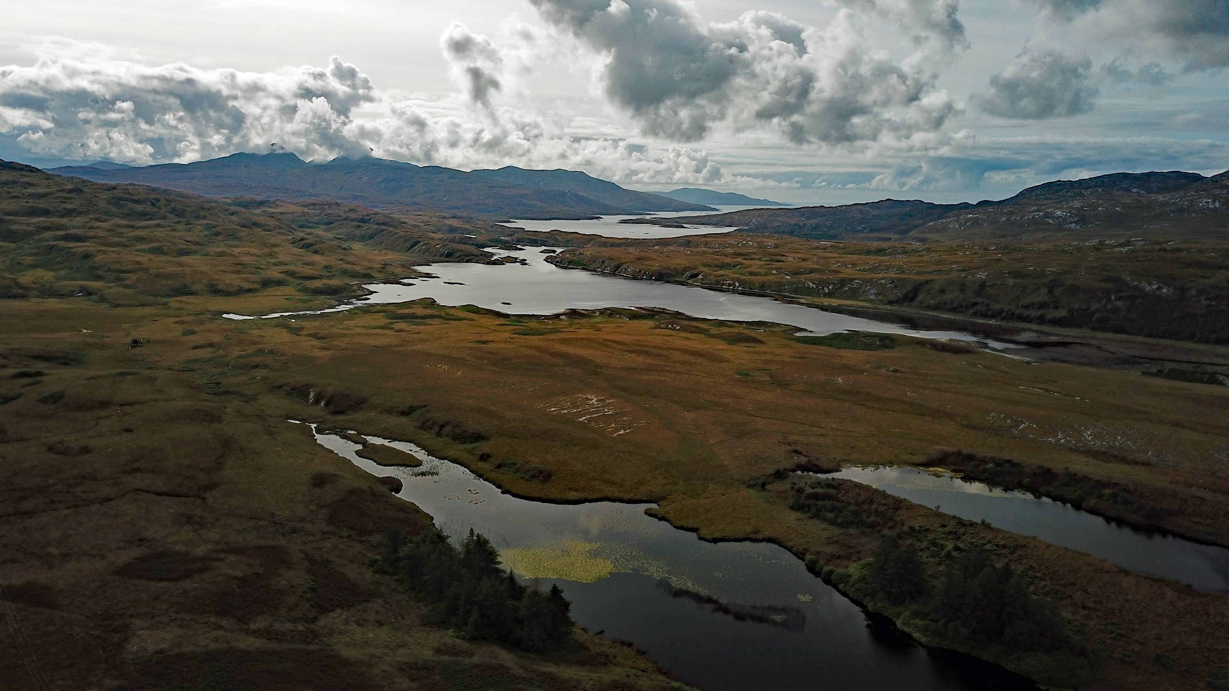
Loch Tarbert is a sea loch on the west coast of Jura, an island in Scotland. As the name Tarbert suggests, it comes close to cutting the island in half. References Sea lochs of Scotland Lochs of Argyll and Bute Loch ''Loch'' () is the Scottish Gaelic, Scots and Irish word for a lake or sea inlet. It is cognate with the Manx lough, Cornish logh, and one of the Welsh words for lake, llwch. In English English and Hiberno-English, the anglicised spelling ... [...More Info...] [...Related Items...] OR: [Wikipedia] [Google] [Baidu] |
Salen Bay
{{disambig, geo ...
Salen may refer to: Places * Salen, Ardnamurchan, a village on the Ardnamurchan peninsula in the highland region of Scotland. * Salen, Mull, a village on the island of Mull in the Inner Hebrides of Scotland *Sälen, in Dalarna, Sweden Other uses * Salen ligand, a type of chemical compound used in chemistry * Salen Kotch, main antagonist in '' Call of Duty: Infinite Warfare'' See also * Salem (other) Salem may refer to: Places Canada Ontario * Bruce County ** Salem, Arran–Elderslie, Ontario, in the municipality of Arran–Elderslie ** Salem, South Bruce, Ontario, in the municipality of South Bruce * Salem, Dufferin County, Ontario, par ... [...More Info...] [...Related Items...] OR: [Wikipedia] [Google] [Baidu] |
Canna, Scotland
Canna (; gd, Canaigh; Eilean Chanaigh; sco, Canna) is the westernmost of the Small Isles archipelago, in the Scottish Inner Hebrides. It is linked to the neighbouring island of Sanday by a road and sandbanks at low tide. The island is long and wide. The isolated skerries of Hyskeir and Humla lie south-west of the island. The islands were left to the National Trust for Scotland (NTS) by their previous owners, the Gaelic folklorists and scholars John Lorne Campbell and Margaret Fay Shaw in 1981, and are run as a farm and conservation area. Canna House, one of two big houses on the island (the other being Tighard), contains John Campbell's important archives of Gaelic materials that were donated with the islands to the nation. Since then the NTS has engaged in new initiatives to attract new residents and visitors to Canna. However, these initiatives have enjoyed only limited success (see 'Call for families for Canna' below), and in December 2017 it was announced that the ... [...More Info...] [...Related Items...] OR: [Wikipedia] [Google] [Baidu] |
East Loch Tarbert
East Loch Tarbert ( gd, Loch an Tairbeairt) is a sea loch that lies to the east of Harris in the Outer Hebrides of Scotland. The loch contains several small islands including Sgeotasaigh, Stiughiag, Stiughiag na Leum and Rosaigh and the larger bridged island of Scalpay. The Caledonian MacBrayne ferry from the Isle of Skye The Isle of Skye, or simply Skye (; gd, An t-Eilean Sgitheanach or ; sco, Isle o Skye), is the largest and northernmost of the major islands in the Inner Hebrides of Scotland. The island's peninsulas radiate from a mountainous hub dominated ... to Harris reaches Tarbert via this loch. The village of Tarbert lies on the small isthmus which separates East Loch Tarbert from West Loch Tarbert and joins North and South Harris. Footnotes Sea lochs of Scotland Lochs of the Outer Hebrides Harris, Outer Hebrides {{WesternIsles-geo-stub ... [...More Info...] [...Related Items...] OR: [Wikipedia] [Google] [Baidu] |
South Harris
Harris ( gd, Na Hearadh, ) is the southern and more mountainous part of Lewis and Harris, the largest island in the Outer Hebrides, Scotland. Although not an island itself, Harris is often referred to in opposition to the ''Isle of Lewis'' as the Isle of Harris, which is the former postal counties of the United Kingdom, postal county and the current post town for Royal Mail postcodes starting HS3 or HS5. The Civil parishes in Scotland, civil parish of Harris is considered to include St Kilda, Scotland, St Kilda, an uninhabited archipelago west-northwest of North Uist, and the uninhabited islet Rockall, which is west of North Uist. Etymology Harris originates from the Old Norse name Harri, the diminutive of the name Harald (other), Harald. Variants are the Dutch Harrie and the Flemish Hariche. Refer also to country and source abbreviations on page 15 These names derive from the Old Norse root word "Hár and Hárr, hár", meaning "high", with the Comparison (grammar), ... [...More Info...] [...Related Items...] OR: [Wikipedia] [Google] [Baidu] |
West Loch Tarbert
West Loch Tarbert ( gd, Loch A Siar) is a sea loch that separates the northern and southern parts of Harris in the Outer Hebrides of Scotland. A small isthmus joins these two areas, on which is to be found the village of Tarbert. The loch contains the islands Soay Mòr, Soay Beag and Isay, while Taransay lies near the mouth of the loch. Amhuinnsuidhe Castle Amhuinnsuidhe Castle is a large 19th-century private country house on Harris, one of the Western Isles of Scotland. It was designated as a Category A listed building in 1971 and is now operated as a hotel and shooting estate. History Original ... is located on the northern shore of the loch. Footnotes Sea lochs of Scotland Lochs of the Outer Hebrides Harris, Outer Hebrides {{WesternIsles-geo-stub ... [...More Info...] [...Related Items...] OR: [Wikipedia] [Google] [Baidu] |
Western Isles
The Outer Hebrides () or Western Isles ( gd, Na h-Eileanan Siar or or ("islands of the strangers"); sco, Waster Isles), sometimes known as the Long Isle/Long Island ( gd, An t-Eilean Fada, links=no), is an island chain off the west coast of mainland Scotland. The islands are geographically coextensive with , one of the 32 unitary council areas of Scotland. They form part of the archipelago of the Hebrides, separated from the Scottish mainland and from the Inner Hebrides by the waters of the Minch, the Little Minch, and the Sea of the Hebrides. Scottish Gaelic is the predominant spoken language, although in a few areas English speakers form a majority. Most of the islands have a bedrock formed from ancient metamorphic rocks, and the climate is mild and oceanic. The 15 inhabited islands have a total population of and there are more than 50 substantial uninhabited islands. The distance from Barra Head to the Butt of Lewis is roughly . There are various important preh ... [...More Info...] [...Related Items...] OR: [Wikipedia] [Google] [Baidu] |
Tarbert, Harris
Tarbert () is the main community on Harris, Outer Hebrides, Harris in the Western Isles of Scotland. The name means "isthmus", "crossing point" or "portage", in Scottish Gaelic, Gaelic. The isthmus, between the sea lochs West Loch Tarbert and East Loch Tarbert, joins south Harris to north Harris and Lewis. In 1981 it had a population of 503. Tarbert's Church of Scotland parish church was built in 1862, and is within the parish of Harris. Tarbert also has a Free Presbyterian Church of Scotland, Free Presbyterian church. The Very Reverend, The Very Rev Mackintosh MacKay was minister of the latter in the 1860s. Transport Tarbert has a car ferry terminal which operates to Uig, Snizort, Uig on Isle of Skye, Skye. The short A868 joins the terminal to the north–south A859 road (Great Britain), A859 road. Economy The Harris distillery, a Scotch whisky and Gin distillery is located in Tarbert. References External links Canmore - Harris, Tarbert, General site record [...More Info...] [...Related Items...] OR: [Wikipedia] [Google] [Baidu] |
East Loch Tarbert, Argyll
East Loch Tarbert, Argyll is a small sea loch on the eastern side of the Kintyre peninsula in Scotland. It is a part of the much larger Loch Fyne. The village of Tarbert lies along the shores of the loch, which is separated from West Loch Tarbert by an isthmus only long. According to Snorri Sturluson's ''Heimskringla'', Magnus Barefoot, King of Norway, had his longship dragged across this isthmus as part of a campaign to increase his possessions in the Hebrides. He made an arrangement with King Malcolm III of Scotland that he could take possession of land on the west coast around which a ship could sail. Magnus declared that Kintyre had "better land than the best of the Hebrides", and by taking command of his ship's tiller and "sailing" across the isthmus he was able to claim the entire peninsula, which remained under Norse rule for more than a dozen years as a result. More than two centuries later Robert the Bruce completed a similar feat during the Scottish Wars of Indepe ... [...More Info...] [...Related Items...] OR: [Wikipedia] [Google] [Baidu] |
West Loch Tarbert, Argyll
West Loch Tarbert, Argyll is a long and narrow sea loch on the western side of the Kintyre peninsula in Scotland. Geography The head of the loch lies near the village of Tarbert and it reaches the open sea at Ardpatrick Point some distant. The island of Eilean Ceann na Creige, off the south shore, is connected to the mainland by a causeway. It is the ferry terminal for Islay. History Around the year 1093, Magnus Barefoot, King of Norway had his longship dragged across the isthmus at Tarbert between West Loch Tarbert and East Loch Tarbert as part of a campaign to increase his possessions in the Hebrides. He made an arrangement with King Malcolm III of Scotland that he could take possession of land on the west coast around which a ship could sail. Magnus declared that Kintyre had "better land than the best of the Hebrides", and by taking command of his ship's tiller and "sailing" across the isthmus he was able to claim the entire peninsula, which remained under Norse rule fo ... [...More Info...] [...Related Items...] OR: [Wikipedia] [Google] [Baidu] |


