|
Tangier-Tetouan
Tangier-Tétouan ( Berber: ''Tanja-Tiṭṭawin'', ⵜⴰⵏⵊⴰ-ⵜⵉⵟⵟⴰⵡⵉⵏ; ) was formerly one of the sixteen regions of Morocco from 1997 to 2015. It covered an area of 11,570 km² and had a population of 3,157,075.2014 census The capital was Tangier. In 2015, Al Hoceïma Province from Taza-Al Hoceima-Taounate was added to it to form the region of Tanger-Tétouan-Al Hoceïma. Geography The region has a coastline on the west formed by the Atlantic Ocean, on the north by the Strait of Gibraltar and on the east by the Mediterranean Sea. It borders the regions of Gharb-Chrarda-Béni Hssen and Taza-Al Hoceima-Taounate to the south, and also has a border with the Spanish exclave of Ceuta. Administrative divisions The region is made up into the following provinces and prefectures: * Tangier Sub-Region ** Prefecture of Tangier-Assilah ** Fahs-Anjra Province * Tétouan Sub-Region ** Prefecture of M'diq-Fnideq ** Chefchaouen Province ** Larache Province ** ... [...More Info...] [...Related Items...] OR: [Wikipedia] [Google] [Baidu] |
Tanger-Tétouan-Al Hoceïma
Tanger-Tetouan-Al Hoceima ( ar, طنجة - تطوان - الحسيمة, ṭanja - tiṭwān - al-ḥusayma; ber, ⵟⴰⵏⵊⴰ ⵜⵉⵟⵡⴰⵏ ⵍⵃⵓⵙⵉⵎⴰ, ṭanja tiṭwan lḥusima) is the northernmost of the twelve regions of Morocco. It covers an area of 15,090 km² and recorded a population of 3,556,729 in the 2014 Moroccan census. The capital of the region is Tangier. Geography Tanger-Tétouan-Al Hoceima is the northernmost of Morocco's twelve regions. In the north it faces the Strait of Gibraltar and the Mediterranean Sea and borders the Spanish exclave of Ceuta. It also borders the Moroccan regions of Rabat-Salé-Kénitra to the southwest, Fès-Meknès to the southeast and Oriental to the east. The Rif rises in the eastern part of the region and is the location of Al Hoceima National Park and Talassemtane National Park. The land near the Atlantic coast in the west is less rugged, and the fertile southwestern corner of the region is drained by the Lou ... [...More Info...] [...Related Items...] OR: [Wikipedia] [Google] [Baidu] |
Regions Of Morocco
Regions are currently the highest administrative divisions in Morocco. Since 2015, Morocco officially administers 12 regions, including one ( Dakhla-Oued Ed-Dahab) that lies completely within the disputed territory of Western Sahara and two ( Laâyoune-Sakia El Hamra and Guelmim-Oued Noun) that lie partially within it. The regions are subdivided into a total of 75 second-level administrative divisions, which are prefectures and provinces. A region is governed by a directly elected regional council. The president of the council is responsible for carrying out the council's decisions. Prior to the 2011 constitutional reforms, this was the responsibility of the Wali, the representative of the central government appointed by the King, who now plays a supporting role in the administration of the region. Regions since 2015 On 3 January 2010, the Moroccan government established the Consultative Commission for the Regionalization (CCR), which aimed to decentralize power to the ... [...More Info...] [...Related Items...] OR: [Wikipedia] [Google] [Baidu] |
Ceuta
Ceuta (, , ; ar, سَبْتَة, Sabtah) is a Spanish autonomous city on the north coast of Africa. Bordered by Morocco, it lies along the boundary between the Mediterranean Sea and the Atlantic Ocean. It is one of several Spanish territories in Africa and, along with Melilla and the Canary Islands, one of only a few that are permanently inhabited by a civilian population. It was a regular municipality belonging to the province of Cádiz prior to the passing of its Statute of Autonomy in March 1995, henceforth becoming an autonomous city. Ceuta, like Melilla and the Canary Islands, was classified as a free port before Spain joined the European Union. Its population consists mainly of Christians and Muslims. There is also a small minority of Sephardic Jews and Sindhi Hindus, the latter of whom originate from current-day Pakistan. Spanish is the only official language, but Darija Arabic is quite prominent as well. Names The name Abyla has been said to have been a ... [...More Info...] [...Related Items...] OR: [Wikipedia] [Google] [Baidu] |
Ouezzane
Ouazzane (also Ouezzane) (Berber: ⵡⴰⵣⵣⴰⵏ, ar, وزان) is a town in northern Morocco, with a population of 59,606 recorded in the 2014 Moroccan census. The city is well known in Morocco and throughout the Islamic world as a spiritual capital for it was home for several pillars of Sufism. It has been known also as "Dar Dmana" ("House of Safety") due to its containing the tomb of the 18th-century Idrisi Sharif. Many Jews of Morocco consider Ouazzane to be a holy city and make pilgrimages there to venerate the tomb of several marabouts (Moroccan saints), particularly ''moul Anrhaz'', the local name for Rabbi Amram ben Diwan, an eighteenth-century rabbi who lived in the city and whose burial site is associated with a number of miracles. During the Rif rebellion (leader Abd el Krim) in 1925 -1926 Ouazzane was an important supply base for the French Army. Ouazzane was connected by a 600 mm gauge narrow gauge railway via Ain Dfali, Mechra Bel Ksiri to Port Lyautey, ... [...More Info...] [...Related Items...] OR: [Wikipedia] [Google] [Baidu] |
Larache Province
Larache is a province in the Moroccan region of Tanger-Tetouan-Al Hoceima. Its population in 2004 was 472,386. The major cities and towns are: * Khemis Sahel * Ksar el Kebir * Larache Subdivisions The province is divided administratively into the following: References Larache Larache ( ar, العرايش, al-'Araysh) is a city in northwestern Morocco. It is on the Moroccan coast, where the Loukkos River meets the Atlantic Ocean. Larache is one of the most important cities of the Tanger-Tetouan-Al Hoceima region. M ... Geography of Tanger-Tetouan-Al Hoceima {{TangerTetouanAlHoceima-geo-stub ... [...More Info...] [...Related Items...] OR: [Wikipedia] [Google] [Baidu] |
Chefchaouen Province
{{TangerTetouanAlHoceima-geo-stub ...
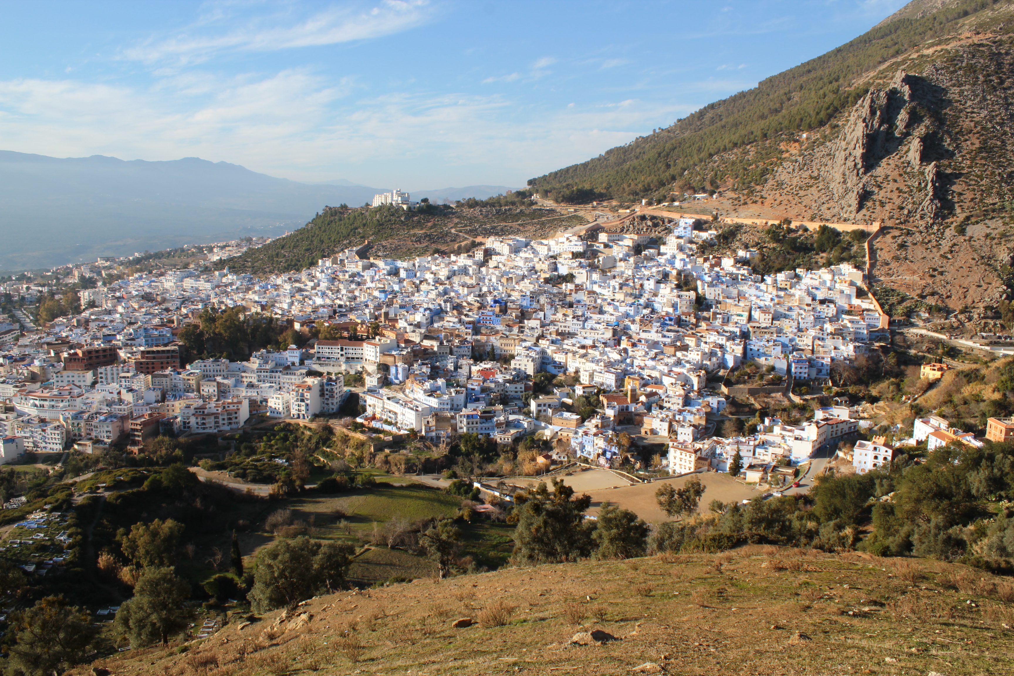
Chefchaouen is a province in the Moroccan economic region of Tanger-Tetouan-Al Hoceima. According to the 2014 national census in Morocco, the province has more than 457,432 inhabitants. The population is 87.45% rural. The major cities and towns are: * Bab Berred * Bab Taza * Brikcha * Chefchaouen * Jebha * Moqrisset * Zoumi Subdivisions The province is divided administratively into the following: References Chefchaouen Chefchaouen ( ar, شفشاون, Shafshāwan, ), also known as Chaouen (), is a city in northwest Morocco. It is the chief town of the province of the same name and is noted for its buildings in shades of blue, for which it is nicknamed the "Bl ... [...More Info...] [...Related Items...] OR: [Wikipedia] [Google] [Baidu] |
Fnideq
Fnideq ( Berber: ⴼⵏⵉⴷⵇ, ar, الفنيدق) is a town in northern Morocco, on the Mediterranean coast of M'diq-Fnideq Prefecture, north of the city of Tétouan. The town is also known under the Spanish name Castillejos. It is the closest Moroccan city to the Spanish exclave of Ceuta Ceuta (, , ; ar, سَبْتَة, Sabtah) is a Spanish autonomous city on the north coast of Africa. Bordered by Morocco, it lies along the boundary between the Mediterranean Sea and the Atlantic Ocean. It is one of several Spanish territo .... During the Hispano-Moroccan War of 1859, it was the location of the decisive Battle of Castillejos. Notable people * Hamza El Moussaoui, international footballer * Amin Erbati, former international footballer References Rif Populated places in M'diq-Fnideq Prefecture {{TangerTetouanAlHoceima-geo-stub ... [...More Info...] [...Related Items...] OR: [Wikipedia] [Google] [Baidu] |
M'diq
Rincón, M'Diq or Mediek, in , meaning 'the''''Strait'') is a Mediterranean town in northern Morocco located between Fnideq and Tétouan. It borders Mellaliyine in the south and Allyene in the west. It is the seat of M'diq-Fnideq Prefecture. M'diq covers an area of , of which is urbanised. It recorded a population of 56,227 in the 2014 Moroccan census The 2014 Moroccan census was held in Morocco between 1 September and 20 September 2014. The census was conducted by the High Planning Commission. [...More Info...] [...Related Items...] OR: [Wikipedia] [Google] [Baidu] |
Fahs-Anjra Province
Fahs-Anjra is a province located in the Tanger-Tetouan-Al Hoceima Region of Morocco Morocco (),, ) officially the Kingdom of Morocco, is the westernmost country in the Maghreb region of North Africa. It overlooks the Mediterranean Sea to the north and the Atlantic Ocean to the west, and has land borders with Algeria .... It was created by Royal decree in 2003. Its population in 2004 was 97,295. A new city, Ch'rafate, is currently being built there. It was announced by the king in 2009 and should be complete by 2020. , January 2009, accessed February 2013 Subdivisions The prefecture is divided administratively into the following: Ref ...
|
Tangier-Assilah
The prefecture of Tangier-Asilah ( ar, إقليم طنجة أصيلة, links=no, Berber: ⵟⴰⵏⵊⴰ - ⴰⵣⵉⵍⴰ) is a largely urban subdivision of the Tanger-Tetouan-Al Hoceima region of Morocco Morocco (),, ) officially the Kingdom of Morocco, is the westernmost country in the Maghreb region of North Africa. It overlooks the Mediterranean Sea to the north and the Atlantic Ocean to the west, and has land borders with Algeria .... Located in the north of the country, on the Atlantic coast. it had inhabitants in 2004 and inhabitants in 2014. Towns of the province See also {{Morocco-stub ... [...More Info...] [...Related Items...] OR: [Wikipedia] [Google] [Baidu] |
Strait Of Gibraltar
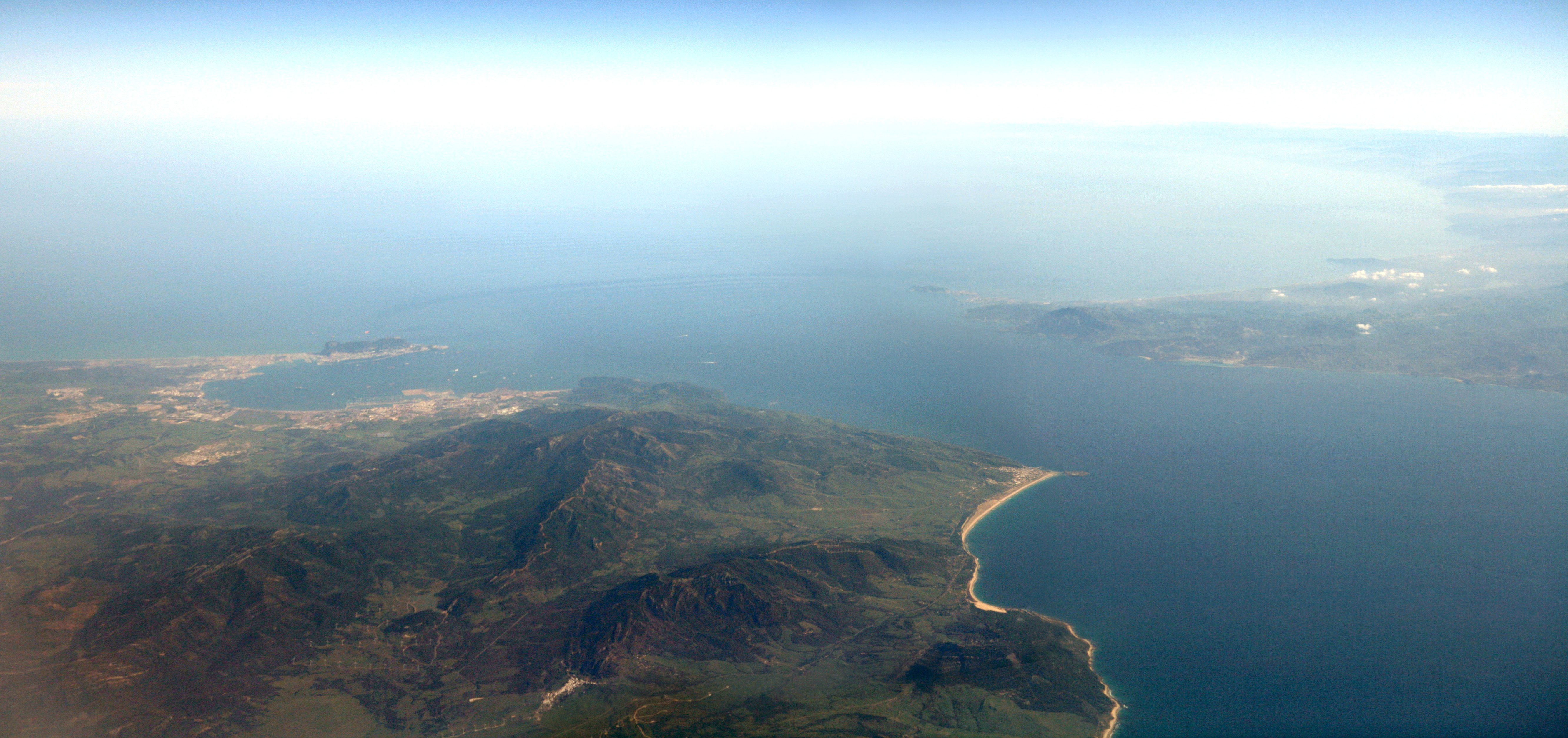
The Strait of Gibraltar ( ar, مضيق جبل طارق, Maḍīq Jabal Ṭāriq; es, Estrecho de Gibraltar, Archaism, Archaic: Pillars of Hercules), also known as the Straits of Gibraltar, is a narrow strait that connects the Atlantic Ocean to the Mediterranean Sea and separates the Iberian Peninsula in Europe from Morocco in Africa. The two continents are separated by of ocean at the Strait's narrowest point between Punta de Tarifa, Point Marroquí in Spain and Point Cires in Morocco. Ferries cross between the two continents every day in as little as 35 minutes. The Strait's depth ranges between which possibly interacted with the lower mean sea level of the last major glaciation 20,000 years ago when the level of the sea is believed to have been lower by . The strait lies in the territorial waters of Morocco, Spain, and the British overseas territory of Gibraltar. Under the United Nations Convention on the Law of the Sea, foreign vessels and aircraft have the freedom of navi ... [...More Info...] [...Related Items...] OR: [Wikipedia] [Google] [Baidu] |


