|
TF5 Motorway
Autopista TF-5 is a motorway in the Canary Islands, in the north of Tenerife, running from Santa Cruz de Tenerife to Puerto de la Cruz. Most of the motorway is a Controlled-access highway or expressway, with some single carriageway remaining west of Puerto de la Cruz. TF-5 begins in Santa Cruz de Tenerife with westbound traffic merging off from Av Tres de Mayo and ends with the motorway splitting between TF42 Motorway and TF82 Motorway in Puerto de la Cruz. At present, it is the motorway that supports the highest traffic density in the Canary Islands, with stretches in which around 100,000 cars per day circulate. Exits From Santa Cruz de Tenerife Santa Cruz de Tenerife (; locally ), commonly abbreviated as Santa Cruz, is a city, the capital of the island of Tenerife, Province of Santa Cruz de Tenerife, and one of the capitals of the Canary Islands, along with Las Palmas. Santa Cruz has a ... to Los Realejos TF5 has numbered exits. References TF-5 TF-5 {{ ... [...More Info...] [...Related Items...] OR: [Wikipedia] [Google] [Baidu] |
Santa Cruz De Tenerife
Santa Cruz de Tenerife (; locally ), commonly abbreviated as Santa Cruz, is a city, the capital of the island of Tenerife, Province of Santa Cruz de Tenerife, and one of the capitals of the Canary Islands, along with Las Palmas. Santa Cruz has a population of 211,436 (2024) within its administrative limits.Instituto Canario de Estadística , population The Larger Urban Zones, urban zone of Santa Cruz extends beyond the city limits with a population of 507,306 and 538,000 within urban area. It is the second largest city in the Canary Islands and the main city on the island of Tenerife, with nearly half of the island's population living in or around it. Santa Cruz is located in the northeast quadrant of Tenerife, off the north-western c ... [...More Info...] [...Related Items...] OR: [Wikipedia] [Google] [Baidu] |
Puerto De La Cruz
Puerto de la Cruz is a city and municipality in the northern part of the island of Tenerife, Canary Islands, Spain. It was formerly known by its English translation, "Port of the Cross", although now it is known by its Spanish name in all languages. Puerto de la Cruz is located on the northern coast, northwest of La Orotava and west of Santa Cruz de Tenerife. The Autopista TF-5, TF-5 motorway passes through the municipality. The population is 30,483 (2018). In Spanish, the local inhabitants are known as ''Portuenses''. With an area of , the municipality is the smallest in Tenerife. The elevation of the town's centre is above sea level and the highest point being Las Arenas, a volcanic cone with an elevation of . Historical population Economy Puerto de la Cruz occupies a prominent place in the history of tourism of the islands. The export economy established by the European colonizers after the conquest of the Canary Islands, conquest in the 15th century generated large com ... [...More Info...] [...Related Items...] OR: [Wikipedia] [Google] [Baidu] |
San Cristóbal De La Laguna
San Cristóbal de La Laguna (commonly known as La Laguna, ) is a city and municipality in the northern part of the island of Tenerife in the Province of Santa Cruz de Tenerife, on the Canary Islands, Spain. The former capital of the Canary Islands, the city is the third-most populous city of the archipelago and the second-most populous city of the island. In 1999 the historical center of La Laguna was declared a World Heritage Site by UNESCO, after being nominated by Spain. La Laguna is situated alongside the city of Santa Cruz de Tenerife; thus, the two cities and municipalities form a single large urban center. Its economy is business-oriented while agriculture dominates the northeastern portion of the city. The urban area dominates the central and the southern parts. La Laguna is considered to be the cultural capital of the Canary Islands. It holds the Incorruptibility, incorrupt body of Mary of Jesus de León y Delgado, Sor María de Jesús, and the Christ of La Laguna (Cri ... [...More Info...] [...Related Items...] OR: [Wikipedia] [Google] [Baidu] |
La Orotava
La Orotava is a town and a municipality in the northern part of Tenerife, one of the Canary Islands of Spain. The area of the municipality stretches from the north coast to the mountainous interior, and includes the summit of the Teide volcano, Canary Islands' and Spain's highest point at 3,718 m. At 207.31 km2, it is the largest municipality of the island of Tenerife. The population is 41,255 (2013Instituto Canario de Estadística ). The town La Orotava, which is the administrative centre of the municipality and also its largest settlement, is situated near the north coast, at about 400 m elevation in the [...More Info...] [...Related Items...] OR: [Wikipedia] [Google] [Baidu] |
Los Realejos
Los Realejos is a town and a municipality in the northern part of the island of Tenerife, which is the biggest town in the Canary Islands. It is part of the province of Santa Cruz de Tenerife (province), Santa Cruz de Tenerife, Spain. The town is located from the north coast, southwest of Puerto de la Cruz, west of La Orotava, and southwest of the island's capital Santa Cruz de Tenerife. The inhabitants are known in Spanish as ''realejeros''. The latest population count consists of 37,970 (2013Instituto Canario de Estadística ), its density being and the area is . The highest peak is . Los Realejos is the western terminus of the Autopista TF-5, TF-5 motorway. Background The town is split into two distinct areas or districts: *R ...[...More Info...] [...Related Items...] OR: [Wikipedia] [Google] [Baidu] |
Motorway
A controlled-access highway is a type of highway that has been designed for high-speed vehicular traffic, with all traffic flow—ingress and egress—regulated. Common English terms are freeway, motorway, and expressway. Other similar terms include ''wikt:throughway, throughway'' or ''thruway'' and ''parkway''. Some of these may be limited-access highways, although this term can also refer to a class of highways with somewhat less isolation from other traffic. In countries following the Vienna Convention on Road Signs and Signals, Vienna convention, the motorway qualification implies that walking and parking are forbidden. A fully controlled-access highway provides an unhindered flow of traffic, with no traffic signals, Intersection (road), intersections or frontage, property access. They are free of any at-grade intersection, at-grade crossings with other roads, railways, or pedestrian paths, which are instead carried by overpasses and underpasses. Entrances and exits to t ... [...More Info...] [...Related Items...] OR: [Wikipedia] [Google] [Baidu] |
Canary Islands
The Canary Islands (; ) or Canaries are an archipelago in the Atlantic Ocean and the southernmost Autonomous communities of Spain, Autonomous Community of Spain. They are located in the northwest of Africa, with the closest point to the continent being 100 kilometres (62 miles) away. The islands have a population of 2.25 million people and are the most populous overseas Special member state territories and the European Union, special territory of the European Union. The seven main islands are from largest to smallest in area, Tenerife, Fuerteventura, Gran Canaria, Lanzarote, La Palma, La Gomera, and El Hierro. The only other populated island is Graciosa, Canary Islands, La Graciosa, which administratively is dependent on Lanzarote. The archipelago includes many smaller islands and islets, including Alegranza, Islote de Lobos, Isla de Lobos, Montaña Clara, Roque del Oeste, and Roque del Este. It includes a number of rocks, including Roque de Garachico, Garachico and Roques de ... [...More Info...] [...Related Items...] OR: [Wikipedia] [Google] [Baidu] |
Tenerife
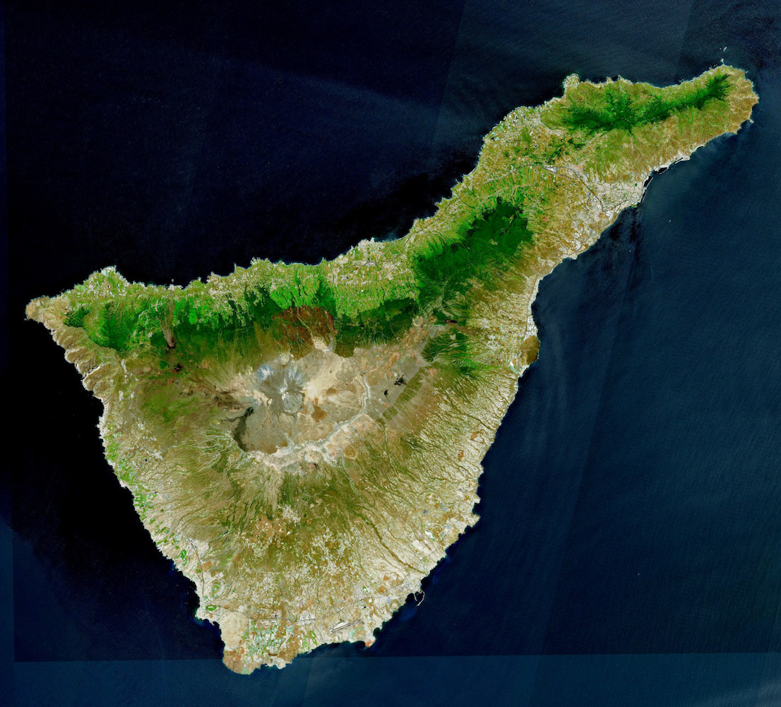
Tenerife ( ; ; formerly spelled ''Teneriffe'') is the largest and most populous island of the Canary Islands, an Autonomous communities of Spain, autonomous community of Spain. With a land area of and a population of 965,575 inhabitants as of April 2025, it is the most populous island in Spain and the entire Macaronesia region. Tenerife is also home to 42.7% of the total population of the archipelago. More than seven million tourists (7,384,707 in 2024) visit Tenerife each year, making it by far the most visited island in the archipelago. It is one of the most important tourist destinations in Spain and the world, hosting one of the world's largest carnivals, the Carnival of Santa Cruz de Tenerife. The capital of the island, , is also the seat of the island council (). That city and are the co-capitals of the Autonomous communities of Spain, autonomous community of the Canary Islands. The two cities are both home to governmental institutions, such as the offices of the preside ... [...More Info...] [...Related Items...] OR: [Wikipedia] [Google] [Baidu] |
Controlled-access Highway
A controlled-access highway is a type of highway that has been designed for high-speed vehicular traffic, with all traffic flow—ingress and egress—regulated. Common English terms are freeway, motorway, and expressway. Other similar terms include ''wikt:throughway, throughway'' or ''thruway'' and ''parkway''. Some of these may be limited-access highways, although this term can also refer to a class of highways with somewhat less isolation from other traffic. In countries following the Vienna Convention on Road Signs and Signals, Vienna convention, the motorway qualification implies that walking and parking are forbidden. A fully controlled-access highway provides an unhindered flow of traffic, with no traffic signals, Intersection (road), intersections or frontage, property access. They are free of any at-grade intersection, at-grade crossings with other roads, railways, or pedestrian paths, which are instead carried by overpasses and underpasses. Entrances and exits to t ... [...More Info...] [...Related Items...] OR: [Wikipedia] [Google] [Baidu] |
TF42 Motorway
''Transformers: Age of Extinction'' is a 2014 American science fiction action film based on Hasbro's ''Transformers'' toy line. It is the standalone sequel to '' Transformers: Dark of the Moon'' (2011) and the fourth installment in the ''Transformers'' film series. Like its predecessor, the film is directed by Michael Bay and written by Ehren Kruger. It stars Mark Wahlberg and Stanley Tucci, with Kelsey Grammer, Nicola Peltz, Jack Reynor, Sophia Myles, Bingbing Li, Titus Welliver, and T.J. Miller in supporting roles. It does not feature the original human cast from the previous three films, instead introducing a new human cast and as well as new Transformers, including the Dinobots. In the film, inventor Cade Yeager teams up with Optimus Prime and the surviving Autobots to investigate a manhunt involving Transformers for their hostility. The film was released in the United States on June 27, 2014, by Paramount Pictures. It received generally negative reviews from critics, cr ... [...More Info...] [...Related Items...] OR: [Wikipedia] [Google] [Baidu] |


