|
Somogy County
Somogy ( hu, Somogy megye, ; hr, Šomođska županija; sl, Šomodska županija, german: Komitat Schomodei) is an administrative county (comitatus or ''megye'') in present Hungary, and also in the former Kingdom of Hungary. Somogy County lies in south-western Hungary, on the border with Croatia (Koprivnica-Križevci County and Virovitica-Podravina County). It stretches between the river Dráva and the southern shore of Lake Balaton. It shares borders with the Hungarian counties of Zala, Veszprém, Fejér, Tolna, and Baranya. It is the most sparsely populated county in Hungary. The capital of Somogy County is Kaposvár. Its area is 6,036 km2. History Somogy was also the name of a historic administrative county (comitatus) of the Kingdom of Hungary. Its territory, which was slightly larger than that of present Somogy County, is now in south-western Hungary. The capital of the county was and still is Kaposvár. Demographics In 2015, it had a population of 312,084 ... [...More Info...] [...Related Items...] OR: [Wikipedia] [Google] [Baidu] |
Counties Of Hungary
, alt_name = , alt_name1 = , alt_name2 = , alt_name3 = , alt_name4 = , map = , category = Unitary state , territory = Hungary , upper_unit = , start_date = 1950 (Current form, 19 + Budapest) , start_date1 = , start_date2 = , start_date3 = , start_date4 = , legislation_begin = , legislation_begin1 = , legislation_begin2 = , legislation_begin3 = , legislation_begin4 = , legislation_end = , legislation_end1 = , legislation_end2 = , legislation_end3 = , legislation_end4 = , end_date = , end_date1 = , end_date2 = , end_date3 = , end_date4 = , current_number = 19 , number_date = 1950 , type = , type1 = , type2 = , type3 = , type4 = , status = , statu ... [...More Info...] [...Related Items...] OR: [Wikipedia] [Google] [Baidu] |
Postal Codes In Hungary
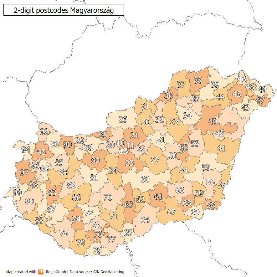
Postal codes in Hungary are four digit numeric. The first digit is for the postal region, as listed below (with the postal centre indicated after the number): * 1xxx Budapest (*) * 2xxx Szentendre * 3xxx Hatvan * 4xxx Debrecen (*) * 5xxx Szolnok * 6xxx Kecskemét * 7xxx Sárbogárd * 8xxx Székesfehérvár * 9xxx Győr Not all of the above are county capitals: Hatvan, Sárbogárd and Szentendre are major cities, but not county capitals. They are, however, all well communicated cities and big junctions. In Budapest postal codes are in the format 1XYZ, where X and Y are the two digits of the district number (from 01 to 23) and the last digit is the identification number of the post office in the district (there are more than one in each district). A special system exists for PO Box deliveries, which do not follow the district system. These special postal codes refer to a specific post office rather than an area. The "1000" postal code designates the Countrywide Logistics Centre ... [...More Info...] [...Related Items...] OR: [Wikipedia] [Google] [Baidu] |
Comitatus (Kingdom Of Hungary)
''Comitatus'' was in ancient times the Latin term for an armed escort or retinue. The term is used especially in the context of Germanic warrior culture for a warband tied to a leader by an oath of fealty and describes the relations between a lord and his retainers, or thanes (OE þegn). The concept is generally considered by scholars to be more of a literary trope rather than one of historical accuracy. Scholars Bruce Mitchell and Fred C. Robinson describe the ''comitatus'' more fully:An heroic warrior brought up in this 'comitatus''tradition would show a reckless disregard for his life. Whether he was doomed or not, courage was best, for the brave man could win ''lof'' lory among menwhile the coward might die before his time. This is the spirit which inspired the code of the ''comitatus''. While his lord lived, the warrior owed him loyalty unto death. If his lord were killed, the warrior had to avenge him or die in the attempt. The lord in his turn had the duty of being gener ... [...More Info...] [...Related Items...] OR: [Wikipedia] [Google] [Baidu] |
Baranya (county)
Baranya ( hu, Baranya megye, ) is a county () in southern Hungary. It is part of the Southern Transdanubia statistical region and the historical Baranya region, which was a county (''comitatus'') in the Kingdom of Hungary dating back to the 11th century. Its current status as one of the 19 counties of Hungary was established in 1950 as part of wider Soviet administrative territorial reform following World War II. It is bordered by Somogy County to the northwest, Tolna County to the north, Bács-Kiskun County and the Danube to the east, and the border with Croatia (part of which is formed by the Drava River) to the south. As of the 2011 census, it had a population of 386,441 residents. Of the 19 counties of Hungary (excluding Budapest), it is ranked 10th by both geographic area and population. Its county seat and largest city is Pécs. Etymology In German, it is known as , and in Croatian as . The county was probably named after its first comes 'Brana' or 'Braina'. Geo ... [...More Info...] [...Related Items...] OR: [Wikipedia] [Google] [Baidu] |
Tolna (county)
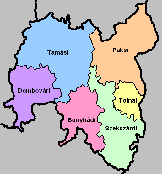
Tolna ( hu, Tolna megye, ; german: Komitat Tolnau) is an administrative county (comitatus or megye) in present Hungary as it was of the former Kingdom of Hungary. It lies in central Hungary, on the west bank of the river Danube. It shares borders with the Hungarian counties Somogy, Fejér, Bács-Kiskun, and Baranya. The capital of Tolna county is Szekszárd. Its area is 3703 km2. History Tolna (in Latin: ''comitatus Tolnensis'') was also the name of a historic administrative county (comitatus) of the Kingdom of Hungary. Its territory, which was about the same as that of present Tolna county, is now in central Hungary. The capital of the county was Szekszárd. Demographics In 2015, it had a population of 225,936 and the population density was . Ethnicity Besides the Hungarian majority, the main minorities are the Germans (approx. 10,000) and Roma (8,500). Total population (2011 census): 230,361 Ethnic groups (2011 census): Identified themselves: 214 953 persons: *Hu ... [...More Info...] [...Related Items...] OR: [Wikipedia] [Google] [Baidu] |
Veszprém (county)
Veszprém (; german: Weißbrunn, sl, Belomost) is one of the oldest urban areas in Hungary, and a city with county rights. It lies approximately north of the Lake Balaton. It is the administrative center of the county (comitatus or 'megye') of the same name. Etymology The name of the city originates from a Slavic personal name ''Bezprem'' or ''Bezprym'' (Proto-Slavic ''Bezprěmъ'') meaning "stubborn", "self-confident, not willing to retreat". ''Besprem'' (before 1002), ''Vezprem'' (1086), ''Bezpremensis'' (1109). The form ''Vezprem'' originates in early medieval scribal habits and frequent exchange of ''B'' and ''V'' under the influence of Greek. The city was named either after a chieftain, or the son of Judith of Hungary, who settled here after her husband Boleslaus I of Poland expelled her and her son. Location and legend The city can be reached via the M7 highway and Road 8. It can also be reached from Győr via Road 82 and from Székesfehérvár via Road 8. Accord ... [...More Info...] [...Related Items...] OR: [Wikipedia] [Google] [Baidu] |
Zala County
Zala ( hu, Zala megye, ; ; ) is an administrative county ( comitatus or ''megye'') in south-western Hungary. It is named after the Zala River. It shares borders with Croatia ( Koprivnica–Križevci and Međimurje Counties) and Slovenia ( Lendava and Moravske Toplice) and the Hungarian counties Vas, Veszprém and Somogy. The capital of Zala county is Zalaegerszeg. Its area is . Lake Balaton lies partly in the county. History In the tenth century, the Hungarian Nyék tribe occupied the region around Lake Balaton. Their occupation was mainly in the areas known today as Zala and Somogy counties. Parts of the western territory of the former county of Zala are now part of Slovenia ( South-Prekmurje) and Croatia ( Međimurje). In 1919 it was part of the unrecognized state of the Republic of Prekmurje, which existed for just six days. Demographics In 2015, it had a population of 277,290 and the population density was . Ethnicity Besides the Hungarian majority, the main m ... [...More Info...] [...Related Items...] OR: [Wikipedia] [Google] [Baidu] |
Dráva
The Drava or Drave''Utrata Fachwörterbuch: Geographie - Englisch-Deutsch/Deutsch-Englisch'' by Jürgen Utrata (2014). Retrieved 10 Apr 2014. (german: Drau, ; sl, Drava ; hr, Drava ; hu, Dráva ; it, Drava ) is a river in southern . With a length of ,Joint Drava River Corridor Analysis Report 27 November 2014 including the Sextner Bach source, it is the fifth or sixth longest tr ... [...More Info...] [...Related Items...] OR: [Wikipedia] [Google] [Baidu] |
Virovitica-Podravina County
Virovitica-Podravina County (; hr, Virovitičko-podravska županija ; hu, Verőce-Drávamente megye) is a northern Slavonian county in Croatia. Its county seat is in Virovitica and it includes the area around the Drava river, hence the name ''Podravina''. Other notable towns are Slatina and Orahovica. Administrative division Virovitica-Podravina County holds the following towns and districts: Towns Municipalities Demographics As of the 2011 census, the county had 84,836 residents. The population density is 42 people per km². Ethnic Croats form the majority with 91.8% of the population, followed by Serbs The Serbs ( sr-Cyr, Срби, Srbi, ) are the most numerous South Slavs, South Slavic ethnic group native to the Balkans in Southeastern Europe, who share a common Serbian Cultural heritage, ancestry, Culture of Serbia, culture, History of ... at 6.0%. References External links * {{Authority control Slavonia Counties of Croatia ... [...More Info...] [...Related Items...] OR: [Wikipedia] [Google] [Baidu] |
Koprivnica-Križevci County
Koprivnica-Križevci County ( hr, Koprivničko-križevačka županija ; hu, Kapronca-Kőrös megye) is a county in Northern Croatia. Its hyphenated name comes from two entities: the two of its largest cities, Koprivnica and Križevci; Koprivnica is the official capital of the county. The county also includes a third town, Đurđevac, but its population is much smaller than the main two (8,862 in 2001). The Koprivnica-Križevci County borders on the Međimurje County in the north, Varaždin County in the northwest, Zagreb County in the southwest, Bjelovar-Bilogora County in the south, Virovitica-Podravina County in the southeast and Hungary in the east. History Koprivnica was first mentioned in 1272 in a document by prince Ladislaus IV of Hungary and was declared a free royal town by king Louis I of Hungary, Ludovic I in 1356. It has flourished as a trading place and a military fortress since that time. The military aspect set it back when it was included in the Croatian Mi ... [...More Info...] [...Related Items...] OR: [Wikipedia] [Google] [Baidu] |
Croatia
, image_flag = Flag of Croatia.svg , image_coat = Coat of arms of Croatia.svg , anthem = "Lijepa naša domovino"("Our Beautiful Homeland") , image_map = , map_caption = , capital = Zagreb , coordinates = , largest_city = capital , official_languages = Croatian , languages_type = Writing system , languages = Latin , ethnic_groups = , ethnic_groups_year = 2021 , religion = , religion_year = 2021 , demonym = , government_type = Unitary parliamentary republic , leader_title1 = President , leader_name1 = Zoran Milanović , leader_title2 = Prime Minister , leader_name2 = Andrej Plenković , leader_title3 = Speaker of Parliament , leader_name3 = Gordan Jandroković , legislature = Sabor , sovereignty_type ... [...More Info...] [...Related Items...] OR: [Wikipedia] [Google] [Baidu] |


