|
Szczecinek
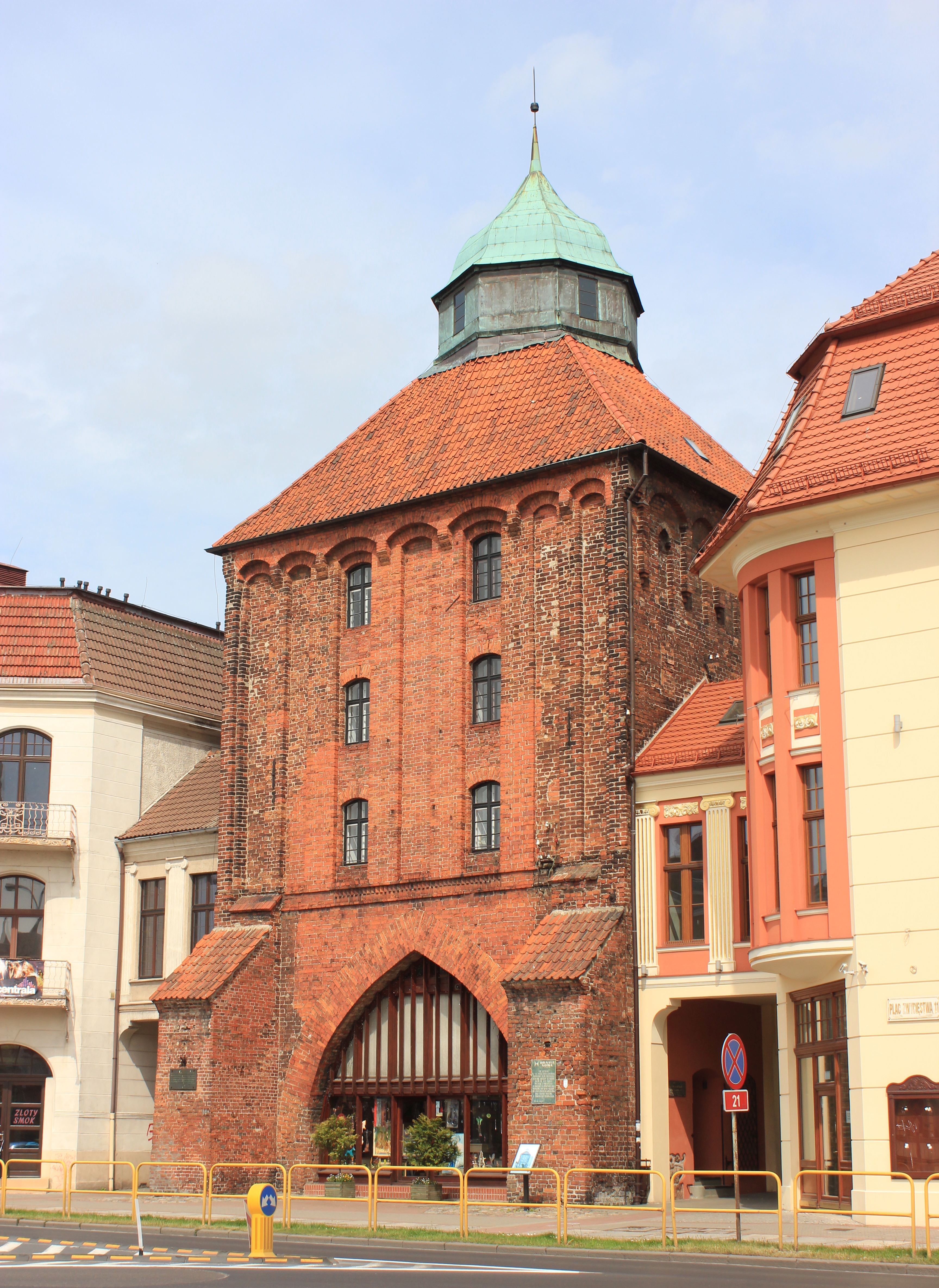
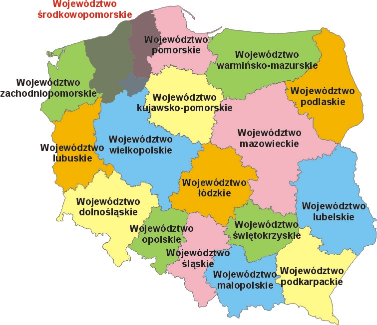
Szczecinek (; ) is a historic city in Middle Pomerania, northwestern Poland, capital of Szczecinek County in the West Pomeranian Voivodeship, with a population of more than 40,000 (2011). The town's total area is . The turbulent history of Szczecinek reaches back to the High Middle Ages, when the area was ruled by Pomeranian dukes and princes. The majority of the city's architecture survived World War II and, subsequently, its entire Old Town was proclaimed a national heritage monument of Poland. Szczecinek is the location of one of the oldest museums and one of the oldest high schools in Pomerania and northern Poland, and one of the places of production of ''krówki''. It is an important railroad junction, located along the main Poznań - Kołobrzeg line, which crosses less important lines to Chojnice and Słupsk. Location Szczecinek lies in eastern part of West Pomeranian Voivodeship. Historically, it was included within Western Pomerania. In 2010, the city boundaries were e ... [...More Info...] [...Related Items...] OR: [Wikipedia] [Google] [Baidu] |
Szczecinek County
__NOTOC__ Szczecinek County () is a unit of territorial administration and local government (powiat) in West Pomeranian Voivodeship, north-western Poland. It came into being on January 1, 1999, as a result of the Polish local government reforms passed in 1998. Its administrative seat and largest town is Szczecinek, which lies east of the regional capital Szczecin. The county contains three other towns: Borne Sulinowo, south-west of Szczecinek, Barwice, west of Szczecinek, and Biały Bór, north-east of Szczecinek. The county covers an area of . As of 2006 its total population is 77,232, out of which the population of Szczecinek is 38,756, that of Borne Sulinowo is 4,224, that of Barwice is 3,838, that of Biały Bór is 2,127, and the rural population is 28,287. Neighbouring counties Szczecinek County is bordered by Koszalin County to the north, Bytów County to the north-east, Człuchów County to the east, Złotów County to the south, Drawsko County and Świdwin Count ... [...More Info...] [...Related Items...] OR: [Wikipedia] [Google] [Baidu] |
Jerzy Hardie-Douglas
Jerzy Hardie-Douglas (born 1 February 1951) is a politician and surgeon. He was a mayor of Szczecinek from 2006 to 2018, and again since 2024, and a member of the Sejm of Poland from 2018 to 2023. Biography Jerzy Hardie-Douglas was born on 1 February 1951 in Łódź, Poland. He is Polish of Scottish descent. His ancestor moved to Ukraine from Scotland in the 19th century. His father, Jakub Douglas (1920–1998) fought in the Warsaw Uprising during the Second World War, and his grandfather, James Douglas (1878–1956), was a diplomat and an activist for Polish independence.Wojciech Skóra: ''Organizacja i pierwszy okres działalności polskich konsulatów w Harbinie i Władywostoku w latach 1920–1924''. In: Andrzej Furier: ''Polskie ślady na Dalekim Wschodzie. Polacy w Harbinie''. Szczecin: Pomeranian Library, 2008. ISBN 978-83-87879-73-0. (in Polish) After graduating from highschool, he began working in the emergency medical services in Łódź, and as a hospital nurse in ... [...More Info...] [...Related Items...] OR: [Wikipedia] [Google] [Baidu] |
Godzimierz, West Pomeranian Voivodeship
Godzimierz is a village in the administrative district of Gmina Szczecinek, within Szczecinek County, West Pomeranian Voivodeship, in north-western Poland. It lies approximately east of Szczecinek and east of the regional capital Szczecin. For the history of the region, see History of Pomerania The history of Pomerania starts shortly before 1000 AD, with ongoing conquests by newly arrived Polans (western), Polan rulers. Before that, the area was recorded nearly 2000 years ago as Germania, and in modern times Pomerania has been split betw .... The village has a population of 250. References Villages in Szczecinek County {{Szczecinek-geo-stub ... [...More Info...] [...Related Items...] OR: [Wikipedia] [Google] [Baidu] |
Marcelin, West Pomeranian Voivodeship
Marcelin is a village in the administrative district of Gmina Szczecinek, within Szczecinek County, West Pomeranian Voivodeship, in north-western Poland. References Villages in Szczecinek County {{Szczecinek-geo-stub ... [...More Info...] [...Related Items...] OR: [Wikipedia] [Google] [Baidu] |
West Pomeranian Voivodeship
West Pomeranian Voivodeship is a Voivodeships of Poland, voivodeship (province) in northwestern Poland. Its capital and largest city is Szczecin. Its area equals , and in 2021, it was inhabited by 1,682,003 people. It was established on 1 January 1999, out of the former Szczecin Voivodeship (1975–1998), Szczecin and Koszalin Voivodeship (1975–1998), Koszalin Voivodeships and parts of Gorzów Voivodeship, Gorzów, Piła Voivodeship, Piła and Słupsk Voivodeships, pursuant to the Polish local government reforms adopted in 1998. It borders on Pomeranian Voivodeship to the east, Greater Poland Voivodeship to the southeast, Lubusz Voivodeship to the south, the Germany, German States of Germany, federal-states of Mecklenburg-Vorpommern, Mecklenburg-West Pomerania and Brandenburg to the west, and the Baltic Sea to the north.Ustawa z dnia 24 lipca 1998 r. o wprowadzeniu zasadniczego trójstopniowego podziału terytorialnego państwa (Dz.U. z 1998 r. nr 96, poz. 603). Geography and ... [...More Info...] [...Related Items...] OR: [Wikipedia] [Google] [Baidu] |
Słupsk
Słupsk (; ; ) is a city with powiat rights located on the Słupia River in the Pomeranian Voivodeship in northern Poland, in the historical region of Pomerania or more specifically in its part known in contemporary Poland as Central Pomerania () within the wider West Pomerania (). According to Statistics Poland, it has a population of 88,835 inhabitants while occupying , thus being one of the most densely populated cities in the country as of December 2021. In addition, the city is the administrative seat of Słupsk County and the rural Gmina Słupsk, despite belonging to neither. Słupsk had its origins as a Pomeranian settlement in the early Middle Ages. In 1265, it was given city rights. By the 14th century, the city had become a centre of local administration and trade and a Hanseatic League associate. Between 1368 and 1478, it was a residence of the Duchy of Słupsk, Dukes of Słupsk, until 1474 vassals of the Crown of the Kingdom of Poland, Kingdom of Poland. According to ... [...More Info...] [...Related Items...] OR: [Wikipedia] [Google] [Baidu] |
National Roads In Poland
According to classes and categories of public roads in Poland, a national road () is a public trunk road controlled by the Polish central government authority, the General Directorship of National Roads and Motorways (). All motorways and expressways in Poland are classified as part of the national roads network. Other types of roads in Poland are under the control of entities at voivodeship, powiat and gmina levels: voivodeship roads, powiat roads and gmina roads. National roads network National roads include: * motorways and expressways and other roads that are planned to be upgraded to motorways or expressways * International E-road network, almost all of which has been upgraded to either Motorway or Expressway by late 2023. * roads connecting the national road network * roads to or from border crossings * roads which are alternatives to toll roads * beltways of major cities and metropolitan areas * roads of military importance Currently, there are 96 national ro ... [...More Info...] [...Related Items...] OR: [Wikipedia] [Google] [Baidu] |
Chojnice
Chojnice (; or ; or ) is a town in northern Poland with 38,789 inhabitants, as of June 2023, near the Tuchola Forest. It is the capital of the Chojnice County in the Pomeranian Voivodeship. Founded in , Chojnice is a former royal city of Poland and was an important center of cloth production in Poland. It is the location of one of the oldest high schools in Poland, and was an important center of Polish youth resistance against the Germanisation policies of Kingdom of Prussia, Prussia following the Partitions of Poland. It was the site of several significant battles, and during World War II Nazi Germany, German occupiers massacred some 2,000 Poles on its outskirts. Chojnice is a railroad junction with railroads towards Brodnica, Kościerzyna, Piła, Szczecinek and Tczew. It contains several Gothic architecture, Gothic and Baroque architecture, Baroque heritage sights, and is the largest town in the immediate vicinity of the Tuchola Forest, a large forest complex of north-central P ... [...More Info...] [...Related Items...] OR: [Wikipedia] [Google] [Baidu] |
Krówki
Krówki (, plural; ''krówka'' Grammatical number, singular), literally a dimunitive form of the Polish word for "cow," are Poland, Polish fudge, semi-soft milk toffee candy, candies. When hand-made, they are hard and crispy on the outside, but the inside is more fluid than solid. It is one of the most common Polish confections, sold worldwide, and might be considered "''dulce de leche'' candy". Commercially, many brands are available; most of them have each individual candy wrapped in white-and-yellow paper with a picture of a Holstein (cattle), Holstein cow. Widely known across Europe even before the end of the Cold War, they are something of an equivalent of the White Rabbit Creamy Candy famous across East Asia, or Scottish Tablet (confectionery), Tablet. The original recipe usually contains milk, sugar, and sometimes butter, cream and vanilla flavor. There are also fruit (e.g. banana), cocoa, coffee, nut, liquorice candy, liquorice flavored ''krówki'' available, as well as ve ... [...More Info...] [...Related Items...] OR: [Wikipedia] [Google] [Baidu] |
Middle Pomerania
The term Middle or Central Pomerania can refer to two distinct areas, depending on whether it is used as a translation of the corresponding German or Polish terms Mittelpommern (also Mittelpommerscher Keil) or Pomorze Środkowe, respectively. Mittelpommern Mittelpommern in historical usage denotes the central parts of the former Duchy, later Province of Pomerania, located approximately between the rivers Peene and Rega, including the towns Trzebiatów, Resko and Nowogard. Mittelpommerscher Keil Mittelpommerscher Keil (Middle Pomeranian Wedge) is a term used in ethnolinguistics, which carries a narrower meaning; it corresponds to the south-central part of Mittelpommern, roughly between the rivers Zarow and Ihna (Ina).Wolfgang Wilhelminus et al, ''Pommern. Geschichte, Kultur, Wissenschaft'', University of Greifswald, 1990, pp.325ff This area differed from the rest of the duchy or province by the dialect of the inhabitants, who spoke the Mittelpommersch variety closely rel ... [...More Info...] [...Related Items...] OR: [Wikipedia] [Google] [Baidu] |
Voivodeship Road
According to classes and categories of public roads in Poland, a voivodeship A voivodeship ( ) or voivodate is the area administered by a voivode (governor) in several countries of central and eastern Europe. Voivodeships have existed since medieval times and the area of extent of voivodeship resembles that of a duchy in ... road () is a category of roads one step below national roads in importance. The roads are numbered from 100 to 993. Total length of voivodeship roads in Poland is of which are unpaved (2008).Transport – activity results in 2008 , Główny Urząd Statystyczny List of voivodeship roads Current list of voivodeship road ...[...More Info...] [...Related Items...] OR: [Wikipedia] [Google] [Baidu] |
Highways In Poland
Controlled-access highways in Poland are part of the National roads in Poland, national roads network and they are divided into motorways and Controlled-access highway, expressways. Both types of highways feature grade-separated Interchange (road), interchanges with all other roads, Shoulder (road), emergency lanes, feeder lanes, wildlife crossings and dedicated roadside rest areas. Motorways differ from expressways in their technical parameters like designated speed, permitted road curvature, lane widths or minimal distances between interchanges. Moreover, expressways might have single-carriageway sections in case of low traffic densities (as of 2025, such sections constitute 3.5% of the highway network). The development of modern highways began in the 1970s, but proceeded very slowly under the Polish People's Republic, communist rule and for the first years afterwards: between 1970 and 2000 only 434 km of highways were constructed in total (5% of the planned network) ... [...More Info...] [...Related Items...] OR: [Wikipedia] [Google] [Baidu] |

