|
Szabolcs County
Szabolcs was an administrative county (Comitatus (Kingdom of Hungary), comitatus) of the Kingdom of Hungary. Its territory is now part of Hungary, except for three villages which are in the Zakarpattia Oblast of Ukraine. The capital of the county was Nyíregyháza. Geography In the late 19th and early 20th centuries Szabolcs county shared borders with the counties of Borsod County, Borsod, Zemplén County, Zemplén, Ung County, Ung, Bereg County, Bereg, Szatmár County, Szatmár, Bihar County, Bihar and Hajdú County, Hajdú. It was situated mostly south of the river Tisza. Its area was around 1910. Prior to the Hungarian administrative reforms of 1876 Szabolcs controlled some additional territory to the south-west giving it borders with Heves County, Heves and Külső-Szolnok and the Nagykunság (part of the Jászkunság from 1745), as well as a small section of border with Békés County (former), Békés. This territory largely became part of Hajdú when it was established i ... [...More Info...] [...Related Items...] OR: [Wikipedia] [Google] [Baidu] |
Comitatus (Kingdom Of Hungary)
Comitatus may refer to: *Comitatus (warband), a Germanic warband who follow a leader * ''Comitatus'', the office of a Roman or Frankish comes, translated as count. * ''Comitatus'', translated as county, a territory such as governed by medieval counts. * Comitatus (Kingdom of Hungary), counties in the Kingdom of Hungary * Comitatenses, armies of the late Roman Empire * Posse comitatus (other), various meanings See also * * Retinue, a body of persons "retained" in the service of a noble or royal person {{disambiguation ... [...More Info...] [...Related Items...] OR: [Wikipedia] [Google] [Baidu] |
Bereg County
Bereg (; ) was an administrative county ( comitatus) of the Kingdom of Hungary. Its territory is now mostly in western Ukraine and a smaller part in northeastern Hungary. The capital of the county was Beregszász ("Berehove" in Ukrainian, ''Berehovo'' in Rusyn, ''Bergsaß'' in German, ''Beregovo'' in Russian, ''Bereg'' in Romanian). Geography Bereg county shared borders with the Austrian crownland Galicia (now in Poland and Ukraine) and the Hungarian counties Máramaros, Ugocsa, Szatmár, Szabolcs and Ung. It was situated between the Carpathian Mountains in the north and the river Tisza in the south. Its area was 3788 km2 around 1910. History Bereg is one of the oldest counties in Hungary. In 1920 the Treaty of Trianon assigned most of the territory to Czechoslovakia. The southwestern part remained in Hungary and the county of Szatmár-Ugocsa-Bereg was created in 1923. Following the First Vienna Award Szatmár County was recreated, thus Bereg-Ugocsa county was cre ... [...More Info...] [...Related Items...] OR: [Wikipedia] [Google] [Baidu] |
Salient (geography)
A salient, panhandle, or bootheel is an elongated protrusion of a geopolitical entity, such as a subnational entity or a sovereign state. While similar to a peninsula in shape, a salient is most often not surrounded by water on three sides. Instead, it has a land border on at least two sides and extends from the larger geographical body of the administrative unit. In American English, the term panhandle is often used to describe a relatively long and narrow salient, such as the westernmost extensions of Florida Panhandle, Florida and Oklahoma Panhandle, Oklahoma, or the northernmost portion of Idaho Panhandle, Idaho. Another term is bootheel, used for the Missouri Bootheel and New Mexico Bootheel areas. Origin The term ''salient'' is derived from salient (military), military salients. The term "panhandle" derives from the analogous part of a cooking pan, and its use is generally confined to North America. The salient shape can be the result of arbitrarily drawn international ... [...More Info...] [...Related Items...] OR: [Wikipedia] [Google] [Baidu] |
Revolutions Of 1848 In The Austrian Empire
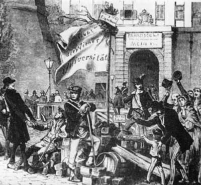
The revolutions of 1848 in the Austrian Empire took place from March 1848 to November 1849. Much of the revolutionary activity had a nationalism, nationalist character: the Austrian Empire, ruled from Vienna, included ethnic Germans, Hungarians, Polish people, Poles, Bohemians (Czechs), Ruthenians (Ukrainians), Slovenes, Slovaks, Romanians, Croats, Italians, and Serbs; all of whom attempted in the course of the revolution to either achieve autonomy, independence, or even hegemony over other nationalities. The nationalist picture was further complicated by the German revolutions of 1848–1849, simultaneous events in the German states, which moved toward greater German national unity. Besides these Nationalism, nationalists, liberalism, liberal and socialism, socialist currents resisted the Empire's longstanding conservatism. Background The revolutions of 1848, events of 1848 were the product of mounting social and political tensions after the Congress of Vienna of 1815. During ... [...More Info...] [...Related Items...] OR: [Wikipedia] [Google] [Baidu] |
Exclave
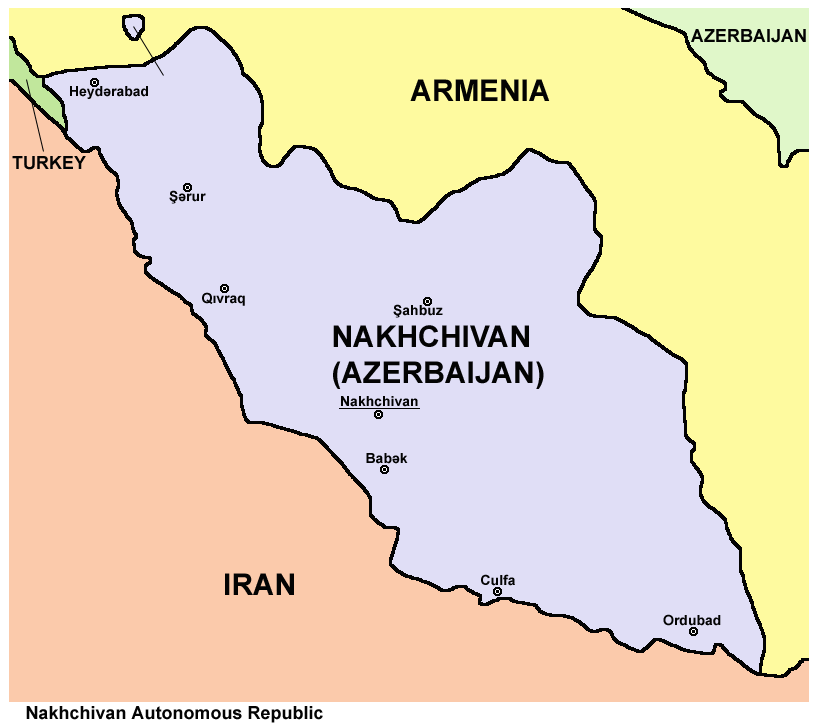
An enclave is a territory that is entirely surrounded by the territory of only one other state or entity. An enclave can be an independent territory or part of a larger one. Enclaves may also exist within territorial waters. ''Enclave'' is sometimes used improperly to denote a territory that is only partly surrounded by another state. Enclaves that are not part of a larger territory are not exclaves, for example Lesotho (enclaved by South Africa), and San Marino and Vatican City (both enclaved by Italy) are enclaved sovereign states. An exclave is a portion of a state or district geographically separated from the main part, by some surrounding alien territory. Many exclaves are also enclaves, but an exclave surrounded by the territory of more than one state is not an enclave. The Azerbaijani exclave of Nakhchivan is an example of an exclave that is not an enclave, as it borders Armenia, Iran, and Turkey. Semi-enclaves and semi-exclaves are areas that, except for possessing ... [...More Info...] [...Related Items...] OR: [Wikipedia] [Google] [Baidu] |
Enclave
An enclave is a territory that is entirely surrounded by the territory of only one other state or entity. An enclave can be an independent territory or part of a larger one. Enclaves may also exist within territorial waters. ''Enclave'' is sometimes used improperly to denote a territory that is only partly surrounded by another state. Enclaves that are not part of a larger territory are not exclaves, for example Lesotho (enclaved by South Africa), and San Marino and Vatican City (both enclaved by Italy) are enclaved sovereign states. An exclave is a portion of a state or district geographically separated from the main part, by some surrounding alien territory. Many exclaves are also enclaves, but an exclave surrounded by the territory of more than one state is not an enclave. The Azerbaijani exclave of Nakhchivan is an example of an exclave that is not an enclave, as it borders Armenia, Iran, and Turkey. Semi-enclaves and semi-exclaves are areas that, except for possessing ... [...More Info...] [...Related Items...] OR: [Wikipedia] [Google] [Baidu] |
Hajduk (Kingdom Of Hungary)
A hajduk (, plural of ) is a type of irregular infantry found in Central, Eastern, and parts of Southeast Europe from the late 16th to mid 19th centuries, especially from Hajdú-Bihar county. They have reputations ranging from bandits to freedom fighters depending on time, place, and their enemies. In the European lands of the Ottoman Empire, the term ''hajduk'' was used to describe bandits and brigands of the Balkans, while in Central Europe for the West Slavs, Hungarians, and Germans, and Eastern Europe for the Ukrainians, it was used to refer to outlaws who protected Christians against provocative actions by the Ottomans. By the 17th century they were firmly established in the Ottoman Balkans, owing to increased taxes, Christian victories against the Ottomans, and a general decline in security. Hajduk bands predominantly numbered one hundred men each, with a firm hierarchy under one leader. They targeted Ottoman representatives and rich people, mainly rich Turks, for pl ... [...More Info...] [...Related Items...] OR: [Wikipedia] [Google] [Baidu] |
Békés County (former)
Békés was an administrative county (Comitatus (Kingdom of Hungary), comitatus) of the Kingdom of Hungary. Its territory, which was smaller than that of present Békés (county), Békés county, is now in southeastern Hungary. The capital of the county was Gyula (town), Gyula. Geography Békés county shared borders with the Hungarian counties Csongrád (former county), Csongrád, Jász-Nagykun-Szolnok (former county), Jász-Nagykun-Szolnok, Hajdú (county), Hajdú, Bihar (county), Bihar, Arad (Hungarian county), Arad and Csanád County, Csanád. The river Körös (river), Körös flowed through the county. Its area was 3,670 km2 around 1910. History Békés county arose as one of the first comitatus of the Kingdom of Hungary, in the 11th century. In 1950, the territory of Békés county was expanded with: * the northeastern part of former Csanád-Arad-Torontál county (the Hungarian part of pre-1920 Arad (Hungarian county), Arad county and the north-eastern part of pre-19 ... [...More Info...] [...Related Items...] OR: [Wikipedia] [Google] [Baidu] |
Nagykunság
Nagykunság ("Greater Cumania", ) is a historical and geographical region in Hungary situated in the current Jász-Nagykun-Szolnok county between Szolnok and Debrecen. Like other historical European regions called Cumania, it is named for the Cumans, a nomadic tribe of pagan Kipchaks that settled the area. Its territory is 1,196 km2. See also *Kunság (Cumania) *Kiskunság Kiskunság ("Little Cumania", ) is a historical and geographical region in Hungary situated in the current between Kalocsa and Szeged. Its territory is 2,423 km2. Like other historical European regions called Cumania, it is named for the ... (Little Cumania) References Historical regions in Hungary Historical regions in the Kingdom of Hungary Cumans {{Jasz-geo-stub ... [...More Info...] [...Related Items...] OR: [Wikipedia] [Google] [Baidu] |
Heves County
Heves county (, ) lies in northern Hungary, between the right bank of the river Tisza and the Mátra and Bükk mountains. It shares borders with the Hungarian counties Pest (county), Pest, Nógrád (county), Nógrád, Borsod-Abaúj-Zemplén and Jász-Nagykun-Szolnok. Eger is the county seat. Tourist sights * Lake Tisza * Bükk National Park * Bélapátfalva, abbey * Castle of Eger, Castle and Eger, City of Eger * Erdőtelek Arboretum * Feldebrő, 11th century Romanesque church * Gyöngyös, Mátra Museum * Hatvan, Grassalkovich mansion * Kisnána castle * Noszvaj, De la Motte mansion * Parád * Sirok castle * Szilvásvárad, Szalajka Valley * Szarvaskő, castle ruins Geography Heves county is a geographically diverse area; its northern part is mountainous (the Mátra and Bükk are the two highest mountain ranges in Hungary), while at south it includes a part of the Great Hungarian Plain. From south it is bordered by Lake Tisza, the largest artificial lake in Hungary. The average ... [...More Info...] [...Related Items...] OR: [Wikipedia] [Google] [Baidu] |
Tisza
The Tisza, Tysa or Tisa (see below) is one of the major rivers of Central and Eastern Europe. It was once called "the most Hungarian river" because it used to flow entirely within the Kingdom of Hungary. Today, it crosses several national borders. The Tisza begins near Rakhiv in Ukraine, at the confluence of the and , which is at coordinates (the former springs in the Chornohora mountains; the latter in the Gorgany range). From there, the Tisza flows west, roughly following Ukraine's borders with Romania and Hungary, then briefly as the border between Slovakia and Hungary, before entering into Hungary, and finally into Serbia. The Tisza enters Hungary at Tiszabecs, traversing the country from north to south. A few kilometers south of the Hungarian city of Szeged, it enters Serbia. Finally, it joins the Danube near the village of Stari Slankamen in Vojvodina, Serbia. The Tisza drains an area of about and has a length of Its mean annual discharge is seasonally to ... [...More Info...] [...Related Items...] OR: [Wikipedia] [Google] [Baidu] |


