|
Suwa Province
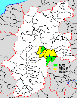
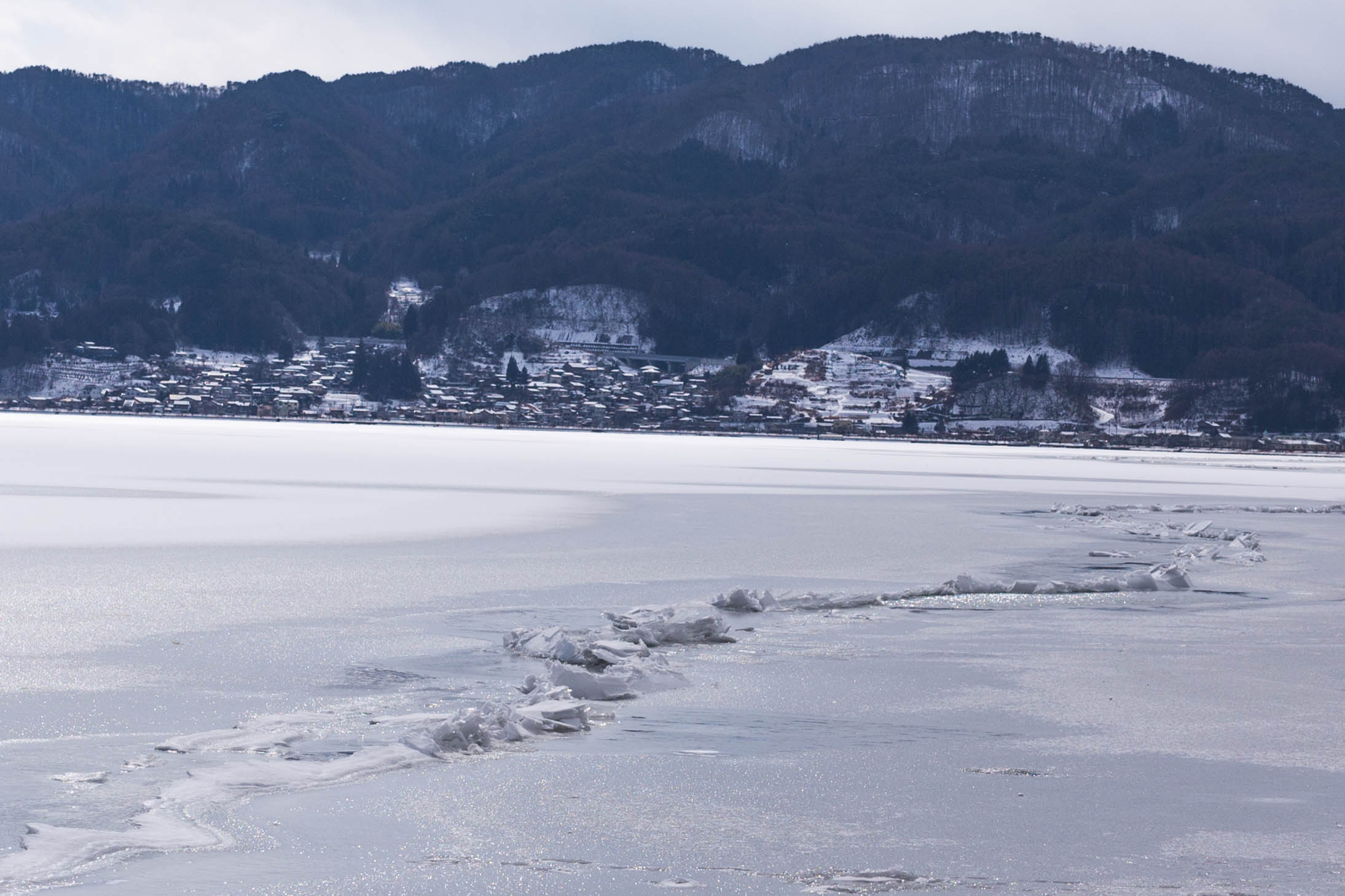
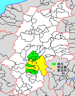
250px, Location of Suwa Province (721) is an old province in the area of Nagano Prefecture. Nussbaum, Louis-Frédéric. (2005). "''Suwa''" in . It was located in the Tōsandō region of central Honshu. According to the old history book ''Shoku Nihongi'', it was established on June 26 of 721 and abolished on March 3 of 731 (old Japanese calendar's date). Neither the location of the capital nor the exact border with Shinano is known. Historical districts Suwa Province consisted of three districts (originally two): * Nagano Prefecture ** Ina District (伊那郡): split to become Kamiina and Shimoina Districts ** Suwa District (諏訪郡) Gallery Image:Suwa Hotspring in Nagano Japan 001.JPG, Geyser in Kamisuwa (上諏訪), Nagano Prefecture See also * Lake Suwa *Suwa taisha *Suwa, Nagano Notes References * Nussbaum, Louis-Frédéric and Käthe Roth. (2005) ''Japan encyclopedia.''Cambridge: Harvard University Press Harvard University Press (HUP) is an academic ... [...More Info...] [...Related Items...] OR: [Wikipedia] [Google] [Baidu] |
Japan Prov Map Suwa721
Japan is an island country in East Asia. Located in the Pacific Ocean off the northeast coast of the Asia, Asian mainland, it is bordered on the west by the Sea of Japan and extends from the Sea of Okhotsk in the north to the East China Sea in the south. The Japanese archipelago consists of four major islands—Hokkaido, Honshu, Shikoku, and Kyushu—and List of islands of Japan, thousands of smaller islands, covering . Japan has a population of over 123 million as of 2025, making it the List of countries and dependencies by population, eleventh-most populous country. The capital of Japan and List of cities in Japan, its largest city is Tokyo; the Greater Tokyo Area is the List of largest cities, largest metropolitan area in the world, with more than 37 million inhabitants as of 2024. Japan is divided into 47 Prefectures of Japan, administrative prefectures and List of regions of Japan, eight traditional regions. About three-quarters of Geography of Japan, the countr ... [...More Info...] [...Related Items...] OR: [Wikipedia] [Google] [Baidu] |
Suwa District, Nagano
is a district located in southern Nagano Prefecture, Japan. As of 2003, the district has an estimated population of 46,162 with a density of 181.18 persons per km2. The total area is 254.79 km2. Municipalities The district consists of two towns and one village: * Fujimi * Hara * Shimosuwa ;Notes: History * January 4, 1879 - Suwa District was created during the early Meiji period The was an era of Japanese history that extended from October 23, 1868, to July 30, 1912. The Meiji era was the first half of the Empire of Japan, when the Japanese people moved from being an isolated feudal society at risk of colonizatio ... establishment of the municipalities system, which initially consisted of 24 villages. Its district headquarters was located at the village of Kamisuwa. District Timeline Districts in Nagano Prefecture {{Nagano-geo-stub ... [...More Info...] [...Related Items...] OR: [Wikipedia] [Google] [Baidu] |
Former Provinces Of Japan
A former is an object, such as a template, gauge or cutting die, which is used to form something such as a boat's hull. Typically, a former gives shape to a structure that may have complex curvature. A former may become an integral part of the finished structure, as in an aircraft fuselage, or it may be removable, being used in the construction process and then discarded or re-used. Aircraft formers Formers are used in the construction of aircraft fuselage, of which a typical fuselage has a series from the nose cone to the empennage, typically perpendicular to the longitudinal axis of the aircraft. The primary purpose of formers is to establish the shape of the fuselage and reduce the column length of stringers to prevent instability. Formers are typically attached to longerons, which support the skin of the aircraft. The "former-and-longeron" technique (also called stations and stringers) was adopted from boat construction, and was typical of light aircraft built until th ... [...More Info...] [...Related Items...] OR: [Wikipedia] [Google] [Baidu] |
731 Disestablishments
__NOTOC__ Year 731 ( DCCXXXI) was a common year starting on Monday of the Julian calendar. The denomination 731 for this year has been used since the early medieval period, when the Anno Domini calendar era became the prevalent method in Europe for naming years. Events By place Europe * Umayyad conquest of Gaul: Munuza, Moorish governor of Cerdagne (eastern Pyrenees), rebels against Umayyad authority. He is defeated and executed by Muslim forces under Abdul Rahman Al Ghafiqi at Urgell (Catalonia). Muslim garrisons in Septimania raid the cities Millau and Arles. * Ragenfrid, ex-mayor of the palace of Neustria, meets Duke Eudes of Aquitaine, to accept his rule and independence from the Frankish Kingdom. Fearing an alliance against him, Charles Martel exiles Ragenfrid's supporter Wandon of Fontenelle, and imprisons bishop Aimar of Auxerre. * Charles Martel leads two raids across the Loire River into the Berry region. The Franks seize and plunder Bourges (central Franc ... [...More Info...] [...Related Items...] OR: [Wikipedia] [Google] [Baidu] |
Harvard University Press
Harvard University Press (HUP) is an academic publishing house established on January 13, 1913, as a division of Harvard University. It is a member of the Association of University Presses. Its director since 2017 is George Andreou. The press maintains offices in Cambridge, Massachusetts, near Harvard Square, and in London, England. The press co-founded the distributor TriLiteral LLC with MIT Press and Yale University Press. TriLiteral was sold to LSC Communications in 2018. Notable authors published by HUP include Eudora Welty, Walter Benjamin, E. O. Wilson, John Rawls, Emily Dickinson, Stephen Jay Gould, Helen Vendler, Carol Gilligan, Amartya Sen, David Blight, Martha Nussbaum, and Thomas Piketty. The Display Room in Harvard Square, dedicated to selling HUP publications, closed on June 17, 2009. Related publishers, imprints, and series HUP owns the Belknap Press imprint (trade name), imprint, which it inaugurated in May 1954 with the publication of the ''Harvard Guide to ... [...More Info...] [...Related Items...] OR: [Wikipedia] [Google] [Baidu] |
Suwa, Nagano
is a city located in Nagano Prefecture, Japan. , the city had an estimated population of 48,972 in 20698 households, and a population density of 452 persons per km². The total area of the city is . History The shores of Lake Suwa have been inhabited since at least the Japanese Paleolithic period. The Suwa clan ruled the area since the Nara period, and the area developed as a castle town for Suwa Domain under the Edo period Tokugawa shogunate and as a post station on the Kōshū Kaidō highway. In the post-Meiji restoration cadastral reforms of April 1, 1889, the village of Kamisuwa was established. Kawasuwa was elevated to town status on April 20, 1891. After merger with the villages of Shiga and Toyoda (from Suwa District), Kamisuwa was elevated to city status on August 10, 1941, changing its name to Suwa. Geography Suwa is located in central Nagano Prefecture, bordered on the north and west by Lake Suwa, approximately 100 kilometers south of the prefectural capital of ... [...More Info...] [...Related Items...] OR: [Wikipedia] [Google] [Baidu] |
Suwa Taisha
, historically also known as Suwa Shrine (諏訪神社 ''Suwa-jinja'') or , is a group of Shinto shrines in Nagano Prefecture, Japan. The shrine complex is the ''ichinomiya'' of former Shinano Province and is considered to be one of the oldest shrines in existence, being implied by the ''Nihon Shoki'' to already stand in the late 7th century. Overview The entire Suwa shrine complex consists of four main shrines grouped into two sites: the Upper Shrine or ''Kamisha'' (上社), comprising the and the , and the Lower Shrine or ''Shimosha'' (下社), comprising the ''Harumiya'' (春宮, spring shrine) and the ''Akimiya'' (秋宮, autumn shrine). The Upper Shrine is located on the south side of Lake Suwa, in the cities of Chino, Nagano, Chino and Suwa, Nagano, Suwa, while the Lower Shrine is on the northern side of the lake, in the town of Shimosuwa. In addition to these four main shrines, some sixty other Setsumatsusha, auxiliary shrines scattered throughout the Lake Suwa area (rang ... [...More Info...] [...Related Items...] OR: [Wikipedia] [Google] [Baidu] |
Lake Suwa
is a lake in the Kiso Mountains, in the central region of Nagano Prefecture, Japan. Geography The lake is the source of the Tenryū River. It ranks 24th in lake water surface area in Japan. The cities of Suwa and Okaya and the town of Shimosuwa are located on the shores of Lake Suwa. Miwatari Lake Suwa is the site of a natural phenomenon known as the ''miwatari'', in recent years with an "o" added to the beginning, meaning , large cracks that form in the winter across the surface of the frozen lake. A vertical temperature gradient results in ice pressure ridges forming in the surface ice, reaching heights of or more, although much greater heights were recorded in the past. Local Shinto tradition holds that the ridges are formed by the gods crossing the lake when traveling between the various buildings of the Suwa Grand Shrine. Folklore says it is the guardian god of Suwa, Takeminakata-no-kami, leaving his sanctuary to meet with his wife, the goddess Yasakatome, joinin ... [...More Info...] [...Related Items...] OR: [Wikipedia] [Google] [Baidu] |
Shimoina District, Nagano
is a district located in southern Nagano Prefecture, Japan. Population As of May 2008, the district has an estimated population of 65,359 with a density of 51.4 persons per km2. The total area is 1,270.43 km2. Municipalities The district consists of three towns and ten villages: * Anan * Achi * Hiraya * Matsukawa * Neba * Ōshika * Shimojō * Takagi * Takamori * Tenryū * Toyooka * Urugi * Yasuoka ;Notes: History * January 4, 1879 - Ina District was split off into Kamiina and Shimoina Districts during the early Meiji period establishment of the municipalities system, which initially consisted of 1 town and 31 villages. Its district headquarters was located at the village of Iida. District Timeline * July 1, 1993 - The town of Kamisato was merged into the expanded city of Iida. Recent mergers * October 1, 2005: The villages of Kami are the Deity, deities, Divinity, divinities, Spirit (supernatural entity), spirits, mythological, ... [...More Info...] [...Related Items...] OR: [Wikipedia] [Google] [Baidu] |
Old Provinces Of Japan
were first-level administrative divisions of Japan from the 600s to 1868. Provinces were established in Japan in the late 7th century under the Ritsuryō law system that formed the first central government. Each province was divided into and grouped into one of the geographic regions or Circuit (administrative division), circuits known as the ''Gokishichidō'' (Five Home Provinces and Seven Circuits). Provincial borders often changed until the end of the Nara period (710 to 794), but remained unchanged from the Heian period (794 to 1185) until the Edo period (1603 to 1868). The provinces coexisted with the ''Han system, han'' (domain) system, the personal estates of feudal lords and warriors, and became secondary to the domains in the late Muromachi period (1336 to 1573). The Provinces of Japan were replaced with the current Prefectures of Japan, prefecture system in the ''Fuhanken sanchisei'' during the Meiji Restoration from 1868 to 1871, except for Hokkaido, which was For ... [...More Info...] [...Related Items...] OR: [Wikipedia] [Google] [Baidu] |
Kamiina District, Nagano
is a district located in southern Nagano Prefecture, Japan. As of May 2008, the district has an estimated population of 86,453 with a density of 168 persons per km2. The total area is 514.55 km2. On the other hand, if the cities of Ina and Komagane were included, the area will be known as the Kamiina Region. Municipalities The district consists of three towns and three villages: * Iijima * Minamiminowa * Minowa * Miyada * Nakagawa * Tatsuno ;Notes: History * January 4, 1879 - Ina District was split off into Kamiina and Shimoina Districts during the early Meiji period establishment of the municipalities system, which initially consisted of 2 towns and 26 villages. Its district headquarters was located at the village of at Ina. District Timeline * April 1, 1954 - The towns of Ina merged with the villages of Tomigata, Midori, Shura, Higashiharuchika, and Nishiminowa to form the city of Ina. * July 1, 1954 - The towns of Akaho and Miyada merged with the vil ... [...More Info...] [...Related Items...] OR: [Wikipedia] [Google] [Baidu] |


