|
Strethall
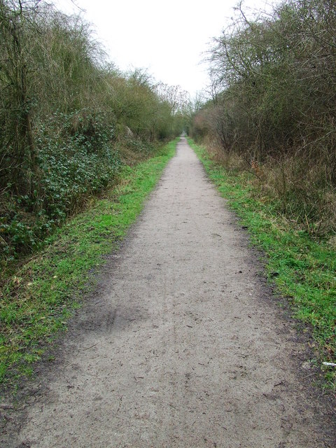
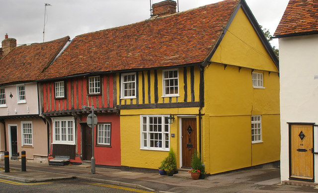
Strethall is a village and a civil parish in the Uttlesford District, in the English county of Essex, near the town of Saffron Walden. Having suffered no casualties in World War I it is known as one of the thankful villages. The Icknield Way Path passes through the village on its 110-mile route between Ivinghoe Beacon in Buckinghamshire and Knettishall Heath in Suffolk. The A route for walkers, horse riders and off-road cyclists also passes through the village. References External links Skullduggery in the History of StrethallThe Hundred Parishes: link to an introduction to STRETHALL See also * The Hundred Parishes The Hundred Parishes is an area of the East of England with no formal recognition or status, albeit that the concept has the blessing of county and district authorities. It encompasses around 450 square miles (1,100 square kilometres) of northwes ... Villages in Essex Uttlesford Civil parishes in Essex {{Essex-geo-stub ... [...More Info...] [...Related Items...] OR: [Wikipedia] [Google] [Baidu] |
The Hundred Parishes
The Hundred Parishes is an area of the East of England with no formal recognition or status, albeit that the concept has the blessing of county and district authorities. It encompasses around 450 square miles (1,100 square kilometres) of northwest Essex, northeast Hertfordshire and southern Cambridgeshire. The area comprises just over 100 administrative parishes, hence its name. It contains over 6,000 listed buildings and many conservation areas, village greens, ancient hedgerows, protected features and a historical pattern of small rural settlements in close proximity to one another. Origins The idea of recognising the area for its special heritage characteristics was originally conceived by local historian and author David Heathcote. A steering group of local historians, conservationists and a local authority representative, spearheaded by the Essex branch of the Campaign to Protect Rural England (CPRE), progressed the idea and defined a boundary. The name arose in response ... [...More Info...] [...Related Items...] OR: [Wikipedia] [Google] [Baidu] |
Thankful Villages
Thankful Villages (also known as Blessed Villages; ) are settlements in England and Wales from which all their members of the armed forces survived World War I. The term Thankful Village was popularised by the writer Arthur Mee in the 1930s; in ''Enchanted Land'' (1936), the introductory volume to '' The King's England'' series of guides, he wrote that a Thankful Village was one which had lost no men in the war because all those who left to serve came home again. His initial list identified 32 villages. There are tens of thousands of villages and towns in the United Kingdom. In an October 2013 update, researchers identified 53 civil parishes in England and Wales from which all serving personnel returned. There are no Thankful Villages identified in Scotland or Ireland yet (all of Ireland was then part of the United Kingdom). Fourteen of the English and Welsh villages are considered "doubly thankful", in that they also lost no service personnel during World War II. These are mark ... [...More Info...] [...Related Items...] OR: [Wikipedia] [Google] [Baidu] |
Uttlesford
Uttlesford is a local government district in Essex, England. Its council is based in the market town of Saffron Walden. At the 2011 Census, the population of the district was 79,443. Other notable settlements include Great Dunmow, Elmdon, Stebbing, Stansted Mountfitchet, Thaxted, Debden, Little Chesterford and Felstead among other settlements. History Its name is derived from its location within the ancient hundred of Uttlesford,Open Domesday: Hundred of Uttlesford. Accessed 6 January 2022. usually spelled ''Vdelesford'' Open Domesday: Saffron Walden. Accessed 6 January 2022. or ''Wdelesford'' [...More Info...] [...Related Items...] OR: [Wikipedia] [Google] [Baidu] |
Essex
Essex () is a county in the East of England. One of the home counties, it borders Suffolk and Cambridgeshire to the north, the North Sea to the east, Hertfordshire to the west, Kent across the estuary of the River Thames to the south, and Greater London to the south and south-west. There are three cities in Essex: Southend, Colchester and Chelmsford, in order of population. For the purposes of government statistics, Essex is placed in the East of England region. There are four definitions of the extent of Essex, the widest being the ancient county. Next, the largest is the former postal county, followed by the ceremonial county, with the smallest being the administrative county—the area administered by the County Council, which excludes the two unitary authorities of Thurrock and Southend-on-Sea. The ceremonial county occupies the eastern part of what was, during the Early Middle Ages, the Anglo-Saxon Kingdom of Essex. As well as rural areas and urban areas, it forms ... [...More Info...] [...Related Items...] OR: [Wikipedia] [Google] [Baidu] |
Saffron Walden (UK Parliament Constituency)
Saffron Walden is a constituency in Essex represented in the House of Commons of the UK Parliament since 2017 by Kemi Badenoch, a Conservative. History Saffron Walden was one of eight single-member divisions of Essex (later classified as county constituencies) created by the Redistribution of Seats Act 1885, replacing the three two member divisions of East, South and West Essex. The boundaries were redrawn under the Representation of the People Act 1918, then remaining virtually unchanged until changes brought in for the 2010 general election by the Fifth Periodic Review of Westminster constituencies. This has been a Conservative safe seat based on election results since 1922, in which period the majorities have occasionally been marginal. However, the constituency now has a Conservative majority of over 27,000. Boundaries and boundary changes 1885–1918: The Borough of Saffron Walden, the Sessional Divisions of Freshwell, Hinckford North, and Walden, part of the Sessi ... [...More Info...] [...Related Items...] OR: [Wikipedia] [Google] [Baidu] |
Saffron Walden
Saffron Walden is a market town in the Uttlesford district of Essex, England, north of Bishop's Stortford, south of Cambridge and north of London. It retains a rural appearance and some buildings of the medieval period. The population was 15,504 at the 2011 census. History Archaeological evidence suggests continuous settlement on or near the site of Saffron Walden from at least the Neolithic period. It is believed that a small Romano-British settlement and fort – possibly in the area round Abbey Lane – existed as an outpost of the much larger settlement of Cestreforda to the north. After the Norman invasion of 1066, a stone church was built. Walden Castle, dating from about 1140, may have been built on pre-existing fortifications. A priory, Walden Abbey, was founded under the patronage of Geoffrey de Mandeville, 1st Earl of Essex about 1136, on the site of what is now Audley End House. The abbey was separated from Walden by Holywell Field. After the dissolution of the m ... [...More Info...] [...Related Items...] OR: [Wikipedia] [Google] [Baidu] |
World War I
World War I (28 July 1914 11 November 1918), often abbreviated as WWI, was List of wars and anthropogenic disasters by death toll, one of the deadliest global conflicts in history. Belligerents included much of Europe, the Russian Empire, the United States, and the Ottoman Empire, with fighting occurring throughout Europe, the Middle East, Africa, the Pacific Ocean, Pacific, and parts of Asia. An estimated 9 million soldiers were killed in combat, plus another 23 million wounded, while 5 million civilians died as a result of military action, hunger, and disease. Millions more died in Genocides in history (World War I through World War II), genocides within the Ottoman Empire and in the Spanish flu, 1918 influenza pandemic, which was exacerbated by the movement of combatants during the war. Prior to 1914, the European great powers were divided between the Triple Entente (comprising French Third Republic, France, Russia, and British Empire, Britain) and the Triple A ... [...More Info...] [...Related Items...] OR: [Wikipedia] [Google] [Baidu] |
Icknield Way Path
Icknield is a parliamentary ward, of the Luton district, in the town of Luton, Bedfordshire, England. The ward takes its name from the Icknield Way, a pre-Roman road which passes through Luton. Situated towards the northeast of Luton, the ward is made up of parts of Runfold and Warden Hill, as well as Bushmead. Politics Icknield ward is represented by Cllr Asif Masood (Labour) and Cllr Jeff Petts (Conservative). The ward forms part of the parliamentary constituency An electoral district, also known as an election district, legislative district, voting district, constituency, riding, ward, division, or (election) precinct is a subdivision of a larger state (a country, administrative region, or other poli ... of Luton North and the MP is Sarah Owen ( Labour). Local Attractions References Luton Borough Council Wards of Luton {{Bedfordshire-geo-stub ... [...More Info...] [...Related Items...] OR: [Wikipedia] [Google] [Baidu] |
Ivinghoe Beacon
Ivinghoe Beacon is a prominent hill and landmark in Buckinghamshire, England, 233 m (757 ft) above sea level in the Chiltern Hills, close to Ivinghoe and Aldbury. Dunstable, Berkhamsted and Tring are nearby. The Beacon lies within the Ashridge Estate and is managed and owned by the National Trust. It is the starting point of the Icknield Way to the east, and the Ridgeway long-distance path to the west. Ivinghoe Beacon is a popular spot for walkers and sightseers. Model aircraft enthusiasts also use lift generated by the wind blowing up the hill to fly their unpowered aircraft – a technique known as slope soaring. History The hill is an ancient signal point, which was used in times of crisis to send messages across long distances. It is also the site of an early Iron Age hillfort protected as a scheduled monument. Archaeological evidence has revealed human activity dating back to the Bronze Age, and the area contains many other scheduled Monuments, including a numb ... [...More Info...] [...Related Items...] OR: [Wikipedia] [Google] [Baidu] |
Knettishall Heath
Knettishall Heath is a biological Site of Special Scientific Interest west of Knettishall in Suffolk. A larger area of 176 hectares is the Knettishall Heath Nature Reserve, which is managed by the Suffolk Wildlife Trust. Despite its name, Knettishall Heath is in fact a diverse mosaic of habitats with woodland and riverside meadows, as well as large areas of heath. Ecology The site is heath and grassland, mainly on acidic soils, with areas of secondary woodland and wet hollows. There are heathland plants such as sheep's sorrel, tormentil, harebell, ling and heath bedstraw, while wet areas have fen vegetation including water mint and yellow iris. Rare species Of the more than 12,500 species living in the Brecks, 30% are nationally rare. The heath is home to the rare grey carpet moth which is only found in Breckland, and the lunar yellow underwing moth. Seven bat species are found at Knettishall, including the nationally scarce barbastelle bat. Exmoor ponies In 2013, ... [...More Info...] [...Related Items...] OR: [Wikipedia] [Google] [Baidu] |
Villages In Essex
A village is a clustered human settlement or community, larger than a hamlet but smaller than a town (although the word is often used to describe both hamlets and smaller towns), with a population typically ranging from a few hundred to a few thousand. Though villages are often located in rural areas, the term urban village is also applied to certain urban neighborhoods. Villages are normally permanent, with fixed dwellings; however, transient villages can occur. Further, the dwellings of a village are fairly close to one another, not scattered broadly over the landscape, as a dispersed settlement. In the past, villages were a usual form of community for societies that practice subsistence agriculture, and also for some non-agricultural societies. In Great Britain, a hamlet earned the right to be called a village when it built a church. [...More Info...] [...Related Items...] OR: [Wikipedia] [Google] [Baidu] |


