|
Streethay
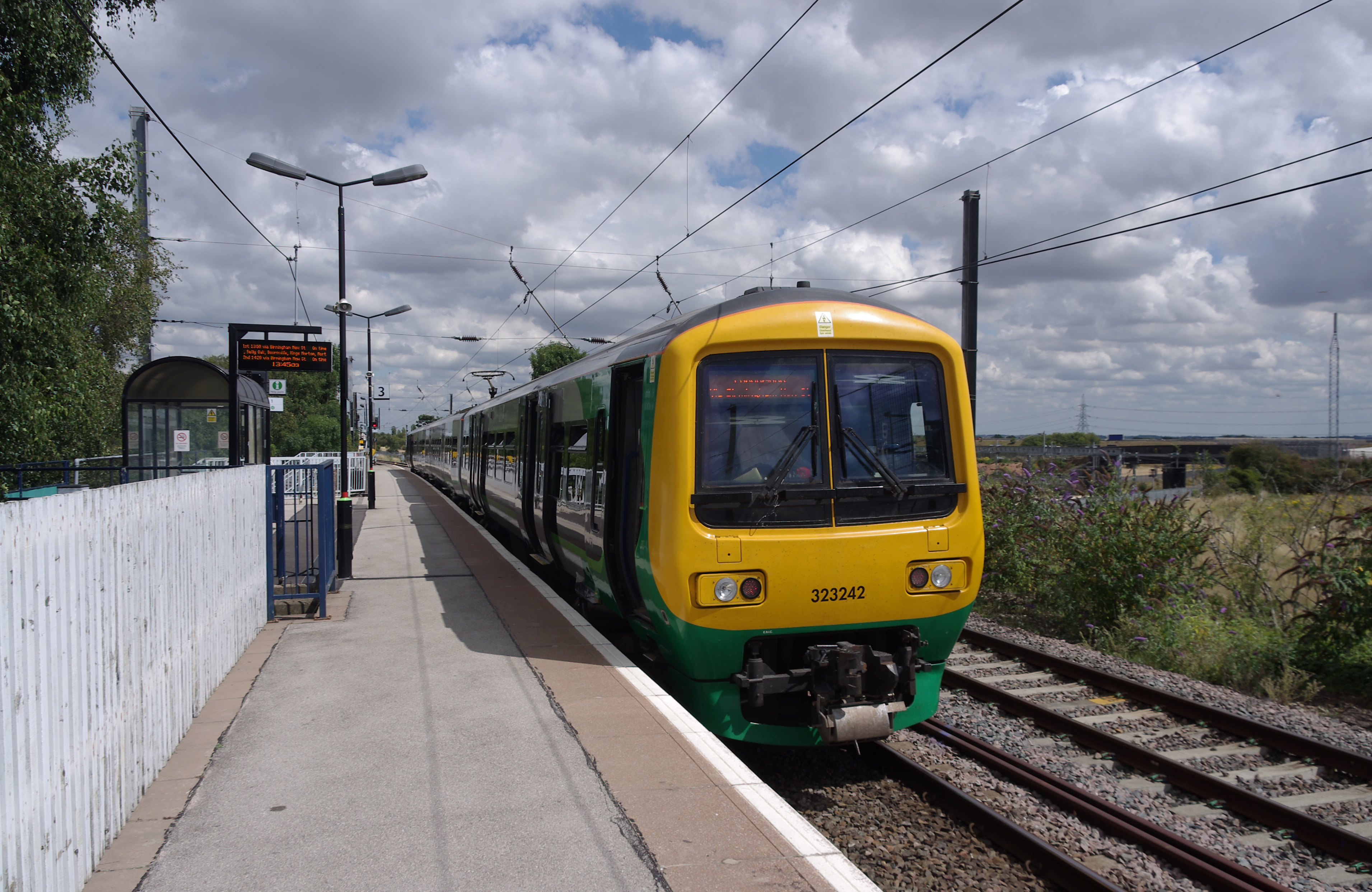
Streethay is an English village in the civil parish of Fradley and Streethay adjoining the city of Lichfield, Staffordshire on the east side of the West Coast Main Line railway. The parish council is a joint one with Fradley. Village amenities Streethay is a small village and has no shops. The main road in Streethay is the Old Burton Road (A5127 road), which starts at the A38 road junction and the road used to be the main route into Birmingham before the A38 was constructed. There was a former public house called 'The Anchor' which has been converted into flats and business premises. There is a children's play park on the A5127 Burton Road. There is a bus service that stops in Streethay, which continues onto Lichfield and Burton Upon Trent, calling at the villages of Fradley and Alrewas. Further up the A5127 road to Lichfield there is Lichfield Trent Valley railway station which is on the West Coast Mainline and has direct links to Birmingham, Northern England, Scotland, and ... [...More Info...] [...Related Items...] OR: [Wikipedia] [Google] [Baidu] |
Listed Buildings In Fradley And Streethay , and the listed buildings on the canals are bridges, locks, workshops, and mi ...
Fradley and Streethay is a civil parish in the district of Lichfield, Staffordshire, England. The parish contains 26 listed buildings that are recorded in the National Heritage List for England. All the listed buildings are designated at Grade II, the lowest of the three grades, which is applied to "buildings of national importance and special interest". The parish includes the villages of Fradley and Streethay and the surrounding area. The Trent and Mersey Canal and Coventry Canal meet in the parish at Fradley Junction Fradley Junction () is a canal junction between Fradley and Alrewas near Lichfield, Staffordshire, EnglandOS Explorer Map 245: The National Forest :(1:25 000) : [...More Info...] [...Related Items...] OR: [Wikipedia] [Google] [Baidu] |
Lichfield
Lichfield () is a cathedral city and civil parish in Staffordshire, England. Lichfield is situated roughly south-east of the county town of Stafford, south-east of Rugeley, north-east of Walsall, north-west of Tamworth and south-west of Burton Upon Trent. At the time of the 2011 Census, the population was estimated at 32,219 and the wider Lichfield District at 100,700. Notable for its three-spired medieval cathedral, Lichfield was the birthplace of Samuel Johnson, the writer of the first authoritative '' Dictionary of the English Language''. The city's recorded history began when Chad of Mercia arrived to establish his Bishopric in 669 AD and the settlement grew as the ecclesiastical centre of Mercia. In 2009, the Staffordshire Hoard, the largest hoard of Anglo-Saxon gold and silver metalwork, was found south-west of Lichfield. The development of the city was consolidated in the 12th century under Roger de Clinton, who fortified the Cathedral Close and ... [...More Info...] [...Related Items...] OR: [Wikipedia] [Google] [Baidu] |
Fradley
Fradley is a village in the Lichfield District, in the county of Staffordshire, England.OS Explorer Map 245: The National Forest :(1:25 000) :Map Details retrieved 11 April 2013 It is in the civil parish of whose population at the 2011 census was 3,753. Location The village is about north-east of the[...More Info...] [...Related Items...] OR: [Wikipedia] [Google] [Baidu] |
Fradley And Streethay
Fradley is a village in the Lichfield District, in the county of Staffordshire, England.OS Explorer Map 245: The National Forest :(1:25 000) :Map Details retrieved 11 April 2013 It is in the civil parish of Fradley and Streethay whose population at the 2011 census was 3,753. Location The village is about north-east of the City of Lichfield and 1 mi ...[...More Info...] [...Related Items...] OR: [Wikipedia] [Google] [Baidu] |
A38 Road
The A38, parts of which are known as Devon Expressway, Bristol Road and Gloucester Road, is a major A-class trunk road in England. The road runs from Bodmin in Cornwall to Mansfield in Nottinghamshire. It is long, making it the longest two-digit A road in England. It was formerly known as the ''Leeds–Exeter Trunk Road'', when this description also included the A61. Before the opening of the M5 motorway in the 1960s and 1970s, the A38 formed the main "holiday route" from the Midlands to Somerset, Devon and Cornwall. Considerable lengths of the road in the West Midlands closely follow Roman roads, including part of Icknield Street. Between Worcester and Birmingham the current A38 follows the line of a Saxon salt road; For most of the length of the M5 motorway, the A38 road runs alongside it as a single carriageway road. Route description Bodmin to Birmingham The road starts on the eastern side of Bodmin at a junction with the A30 before traversing the edge of the to ... [...More Info...] [...Related Items...] OR: [Wikipedia] [Google] [Baidu] |
Lichfield Trent Valley Railway Station
Lichfield Trent Valley is a railway station on the outskirts of the city of Lichfield in Staffordshire, England. It is one of two stations in Lichfield, the other being in the city-centre. It is a split-level station, with low level platforms served by the Trent Valley section of the West Coast Main Line, and a single high level platform, which is the northern terminus of the Cross-City Line. Location The station is located 1 mile north-east from the city-centre and serves the east and north side of the city. It is also being used by commuters from surrounding villages, such as Fradley, Alrewas and Whittington. The station bears the name Trent Valley, as the line on the lower level was opened by the Trent Valley Railway, which ran between Rugby and Stafford. The River Trent is found around 6 miles north of Lichfield Trent Valley at Wynchnor Junction, where it is joined by two of its tributaries, the River Tame and the River Mease. Access to the station is from the A512 ... [...More Info...] [...Related Items...] OR: [Wikipedia] [Google] [Baidu] |
Lichfield (district)
Lichfield () is a local government district in Staffordshire, England. It is administered by Lichfield District Council, based in Lichfield. The dignity and privileges of the City of Lichfield are vested in the parish council of the 14 km² Lichfield civil parish. The non-metropolitan district of Lichfield covers nearly 25 times this area and its local authority is Lichfield District Council. The district was formed on 1 April 1974, under the Local Government Act 1972, by a merger of the existing City of Lichfield with most of the Lichfield Rural District. Geography The district includes areas in two parliamentary constituencies: Lichfield and Tamworth. Settlements within the district * Alrewas, Armitage *Blithbury, Burntwood * Chase Terrace, Chasetown, Chorley, Clifton Campville, Colton, Comberford, Croxall, Curborough * Drayton Bassett * Edingale, Elford, Elmhurst *Farewell, Fazeley, Fisherwick, Fradley * Gentleshaw * Hademore, Hammerwich, Hamstal ... [...More Info...] [...Related Items...] OR: [Wikipedia] [Google] [Baidu] |
Handsacre
Handsacre is a village in the English county of Staffordshire, England.OS Explorer Map 244: Cannock Chase & Chasewater: (1:25 000) :Map Details retrieved 11 April 2013 Population details taken at the 2011 census can be found under Armitage with Handsacre Location The village lies east of the larger village of . ...[...More Info...] [...Related Items...] OR: [Wikipedia] [Google] [Baidu] |
High Speed 2
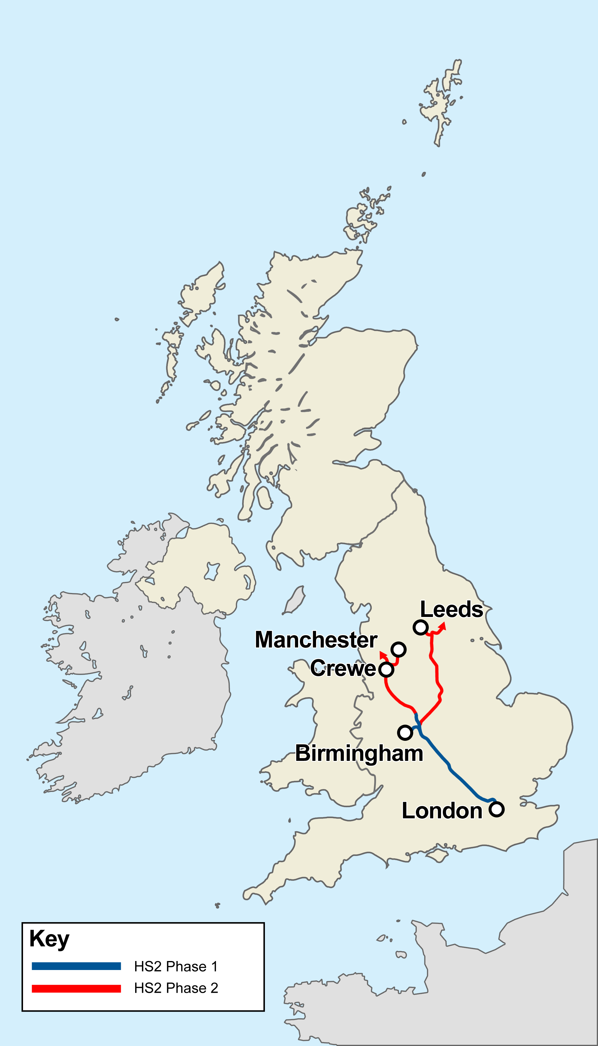
High Speed 2 (HS2) is a planned high-speed railway line in England, the first phase of which is under construction in stages and due for completion between 2029 and 2033, depending on approval for later stages. The new line will run from its most southerly terminus, London, to its most northerly point, Manchester, with branches to Birmingham and the East Midlands. HS2 will be Britain's second purpose-built high-speed line, the first being High Speed 1, which connects London to the Channel Tunnel. At its southern end, the line will terminate at London's Euston station while other termini will be Birmingham Curzon Street station and Manchester Piccadilly station. In addition to these stations, the dedicated track will serve Old Oak Common in west London, Birmingham Interchange, East Midlands Parkway south of Nottingham, Crewe, and Manchester Airport. There will be several junctions for trains to progress onto the existing West Coast Main Line and Midland Main Line to r ... [...More Info...] [...Related Items...] OR: [Wikipedia] [Google] [Baidu] |
London
London is the capital and List of urban areas in the United Kingdom, largest city of England and the United Kingdom, with a population of just under 9 million. It stands on the River Thames in south-east England at the head of a estuary down to the North Sea, and has been a major settlement for two millennia. The City of London, its ancient core and financial centre, was founded by the Roman Empire, Romans as ''Londinium'' and retains its medieval boundaries.See also: Independent city#National capitals, Independent city § National capitals The City of Westminster, to the west of the City of London, has for centuries hosted the national Government of the United Kingdom, government and Parliament of the United Kingdom, parliament. Since the 19th century, the name "London" has also referred to the metropolis around this core, historically split between the Counties of England, counties of Middlesex, Essex, Surrey, Kent, and Hertfordshire, which largely comprises Greater London ... [...More Info...] [...Related Items...] OR: [Wikipedia] [Google] [Baidu] |
Scotland
Scotland (, ) is a country that is part of the United Kingdom. Covering the northern third of the island of Great Britain, mainland Scotland has a border with England to the southeast and is otherwise surrounded by the Atlantic Ocean to the north and west, the North Sea to the northeast and east, and the Irish Sea to the south. It also contains more than 790 islands, principally in the archipelagos of the Hebrides and the Northern Isles. Most of the population, including the capital Edinburgh, is concentrated in the Central Belt—the plain between the Scottish Highlands and the Southern Uplands—in the Scottish Lowlands. Scotland is divided into 32 administrative subdivisions or local authorities, known as council areas. Glasgow City is the largest council area in terms of population, with Highland being the largest in terms of area. Limited self-governing power, covering matters such as education, social services and roads and transportation, is devolved from the ... [...More Info...] [...Related Items...] OR: [Wikipedia] [Google] [Baidu] |
Northern England
Northern England, also known as the North of England, the North Country, or simply the North, is the northern area of England. It broadly corresponds to the former borders of Angle Northumbria, the Anglo-Scandinavian Kingdom of Jorvik, and the Celt Britonic Yr Hen Ogledd Kingdoms. The common governmental definition of the North is a grouping of three statistical regions: the North East, the North West, and Yorkshire and the Humber. These had a combined population of 14.9 million at the 2011 census, an area of and 17 cities. Northern England is culturally and economically distinct from both the Midlands and the South of England. The area's northern boundary is the border with Scotland, its western the border with Wales, and its eastern the North Sea; there are varying interpretations of where the southern border with the Midlands lies culturally; the Midlands is often also split by closeness to the North and the South. Many Industrial Revolution innovations began ... [...More Info...] [...Related Items...] OR: [Wikipedia] [Google] [Baidu] |


