|
Stockholmsåsen
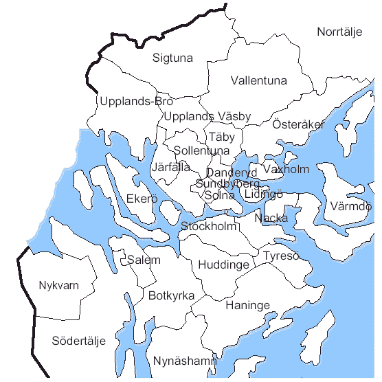
Stockholmsåsen, is a long esker stretching from southern Uppland to northeastern Södermanland, in Stockholm County, Sweden. The esker extends from Arlanda to Jordbro and Västerhaninge, passing through Stockholm where it is known as Brunkebergsåsen. See also * Brunkebergsåsen Brunkebergsåsen was an esker that once reached over much of Stockholm's Norrmalm district. Geologically, it is a part of the much larger Stockholmsåsen. It formed a considerable obstacle to traffic, effectively dividing Norrmalm into a western ... {{DEFAULTSORT:Stockholmsasen Uppland Södermanland Eskers of Sweden ... [...More Info...] [...Related Items...] OR: [Wikipedia] [Google] [Baidu] |
Brunkebergsåsen
Brunkebergsåsen was an esker that once reached over much of Stockholm's Norrmalm district. Geologically, it is a part of the much larger Stockholmsåsen. It formed a considerable obstacle to traffic, effectively dividing Norrmalm into a western and an eastern part. Consequently, most of it has been dug away over the centuries to make room for the development of that district. The pedestrian tunnel Brunkebergstunneln and, since the 1910s, the eastern part of Kungsgatan cut through Brunkebergsåsen's southern part. Conspicuous remnants of the esker can be seen in the vicinity of Johannes kyrka, at Observatorielunden, and Vanadislunden. See also *Battle of Brunkeberg Further reading Essay, with several maps, on the city's development in Stockholm City Museum The Stockholm City Museum ( sv, Stadsmuseet i Stockholm) is a museum documenting, preserving and exhibiting the history of Stockholm. The museum is housed in Södra Stadshuset at Slussen on Södermalm. The building was ... [...More Info...] [...Related Items...] OR: [Wikipedia] [Google] [Baidu] |
Esker
An esker, eskar, eschar, or os, sometimes called an ''asar'', ''osar'', or ''serpent kame'', is a long, winding ridge of stratified sand and gravel, examples of which occur in glaciated and formerly glaciated regions of Europe and North America. Eskers are frequently several kilometres long and, because of their uniform shape, look like railway embankments. Etymology The term ''esker'' is derived from the Irish word ''eiscir'' ( Old Irish: ''escir''), which means "ridge or elevation, especially one separating two plains or depressed surfaces". The Irish word was and is used particularly to describe long sinuous ridges, which are now known to be deposits of fluvio-glacial material. The best-known example of such an ''eiscir'' is the '' Eiscir Riada'', which runs nearly the whole width of Ireland from Dublin to Galway, a distance of , and is still closely followed by the main Dublin-Galway road The synonym ''os'' comes from the Swedish word ''ås'', "ridge". Geology M ... [...More Info...] [...Related Items...] OR: [Wikipedia] [Google] [Baidu] |
Uppland
Uppland () is a historical province or ' on the eastern coast of Sweden, just north of Stockholm, the capital. It borders Södermanland, Västmanland and Gästrikland. It is also bounded by lake Mälaren and the Baltic Sea. On the small uninhabited island of Märket in the Baltic, Uppland has a very short and unusually shaped land border with Åland, an autonomous province of Finland. The name literally means ''up land'', a name which is commonly encountered in especially older English literature as ''Upland''. Its Latinised form, which is occasionally used, is ''Uplandia''. Uppland is famous for having the highest concentration of runestones in the world, with as many as 1,196 inscriptions in stone left by the Vikings. Administration The traditional provinces of Sweden serve no administrative or political purposes, but are historical and cultural entities. The corresponding administrative county, or ', is Uppsala County, which occupies the larger part of the territory ... [...More Info...] [...Related Items...] OR: [Wikipedia] [Google] [Baidu] |
Södermanland
Södermanland ( or ), locally Sörmland, sometimes referred to under its Latin form ''Sudermannia'' or ''Sudermania'', is a historical province or ''landskap'' on the south eastern coast of Sweden. It borders Östergötland, Närke, Västmanland and Uppland. It is also bounded by lake Mälaren and the Baltic Sea. Södermanland means "(The) Land of the Southern Men", where the "southern men" (''södermännen'') were the people living south of Uppland. Administration The traditional provinces of Sweden serve no administrative or political purposes, but are historical and cultural entities. There is a corresponding administrative Södermanland County. However, the bulk of the population is within Stockholm County. Heraldry The coat of arms was granted in 1560. The arms is represented with a ducal coronet. Blazon: "Or, a Griffin rampant Sable beaked, langued, membered and armed Gules." The same CoA was granted for the county in 1940. Geography Södermanland is situ ... [...More Info...] [...Related Items...] OR: [Wikipedia] [Google] [Baidu] |
Stockholm County
Stockholm County ( sv, Stockholms län, link=no ) is a county or '' län'' (in Swedish) on the Baltic Sea coast of Sweden. It borders Uppsala County and Södermanland County. It also borders Mälaren and the Baltic Sea. The city of Stockholm is the capital of Sweden. Stockholm County is divided by the historic provinces of Uppland ( Roslagen) and Södermanland (Södertörn). More than one fifth of the Swedish population lives in the county. Stockholm County is also one of the statistical '' riksområden'' (national areas) according to NUTS:SE, Nomenclature of Territorial Units for Statistics within the EU. With more than two million inhabitants, Stockholm is the most densely populated county of Sweden. History Stockholm County was established in 1714. The City of Stockholm then constituted its own administrative entity under the Governor of Stockholm and was not part of Stockholm County. Though outside Stockholm County, the City of Stockholm was its seat. On 1 Jan ... [...More Info...] [...Related Items...] OR: [Wikipedia] [Google] [Baidu] |
Sweden
Sweden, ; fi, Ruotsi; fit, Ruotti; se, Ruoŧŧa; smj, Svierik; sje, Sverji; sju, Sverje; sma, Sveerje or ; yi, שוועדן, Shvedn; rmu, Svedikko; rmf, Sveittiko. formally the Kingdom of Sweden, is a Nordic countries, Nordic country located on the Scandinavian Peninsula in Northern Europe. It borders Norway to the west and north, and Finland to the east. At , Sweden is the largest Nordic country and the List of European countries by area, fifth-largest country in Europe. The Capital city, capital and largest city is Stockholm. Sweden has a population of 10.5 million, and a low population density of ; around 87% of Swedes reside in urban areas in the central and southern half of the country. Sweden’s urban areas together cover 1.5% of its land area. Because the country is so long, ranging from 55th parallel north, 55°N to 69th parallel north, 69°N, the climate of Sweden is diverse. Sweden has been inhabited since Prehistoric Sweden, prehistoric times, . T ... [...More Info...] [...Related Items...] OR: [Wikipedia] [Google] [Baidu] |
Arlanda
Stockholm Arlanda Airport is an international airport located in the Sigtuna Municipality of Sweden, near the town of Märsta, north of Stockholm and nearly south-east of Uppsala. The airport is located within Stockholm County and the province of Uppland. It is the largest airport in Sweden and the third-largest airport in the List of the largest airports in the Nordic countries, Nordic countries. The airport is the major gateway to international air travel for large parts of Sweden. Arlanda Airport was used by nearly 27 million passengers in 2017, with 21.2 million international passengers and 5.5 million domestic. Stockholm Arlanda Airport is the larger of Stockholm's two airports. The other, Stockholm Bromma Airport, Stockholm–Bromma, is located north-west of the city's centre but can be used only by a small number of smaller aircraft. The smaller airports Stockholm Skavsta Airport, Stockholm-Skavsta and Stockholm Västerås Airport, Stockholm-Västerås are both locate ... [...More Info...] [...Related Items...] OR: [Wikipedia] [Google] [Baidu] |
Jordbro
Jordbro is a suburban locality situated in Haninge Municipality, Stockholm County, Sweden with 10,291 inhabitants in 2010. The suburb is separated in two by the Stockholm commuter rail. Route 73 (Nynäsvägen), passes just east of Jordbro and connects Stockholm and Nynäshamn. East of the railway lies a housing area built as part of the Million Programme, in the 1960s and 1970s. The housing area is made up of blocks of flats, with single family homes to the north and to the south. To the west of the housing area and the railway lies a relatively large industrial area, containing the main offices and production plant of The Coca-Cola Company in Sweden. Dagab, Lagena, Osram and Åhlens also have distribution warehouses in the industrial area. Just to the south, between Jordbro and Västerhaninge Västerhaninge () is a locality situated in Haninge Municipality, Stockholm County, Sweden. It had 15,134 inhabitants in 2010. It is connected to Stockholm by commuter rail. V� ... [...More Info...] [...Related Items...] OR: [Wikipedia] [Google] [Baidu] |
Västerhaninge
Västerhaninge () is a locality situated in Haninge Municipality, Stockholm County, Sweden. It had 15,134 inhabitants in 2010. It is connected to Stockholm by commuter rail. Västerhaninge borders the large Hanveden forest to the north, the Jordbro locality to the east, an agricultural region to the south, and the Tungelsta area to the west. The locality lies 22 km from Stockholm and 6 km from Handen. Districts of the locality include Åbylund, Norrskogen, and Jägartorp in the north, and Ribbyberg and Nedersta in the south. The Stockholm-Nynäs railway runs through the town, and the original station building was demolished to make way for a new one in 1997. The nearby Tungelsta station is the only one in the region to survive from the railway's original construction. Residential, service and future Västerhaninge's several residential areas underwent expansion in the 1960s-1980s. Housing stock today includes co-operative apartments, rental apartments and villas ... [...More Info...] [...Related Items...] OR: [Wikipedia] [Google] [Baidu] |
Stockholm
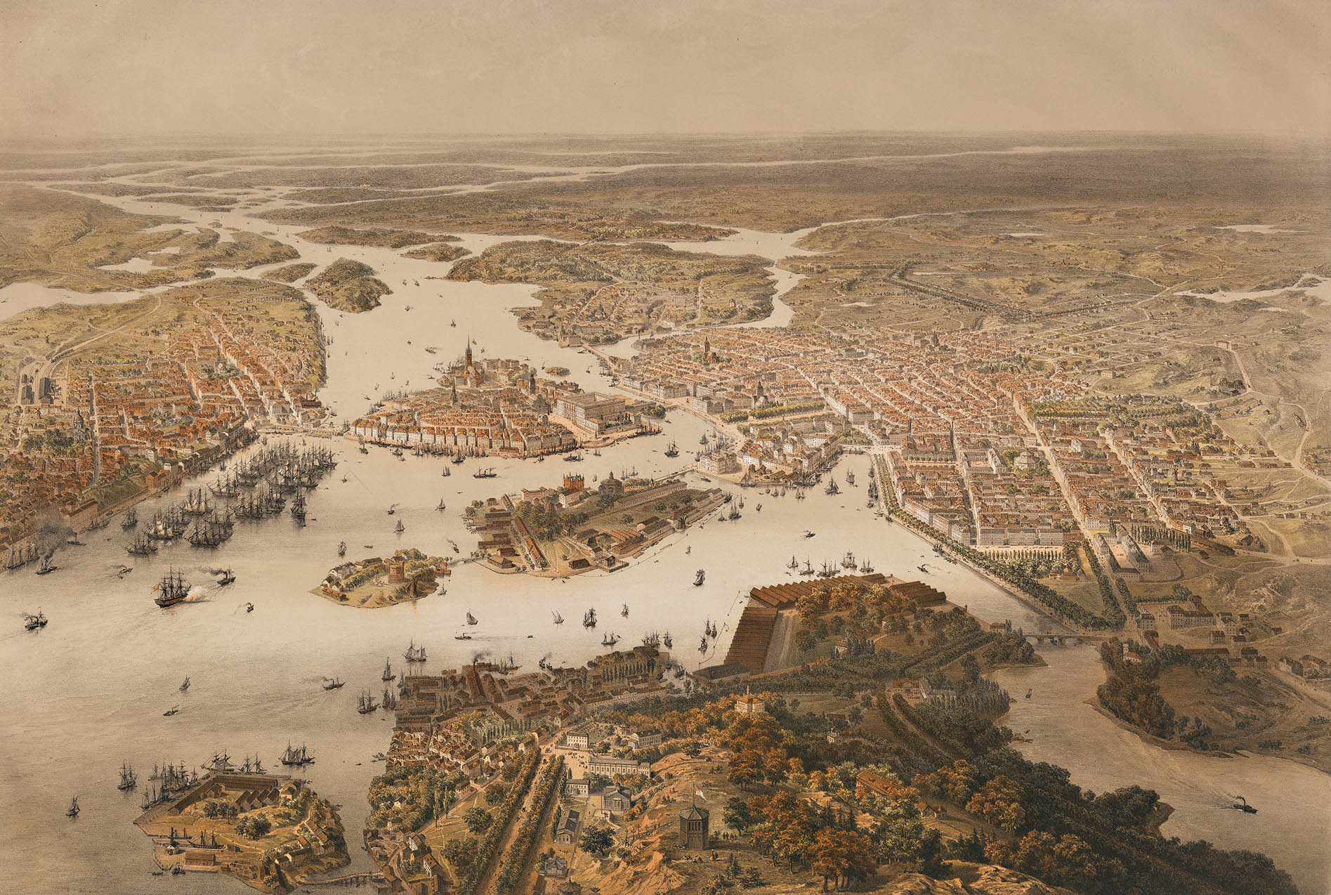
Stockholm () is the Capital city, capital and List of urban areas in Sweden by population, most populous city of Sweden as well as the List of urban areas in the Nordic countries, largest urban area in the Nordic countries. Approximately 1 million people live in the Stockholm Municipality, municipality, with 1.6 million in the Stockholm urban area, urban area, and 2.4 million in the Metropolitan Stockholm, metropolitan area. The city stretches across fourteen islands where Mälaren, Lake Mälaren flows into the Baltic Sea. Outside the city to the east, and along the coast, is the island chain of the Stockholm archipelago. The area has been settled since the Stone Age, in the 6th millennium BC, and was founded as a city in 1252 by Swedish statesman Birger Jarl. The city serves as the county seat of Stockholm County. Stockholm is the cultural, media, political, and economic centre of Sweden. The Stockholm region alone accounts for over a third of the country's Gross d ... [...More Info...] [...Related Items...] OR: [Wikipedia] [Google] [Baidu] |


.jpg)
