|
Stilos
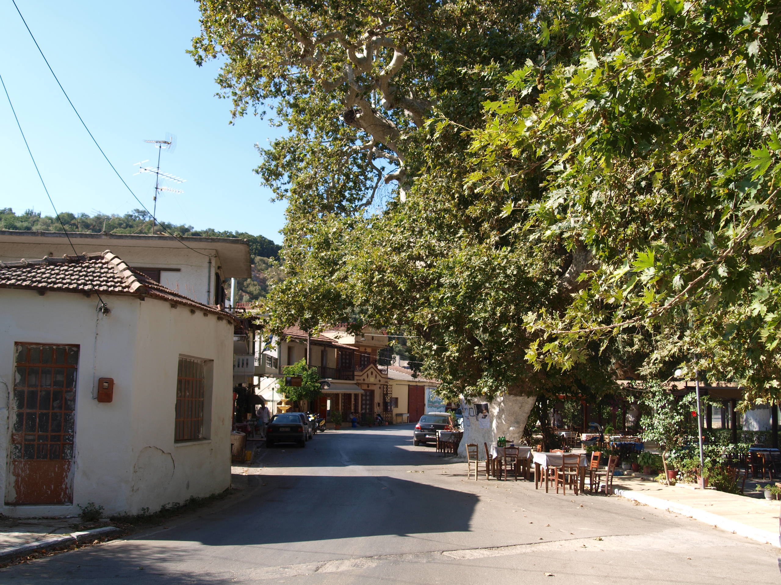
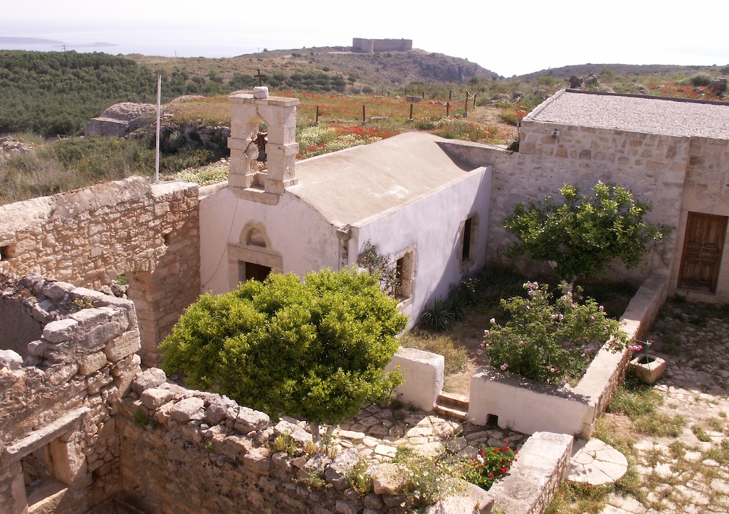
Stylos or Stilos () is a village and part of the Apokoronas municipal unit in the Chania (regional unit), Chania regional unit of the Greek island of Crete. The Greek etymology of the name of the village is 'column' or 'pillar'. No existing topographical or surviving architectural feature could account for this naming. In the Minoan time a large and important Minoan settlement (mentioned in Linear B as a-pa-ta-wa) was located here. When it declined, its name was given to the city of Aptera (Greece), Aptera that was built approximately 1.5 km away from Stylos. The village is laid out to the south side of the road from Megala Chorafia to Neo Chorio, Crete, Neo Chorio. The two-aisled Byzantine Church of St. John the Theologian stands by the village road, as does a modern domed church. Next to the Church of St. John, the fossilized remains of the extinct Sirenia sea mammal Metaxytherium medium, can be seen. The Etanap (Greek ΕΤΑΝΑΠ Α.Ε. - Επιτραπέζιο Ν� ... [...More Info...] [...Related Items...] OR: [Wikipedia] [Google] [Baidu] |
Crete
Crete ( ; , Modern Greek, Modern: , Ancient Greek, Ancient: ) is the largest and most populous of the Greek islands, the List of islands by area, 88th largest island in the world and the List of islands in the Mediterranean#By area, fifth largest island in the Mediterranean Sea, after Sicily, Sardinia, Cyprus, and Corsica. Crete is located about south of the Peloponnese, and about southwest of Anatolia. Crete has an area of and a coastline of 1,046 km (650 mi). It bounds the southern border of the Aegean Sea, with the Sea of Crete (or North Cretan Sea) to the north and the Libyan Sea (or South Cretan Sea) to the south. Crete covers 260 km from west to east but is narrow from north to south, spanning three longitudes but only half a latitude. Crete and a number of islands and islets that surround it constitute the Region of Crete (), which is the southernmost of the 13 Modern regions of Greece, top-level administrative units of Greece, and the fifth most popu ... [...More Info...] [...Related Items...] OR: [Wikipedia] [Google] [Baidu] |
Battle Of Crete
The Battle of Crete (, ), codenamed Operation Mercury (), was a major Axis Powers, Axis Airborne forces, airborne and amphibious assault, amphibious operation during World War II to capture the island of Crete. It began on the morning of 20 May 1941, with multiple Nazi Germany, German airborne landings on Crete. Hellenic Army, Greek and other Allies of World War II, Allied forces, along with Cretan civilians, defended the island. After only one day of fighting, the Germans had suffered heavy casualties and the Allied troops were confident that they would defeat the invasion. The next day, through communication failures, Allied tactical hesitation, and German offensive operations, Maleme Airfield in western Crete fell, enabling the Germans to land reinforcements and overwhelm the defensive positions on the north of the island. Allied forces withdrew to the south coast. More than half were evacuated by the British Royal Navy and the remainder surrendered or joined the Cretan resista ... [...More Info...] [...Related Items...] OR: [Wikipedia] [Google] [Baidu] |
Cross-in-square
A cross-in-square or crossed-dome floor plan was the dominant form of church architecture in the middle and late Byzantine Empire. It featured a square centre with an internal structure shaped like a cross, topped by a dome. Architecture Architectural form A cross-in-square church is centered around a quadratic cella, naos (the 'square') which is divided by four columns or piers into nine bay (architecture), bays (divisions of space). The inner five divisions form the shape of a quincunx (the 'cross'). The central bay is usually larger than the other eight, and is crowned by a dome which rests on the columns. The four rectangular bays that directly adjoin this central bay are usually covered by barrel vaults; these are the arms of the "cross" which is inscribed within the "square" of the naos. The four remaining bays in the corner are usually Groin vault, groin-vaulted. The spatial hierarchy of the three types of bay, from the largest central bay to the smallest corner bays, i ... [...More Info...] [...Related Items...] OR: [Wikipedia] [Google] [Baidu] |
Panagia Serviotissa
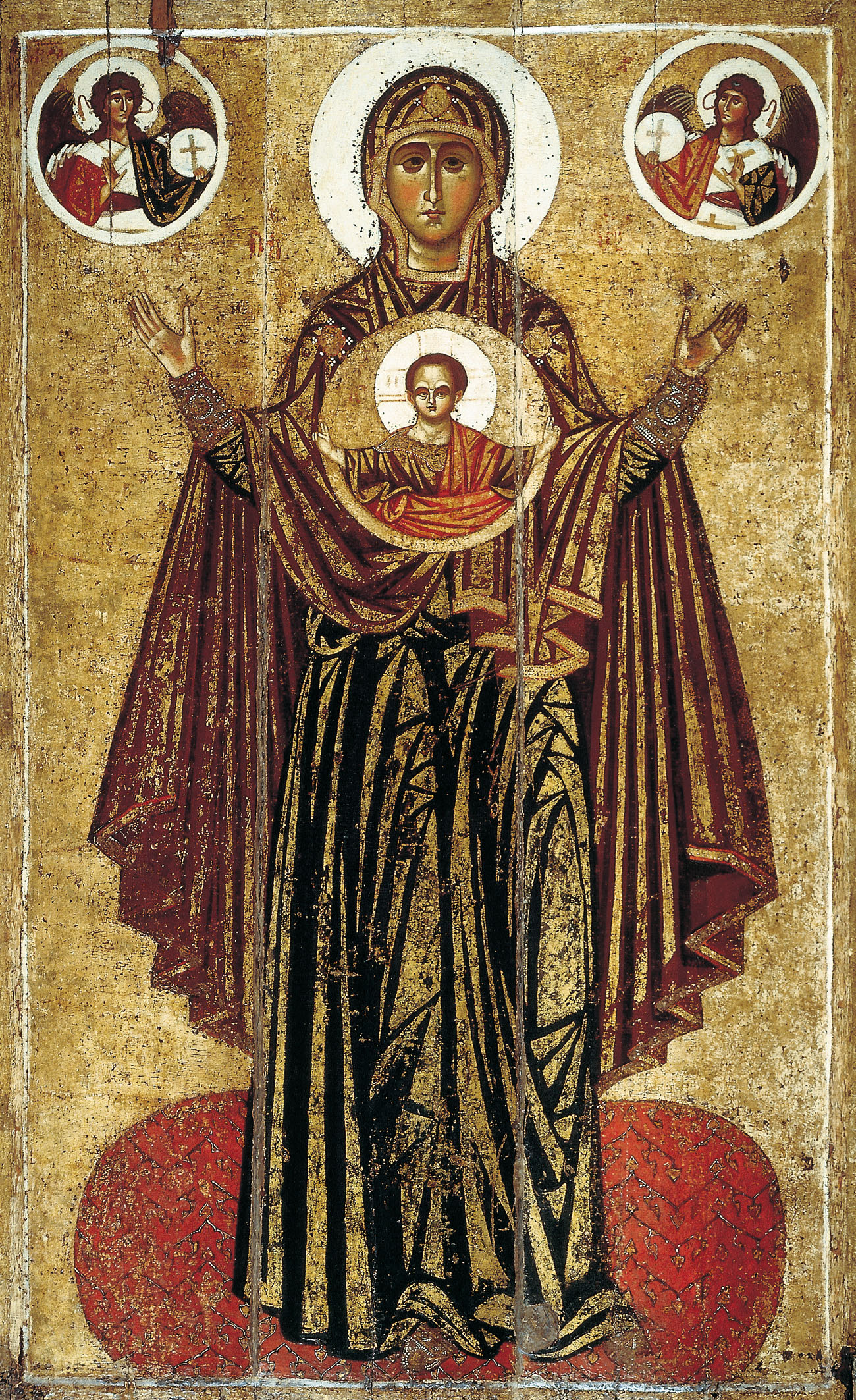
Panagia (, fem. of , + , the ''All-Holy'', or the ''Most Holy''; pronounced ) (also transliterated Panaghia or Panayia), in Medieval and Modern Greek, is one of the titles of Mary, Mother of God, used especially in Orthodox Christianity and Eastern Catholicism. Most Greek churches dedicated to the Virgin Mary are called ''Panagia''; the standard western Christian designation of "St. Mary" is rarely used in the East, as Mary is considered the holiest of all created beings and therefore of the highest status and glory of all the saints. Iconography ''Panagia'' is also the term for a particular type of icon of the Theotokos, wherein she is facing the viewer directly, usually depicted full length with her hands in the ''orans'' position, and with a medallion showing the image of Christ as a child in front of her chest. This medallion symbolically represents Jesus within the womb of the Virgin Mary at the moment of the Incarnation. This type of icon is also called the ''Platyté ... [...More Info...] [...Related Items...] OR: [Wikipedia] [Google] [Baidu] |
Aptera, Greece
Aptera ( or ) or Apteron was an ancient city, now an archaeological site in Kalives in western Crete, a kilometre inland from the southern shore of Souda Bay, about 13 km east of the city of Chania in the municipality of Chania. History It is mentioned (A-pa-ta-wa) in Linear B tablets from the 14th-13th centuries Before Christ, BC. With its highly fortunate geographical situation, the city-state was powerful from Minoan civilization, Minoan through Hellenistic times, when it gradually declined. However, the Minoan settlement of the Bronze Age was located about 1.5 km away from Aptera, at the place of the modern Stylos settlement. In Greek mythology, Aptera was the site of the legendary contest between the Siren (mythology), Sirens and the Muses, when after the victory of the Muses, the Sirens lost the feathers of their wings from their shoulders, and having thus become white, cast themselves into the sea. The name of the city literally means "without wings", and the ... [...More Info...] [...Related Items...] OR: [Wikipedia] [Google] [Baidu] |
Sfakia
Sfakiá () is a mountainous area in the southwestern part of the island of Crete, in the Chania (regional unit), Chania regional unit. It is considered to be one of the few places in Greece that have never been fully occupied by foreign powers. With a 2021 census population of 2,002 inhabitants living on a land area of , Sfakia is one of the largest and population density, least densely populated Communities and Municipalities of Greece, municipalities on the island of Crete. The etymology of its name is disputed. According to the prevailing theory, it relates to its rugged terrain, deriving from the ancient Greek word ''σφαξ'', meaning land chasm or gorge. Description The road from Chania to Sfakiá crosses the island from north to south, through the village of Vryses. From this village the route crosses the White Mountains (Lefka Ori, Lefká Óri) to Hora Sfakion, Hóra Sfakíon () by the Libyan Sea. Halfway from Vrisses to Hóra Sfakíon is the fertile plateau of Askifou ... [...More Info...] [...Related Items...] OR: [Wikipedia] [Google] [Baidu] |
Church Of St
Church may refer to: Religion * Church (building), a place/building for Christian religious activities and praying * Church (congregation), a local congregation of a Christian denomination * Church service, a formalized period of Christian communal worship * Christian denomination, a Christian organization with distinct doctrine and practice * Christian Church, either the collective body of all Christian believers, or early Christianity Places United Kingdom * Church, a former electoral ward of Kensington and Chelsea London Borough Council that existed from 1964 to 2002 * Church (Liverpool ward), a Liverpool City Council ward * Church (Reading ward), a Reading Borough Council ward * Church (Sefton ward), a Metropolitan Borough of Sefton ward * Church, Lancashire, England United States * Church, Iowa, an unincorporated community * Church Lake, a lake in Minnesota * Church, Michigan, ghost town Arts, entertainment, and media * ''Church magazine'', a pastoral theology magazine pu ... [...More Info...] [...Related Items...] OR: [Wikipedia] [Google] [Baidu] |
Chania (regional Unit)
Chania (), also spelled Hania, is one of the four regional units of Crete; it covers the westernmost quarter of the island. Its capital is the city of Chania. Chania borders only one other regional unit: that of Rethymno to the east. The western part of Crete is bounded to the north by the Cretan Sea (part of the Aegean Sea) and to the west and south by the Mediterranean Sea and Libyan Sea. The regional unit also includes the southernmost island of Europe, Gavdos. Geography Chania regional unit, often informally termed 'Western Crete', is a part of the island which includes the capital Chania, and the districts of Platanias and Apokoronas in the north, and Sfakia and Selino in the far south west corner. Other towns in the Chania prefecture include Hora Sfakion, Kissamos, Palaiochora, Maleme, Vryses, Vamos, Georgioupolis and Kalives. The natural park of Samariá Gorge, a tourist attraction and a refuge for the rare Cretan wild goat or '' kri-kri'', is in the South ... [...More Info...] [...Related Items...] OR: [Wikipedia] [Google] [Baidu] |
Byzantine
The Byzantine Empire, also known as the Eastern Roman Empire, was the continuation of the Roman Empire centred on Constantinople during late antiquity and the Middle Ages. Having survived the events that caused the fall of the Western Roman Empire in the 5th centuryAD, it endured until the fall of Constantinople to the Ottoman Empire in 1453. The term 'Byzantine Empire' was coined only after its demise; its citizens used the term 'Roman Empire' and called themselves 'Romans'. During the early centuries of the Roman Empire, the western provinces were Latinised, but the eastern parts kept their Hellenistic culture. Constantine I () legalised Christianity and moved the capital to Constantinople. Theodosius I () made Christianity the state religion and Greek gradually replaced Latin for official use. The empire adopted a defensive strategy and, throughout its remaining history, experienced recurring cycles of decline and recovery. It reached its greatest extent un ... [...More Info...] [...Related Items...] OR: [Wikipedia] [Google] [Baidu] |
Neo Chorio, Crete
Neo Chorio is a village located 25km (15.5 miles) southeast of Chania in the center of Apokoronas Apokoronas () is a municipality and a former province (επαρχία) in the Chania regional unit, north-west Crete, Greece. It is situated on the north coast of Crete, to the east of Chania itself. The seat of the municipality is the village Vry .... It was named Neo ("new") Chorio because it was a new village, but it was built on the ruins of an old village which was destroyed during the raids in Crete. It is built on a stone hill on a plain that is crossed by the river Mantamas. Smaller rivers include: the Anavreti, the Koliakoudes, etc. According to tradition, the small town was originally settled in the Late Minoan era, on a site located in the northernmost part of the village where it still stands today. According to the census of 1881, the village had only 451 inhabitants. At the village square, there is a plane tree which is many centuries old. Under this tree, there is a fam ... [...More Info...] [...Related Items...] OR: [Wikipedia] [Google] [Baidu] |


