|
Staveley, Cumbria
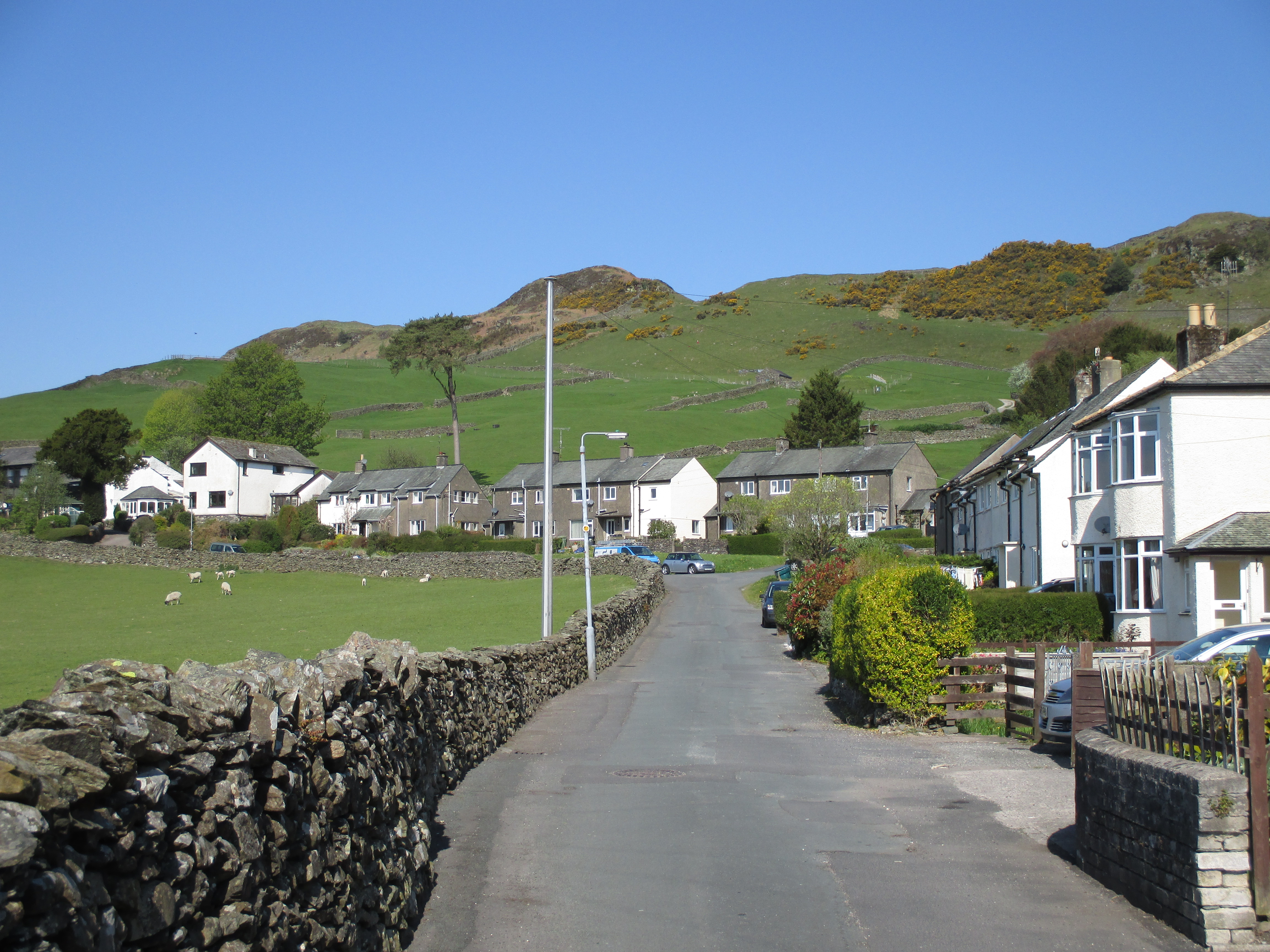
Staveley () is a village in the South Lakeland district, in Cumbria, England. Historically part of Westmorland, it is situated northwest of Kendal where the River Kent is joined by its tributary the Gowan. It is also known as Staveley-in-Westmorland and Staveley-in-Kendal to distinguish it from Staveley-in-Cartmel (a small village near Newby Bridge which is now in Cumbria but was previously in Lancashire). There are three civil parishes – Nether Staveley, Over Staveley and Hugill (part). Their total population at the 2011 Census was 1,593 but this includes those living in the hamlet of Ings in Hugill parish. Governance Historically within the county of Westmorland, it became part of the new non-metropolitan county of Cumbria in 1974. Staveley is divided between three civil parishes; * The village south of the rivers Gowan and Kent is in Nether Staveley, * Most of the village north of the Gowan is in Over Staveley * Part of the village to the north-west is in Hugill The ... [...More Info...] [...Related Items...] OR: [Wikipedia] [Google] [Baidu] |
Reston Scar
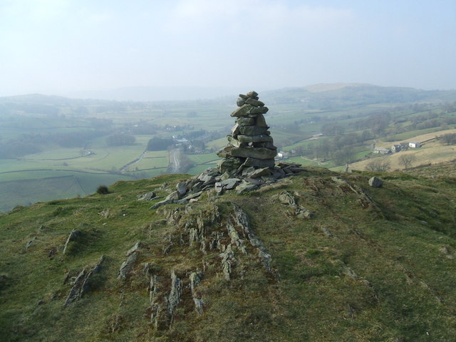
Reston Scar is a fell in the Lake District of Cumbria Cumbria ( ) is a ceremonial and non-metropolitan county in North West England, bordering Scotland. The county and Cumbria County Council, its local government, came into existence in 1974 after the passage of the Local Government Act 1972. ..., England. It overlooks the north side of Staveley village, and is listed among Alfred Wainwright's " Outlying Fells of Lakeland" guide. The summit offers good views of the Coniston Fells, the Sca Fells and the Langdale Pikes. The main footpath up to the summit from Staveley passes to the south of Kemp Tarn, the largest of several ponds on the Scar. The summit is at and has a cairn. In his book '' The Outlying Fells of Lakeland'', Wainwright describes the ascent of Reston Scar from Staveley and calls the fell "a fine place for a siesta on a sunny day". References {{Outlying Fells Fells of the Lake District South Lakeland District ... [...More Info...] [...Related Items...] OR: [Wikipedia] [Google] [Baidu] |
Civil Parishes
In England, a civil parish is a type of Parish (administrative division), administrative parish used for Local government in England, local government. It is a territorial designation which is the lowest tier of local government below districts of England, districts and metropolitan and non-metropolitan counties of England, counties, or their combined form, the Unitary authorities of England, unitary authority. Civil parishes can trace their origin to the ancient system of Parish (Church of England), ecclesiastical parishes, which historically played a role in both secular and religious administration. Civil and religious parishes were formally differentiated in the 19th century and are now entirely separate. Civil parishes in their modern form came into being through the Local Government Act 1894, which established elected Parish councils in England, parish councils to take on the secular functions of the vestry, parish vestry. A civil parish can range in size from a sparsely ... [...More Info...] [...Related Items...] OR: [Wikipedia] [Google] [Baidu] |
Craggy Plantation - Geograph
Crag may refer to: * Crag (climbing), a cliff or group of cliffs, in any location, which is or may be suitable for climbing * Crag (dice game), a dice game played with three dice * Crag, Arizona, US * Crag, West Virginia, US * Crag and tail, a geological formation caused by the passage of a glacier over an area of hard rock * Crag Group, a geological group outcropping in East Anglia, UK ** Coralline Crag Formation ** Norwich Crag Formation ** Red Crag Formation ** Wroxham Crag Formation, see Cromer Forest Bed * Crag Hotel, Penang, Malaysia * Crag Jones (born 1962), Welsh climber * USS ''Crag'' (AM-214), a 1943 US Navy ''Admirable''-class minesweeper * The Crag, the final event in the Nickelodeon Guts action sports program * Club de Radioaficionados de Guatemala, an amateur radio organization in Guatemala * Constitutional Reform and Governance Act 2010, concerning United Kingdom constitutional law See also * * Cragg (other) Cragg may refer to: People * Cragg Hines, ... [...More Info...] [...Related Items...] OR: [Wikipedia] [Google] [Baidu] |
Latin
Latin (, or , ) is a classical language belonging to the Italic branch of the Indo-European languages. Latin was originally a dialect spoken in the lower Tiber area (then known as Latium) around present-day Rome, but through the power of the Roman Republic it became the dominant language in the Italian region and subsequently throughout the Roman Empire. Even after the fall of Western Rome, Latin remained the common language of international communication, science, scholarship and academia in Europe until well into the 18th century, when other regional vernaculars (including its own descendants, the Romance languages) supplanted it in common academic and political usage, and it eventually became a dead language in the modern linguistic definition. Latin is a highly inflected language, with three distinct genders (masculine, feminine, and neuter), six or seven noun cases (nominative, accusative, genitive, dative, ablative, and vocative), five declensions, four ... [...More Info...] [...Related Items...] OR: [Wikipedia] [Google] [Baidu] |
Old High German
Old High German (OHG; german: Althochdeutsch (Ahd.)) is the earliest stage of the German language, conventionally covering the period from around 750 to 1050. There is no standardised or supra-regional form of German at this period, and Old High German is an umbrella term for the group of continental West Germanic dialects which underwent the set of consonantal changes called the Second Sound Shift. At the start of this period, the main dialect areas belonged to largely independent tribal kingdoms, but by 788 the conquests of Charlemagne had brought all OHG dialect areas into a single polity. The period also saw the development of a stable linguistic border between German and Gallo-Romance, later French. The surviving OHG texts were all written in monastic scriptoria and, as a result, the overwhelming majority of them are religious in nature or, when secular, belong to the Latinate literary culture of Christianity. The earliest written texts in Old High German, glosses and ... [...More Info...] [...Related Items...] OR: [Wikipedia] [Google] [Baidu] |
Old English
Old English (, ), or Anglo-Saxon, is the earliest recorded form of the English language, spoken in England and southern and eastern Scotland in the early Middle Ages In the history of Europe, the Middle Ages or medieval period lasted approximately from the late 5th to the late 15th centuries, similar to the post-classical period of global history. It began with the fall of the Western Roman Empire .... It was brought to Great Britain by Anglo-Saxon settlement of Britain, Anglo-Saxon settlers in the mid-5th century, and the first Old English literature, Old English literary works date from the mid-7th century. After the Norman conquest of 1066, English was replaced, for a time, by Anglo-Norman language, Anglo-Norman (a langues d'oïl, relative of French) as the language of the upper classes. This is regarded as marking the end of the Old English era, since during this period the English language was heavily influenced by Anglo-Norman, developing into a phase know ... [...More Info...] [...Related Items...] OR: [Wikipedia] [Google] [Baidu] |
Middle English
Middle English (abbreviated to ME) is a form of the English language that was spoken after the Norman conquest of 1066, until the late 15th century. The English language underwent distinct variations and developments following the Old English period. Scholarly opinion varies, but the '' Oxford English Dictionary'' specifies the period when Middle English was spoken as being from 1150 to 1500. This stage of the development of the English language roughly followed the High to the Late Middle Ages. Middle English saw significant changes to its vocabulary, grammar, pronunciation, and orthography. Writing conventions during the Middle English period varied widely. Examples of writing from this period that have survived show extensive regional variation. The more standardized Old English language became fragmented, localized, and was, for the most part, being improvised. By the end of the period (about 1470) and aided by the invention of the printing press by Johannes Gutenberg in ... [...More Info...] [...Related Items...] OR: [Wikipedia] [Google] [Baidu] |
Dales Way
The Dales Way is an long-distance footpath in Northern England, from (south-east to north-west) Ilkley, West Yorkshire, to Bowness-on-Windermere, Cumbria. This walk was initially devised by the West Riding Ramblers' Association with the 'leading lights' being Colin Speakman and Tom Wilcock (Footpath Secretary). The route was announced to the public in 1968 and the first recorded crossing was by a group of Bradford Grammar School Venture Scouts in 1969. The Dales Way passes through two National Parks: the Yorkshire Dales National Park and the Lake District National Park. The first half of the walk follows the River Wharfe upstream to the main watershed of Northern England at Ribblehead. The second half follows several river valleys (Dentdale, River Mint, River Kent) to descend to the shores of Windermere. Route The walk is shorter and less strenuous than better-known routes such as the Pennine Way and Coast to Coast Walk, being mostly along river valleys. It thus makes a go ... [...More Info...] [...Related Items...] OR: [Wikipedia] [Google] [Baidu] |
National Cycle Route 6
Route Parts of the route are currently incomplete and some sections follow other routes. London to Milton Keynes The proposed route is to begin in central London, running from via Paddington railway station to the Grand Union Canal. The towpath alongside the canal between Paddington and Northolt is already designated as a local cycle path, and will eventually form part of Route 6 when the route is completed. The canal continues to Uxbridge where the National Cycle Route 6 joins National Cycle Route 61 at Cowley, near Brunel University, sharing the same path until the two routes diverge at St Albans. The route continues along the Grand Union Canal and the Colne Valley on mainly traffic-free routes. At Rickmansworth it joins the Ebury Way, a rail trail which runs along a former line of the Watford and Rickmansworth Railway. Entering central Watford, the route continues north via St Albans with some on-road sections to Harpenden, where it intersects with National Cycle Route ... [...More Info...] [...Related Items...] OR: [Wikipedia] [Google] [Baidu] |
Burneside
Burneside () is a small village in South Lakeland in Cumbria, England. It is located to the north of Kendal and to the south east of Staveley, on the River Kent, just upstream from the confluence of the River Sprint. It has about 3,000 inhabitants. By the time of the 2011 Census Burneside had been transformed into an electoral ward only. The population of this ward was 1,888. The majority of the population are now recorded as living in Strickland Ketel parish. Burneside railway station is situated on the Windermere Branch Line, with services to Windermere to the north west, Oxenholme on the West Coast Main Line, and Lancaster to the south. Burneside is around from the M6 motorway. Politics In 1974, under the Local Government Act 1972, Burneside became a part of the South Lakeland district whose administrative centre is Kendal. Burneside is part of Westmorland and Lonsdale constituency for which Tim Farron is the current member of parliament, representing the Liberal Dem ... [...More Info...] [...Related Items...] OR: [Wikipedia] [Google] [Baidu] |
Bypass Route
A bypass is a road or highway that avoids or "bypasses" a built-up area, town, or village, to let through traffic flow without interference from local traffic, to reduce congestion in the built-up area, and to improve road safety. A bypass specifically designated for trucks may be called a truck route. If there are no strong land use controls, buildings are often built in town along a bypass, converting it into an ordinary town road, and the bypass may eventually become as congested as the local streets it was intended to avoid. Petrol stations, shopping centres and some other businesses are often built there for ease of access, while homes are often avoided for noise and pollution reasons. Bypass routes are often controversial, as they require the building of a road carrying heavy traffic where no road previously existed. This creates a conflict between those who support a bypass to reduce congestion in a built up area, and those who oppose the development of (often rural) ... [...More Info...] [...Related Items...] OR: [Wikipedia] [Google] [Baidu] |
A591 Road
The A591 is a major road in Cumbria, in the north-west of England, which lies almost entirely within the Lake District national park. A 2009 poll by satellite navigation firm Garmin named the stretch of the road between Windermere and Keswick as the most popular road in Britain. The 29.8 mile stretch between Kendal and Keswick was also named the UK's best driving road, according to a specially devised driving ratio formulated by car rental firm Avis. Route The road begins (at its southern end) north-west of junction 36 of the M6 motorway at Brettargh Holt roundabout with the A590 road close to Sizergh Castle. It bypasses the town of Kendal as a dual carriageway, this £1.9m section opened on 29 August 1971. It becomes a busy single carriageway road as it enters the Lake District. It bypasses the town of Windermere, closely following the north-eastern bank of Windermere. It then travels through the centre of Ambleside, follows the northern side of Rydal Water, passes Wh ... [...More Info...] [...Related Items...] OR: [Wikipedia] [Google] [Baidu] |


.jpg)


