|
State Highway 123 (Oklahoma)
State Highway 123 (abbreviated SH-123) is a state highway in the U.S. state of Oklahoma. It runs a general southwest–northeast course for in northern Oklahoma. SH-123 has no lettered spur routes. Route description SH-123 begins east of Barnsdall, Oklahoma, in Osage County at State Highway 11. It heads north to the Woolaroc Museum before turning northeast. As it approaches the Washington County line, it turns northward to parallel it. SH-123 then enters western Bartlesville, overlap Overlap may refer to: * In set theory, an overlap of elements shared between sets is called an intersection, as in a Venn diagram. * In music theory, overlap is a synonym for reinterpretation of a chord at the boundary of two musical phrases * Ove ...ping US-60 for . SH-123 briefly runs east–west before turning north and leaving Bartlesville. It then heads due north until it changes course and runs due east to Dewey, where it terminates at US-75. Junction list {{jctbtm, keys=conc ... [...More Info...] [...Related Items...] OR: [Wikipedia] [Google] [Baidu] |
Oklahoma Department Of Transportation
The Oklahoma Department of Transportation (ODOT) is an government agency, agency of the government of Oklahoma responsible for the construction and maintenance of the state's transportation infrastructure. Under the leadership of the Oklahoma Secretary of Transportation, Oklahoma secretary of transportation and ODOT executive director, the department maintains public infrastructure that includes highways and state-owned railroads and administers programs for county roads, city streets, public transit, passenger rail, waterways and active transportation. Along with the Oklahoma Turnpike Authority, the department is the primary infrastructure construction and maintenance agency of the State.Okla. Stat. tit. 47, § 2-106.2A ODOT is overseen by the Oklahoma Transportation Commission, composed of nine members appointed by the governor of Oklahoma, Oklahoma Senate and Oklahoma House of Representatives. Tim Gatz, a professional landscape architect with a bachelor's degree in landscape a ... [...More Info...] [...Related Items...] OR: [Wikipedia] [Google] [Baidu] |
Barnsdall, Oklahoma
Barnsdall is a city in Osage County, Oklahoma, United States. As of the 2020 census, the population of the city was 1,034. History The community was founded in 1905 and originally named Bigheart, for the Osage Chief James Bigheart. It was initially a 160-acre site along the Midland Valley Railroad in March 1905. The railroad opened Bigheart Station in September 1905 and the Bigheart Post Office opened in January 1906. The community was exempted from the Osage allotment, so lots could be sold to anyone. Lots were auctioned in May 1906. The first newspaper, the ''Bigheart Star'', first appeared in 1906.Jon D. May, "Barnsdall," ''Encyclopedia of Oklahoma History and Culture''. Accessed May 8, 2015. Joshua Cosden built the Southwest Refining ... [...More Info...] [...Related Items...] OR: [Wikipedia] [Google] [Baidu] |
Bartlesville, Oklahoma
Bartlesville is a city mostly in Washington County and Osage County, Oklahoma. The population was 37,290 at the 2020 census. Bartlesville is north of Tulsa and south of the Kansas border. It is the county seat of Washington County. The Caney River runs through Bartlesville. Bartlesville is the primary city of the Bartlesville Micropolitan area, which consists of Washington County and had a population of 51,843 in 2018. A small portion of the city is in Osage County. The city is also part of the Tulsa Combined Statistical Area, with a population of 1,151,172 in 2015. Bartlesville is notable as the longtime home of Phillips Petroleum Company. Frank Phillips founded Phillips Petroleum in Bartlesville in 1905 when the area was still an Indian Territory. The company merged with Conoco as ConocoPhillips and later split into the two independent companies, Phillips 66 and ConocoPhillips. Both companies have retained some operations in Bartlesville, but they have moved their co ... [...More Info...] [...Related Items...] OR: [Wikipedia] [Google] [Baidu] |
Dewey, Oklahoma
Dewey is a city in Washington County, Oklahoma, United States. The population was 3,179 at the 2000 census and 3,432 at the 2010 census, an increase of 8 percent. It is located near the north side of Bartlesville. History In 1899, Jacob Bartles moved his grist mill and trading post three miles north from Bartlesville to property he owned along the Atchison, Topeka and Santa Fe Railroad. He built the Dewey Hotel in the following year. The town was named for Admiral George Dewey. The first newspaper in town, the ''Dewey Eagle'', began publication in 1900, and the Missouri, Kansas and Texas Railroad came to Dewey in 1903. The community was incorporated December 8, 1905.May, John D. Encyclopedia of Oklahoma History and Culture. "Dewey" Accessed September 1, 201/ref> Geography According to the United States Census Bureau, the city has a total area of , all land. Demographics As of the census of 2000, there were 3,179 people, 1,298 households, and 869 families residing ... [...More Info...] [...Related Items...] OR: [Wikipedia] [Google] [Baidu] |
State Highway
A state highway, state road, or state route (and the equivalent provincial highway, provincial road, or provincial route) is usually a road that is either Route number, numbered or maintained by a sub-national state or province. A road numbered by a state or province falls below numbered national highways (Canada being Trans-Canada Highway#Jurisdiction and designation, a notable exception to this rule) in the hierarchy (route numbers are used to aid navigation, and may or may not indicate ownership or maintenance). Roads maintained by a state or province include both nationally numbered highways and un-numbered state highways. Depending on the state, "state highway" may be used for one meaning and "state road" or "state route" for the other. In some countries such as New Zealand, the word "state" is used in its sense of a sovereign state or country. By this meaning a state highway is a road maintained and numbered by the national government rather than local authorities. By co ... [...More Info...] [...Related Items...] OR: [Wikipedia] [Google] [Baidu] |
Oklahoma
Oklahoma ( ; Choctaw language, Choctaw: , ) is a landlocked U.S. state, state in the South Central United States, South Central region of the United States. It borders Texas to the south and west, Kansas to the north, Missouri to the northeast, Arkansas to the east, New Mexico to the west, and Colorado to the northwest. Partially in the western extreme of the Upland South, it is the List of U.S. states and territories by area, 20th-most extensive and the List of U.S. states and territories by population, 28th-most populous of the 50 United States. Its residents are known as Oklahomans and its capital and largest city is Oklahoma City. The state's name is derived from the Choctaw language, Choctaw words , 'people' and , which translates as 'red'. Oklahoma is also known informally by its List of U.S. state and territory nicknames, nickname, "The Sooner State", in reference to the Sooners, American pioneer, American settlers who staked their claims in formerly American Indian-o ... [...More Info...] [...Related Items...] OR: [Wikipedia] [Google] [Baidu] |
Osage County, Oklahoma
Osage County () is the largest county by area in the U.S. state of Oklahoma. Created in 1907 when Oklahoma was admitted as a state, the county is named for and is home to the federally recognized Osage Nation. The county is coextensive with the Osage Nation Reservation, established by treaty in the 19th century when the Osage relocated there from Kansas. The county seat is in Pawhuska, one of the first three towns established in the county. The total population of the county as of 2020 was 45,818. History During the 17th century, the Osage and other Dhegihan Siouan tribes were displaced westward from the Ohio Country following the Beaver Wars. The Osage became established as a powerful nation in the areas of present-day Missouri and Arkansas between the Missouri and Red rivers, as well as extending to the west. By 1760, they had increased their range to include the present Osage County. Historically one of the most powerful Great Plains tribes, their numbers were reduce ... [...More Info...] [...Related Items...] OR: [Wikipedia] [Google] [Baidu] |
State Highway 11 (Oklahoma)
State Highway 11 (abbreviated SH-11) is a state highway in Oklahoma. It runs in an irregular west-to-east path across the northern part of the state, from U.S. Highway 281 (US-281) north of Alva to Interstate 244 (I-244) / US-412 in Tulsa. There is one letter-suffixed spur highway branching from SH-11, SH-11A. Route description From its beginning at US-281, SH-11 travels east through the town of Capron. later, it reaches SH-8. SH-11 and SH-8 overlap for , passing through the town of Burlington along the way. SH-8 / SH-11 meet SH-58 east of Burlington, and turn south, forming a three-route concurrency. The combined route passes through the unincorporated community of Driftwood and intersects US-64 just west of the town of Ingersoll. At this point, SH-11 turns to the east, leaving SH-8 and SH-58. SH-11 passes through the northern part of Great Salt Plains State Park, and after , intersects with SH-38. SH-11 continues on another , before intersecting wit ... [...More Info...] [...Related Items...] OR: [Wikipedia] [Google] [Baidu] |
Woolaroc Museum
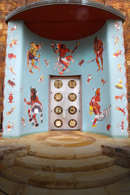
Woolaroc is a museum and wildlife preserve located in the Osage Hills of Northeastern Oklahoma on Oklahoma State Highway 123 about southwest of Bartlesville, Oklahoma, and north of Tulsa, Oklahoma. Woolaroc was established in 1925 as the ranch retreat of oilman Frank Phillips. The ranch is a wildlife preserve, home to over 30 different species of native and exotic wildlife, such as bison, elk and longhorn cattle. Woolaroc is also a museum with a collection of Western art and artifacts, American Indian material, and one of the largest collections of Colt firearms in the world. Also on display is ''Woolaroc'', the aircraft that won the ill-fated Dole Air Race in 1927. Woolaroc features a nature trail and a living history area inviting visitors to experience the natural environment of Woolaroc, the life in a pre-Civil War 1840s mountain man camp. Name The name Woolaroc is a portmanteau of the words woods, lakes, and rocks that are featured in the Osage Hills of northeast ... [...More Info...] [...Related Items...] OR: [Wikipedia] [Google] [Baidu] |
Washington County, Oklahoma
Washington County is a county located in the northeastern part of the U.S. state of Oklahoma. As of the 2020 census, the population was 52,455. Its county seat is Bartlesville. Named for President George Washington, it is the smallest county in Oklahoma in total area, adjacent to the largest county in Oklahoma, Osage County. Washington County comprises the Bartlesville, OK micropolitan statistical area, which is also included in the Tulsa- Muskogee-Bartlesville, OK combined statistical area. It is located along the border with Kansas. History The Osage ceded their land claims in 1825, and the Federal Government allowed the Western Cherokee to settle in this area in 1828. The 1835 Treaty of New Echota confirmed Cherokee ownership of the land. The area now covered by Washington County was part of the Cherokee Saline District between 1840 and 1856 and the Cooweescoowee District from 1856 to 1906. The first post office was established in 1859 at the confluence of Butler Creek ... [...More Info...] [...Related Items...] OR: [Wikipedia] [Google] [Baidu] |
Overlap (road)
In a road network, a concurrency is an instance of one physical Carriageway, roadway bearing two or more different route numbers. The practice is often economically and practically advantageous when multiple routes must pass between a single mountain crossing or over a bridge, or through a major city, and can be accommodated by a single right-of-way. Each route number is typically posted on highways signs where concurrencies are allowed, while some jurisdictions simplify signage by posting one priority route number on highway signs. In the latter circumstance, other route numbers disappear when the concurrency begins and reappear when it ends. In most cases, each route in a concurrency is recognized by maps and atlases. Terminology When two roadways share the same right-of-way (transportation), right-of-way, it is sometimes called a common section or commons. Other terminology for a concurrency includes overlap, coincidence, duplex (two concurrent routes), triplex (three concur ... [...More Info...] [...Related Items...] OR: [Wikipedia] [Google] [Baidu] |
State Highways In Oklahoma
State most commonly refers to: * State (polity), a centralized political organization that regulates law and society within a territory **Sovereign state, a sovereign polity in international law, commonly referred to as a country **Nation state, a state where the majority identify with a single nation (with shared culture or ethnic group) ** Constituent state, a political subdivision of a state ** Federated state, constituent states part of a federation *** U.S. state * State of nature, a concept within philosophy that describes the way humans acted before forming societies or civilizations State may also refer to: Arts, entertainment, and media Literature * ''State Magazine'', a monthly magazine published by the U.S. Department of State * ''The State'' (newspaper), a daily newspaper in Columbia, South Carolina, United States * '' Our State'', a monthly magazine published in North Carolina and formerly called ''The State'' * The State (Larry Niven), a fictional future governmen ... [...More Info...] [...Related Items...] OR: [Wikipedia] [Google] [Baidu] |


