|
St Austell Rural District
St Austell Rural District was a local government division of Cornwall in England, UK, between 1894 and 1974. Established under the Local Government Act 1894, the rural district was reduced to create Fowey Municipal Borough in 1913 and enlarged by the abolition of Bodmin Rural District and St Columb Major Rural District in 1934 and Lostwithiel Municipal Borough in 1968. In 1974 the district was abolished under the Local Government Act 1972, forming part of the new Restormel district. Civil parishes The civil parishes within the district were: * Colan * Grampound with Creed * Lanlivery * Lostwithiel * Luxulyan * Mawgan in Pydar * Roche * St Columb Major * St Dennis * St Enoder * St Ewe * St Goran * St Mewan * St Michael Caerhays St Michael Caerhays () is a civil parish and village in Cornwall, England, United Kingdom. The village is about south-southwest of St Austell. The population as of the 2011 census was 96 St Michael Caerhays lies within the Cornwall Area ... [...More Info...] [...Related Items...] OR: [Wikipedia] [Google] [Baidu] |
Cornwall
Cornwall (; or ) is a Ceremonial counties of England, ceremonial county in South West England. It is also one of the Celtic nations and the homeland of the Cornish people. The county is bordered by the Atlantic Ocean to the north and west, Devon to the east, and the English Channel to the south. The largest urban area is the Redruth and Camborne conurbation. The county is predominantly rural, with an area of and population of 568,210. After the Redruth-Camborne conurbation, the largest settlements are Falmouth, Cornwall, Falmouth, Penzance, Newquay, St Austell, and Truro. For Local government in England, local government purposes most of Cornwall is a Unitary authorities of England, unitary authority area, with the Isles of Scilly governed by a Council of the Isles of Scilly, unique local authority. The Cornish nationalism, Cornish nationalist movement disputes the constitutional status of Cornwall and seeks greater autonomy within the United Kingdom. Cornwall is the weste ... [...More Info...] [...Related Items...] OR: [Wikipedia] [Google] [Baidu] |
Mawgan In Pydar
St Mawgan or St Mawgan in Pydar () is a village and civil parish in Cornwall, England, United Kingdom. The population of this parish at the 2011 census was 1,307. The village is situated four miles northeast of Newquay, and the parish also includes the hamlet of Mawgan Porth.Ordnance Survey: Landranger map sheet 200 ''Newquay & Bodmin'' The surviving manor house known as Lanherne House is an early 16th-century grade I listed building. The nearby Royal Air Force station, RAF St Mawgan, takes its name from the village and is next to Newquay Cornwall Airport. The River Menalhyl runs through St Mawgan village and the valley is known as ''The Vale of Lanherne''. It was the subject of a poem by poet Henry Sewell Stokes. History There is evidence of Bronze Age and Iron Age settlements, though the village history proper is considered to start from the arrival of the Welsh missionary St Mawgan (or Meugan) and his followers in the 6th century when they set up a monastery and the ... [...More Info...] [...Related Items...] OR: [Wikipedia] [Google] [Baidu] |
Districts Of England Abolished By The Local Government Act 1972
A district is a type of administrative division that in some countries is managed by the local government. Across the world, areas known as "districts" vary greatly in size, spanning regions or counties, several municipalities, subdivisions of municipalities, school district, or political district. Etymology The word "district" in English is a loan word from French. It comes from Medieval Latin districtus–"exercising of justice, restraining of offenders". The earliest known English-language usage dates to 1611, in the work of lexicographer Randle Cotgrave. By country or territory Afghanistan In Afghanistan, a district ( Persian ) is a subdivision of a province. There are almost 400 districts in the country. Australia Electoral districts are used in state elections. Districts were also used in several states as cadastral units for land titles. Some were used as squatting districts. New South Wales had several different types of districts used in the 21st cen ... [...More Info...] [...Related Items...] OR: [Wikipedia] [Google] [Baidu] |
St Wenn
St Wenn () is a civil parish and village in Cornwall, England, United Kingdom. The village is situated west of Bodmin and east of Newquay. The parish population at the 2011 census was 369. Other settlements in the parish include Rosenannon, Demelza, Tregonetha (), and Tregurtha Barton, once the home of Michael Tregury, Archbishop of Dublin who died in 1471. The last heir-male of the elder branch of this family died in the reign of Henry V. The Borlase family, ancestors of William Borlase, were residents of three farms in this parish. Later William Hals, who wrote the ''Parochial History of Cornwall'', lived here in the latter part of his life: Hals, who owned the rectorial tithes of St Wenn, died here. There is a Cornish cross at Cross and Hand, a place in the valley next to Castle-an-Dinas and in the extreme south of the parish. This cross (locally known as Crossy Ann) marks the boundary of the parishes of St Wenn, St Columb Major and Roche. Churches and schools Th ... [...More Info...] [...Related Items...] OR: [Wikipedia] [Google] [Baidu] |
St Stephen In Brannel
St Stephen-in-Brannel (known locally as ''St Stephen's'' or ''St Stephen'') () is a civil parish and village in mid Cornwall, England. The village is four miles (6.5 km) west of St Austell on the southern edge of Cornwall's china clay district. The parish also contains the villages of Foxhole, Nanpean, Treviscoe and Whitemoor, and the hamlets of Carpalla, Coombe, Currian Vale, High Street, Hornick, Lanjeth, Stepaside and Terras. The population of the civil parish at the 2011 census was 7,119. An electoral ward also exists, bearing the name ''St. Stephen''. The population at the same census was 4,772 only. Within the parish, at Tolgarrick mill, is one of only two uranium and radium mines in the United Kingdom: South Terras Mine. History In medieval times the parish lay within the royal manor of Brannel. St Dennis and St Michael Caerhays were daughter churches. From the 16th century the rectors resided at the latter, so it came to be regarded as the mother church ... [...More Info...] [...Related Items...] OR: [Wikipedia] [Google] [Baidu] |
St Sampson, Cornwall
St Sampson is a civil parish in mid-Cornwall, England, United Kingdom. The population at the 2011 census was 260. Formally known as the parish of Golant ( Golant is a small village on the west bank of the Fowey river) the parish is bounded on the north by Lanlivery, on the east by the river Fowey which separates it from St Winnow, St Veep and Lanteglos-by-Fowey, on the south by Fowey, and on the west by Tywardreath Tywardreath (; , meaning "House on the Beach" (or Strand)) is a small hilltop village on the south coast of Cornwall, England, United Kingdom, about north west of Fowey. It is located in a sheltered spot overlooking a silted-up estuary opposite .... The small church has a holy well by the south porch and is dedicated to St Sampson, by whose name the parish is usually known. The church was probably all built at the same time and was dedicated in 1509. There is a low western tower. Features of interest include bench ends made into a pulpit and a sculpture of ... [...More Info...] [...Related Items...] OR: [Wikipedia] [Google] [Baidu] |
St Michael Caerhays
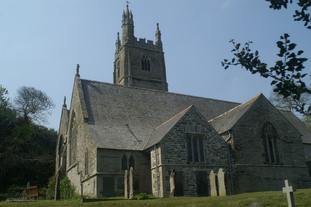
St Michael Caerhays () is a civil parish and village in Cornwall, England, United Kingdom. The village is about south-southwest of St Austell. The population as of the 2011 census was 96 St Michael Caerhays lies within the Cornwall Area of Outstanding Natural Beauty (AONB). The ecclesiastical parish was a chapelry of St Stephen in Brannel until 1832. From the 16th century the Rectors of St Stephen resided here so the church of St Michael came to be regarded as the mother church. The church is Norman but the Lady Chapel was added in the 15th century by the Trevanions and it contains their monuments. Their home was on the site of Caerhayes Castle. Caerhays Castle, a picturesque castellated mansion, is situated half-a-mile south of the village and was built by John Nash for J. B. Trevanion in 1808.Pevsner, N. (1970) ''Cornwall''; 2nd ed. Penguin; p. 192 Notable people George Martin, (1864 – 1946), was a priest in the Church of England who gave up his living and went to Sout ... [...More Info...] [...Related Items...] OR: [Wikipedia] [Google] [Baidu] |
St Mewan
St Mewan () is a civil parish and village in south Cornwall, England, United Kingdom. The village is approximately west of St Austell. It is a small settlement, comprising the parish church, rectory, a school and nearby farms. St Mewan parish also includes the settlements of Hewas Water, Sticker, Trelowth, Trewoon, and most of Polgooth. At the 2021 census, the parish had a population of 3,315. For elections to Cornwall Council, St Mewan is in the St Mewan and Grampound electoral ward. It was in the St Mewan electoral ward (which also included neighbouring villages) from 2005 to 2021. Parish church The church is dedicated to Saint Mewan, a sixth-century Celtic saint who was born in Wales, visited Cornwall, and is mostly venerated in Brittany. The current building dates from the 13th century and is mentioned in a bishops' inquisition of 1294 as the 'Ecclesia de St Mewany'. It was, however, substantially rebuilt in 1854 by George Edmund Street and enlarged in 1890. The c ... [...More Info...] [...Related Items...] OR: [Wikipedia] [Google] [Baidu] |
St Goran
St Goran is a coastal civil parish in Cornwall, England, UK, six miles (10 km) south-southwest of St Austell. The largest settlement in the parish is the coastal village of Gorran Haven, a mile to the east with a further cluster of homes at Trevarrick. The population (including Boswinger) at the 2011 census was 1,411. The parish is bounded by the sea to the east and south. It is bordered by St Michael Caerhays parish to the west and by St Ewe and Mevagissey parishes to the north. The patron saint Guron or Goronus is said to have come here from Bodmin. The parish church is a fine building of the 15th century though the foundation is Norman. Features of interest include the bench ends and the late medieval font. At Gorran Haven is a 15th-century chapel of St Just, restored in the 1860s. At Bodrugan, there are some remains of the medieval manor house of the Bodrugans which also had a chapel.''Cornish Church Guide'' (1925) Truro: Blackford; pp. 102-103 Thomas Tonkin, MP an ... [...More Info...] [...Related Items...] OR: [Wikipedia] [Google] [Baidu] |
St Ewe
St Ewe () is a civil parish and village in mid-Cornwall, England, United Kingdom, which is believed by hagiographers to have been named after the English moniker of Saint Avoye. The village is situated approximately five miles (8 km) southwest of St Austell. Antiquities Evidence of early medieval habitation is in the form of a roadside Celtic cross that once stood near Nunnery Hill ( Charles Henderson in 1925 refers to it being at Lanhadron). However, the crosshead and shaft were thrown down in 1873 by a farmer looking for buried treasure, and both pieces were afterwards lost. The base has survived ''in situ'' with an inscription in insular script, unreadable except for the word ''crucem''; Elisabeth Okasha dates the construction of this monument between the ninth and eleventh centuries. There is another cross at Corran, about half a mile east of the churchtown. This cross is also known as Beacon Cross since its site is known as the Beacon. There is a cross at Heligan know ... [...More Info...] [...Related Items...] OR: [Wikipedia] [Google] [Baidu] |
St Enoder
St Enoder () is a civil parish and hamlet in Cornwall, England, United Kingdom. The hamlet is situated five miles (8 km) southeast of Newquay. There is an electoral ward bearing this name which includes St Columb Road. The population at the 2011 census (including Blue Anchor) was 4,563. The nearest village is Summercourt half-a-mile (0.8 km) to the south and other settlements include Fraddon, Penhale, Indian Queens and Trevarren. History St Enoder is apparently named after an unknown saint though the oldest form of the name is "Heglosenuder" in Domesday Book. The next mention of St Enoder appears to be as "Sancti Enodri" (gen.) in 1271 and "Eglos Enoder" occurs in 1416 (this is interpreted by Craig Weatherhill as "St Enoder's church"). The church and manor of St Enoder belonged in Anglo-Saxon times to the monks of Bodmin and were before 1066 held by Godric. In 1086 they were held by Robert, Count of Mortain, from the monks; there was one hide of land, land for ... [...More Info...] [...Related Items...] OR: [Wikipedia] [Google] [Baidu] |


