|
St. Quentin Canal
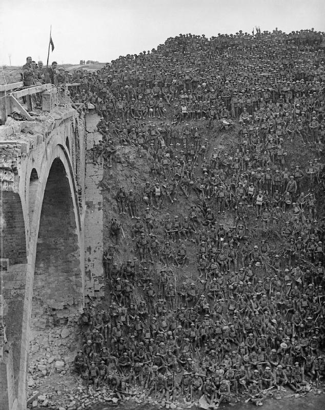
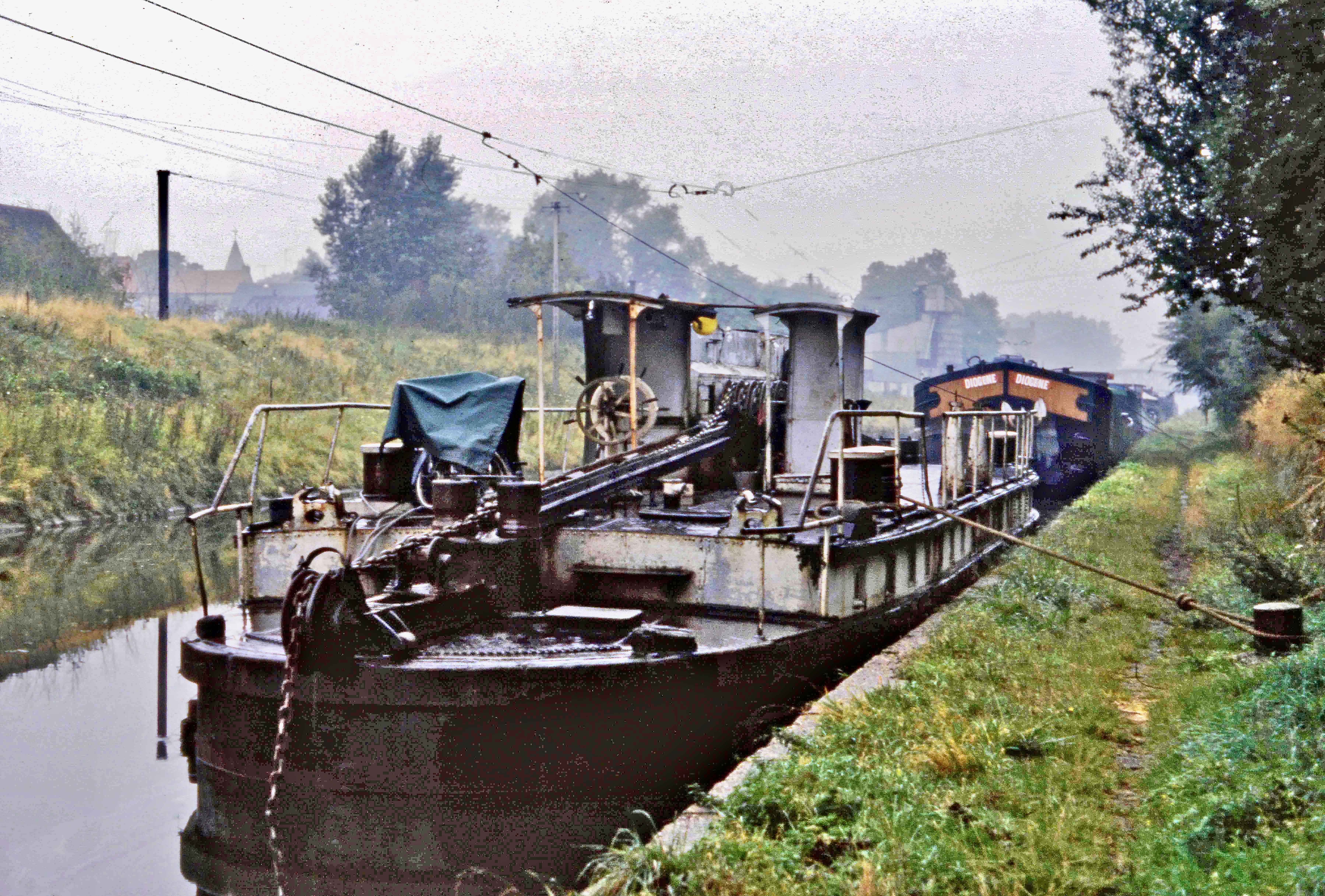
The Canal de Saint-Quentin () is a canal in northern France connecting the canalised river Scheldt, Escaut in Cambrai to the Canal latéral à l'Oise and Canal de l'Oise à l'Aisne in Chauny. History The canal was built in two phases, the second much longer than the first. Louis XIV of France, King Louis XIV's ministers Jean-Baptiste Colbert, Colbert and Mazarin had both proposed linking the rivers Oise (river), Oise and Somme (river), Somme in the 17th century and this resulted in the Canal Crozat, or Canal de Picardie, between Chauny and Saint-Simon, Aisne, Saint-Simon in 1738. The remainder, connecting the Seine Basin with the Scheldt, Escaut was a lengthy process. The original designer, Devicq in 1727, died in 1742. Little was accomplished until Napoléon demanded that work begin again in 1801. He officiated at the opening in April 1810. The canal was such a success that the locks had to be duplicated throughout in the early 20th century, at the same time deepening the channel ... [...More Info...] [...Related Items...] OR: [Wikipedia] [Google] [Baidu] |
Canal Latéral à L'Oise
Canals or artificial waterways are waterways or engineered channels built for drainage management (e.g. flood control and irrigation) or for conveyancing water transport vehicles (e.g. water taxi). They carry free, calm surface flow under atmospheric pressure, and can be thought of as artificial rivers. In most cases, a canal has a series of dams and locks that create reservoirs of low speed current flow. These reservoirs are referred to as ''slack water levels'', often just called ''levels''. A canal can be called a navigation canal when it parallels a natural river and shares part of the latter's discharges and drainage basin, and leverages its resources by building dams and locks to increase and lengthen its stretches of slack water levels while staying in its valley. A canal can cut across a drainage divide atop a ridge, generally requiring an external water source above the highest elevation. The best-known example of such a canal is the Panama Canal. Man ... [...More Info...] [...Related Items...] OR: [Wikipedia] [Google] [Baidu] |
Saint-Quentin, Aisne
Saint-Quentin (; ; ) is a city in the Aisne Departments of France, department, Hauts-de-France, northern France. It has been identified as the ''Augusta Veromanduorum'' of antiquity. It is named after Saint Quentin, Saint Quentin of Amiens, who is said to have been martyred there in the 3rd century. Administration Saint-Quentin is a Subprefectures in France, sub-prefecture of Aisne. Although Saint-Quentin is by far the largest city in Aisne, the capital is the third-largest city, Laon. Mayors The mayor of Saint-Quentin is Frédérique Macarez, a member of the centre-right The Republicans (France), LR Party. History The city was founded by the Romans, in the Augustus, Augustean period, to replace the ''oppidum'' of Vermand (11 km away) as the capital of ''Viromandui'' (Celtic Belgian people who occupied the region). It received the name "''Augusta Viromanduorum''", ''Augusta'' of the ''Viromandui'', in honor of the emperor Augustus. The site is that of a river ford, fo ... [...More Info...] [...Related Items...] OR: [Wikipedia] [Google] [Baidu] |
Lesdins
Lesdins () is a commune in the Aisne department in Hauts-de-France in northern France. Population See also *Communes of the Aisne department The following is a list of the 796 communes in the French department of Aisne. The communes cooperate in the following intercommunalities (as of 2025):Communes of Aisne Aisne communes articles needing translation from French Wikipedia {{SaintQuentin-geo-stub ... [...More Info...] [...Related Items...] OR: [Wikipedia] [Google] [Baidu] |
Bony, Aisne
Bony () is a commune in the department of Aisne in Hauts-de-France in northern France France, officially the French Republic, is a country located primarily in Western Europe. Overseas France, Its overseas regions and territories include French Guiana in South America, Saint Pierre and Miquelon in the Atlantic Ocean#North Atlan .... Population See also * Somme American Cemetery and Memorial * Communes of the Aisne department References Communes of Aisne Aisne communes articles needing translation from French Wikipedia {{SaintQuentin-geo-stub ... [...More Info...] [...Related Items...] OR: [Wikipedia] [Google] [Baidu] |
Riqueval Tunnel
The Riqueval Tunnel is a -long tunnel on the St. Quentin Canal, close to the commune of Bellicourt, in the department of Aisne, France. It connects Bellicourt with Bony. It was constructed as part of the St Quentin Canal between 1801 and 1810, on the orders of Napoleon. The tunnel remains in use, and can be traversed using a chain boat. Along with the Mauvages tunnel, on the Marne–Rhine Canal, it is one of the last locations in the world where a system of chain towing is still in operation. It was the longest tunnel in the world until the construction of Biassa II tunnel, La Spezia La Spezia (, or ; ; , in the local ) is the capital city of the province of La Spezia and is located at the head of the Gulf of La Spezia in the southern part of the Liguria region of Italy. La Spezia is the second-largest city in the Liguria ..., Italy.Oskar Teubert: ''Die Binnenschiffahrt – Ein Handbuch für alle Beteiligten'', Band 2, Verlag Wilhelm Engelmann, Leipzig 1918, 4. Teil, ... [...More Info...] [...Related Items...] OR: [Wikipedia] [Google] [Baidu] |
Honnecourt-sur-Escaut
Honnecourt-sur-Escaut (, literally '' Honnecourt on Escaut'') is a commune in the Nord department in northern France. Heraldry See also *Communes of the Nord department The following is a list of the 647 communes of the Nord department of the French Republic. The communes cooperate in the following intercommunalities (as of 2025): References Honnecourtsurescaut {{Cambrai-geo-stub ...[...More Info...] [...Related Items...] OR: [Wikipedia] [Google] [Baidu] |
Les Rues-des-Vignes
Les Rues-des-Vignes (; called ''Vinchy'' in the Middle Ages) is a commune in the Nord department in northern France. Vinchy was the site of a famous battle of the then-rising Charles Martel in spring 717. See also *Communes of the Nord department The following is a list of the 647 communes of the Nord department of the French Republic. The communes cooperate in the following intercommunalities (as of 2025): References Communes of Nord (French department) {{Cambrai-geo-stub ...[...More Info...] [...Related Items...] OR: [Wikipedia] [Google] [Baidu] |
Masnières
Masnières () is a commune in the Nord department in northern France. Population Heraldry History Masnières figured into the 1917 Battle of Cambrai during which time it was briefly captured by the British on the first day of the battle, November 20, and held for twelve days to protect vital bridgeheads between Masnières and Marcoing before the British withdrawal under the weight of heavy German counter-attack. The actions of the battle are commemorated in and around Masnières by several Commonwealth War Graves Commission landmarks in and around the town, including: * Masnières Newfoundland Memorial * Masnières British Cemetery *Marcoing British Cemetery See also *Communes of the Nord department *Marcel Gaumont Marcel Gaumont was a French sculptor born on 27 January 1880 in Tours. He died in Paris on 20 November 1962. Biography Gaumont was a pupil at the École nationale supérieure des Beaux-Arts in Paris and studied under Louis-Ernest Barrias .... Sculp ... [...More Info...] [...Related Items...] OR: [Wikipedia] [Google] [Baidu] |
Point Kilométrique
A milestone is a numbered marker placed on a route such as a road, railway, railway line, canal or border, boundary. They can indicate the distance to towns, cities, and other places or landmarks like Mileage sign, mileage signs; or they can give their position on the route relative to some datum location. On roads they are typically located at the side or in a Central reservation, median or central reservation. They are alternatively known as mile markers (sometimes abbreviated MMs), mileposts or mile posts (sometimes abbreviated MPs). A "kilometric point" is a term used in Metrication, metricated areas, where distances are commonly measured in kilometres instead of miles. "Distance marker" is a generic unit-agnostic term. Milestones are installed to provide linear referencing points along the road. This can be used to reassure travellers that the proper path is being followed, and to indicate either distance travelled or the remaining distance to a destination. Such refer ... [...More Info...] [...Related Items...] OR: [Wikipedia] [Google] [Baidu] |
Armistice Of 11 November 1918
The Armistice of 11 November 1918 was the armistice signed in a railroad car, in the Compiègne Forest near the town of Compiègne, that ended fighting on land, at sea, and in the air in World War I between the Entente and their last remaining opponent, Germany. Previous armistices had been agreed with Bulgaria, the Ottoman Empire and Austria-Hungary. It was concluded after the German government sent a message to American president Woodrow Wilson to negotiate terms on the basis of a recent speech of his and the earlier declared " Fourteen Points", which later became the basis of the German surrender at the Paris Peace Conference, which took place the following year. Also known as the Armistice of Compiègne (, ) from the town near the place where it was officially agreed to at 5:00 a.m. by the Allied Supreme Commander, French Marshal Ferdinand Foch, it came into force at 11:00 a.m. Central European Time (CET) on 11 November 1918 and marked a vic ... [...More Info...] [...Related Items...] OR: [Wikipedia] [Google] [Baidu] |


