|
Springfield Township, Delaware County, Pennsylvania
Springfield Township, or simply Springfield, is a township (Pennsylvania), township in Delaware County, Pennsylvania, Delaware County in the U.S. state of Pennsylvania. The population was 25,070 at the 2020 census. Springfield is a suburb of Philadelphia, located about west of the city. History First settled by Quakers who arrived in Pennsylvania with William Penn, Springfield was first recognized as a governmental entity in 1686. Many of the streets in Springfield are named after former prominent citizens, including Kennerly, Lownes, Levis, Maris, Thomas, Beatty, Lewis, Foulke, Evans, Powell, Pancoast, Worrell, and Edge. Originally, Springfield was primarily a farming town. On December 9, 1687, the settlers began laying the road to Amosland as it was then called. This road is now known as Springfield Road. In 1701 construction began on the Baltimore Pike; the road was formed of sturdy oak planks, some of which still exist under the current Baltimore Pike. 1701 also marked the ... [...More Info...] [...Related Items...] OR: [Wikipedia] [Google] [Baidu] |
Township (Pennsylvania)
A township, under the laws of the Commonwealth of Pennsylvania, is the lowest level of municipal incorporation of government. All of Pennsylvania's community, communities outside of incorporated local government in Pennsylvania#City, cities, borough (Pennsylvania), boroughs, and Bloomsburg, Pennsylvania#History, one town have been incorporated into individual townships that serve as the legal entities providing local self-government functions. In general, townships in Pennsylvania encompass larger land areas than other Municipality, municipalities, and tend to be located in suburban, exurban, or rural parts of the commonwealth. As with other incorporated municipalities in Pennsylvania, townships exist within local government in Pennsylvania#County, counties and are subordinate to or dependent upon the county level of government. History Townships in Pennsylvania were created in the 17th century during the colonial-era Province of Pennsylvania prior to the American Revolution. Muc ... [...More Info...] [...Related Items...] OR: [Wikipedia] [Google] [Baidu] |
Urban Sprawl
Urban sprawl (also known as suburban sprawl or urban encroachment) is defined as "the spreading of urban developments (such as houses and shopping centers) on undeveloped land near a city". Urban sprawl has been described as the unrestricted growth in many urban areas of housing, commercial development, and roads over large expanses of land, with little concern for very dense urban planning. Sometimes the urban areas described as the most "sprawling" are the most densely populated. In addition to describing a special form of urbanization, the term also relates to the social and environmental consequences associated with this development. In modern times some suburban areas described as "sprawl" have less detached housing and higher density than the nearby core city. Medieval suburbs suffered from the loss of protection of city walls, before the advent of industrial warfare. Modern disadvantages and costs include increased travel time, transport costs, pollution, and dest ... [...More Info...] [...Related Items...] OR: [Wikipedia] [Google] [Baidu] |
Exclave
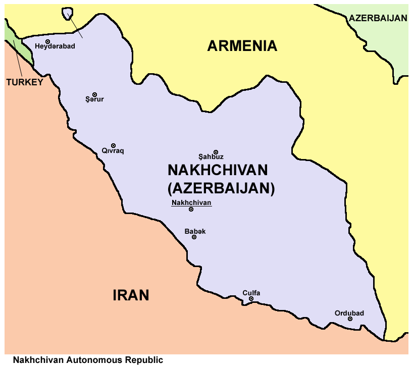
An enclave is a territory that is entirely surrounded by the territory of only one other state or entity. An enclave can be an independent territory or part of a larger one. Enclaves may also exist within territorial waters. ''Enclave'' is sometimes used improperly to denote a territory that is only partly surrounded by another state. Enclaves that are not part of a larger territory are not exclaves, for example Lesotho (enclaved by South Africa), and San Marino and Vatican City (both enclaved by Italy) are enclaved sovereign states. An exclave is a portion of a state or district geographically separated from the main part, by some surrounding alien territory. Many exclaves are also enclaves, but an exclave surrounded by the territory of more than one state is not an enclave. The Azerbaijani exclave of Nakhchivan is an example of an exclave that is not an enclave, as it borders Armenia, Iran, and Turkey. Semi-enclaves and semi-exclaves are areas that, except for possessing ... [...More Info...] [...Related Items...] OR: [Wikipedia] [Google] [Baidu] |
Swarthmore, Pennsylvania
Swarthmore ( , ) is a borough in Delaware County, Pennsylvania, United States. Swarthmore was originally named Westdale in honor of painter Benjamin West, who was one of the early residents of the town. The name was changed to Swarthmore after the establishment of Swarthmore College. The borough population was 6,194 as of the 2010 census. History Originally, the area belonged to the Lenape people. It was settled in the late 1600s by Quakers after William Penn granted them the land. By the early 1800s, it was still mainly farmland, and was known as Westdale in honor of local artist Benjamin West. It was part of Springfield Township, but the area began to become a distinct town after Swarthmore College was founded in 1864. The advent of passenger rail service from Philadelphia in the 1880s greatly enhanced the desirability of the borough as a commuter suburb, and the borough was incorporated in 1893. About one third of the borough's land area consists of the Swarthmore Colleg ... [...More Info...] [...Related Items...] OR: [Wikipedia] [Google] [Baidu] |
Morton, Pennsylvania
Morton is a borough in Delaware County, Pennsylvania, United States. The population was 2,778 at the 2020 census. Geography Morton is located in eastern Delaware County at (39.910612, -75.327273). It is bordered to the north, east, and west by Springfield Township and to the south by Ridley Township. According to the United States Census Bureau, Morton has a total area of , all land. Transportation As of 2010, there were of public roads in Morton, of which were maintained by the Pennsylvania Department of Transportation (PennDOT) and were maintained by the borough. Pennsylvania Route 420 traverses Morton, following a southeast-to-northwest alignment following Woodland Avenue through the southwestern portion of the borough. PA 420 leads north to U.S. Route 1 in Springfield Township and south to Interstate 95 in Tinicum Township. Demographics As of Census 2010, the racial makeup of the borough was 65.1% White, 25.4% African American, 0.3% Native American, 6.0% ... [...More Info...] [...Related Items...] OR: [Wikipedia] [Google] [Baidu] |
Ridley Township, Pennsylvania
Ridley Township is a township in Delaware County, Pennsylvania, United States. The population was 30,768 at the 2010 census. Ridley Township contains the (CDPs) of Folsom and Woodlyn, along with the unincorporated communities of Crum Lynne and Holmes and a portion of Secane. History Ridley Township derives its name from Ridley, Cheshire, England, from where John Simcock, one of the original settlers, emigrated. The first mention of Ridley in court records is from 1684 when tax collectors were appointed for the township. During the Revolutionary War, Ridley was traversed by both the Continental Army and the British Army during the American Revolutionary War, British Army. George Washington moved his troops through Ridley Township on his way to Wilmington, Delaware, Wilmington, Delaware to oppose General Howe. After the Battle of Brandywine, Continental Army soldiers camped along the road in Ridley and George Washington spent the night in the home of John McIlvain. On Novembe ... [...More Info...] [...Related Items...] OR: [Wikipedia] [Google] [Baidu] |
Upper Darby Township, Pennsylvania
Upper Darby Township, often shortened to Upper Darby, is a Home Rule Municipality (Pennsylvania), home rule Township (Pennsylvania), township in Delaware County, Pennsylvania, United States. As of the 2020 census, the township had a total population of 85,681, making it the state's List of municipalities in Pennsylvania, sixth-most populated municipality after Philadelphia, Pittsburgh, Allentown, Pennsylvania, Allentown, Reading, Pennsylvania, Reading, and Erie, Pennsylvania, Erie. Upper Darby borders Philadelphia, the nation's List of United States cities by population, sixth-most populous city, and constitutes part of the Delaware Valley, also known as the Philadelphia metropolitan area, the nation's Metropolitan statistical area, seventh-largest metropolitan area. Upper Darby is home to the Tower Theater (Pennsylvania), Tower Theater, a historic music venue on 69th Street built in the 1920s, and to several Underground Railroad sites. In August 2019, the radio tower on top of ... [...More Info...] [...Related Items...] OR: [Wikipedia] [Google] [Baidu] |
Haverford Township, Pennsylvania
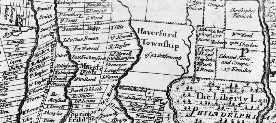
Haverford Township is a home rule municipality township in Delaware County, Pennsylvania, United States.323 Pennsylvania Code § 23.1-101 ''et seq.'' Haverford is named after the town of in Wales. It is a commuting suburb located due west of and is officially known as the Township of Haverford. It is referred by its name alone, like many townships in Pennsylvania, simply as Haverford. Despite being under a home rule charter since 1977, it continues to operate under a Board of Commissioners divided into wards, [...More Info...] [...Related Items...] OR: [Wikipedia] [Google] [Baidu] |
Hardiness Zone
A hardiness zone is a geographic area defined as having a certain average annual minimum temperature, a factor relevant to the survival of many plants. In some systems other statistics are included in the calculations. The original and most widely used system, developed by the United States Department of Agriculture (USDA) as a rough guide for landscaping and gardening, defines 13 zones by long-term average annual extreme minimum temperatures. It has been adapted by and to other countries (such as Canada) in various forms. A plant may be described as "hardy to zone 10": this means that the plant can withstand a minimum temperature of . Unless otherwise specified, in American contexts "hardiness zone" or simply "zone" usually refers to the USDA scale. However, some confusion can exist in discussing buildings and HVAC, where "climate zone" can refer to the International Energy Conservation Code zones, where Zone 1 is warm and Zone 8 is cold. Other hardiness rating schemes have been ... [...More Info...] [...Related Items...] OR: [Wikipedia] [Google] [Baidu] |
Humid Subtropical Climate
A humid subtropical climate is a subtropical -temperate climate type, characterized by long and hot summers, and cool to mild winters. These climates normally lie on the southeast side of all continents (except Antarctica), generally between latitudes 25° and 40° and are located poleward from adjacent tropical climates, and equatorward from either humid continental (in North America and Asia) or oceanic climates (in other continents). It is also known as warm temperate climate in some climate classifications. Under the Köppen climate classification, ''Cfa'' and ''Cwa'' climates are either described as humid subtropical climates or warm temperate climates. This climate features mean temperature in the coldest month between (or ) and and mean temperature in the warmest month or higher. However, while some climatologists have opted to describe this climate type as a "humid subtropical climate", Köppen himself never used this term. The humid subtropical climate classific ... [...More Info...] [...Related Items...] OR: [Wikipedia] [Google] [Baidu] |
Delaware River
The Delaware River is a major river in the Mid-Atlantic region of the United States and is the longest free-flowing (undammed) river in the Eastern United States. From the meeting of its branches in Hancock, New York, the river flows for along the borders of New York, Pennsylvania, New Jersey, and Delaware, before emptying into Delaware Bay. The river has been recognized by the National Wildlife Federation as one of the country's Great Waters and has been called the "Lifeblood of the Northeast" by American Rivers. Its watershed drains an area of and provides drinking water for 17 million people, including half of New York City via the Delaware Aqueduct. The Delaware River has two branches that rise in the Catskill Mountains of New York: the West Branch at Mount Jefferson in Jefferson, Schoharie County, and the East Branch at Grand Gorge, Delaware County. The branches merge to form the main Delaware River at Hancock, New York. Flowing south, the river re ... [...More Info...] [...Related Items...] OR: [Wikipedia] [Google] [Baidu] |
Crum Creek
Crum Creek (from the Dutch, meaning "crooked creek") is a creek in Delaware County and Chester County, Pennsylvania, flowing approximately , generally in a southward direction and draining into the Delaware River in Eddystone, Pennsylvania. It begins in a swamp (formerly a lake, dammed out) near Newtown Square, Pennsylvania along which several mills were established in the 19th century. Right afterward it crosses under Pennsylvania Route 29 and winds one and a half miles () downstream until it hits the hamlet of Crum Creek. It later flows into the Delaware River near Philadelphia. Two notable landmarks along the creek's course are high trestles: a trolley trestle about high runs across the creek in Smedley Park, in Nether Providence Township; this trestle carries the Southeastern Pennsylvania Transportation Authority's 101 trolley line from Media, Pennsylvania across the creek. About a mile () south, a , trestle carries SEPTA's Media/Wawa Line commuter railroad line ac ... [...More Info...] [...Related Items...] OR: [Wikipedia] [Google] [Baidu] |


