|
Sparta, New York
Sparta is a town in Livingston County, New York, United States. The population was 1,624 at the 2010 census. Sparta is in the southeast part of the county and is north of Dansville. History The area was first settled ''circa'' 1794. Sparta was established in 1789 before the establishment of Livingston County. Eventually, Sparta was diminished by the removal of land for other towns, including Springwater (1816), West Sparta (1846), and Groveland (1856). Sparta also received territory from other towns: Dansville (in Steuben County) (1822) and Groveland (1856). Notable people * Daniel Shays, leader of Shays' Rebellion, lived his later life here Geography According to the United States Census Bureau, the town has a total of , all land. A small part of the south town line is the border of Steuben County. New York State Route 255 (now decommissioned) joined New York State Route 256 in Sparta. New York State Route 63 is a north-south highway in the western part of the to ... [...More Info...] [...Related Items...] OR: [Wikipedia] [Google] [Baidu] |
Administrative Divisions Of New York
The administrative divisions of New York are the various units of government that provide local government, local services in the American New York (state), state of New York. The state is divided into boroughs of New York City, boroughs, counties, cities, towns, and villages. (The only boroughs, the five boroughs of New York City, have the same boundaries as their respective counties.) They are municipal corporations, chartered (created) by the New York State Legislature, as under the Constitution of New York, New York State Constitution the only body that can create governmental units is the state. All of them have their own governments, sometimes with no paid employees, that provide local services. Centers of population that are not incorporated and have no government or local services are designated Administrative divisions of New York (state)#Hamlet, hamlets. Whether a municipality is defined as a borough, city, town, or village is determined not by population or land are ... [...More Info...] [...Related Items...] OR: [Wikipedia] [Google] [Baidu] |
Shays' Rebellion
Shays's Rebellion was an armed uprising in Western Massachusetts and Worcester, Massachusetts, Worcester in response to a debt crisis among the citizenry and in opposition to the state government's increased efforts to collect taxes on both individuals and their trades. The fighting took place in the areas around Springfield, Massachusetts, Springfield during 1786 and 1787. Historically, scholars have argued that the four thousand rebels, called ''Shaysites'', who protested against economic and civil rights injustices by the Massachusetts Government were led by American Revolutionary War, Revolutionary War veteran Daniel Shays. By the early 2020s, scholarship has suggested that Shays's role in the protests was significantly and strategically exaggerated by Massachusetts elites, who had a political interest in shifting blame for bad economic conditions away from themselves. In 1787, the protesters marched on the federal Springfield Armory in an unsuccessful attempt to seize its ... [...More Info...] [...Related Items...] OR: [Wikipedia] [Google] [Baidu] |
South
South is one of the cardinal directions or compass points. The direction is the opposite of north and is perpendicular to both west and east. Etymology The word ''south'' comes from Old English ''sūþ'', from earlier Proto-Germanic ''*sunþaz'' ("south"), possibly related to the same Proto-Indo-European root that the word ''sun'' derived from. Some languages describe south in the same way, from the fact that it is the direction of the sun at noon (in the Northern Hemisphere), like Latin meridies 'noon, south' (from medius 'middle' + dies 'day', ), while others describe south as the right-hand side of the rising sun, like Biblical Hebrew תֵּימָן teiman 'south' from יָמִין yamin 'right', Aramaic תַּימנַא taymna from יָמִין yamin 'right' and Syriac ܬܰܝܡܢܳܐ taymna from ܝܰܡܝܺܢܳܐ yamina (hence the name of Yemen, the land to the south/right of the Levant). South is sometimes abbreviated as S. Navigation By convention, the ''bottom or down ... [...More Info...] [...Related Items...] OR: [Wikipedia] [Google] [Baidu] |
North Dansville, New York
North Dansville is a town in Livingston County, New York, United States. The population was 5,538 at the 2010 census. The town is in the southeast part of the county. The village of Dansville occupies the center of the town. History The first settlers arrived ''circa'' 1795. The town was organized from the town of Sparta in 1846, and in 1849 North Dansville was increased by more territory from Sparta. The town was at one time on a branch of the Genesee Valley Canal. Geography According to the United States Census Bureau, the town has a total area of , all land. The eastern and southern town lines are the border of Steuben County. The town of Dansville is in Steuben County, directly south of the town of North Dansville. Interstate 390 passes through the town. New York State Route 36, New York State Route 63, and New York State Route 256 pass through the town. Canaseraga Creek flows northward within the town toward the Genesee River. Adjacent towns and areas (Clockwise) ... [...More Info...] [...Related Items...] OR: [Wikipedia] [Google] [Baidu] |
Wayland, New York
Wayland is a town in Steuben County, New York, United States. The population was 3,733 at the 2020 census. The Town of Wayland contains a village called Wayland. The town is in the northern part of the county, northwest of Bath. History The region was first settled by European Americans around 1806, after the Revolutionary War. In historic times, for centuries it had been territory inhabited by the Seneca Native Americans, one of the powerful five tribes of the Iroquois Confederacy. The town was formed in 1848 from the Towns of Cohocton and Dansville. Part of Wayland was used to form the Town of Fremont in 1854. The Rowe House is listed on the National Register of Historic Places. On August 30, 1943, the Lackawanna Limited wreck, occurred when the ''Lackawanna Limited'', flagship passenger train of the Delaware, Lackawanna and Western Railroad sideswiped a local freight that had not cleared into a siding, killing 29 people near the Gunlocke chair factory. Geo ... [...More Info...] [...Related Items...] OR: [Wikipedia] [Google] [Baidu] |
East
East is one of the four cardinal directions or points of the compass. It is the opposite direction from west and is the direction from which the Sun rises on the Earth. Etymology As in other languages, the word is formed from the fact that east is the direction where the Sun rises: ''east'' comes from Middle English ''est'', from Old English ''ēast'', which itself comes from the Proto-Germanic *''aus-to-'' or *''austra-'' "east, toward the sunrise", from Proto-Indo-European *aus- "to shine," or " dawn", cognate with Old High German ''*ōstar'' "to the east", Latin ''aurora'' 'dawn', and Greek ''ēōs'' 'dawn, east'. Examples of the same formation in other languages include Latin oriens 'east, sunrise' from orior 'to rise, to originate', Greek ανατολή anatolé 'east' from ἀνατέλλω 'to rise' and Hebrew מִזְרָח mizraḥ 'east' from זָרַח zaraḥ 'to rise, to shine'. ''Ēostre'', a Germanic goddess of dawn, might have been a personification of bot ... [...More Info...] [...Related Items...] OR: [Wikipedia] [Google] [Baidu] |
North
North is one of the four compass points or cardinal directions. It is the opposite of south and is perpendicular to east and west. ''North'' is a noun, adjective, or adverb indicating Direction (geometry), direction or geography. Etymology The word ''north'' is etymology, related to the Old High German ''nord'', both descending from the Proto-Indo-European language, Proto-Indo-European unit *''ner-'', meaning "left; below" as north is to left when facing the rising sun. Similarly, the other cardinal directions are also related to the sun's position. The Latin word ''borealis'' comes from the Ancient Greek, Greek ''boreas'' "north wind, north" which, according to Ovid, was personified as the wind-god Boreas (god), Boreas, the father of Calais and Zetes. ''Septentrionalis'' is from ''septentriones'', "the seven plow oxen", a name of ''Ursa Major''. The Greek ἀρκτικός (''arktikós'') is named for the same constellation, and is the source of the English word ''Arctic''. ... [...More Info...] [...Related Items...] OR: [Wikipedia] [Google] [Baidu] |
Conesus, New York
Conesus is a Administrative divisions of New York#Town, town in Livingston County, New York, Livingston County, New York (state), New York, United States. The population was 2,473 at the 2010 census. The name is derived from a native word meaning "berry place". Conesus is on the county's east border, and is north of Dansville, Livingston County, New York, Dansville. History Settlement began ''circa'' 1795. In 1819, Conesus was formed from parts of the towns of Groveland, New York, Groveland and Livonia (town), New York, Livonia as the "Town of Freeport". The name was changed to "Browersville" in March 1825 and was changed to "Conesus" a month later. Conesus is home to the former St. Michael's Mission, a school for Catholic priests that operated from the 1930s until the 1970s. The sprawling complex on Mission Road is now owned by an evangelical Christian church from Colorado Springs. The Conesus Amusement Hall, Kellerman Log Cabin, Payne Cobblestone House, and Sliker Cobblesto ... [...More Info...] [...Related Items...] OR: [Wikipedia] [Google] [Baidu] |
Clockwise
Two-dimensional rotation can occur in two possible directions or senses of rotation. Clockwise motion (abbreviated CW) proceeds in the same direction as a clock's hands relative to the observer: from the top to the right, then down and then to the left, and back up to the top. The opposite sense of rotation or revolution is (in Commonwealth English) anticlockwise (ACW) or (in North American English) counterclockwise (CCW). Three-dimensional rotation can have similarly defined senses when considering the corresponding angular velocity vector. Terminology Before clocks were commonplace, the terms " sunwise" and "deasil", "deiseil" and even "deocil" from the Scottish Gaelic language and from the same root as the Latin "dexter" ("right") were used for clockwise. " Widdershins" or "withershins" (from Middle Low German "weddersinnes", "opposite course") was used for counterclockwise. The terms clockwise and counterclockwise can only be applied to a rotational motion once a side ... [...More Info...] [...Related Items...] OR: [Wikipedia] [Google] [Baidu] |
Conesus Lake
Conesus Lake is located in Livingston County, New York. Conesus Lake is one of New York's twelve Finger Lakes. It is located off Interstate 390 about south of Interstate 90. Description Conesus Lake is long, with a maximum depth of . It flows south to north, from its inlet in the Town of Conesus to its outlet, Conesus Creek, in Lakeville, a hamlet in the Town of Livonia in Livingston County. Conesus Creek in turn flows into the Genesee River near Avon. The first steamboat on Conesus Lake was named the "Jessie" launched July 1, 1874, after the Civil War. In August 2006, the New York State Department of Environmental Conservation confirmed that the lake was the first outside the contiguous Great Lakes waterways to be stricken with a new strain of viral hemorrhagic septicemia (VHS), an infectious fish disease responsible for mass die-offs of many species, but not linked to any human health concerns. The disease is spread between waterways through live or frozen ba ... [...More Info...] [...Related Items...] OR: [Wikipedia] [Google] [Baidu] |
New York State Route 63
New York State Route 63 (NY 63) is a state highway in the western part of New York (state), New York in the United States. It extends for in a generally southeast–northwest direction from an intersection with New York State Route 15, NY 15 and New York State Route 21, NY 21 in the Wayland (village), New York, village of Wayland in Steuben County, New York, Steuben County to a junction with New York State Route 18, NY 18 in the town of Yates, New York, Yates in Orleans County, New York, Orleans County, south of the Lake Ontario shoreline. The route passes through the Batavia, New York, city of Batavia and enters or comes near several villages, including Dansville, Livingston County, New York, Dansville and Medina, New York, Medina. NY 63 was assigned as part of the 1930 state highway renumbering (New York), 1930 renumbering of state highways in New York, but to a largely different routing than it follows today. The original alignment of NY 63 ... [...More Info...] [...Related Items...] OR: [Wikipedia] [Google] [Baidu] |
New York State Route 256
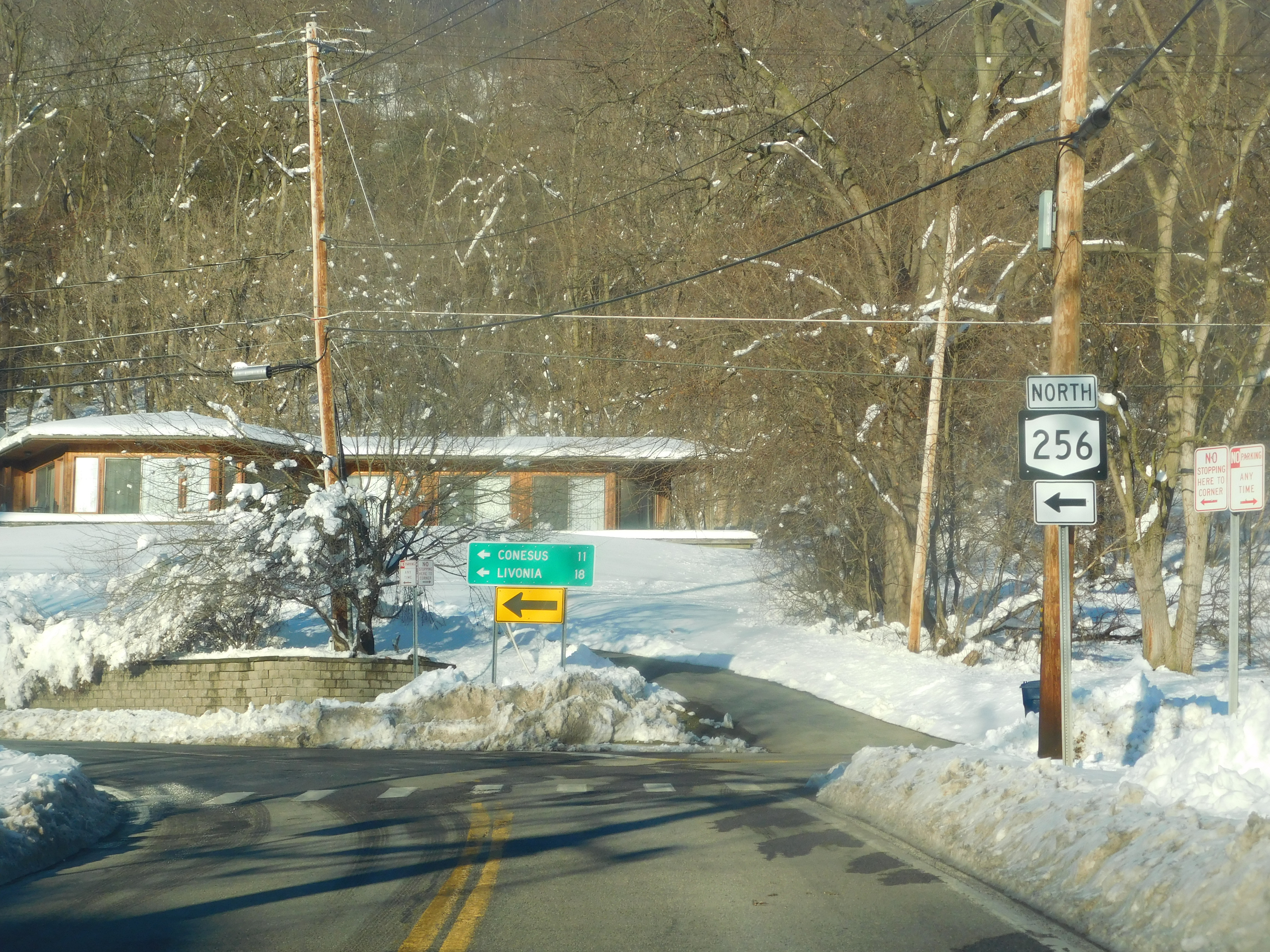
New York State Route 256 (NY 256) is a north–south state highway located within Livingston County, New York, in the United States. It extends for across mostly rural terrain from an intersection with New York State Route 63, NY 63 in the village of Dansville, Livingston County, New York, Dansville to a junction with New York State Route 15, NY 15 on the Geneseo (town), New York, Geneseo–Livonia (town), New York, Livonia town line. The northern half of NY 256, named West Lake Road, passes along the western shore of Conesus Lake. NY 256 was assigned as part of the 1930 state highway renumbering (New York), 1930 renumbering of state highways in New York to an alignment extending from Groveland, New York, Groveland to modern U.S. Route 20A (New York), U.S. Route 20A (US 20A) west of Lakeville, New York, Lakeville. It was extended north to its current northern terminus and south to Dansville in stages during the 1930s and 1940s. Route desc ... [...More Info...] [...Related Items...] OR: [Wikipedia] [Google] [Baidu] |


