|
South Peninsula
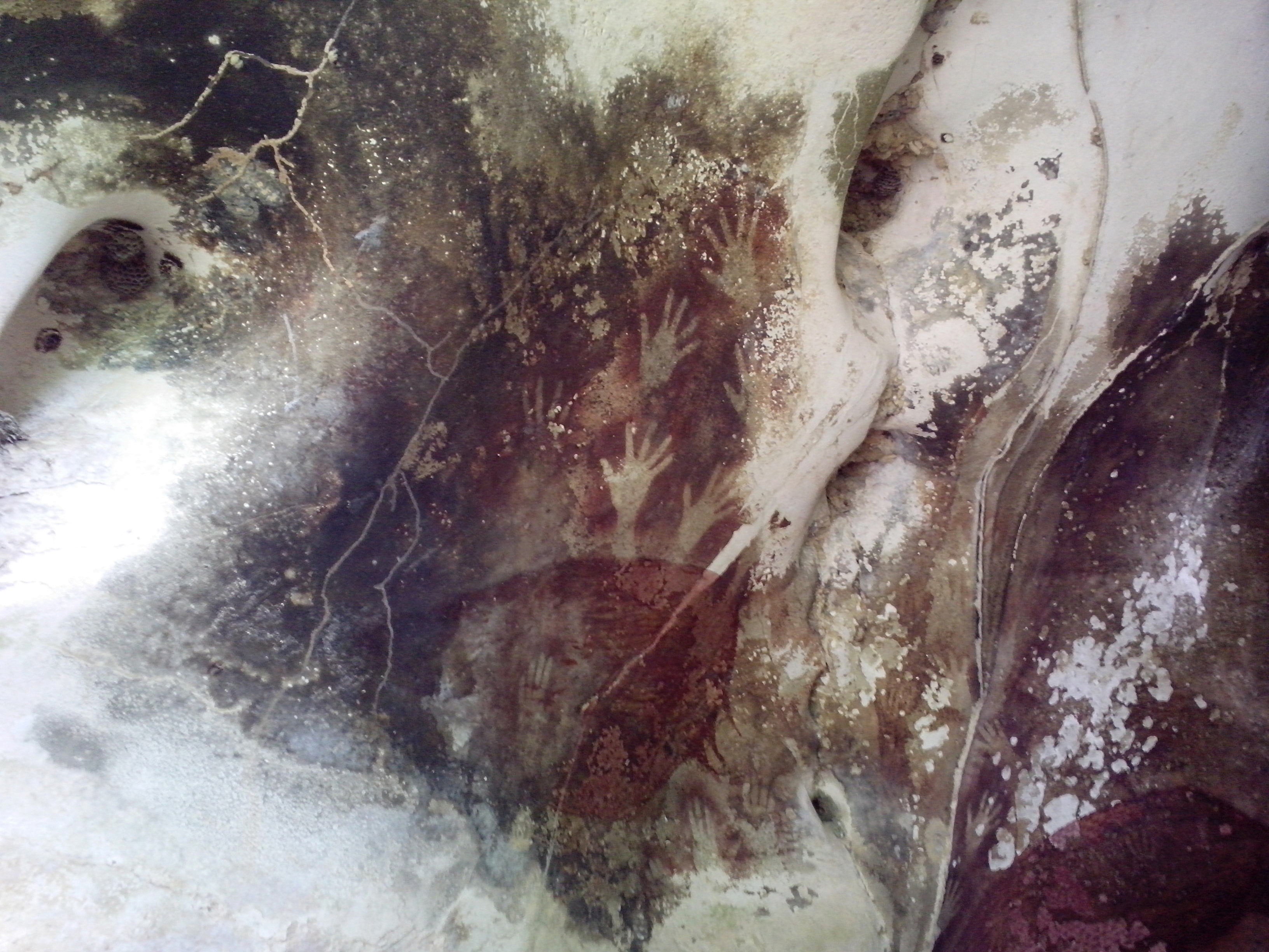
The South Peninsula is one of the four principal peninsulas on the island of Sulawesi, stretching south from the central part of the island. It is part of the province of South Sulawesi. The southern peninsula is the most densely populated peninsula in Sulawesi; over 45% of the population of Sulawesi (or 8.8 million people) are on the southern peninsula. Inhabited by an Austronesian people who came thousands of years ago. The largest ethnic group in Sulawesi is the Bugis, followed by Makassar and Toraja. Mount Lompobattang lies near the southern tip of this peninsula. and the latimojong mountain is the highest mountain in the southern peninsula of sulawesi and on the island of sulawesi. History South Peninsula was first inhabited by humans about 30,000 years ago. The archaeological remains of the earliest inhabitants were discovered in caves near limestone hills around Maros, about 30 km northeast of Makassar, the capital of the South Sulawesi province. Pebble and flake ... [...More Info...] [...Related Items...] OR: [Wikipedia] [Google] [Baidu] |
Makassar
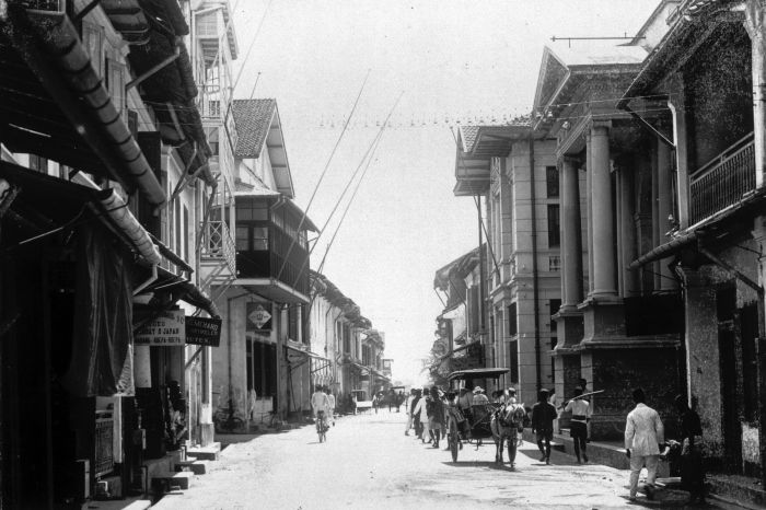
Makassar ( ), formerly Ujung Pandang ( ), is the capital of the Indonesian Provinces of Indonesia, province of South Sulawesi. It is the largest city in the region of Eastern Indonesia and the country's fifth-largest urban center after Jakarta, Surabaya, Medan, and Bandung.Ministry of Internal AffairsRegistration Book for Area Code and Data of 2013 The city is located on the southwest coast of the island of Sulawesi, facing the Makassar Strait. Throughout its history, Makassar has been an important trading port, hosting the center of the Gowa Sultanate and a Portuguese naval base before its conquest by the Dutch East India Company in the 17th century. It remained an important port in the Dutch East Indies, serving Eastern Indonesian regions with Makassarese fishers going as far south as the Australian coast. For a brief period after Independence of Indonesia, Indonesian independence, Makassar became the capital of the State of East Indonesia, during which an Makassar Uprising, u ... [...More Info...] [...Related Items...] OR: [Wikipedia] [Google] [Baidu] |
Moncong Lompobatang
Moncong Lompobattang is a mountain in Indonesia with an elevation of 2,874 m. Moncong Lompobattang is ranked 116th in the world by topographic prominence. There is a small antenna compound at the summit of Moncong Lompobattang, along with a triangular pillar and a boulder with the names previous climbers written on it."Moncong Lompobattang" GunungBagging.com. Retrieved 2012-04-17. One kilometre north of the summit lies a slightly lower sub-peak known as Puncak Ko’bang (2,870 m) which is the alleged site of the tomb of a King of Gowa. The two peaks, including the entire mountain and its surrounding area, are considered spiritually significant among local people. ...
|
Sultanate Of Gowa
The Sultanate of Gowa was one of the great kingdoms in the history of Indonesia and the most successful kingdom in the South Sulawesi region. People of this kingdom come from the Makassar tribe who lived in the south end and the west coast of southern Sulawesi. History Before the establishment of the kingdom, the region had been known as ''Makassar'' and its people as '' Makassarese''. The history of the kingdom can be divided into two eras: pre-Islamic kingdom and post-Islamic sultanate. Early history The epic poem the ''Nagarakretagama'', in praise of King Rajasanagara of Majapahit, lists Makassar as one of the kingdom's tributaries in 1365. The first queen of Gowa was ''Tomanurung Baine''. Not much is known about the exact time when the kingdom was established nor about the first queen, and only during the reign of the 6th king, ''Tonatangka Kopi'', have local sources noted about the division of the kingdom into two new kingdoms led by two Kopi's sons: Kingdom of Gowa l ... [...More Info...] [...Related Items...] OR: [Wikipedia] [Google] [Baidu] |
Celebes In 1905
Sulawesi ( ), also known as Celebes ( ), is an island in Indonesia. One of the four Greater Sunda Islands, and the world's 11th-largest island, it is situated east of Borneo, west of the Maluku Islands, and south of Mindanao and the Sulu Archipelago. Within Indonesia, only Sumatra, Borneo, and Papua are larger in territory, and only Java and Sumatra are more populous. The landmass of Sulawesi includes four peninsulas: the northern Minahasa Peninsula, the East Peninsula, the South Peninsula, and the Southeast Peninsula. Three gulfs separate these peninsulas: the Gulf of Tomini between the northern Minahasa and East peninsulas, the Tolo Gulf between the East and Southeast peninsulas, and the Bone Gulf between the South and Southeast peninsulas. The Strait of Makassar runs along the western side of the island and separates the island from Borneo. Etymology The name ''Sulawesi'' possibly comes from the words ''sula'' ("island") and ''besi'' ("iron") and may refer to the histor ... [...More Info...] [...Related Items...] OR: [Wikipedia] [Google] [Baidu] |


