|
South Belridge Oil Field
The South Belridge Oil Field is a large oil field in northwestern Kern County, San Joaquin Valley, California, about forty miles west of Bakersfield. Discovered in 1911, and having a cumulative production of over of oil equivalent at the end of 2023, it is the fourth-largest oil field in California, after the Midway-Sunset Oil Field, Kern River Oil Field, and Wilmington Oil Field, and is the sixth-most productive field in the United States. Its estimated remaining reserves, as of the end of 2008, were around out of approximately 10.2 billion barrels of original oil in place, and it had 6,253 active wells. p. 63. The principal operator on the field was Aera Energy LLC, a joint venture between Royal Dutch Shell and ExxonMobil. Additionally, the field included the only onshore wells in California owned and operated by ExxonMobil. Setting The oil field is located along State Route 33, between the junctions with State Route 58 on the south and State Route 46 on the north. ... [...More Info...] [...Related Items...] OR: [Wikipedia] [Google] [Baidu] |
Lost Hills Oil Field
The Lost Hills Oil Field is a large oil field in the Lost Hills Range, north of the town of Lost Hills, California, Lost Hills in western Kern County, California, Kern County, California, in the United States. Production While only the 18th-largest oil field in California in size, in total remaining reserves it ranks sixth, with the equivalent of over producible reserves still in the ground, according to the California Division of Oil, Gas and Geothermal Resources (Chevron Corp., the principal operator, estimates considerably more oil in the ground). Production at Lost Hills has been increasing steadily: as of the end of 2006, it was California's second fastest-growing oil field, exceeded only by the nearby Cymric Oil Field, Cymric Field. The Lost Hills field also contains considerable reserves of natural gas. In 1998, one of the field's gas wells was the site of a spectacular blowout, producing a pillar of fire which burned for 14 days and was visible more than away. Setting ... [...More Info...] [...Related Items...] OR: [Wikipedia] [Google] [Baidu] |
Etchegoin Formation
The Etchegoin Formation is a Pliocene epoch geologic formation in the lower half of the San Joaquin Valley in central California.USGS.gov: "Neogene Gas Total Petroleum System—Neogene Nonassociated Gas Assessment Unit of the San Joaquin Basin Province" Chapter 22 of the ''Petroleum Systems and Geologic Assessment of Oil and Gas in the San Joaquin Basin Province, California''; by Allegra Hosford Scheirer and Leslie B. Magoon.USGS.gov: "The Kern River Formation, Southeastern San Joaquin Valley, California" Geological Sur ... [...More Info...] [...Related Items...] OR: [Wikipedia] [Google] [Baidu] |
Monterey Formation
The Monterey Formation is an extensive Miocene oil-rich geology, geological sedimentary formation in California, with outcrops of the formation in parts of the California Coast Ranges, Peninsular Ranges, and on some of California's off-shore islands. The Type locality (geology), type locality is near the city of Monterey, California. The Monterey Formation is the major source-rock for 37 to 38 billion barrels of oil in conventional traps such as sandstones. This is most of California's known oil resources. The Monterey has been extensively investigated and mapped for Hydrocarbon exploration, petroleum potential, and is of major importance for understanding the complex geological history of California. Its rocks are mostly highly siliceous strata that vary greatly in composition, stratigraphy, and Tectonostratigraphy, tectono-stratigraphic history. The US Energy Information Administration (EIA) estimated in 2014 that the 1,750 square mile Monterey Formation could, as a ... [...More Info...] [...Related Items...] OR: [Wikipedia] [Google] [Baidu] |
Miocene
The Miocene ( ) is the first epoch (geology), geological epoch of the Neogene Period and extends from about (Ma). The Miocene was named by Scottish geologist Charles Lyell; the name comes from the Greek words (', "less") and (', "new") and means "less recent" because it has 18% fewer modern marine invertebrates than the Pliocene has. The Miocene followed the Oligocene and preceded the Pliocene. As Earth went from the Oligocene through the Miocene and into the Pliocene, the climate slowly cooled towards a series of ice ages. The Miocene boundaries are not marked by distinct global events but by regionally defined transitions from the warmer Oligocene to the cooler Pliocene Epoch. During the Early Miocene, Afro-Arabia collided with Eurasia, severing the connection between the Mediterranean and Indian Oceans, and allowing the interchange of fauna between Eurasia and Africa, including the dispersal of proboscideans and Ape, hominoids into Eurasia. During the late Miocene, the conn ... [...More Info...] [...Related Items...] OR: [Wikipedia] [Google] [Baidu] |
Pliocene
The Pliocene ( ; also Pleiocene) is the epoch (geology), epoch in the geologic time scale that extends from 5.33 to 2.58See the 2014 version of the ICS geologic time scale million years ago (Ma). It is the second and most recent epoch of the Neogene Period in the Cenozoic, Cenozoic Era. The Pliocene follows the Miocene Epoch and is followed by the Pleistocene Epoch. Prior to the 2009 revision of the geologic time scale, which placed the four most recent major glaciations entirely within the Pleistocene, the Pliocene also included the Gelasian Stage, which lasted from 2.59 to 1.81 Ma, and is now included in the Pleistocene. As with other older geologic periods, the Stratum, geological strata that define the start and end are well-identified but the exact dates of the start a ... [...More Info...] [...Related Items...] OR: [Wikipedia] [Google] [Baidu] |
Diatomite
Diatomaceous earth ( ), also known as diatomite ( ), celite, or kieselguhr, is a naturally occurring, soft, siliceous sedimentary rock that can be crumbled into a fine white to off-white powder. It has a particle size ranging from more than 3 mm to less than 1 μm, but typically 10 to 200 μm. Depending on the granularity, this powder can have an abrasive feel, similar to pumice powder, and has a low density as a result of its high porosity. The typical chemical composition of oven-dried diatomaceous earth is 80–90% silica, with 2–4% alumina (attributed mostly to clay minerals), and 0.5–2% iron oxide. Diatomaceous earth consists of the fossilized remains of diatoms, a type of hard-shelled microalgae, that have accumulated over millions of years. It is used as a filtration aid, mild abrasive in products including metal polishes and toothpaste, mechanical insecticide, absorbent for liquids, matting agent for coatings, reinforcing filler in plastics and r ... [...More Info...] [...Related Items...] OR: [Wikipedia] [Google] [Baidu] |
Pleistocene
The Pleistocene ( ; referred to colloquially as the ''ice age, Ice Age'') is the geological epoch (geology), epoch that lasted from to 11,700 years ago, spanning the Earth's most recent period of repeated glaciations. Before a change was finally confirmed in 2009 by the International Union of Geological Sciences, the cutoff of the Pleistocene and the preceding Pliocene was regarded as being 1.806 million years Before Present (BP). Publications from earlier years may use either definition of the period. The end of the Pleistocene corresponds with the end of the last glacial period and also with the end of the Paleolithic age used in archaeology. The name is a combination of Ancient Greek () 'most' and (; Latinized as ) 'new'. The aridification and cooling trends of the preceding Neogene were continued in the Pleistocene. The climate was strongly variable depending on the glacial cycle, oscillating between cold Glacial period, glacial periods and warmer Interglacial, int ... [...More Info...] [...Related Items...] OR: [Wikipedia] [Google] [Baidu] |
Tulare Formation
The Tulare Formation () is a Pliocene to Holocene epoch geologic formation in the central and southern San Joaquin Valley of central California. USGS.gov: "Geology of the Tulare Formation and other continental deposits, Kettleman City area, San Joaquin Valley, California, with a section on ground-water management considerations and use of texture maps" Water-Resources Investigations Report 83-4000; by R.W. Page; 1983. [...More Info...] [...Related Items...] OR: [Wikipedia] [Google] [Baidu] |
Tar Seal
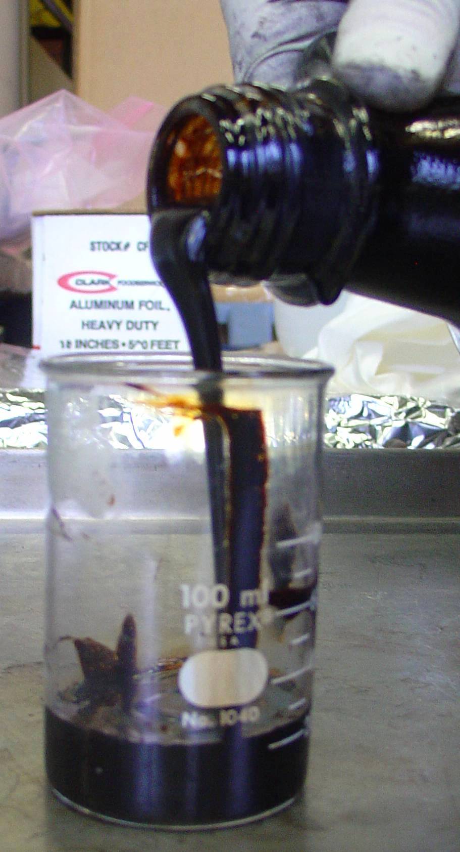
Tar is a dark brown or black viscous liquid of hydrocarbons and free carbon, obtained from a wide variety of organic materials through destructive distillation. Tar can be produced from coal, wood, petroleum, or peat. "a dark brown or black bituminous usually odorous viscous liquid obtained by destructive distillation of organic material (such as wood, coal, or peat)". "tar and pitch, viscous, dark-brown to black substances obtained by the destructive distillation of coal, wood, petroleum, peat and certain other organic materials. " Mineral products resembling tar can be produced from fossil hydrocarbons, such as petroleum. Coal tar is produced from coal as a byproduct of coke production. Terminology "Tar" and " pitch" can be used interchangeably. Asphalt (naturally occurring pitch) may also be called either "mineral tar" or "mineral pitch". There is a tendency to use "tar" for more liquid substances and "pitch" for more solid (viscoelastic) substances. Both "tar" and "pitch" ... [...More Info...] [...Related Items...] OR: [Wikipedia] [Google] [Baidu] |
Petroleum Reservoir
A petroleum reservoir or oil and gas reservoir is a subsurface accumulation of hydrocarbons contained in porous or fractured rock formations. Such reservoirs form when kerogen (ancient plant matter) is created in surrounding rock by the presence of high heat and pressure in the Earth's crust. Reservoirs are broadly classified as ''conventional'' and '' unconventional'' reservoirs. In conventional reservoirs, the naturally occurring hydrocarbons, such as crude oil (petroleum) or natural gas, are trapped by overlying rock formations with lower permeability, while in unconventional reservoirs the rocks have high porosity and low permeability, which keeps the hydrocarbons trapped in place, therefore not requiring a cap rock. Reservoirs are found using hydrocarbon exploration methods. Oil field An oil field is an area of accumulated liquid petroleum underground in multiple (potentially linked) reservoirs, trapped as it rises to impermeable rock formations. In industrial te ... [...More Info...] [...Related Items...] OR: [Wikipedia] [Google] [Baidu] |
Anticline
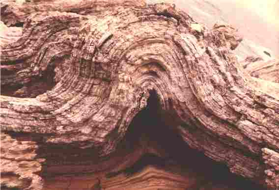
In structural geology, an anticline is a type of Fold (geology), fold that is an arch-like shape and has its oldest Bed (geology), beds at its core, whereas a syncline is the inverse of an anticline. A typical anticline is convex curve, convex up in which the hinge or crest is the location where the curvature is greatest, and the limbs are the sides of the fold that Strike and dip, dip away from the hinge. Anticlines can be recognized and differentiated from antiforms by a sequence of rock layers that become progressively older toward the center of the fold. Therefore, if age relationships between various Stratum, rock strata are unknown, the term antiform should be used. The progressing age of the rock strata towards the core and uplifted center, are the trademark indications for evidence of anticlines on a geological map. These formations occur because anticlinal ridges typically develop above thrust faults during crustal deformations. The uplifted core of the fold cau ... [...More Info...] [...Related Items...] OR: [Wikipedia] [Google] [Baidu] |


