|
South Auckland
South Auckland ( or ) is one of the major geographical regions of Auckland, the largest city in New Zealand. The area is south of the Auckland isthmus, and on the eastern shores of the Manukau Harbour. The area has been populated by Tāmaki Māori since at least the 14th century, and has important archaeological sites, such as the Ōtuataua stonefield gardens at Ihumātao, and Māngere Mountain, a former pā site important to Waiohua tribes. The area was primarily farmland until the mid-20th century, when the construction of the Auckland Southern Motorway led to major suburban development, and the establishing of Manukau City, which was later amalgamated into Auckland. Large-scale State housing in New Zealand, state housing areas were constructed in the 1960s and 1970s, which led to significant Urban Māori and Pasifika New Zealanders, Pasifika communities developing in the area. The presence of 165 different ethnicities makes South Auckland one of the most diverse places in Ne ... [...More Info...] [...Related Items...] OR: [Wikipedia] [Google] [Baidu] |
List Of Sovereign States
The following is a list providing an overview of sovereign states around the world with information on their status and recognition of their sovereignty. The 205 listed states can be divided into three categories based on membership within the United Nations System: 193 member states of the United Nations, UN member states, two United Nations General Assembly observers#Current non-member observers, UN General Assembly non-member observer states, and ten other states. The ''sovereignty dispute'' column indicates states having undisputed sovereignty (188 states, of which there are 187 UN member states and one UN General Assembly non-member observer state), states having disputed sovereignty (15 states, of which there are six UN member states, one UN General Assembly non-member observer state, and eight de facto states), and states having a political status of the Cook Islands and Niue, special political status (two states, both in associated state, free association with New ... [...More Info...] [...Related Items...] OR: [Wikipedia] [Google] [Baidu] |
Auckland
Auckland ( ; ) is a large metropolitan city in the North Island of New Zealand. It has an urban population of about It is located in the greater Auckland Region, the area governed by Auckland Council, which includes outlying rural areas and the islands of the Hauraki Gulf, and which has a total population of as of It is the List of cities in New Zealand, most populous city of New Zealand and the List of cities in Oceania by population, fifth-largest city in Oceania. The city lies between the Hauraki Gulf to the east, the Hunua Ranges to the south-east, the Manukau Harbour to the south-west, and the Waitākere Ranges and smaller ranges to the west and north-west. The surrounding hills are covered in rainforest and the landscape is dotted with 53 volcanic centres that make up the Auckland Volcanic Field. The central part of the urban area occupies a narrow isthmus between the Manukau Harbour on the Tasman Sea and the Waitematā Harbour on the Pacific Ocean. Auckland is one of ... [...More Info...] [...Related Items...] OR: [Wikipedia] [Google] [Baidu] |
Franklin (local Board Area)
The Franklin Local Board is one of the 21 local boards of the Auckland Council. It is overseen by the Franklin ward councillor. The Franklin Local Board area spans the full width of the North Island, from the Hauraki Gulf to the Manukau Harbour. It includes the Hunua Ranges. Angela Fulljames is the current chair of the board. Geography The area spans from the Hauraki Gulf in the east to the Manukau Harbour and Tasman Sea in the west. The forests of the Hunua Ranges and the southern and western shores of the Manukau Harbour provide a habitat for a range of wildlife, including birds. Franklin includes the townships of Pukekohe, Waiuku and Beachlands, as well as Awhitu Peninsula, Karaka, Ardmore, Clevedon Clevedon (, ) is a seaside town and civil parishes in England, civil parish in the unitary authority of North Somerset, England. It recorded a parish population of 21,281 in the United Kingdom Census 2011, estimated at 21,442 in 2019. It lies ..., Whitford, ... [...More Info...] [...Related Items...] OR: [Wikipedia] [Google] [Baidu] |
Pasifika New Zealanders
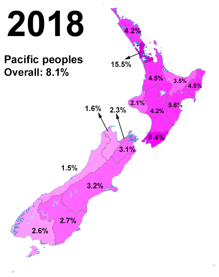
Pasifika New Zealanders (also called Pacific Peoples) are a pan-ethnic group of New Zealanders associated with, and descended from, the indigenous peoples of the Pacific Islands (also known as Pacific Islander#New Zealand, Pacific Islanders) outside New Zealand itself. They form the fourth-largest ethnic grouping in the country, after European New Zealanders, European descendants, indigenous Māori people, Māori, and Asian New Zealanders. Over 380,000 people identify as being of Pacific origin, representing 8% of the country's population, with the majority residing in Auckland. History Prior to the Second World War Pasifika in New Zealand numbered only a few hundred. Wide-scale Pasifika migration to New Zealand began in the 1950s and 1960s, typically from countries associated with the Commonwealth and the Realm of New Zealand, including Western Samoa (modern-day Samoa), the Cook Islands and Niue. In the 1970s, governments (both New Zealand Labour Party, Labour and New Zealand ... [...More Info...] [...Related Items...] OR: [Wikipedia] [Google] [Baidu] |
Urban Māori
Urban Māori are Māori people living in urban areas outside the ''rohe'' (traditional tribal lands) of their ''iwi'' (tribe) or ''hapū'' (sub-tribe). The 2013 New Zealand census showed that 84% of Māori in New Zealand lived in urban areas, 25% lived in Auckland, and most others lived in other metropolitan centres like Wellington and Christchurch. Many Māori continued to associate with their ''iwi'' and their ''rohe'', but more than 15% did not know their tribal affiliation. Urban Māori associations include Ngāti Ākarana in Auckland, Ngāti Poneke in Wellington. There are also Māori associations in major cities in Australia, as well as Ngāti Rānana in London. History During the 19th and early 20th centuries, the Māori population of New Zealand predominantly lived in rural communities away from large urban centres. This began to change during World War II, when the Manpower Act 1944 was used to encourage young Māori men and women who were ineligible to join the m ... [...More Info...] [...Related Items...] OR: [Wikipedia] [Google] [Baidu] |
State Housing In New Zealand
State housing is a system of public housing in New Zealand, offering low-cost rental housing to residents on low to moderate incomes. Some 69,000 state houses are managed by Kāinga Ora – Homes and Communities, most of which are owned by the Crown. In excess of 31,000 former state houses exist, which are now privately owned after large-scale sell-offs during recent decades. Since 2014, state housing has been part of a wider social housing system, which also includes privately owned low-cost housing. An archetypal 1930s and 1940s state house is a detached two- or three-bedroom cottage-style house, with weatherboard or brick veneer cladding, a steep hipped tile roof, and multi-paned timber casement windows. Thousands of these houses were built across New Zealand as state housing, and as private housing after World War II, when the New Zealand Government, Government started selling their drawings and plans in an attempt to hasten housing construction. These houses, also known as " ... [...More Info...] [...Related Items...] OR: [Wikipedia] [Google] [Baidu] |
Manukau City
Manukau City was a territorial authority district in Auckland, New Zealand, that was governed by the Manukau City Council. The area is also referred to as "South Auckland", although this term never possessed official recognition and does not encompass areas such as East Auckland, which was within the city boundary. It was a relatively young city, both in terms of legal status and large-scale settlement – though in June 2010, it was the third largest in New Zealand, and the fastest growing.About Manukau (from the Manukau City Council website. Accessed 21 June 2008.) In the same year, the entire |
Auckland Southern Motorway
The Auckland Southern Motorway (also known as the Southern Motorway, and historically as the Auckland–Hamilton Motorway) is the major route south out of the Auckland Region of New Zealand. It is part of New Zealand State Highway 1, State Highway 1. The motorway is 45 kilometres in length, with 28 junctions including termini. It runs from the Central Motorway Junction in central Auckland, through Manukau City, Papakura, and Drury, before terminating onto the Waikato Expressway at the top of the Bombay Hills. Route The Southern Motorway starts just north of the Central Motorway Junction (Spaghetti Junction) on the west side of central Auckland. The motorway is a direct extension of the Auckland Northern Motorway, Northern Motorway, which changes to the Southern Motorway just south of exits 424C and 424D. For the first kilometre, the road is two lanes each way due to the constraints of the Victoria Park Viaduct to the north. The motorway then delves deep into the Central Motorw ... [...More Info...] [...Related Items...] OR: [Wikipedia] [Google] [Baidu] |
Waiohua
Te Waiohua or Te Wai-o-Hua is a Māori people, Māori iwi (tribe) confederation that thrived in the early 17th century. The rohe (tribal area) was primarily the central Auckland, Tāmaki Makaurau area (the Auckland isthmus) and they had pā (fortified settlements) at Te Tātua a Riukiuta (Three Kings), Puketāpapa (Mt Roskill), Te Ahi-kā-a-Rakataura (Mt Albert), Maungakiekie (One Tree Hill), Maungawhau (Mt Eden), Tītīkōpuke (Mt St John), Ōhinerau (Mt Hobson), Rangitotoiti (Upland Reserve), Taurarua (Judges Bay), Rarotonga (Mt Smart), Ōtāhuhu, Te Pane o Mataaoho (Māngere Mountain), Ihumātao, Matukutūreia (McLaughlin's Mountain) and Matukutūruru (Wiri Mountain), until the 1740s, when the paramount Waiohua chief, Kiwi Tāmaki, was defeated by the Ngāti Whātua hapū, Te Taoū. The descendants of the Waiohua confederation today include Ngāti Te Ata Waiohua, Ngāti Tamaoho and Te Ākitai Waiohua. History Waiohua was a confederation of tribes of the Tāmaki Makaurau reg ... [...More Info...] [...Related Items...] OR: [Wikipedia] [Google] [Baidu] |
Māngere Mountain
Māngere Mountain, also known by the names Te Pane-o-Mataaho and Te Ara Pueru, is a volcanic cone in Māngere, Auckland. Located within Māngere Domain, it is one of the largest volcanic cones in the Auckland volcanic field, with a peak above sea level. It was the site of a major pā (Māori people, Māori fortified settlement) and many of the pā's earthworks are still visible. It has extensive panoramic views of Auckland from its location in the southeastern portion of the city's urban area. Geography The volcano features two large craters. It has a wide crater with a lava dome near its centre, a feature shared by no other volcano in Auckland. It first erupted approximately 70,000 years ago. The mountain is one of the largest and best preserved of Auckland's volcanic cones. Most of the suburb of Māngere Bridge (suburb), Māngere Bridge was formed from the lava flows that came from the mountain's eruptions. Approximately 50,000 years ago, an eruption created hot fluid pāhoe ... [...More Info...] [...Related Items...] OR: [Wikipedia] [Google] [Baidu] |
Ihumātao
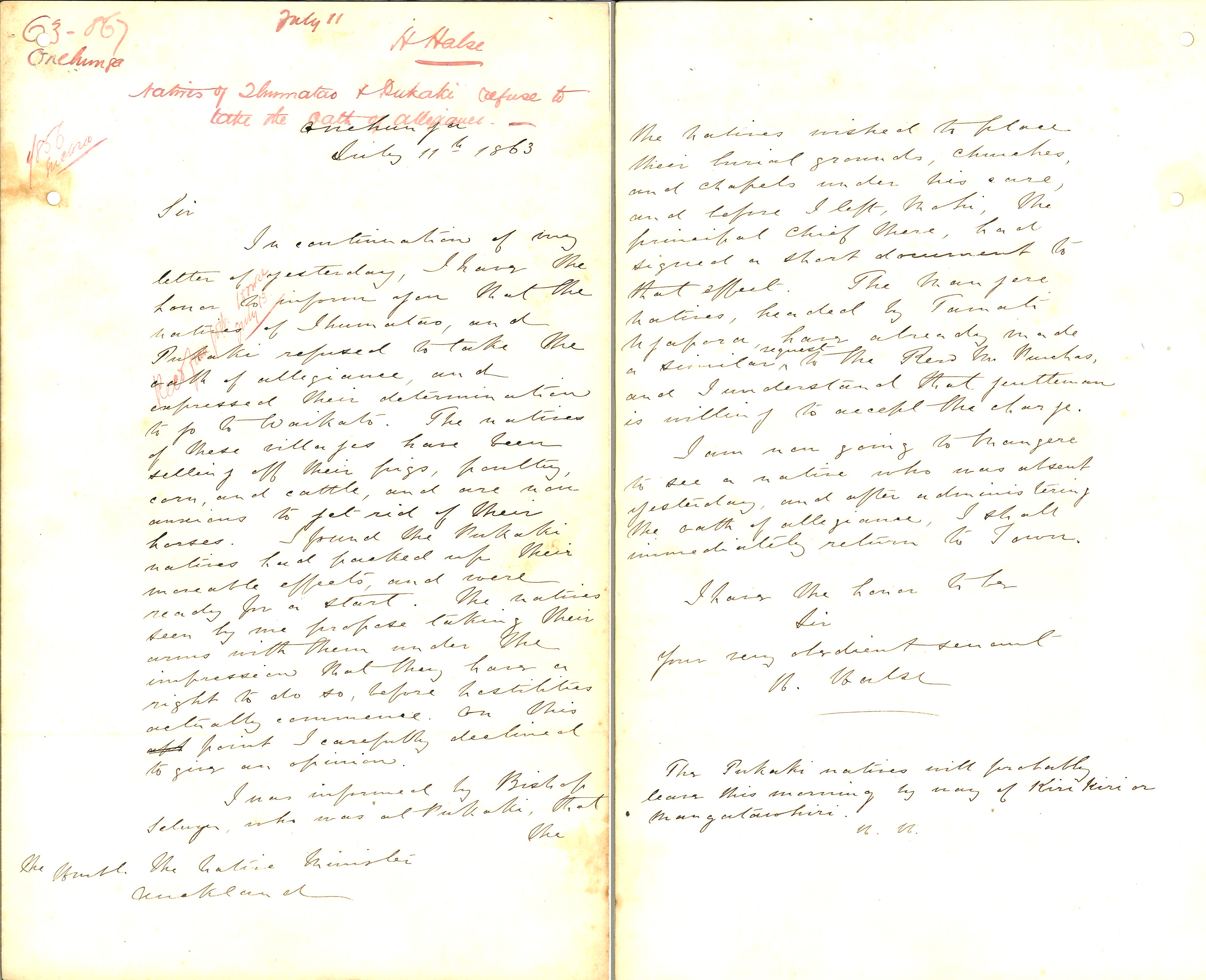
Ihumātao is an archaeological site of historic importance in the suburb of Māngere, Auckland. Once a pā site, it stands on the Ihumātao Peninsula, at the base of Ōtuataua, part of the Auckland volcanic field. Its scoria cone reaches above sea level. Māori first settled in the area as early as the 14th century CE. During the Invasion of the Waikato in 1863, the local Māori had their land confiscated by the New Zealand government as punishment for supporting the Kīngitanga movement. The name translates as "cold nose". The land was largely used for farming until late 2016 when the construction-management company Fletcher Building acquired the site as part of a housing-development project. A group of local activists, led by Pania Newton, opposed the development of the site and staged protests and an occupation of the land over the next three years. In December 2021, the site was purchased by the government with the proposal that it be used for housing purposes. a steerin ... [...More Info...] [...Related Items...] OR: [Wikipedia] [Google] [Baidu] |
Tāmaki Māori
Tāmaki Māori are Māori ''iwi'' and ''hapū'' (tribes and sub-tribes) who have a strong connection to Tāmaki Makaurau (the Auckland Region), and whose rohe was traditionally within the region. Among Ngā Mana Whenua o Tāmaki Makaurau (the Māori tribes of Auckland), also known as the Tāmaki Collective, there are thirteen iwi and hapū, organised into three rōpū (collectives), however Tāmaki Māori can also refer to subtribes and historical iwi not included in this list. Ngāti Whātua Rōpū Ngāti Whātua descend from the '' Māhuhu-ki-te-rangi'' waka, which landed north of the Kaipara Harbour. The rōpū includes Ngāti Whātua o Kaipara, Ngāti Whātua Ōrākei and Te Rūnanga o Ngāti Whātua. Te Rūnanga o Ngāti Whātua is a Māori Trust Board formed in the mid 2000s to represent the interests of Ngāti Whātua iwi and hapū collectively, including those outside of Ngāti Whātua o Kaipara and Ngāti Whātua Ōrākei. The rūnanga represents Ngā Oho, Ngāi Tāhu ... [...More Info...] [...Related Items...] OR: [Wikipedia] [Google] [Baidu] |


