|
Sorong
Sorong is the largest city and the capital of the Indonesian province of Southwest Papua. The city is located on the western tip of the island of New Guinea with its only land borders being with Sorong Regency. It is the gateway to Indonesia's Raja Ampat Islands, species rich coral reef islands in an area considered the heart of the world's coral reef biodiversity. It also is the logistics hub for Indonesia's thriving eastern oil and gas frontier. Sorong experienced rapid growth during the decade from 2010, and further growth is anticipated as Sorong becomes linked by road to other frontier towns in Papua's Bird's Head Peninsula. The official estimate of population as of mid 2023 was 294,978 - comprising 154,543 males and 140,435 females.Badan Pusat Statistik, Jakarta, 28 February 2024, ''Kota Sorong Dalam Angka 2024'' (Katalog-BPS 1102001.9271) The suburban area of Sorong city contains tropical rainforest and mangrove forest that has increasingly become popular as ecotouris ... [...More Info...] [...Related Items...] OR: [Wikipedia] [Google] [Baidu] |
Southwest Papua
Southwest Papua (; ) is the 38th provinces of Indonesia, province of Indonesia to be created, and was split off from West Papua (province), West Papua on 8 December 2022. Despite being named "southwest", this is actually a misnomer and this province is actually located in the northwest edge of Indonesian Papua, Papua. The province comprises the Greater Sorong area (; ) which consists of Sorong City, Sorong Regency, South Sorong Regency, Maybrat Regency, Tambrauw Regency, and Raja Ampat Regency. The Bill (RUU) on the Establishment of the Southwest Papua Province was passed into law (by Act No. 29 of 2022) and therefore it became the 38th province in Indonesia with effect from 8 December 2022. Southwest Papua is situated on the northwestern side of the region known as the Doberai Peninsula, or the Bird's Head Peninsula. The province's westernmost point encompasses the protected region of the Raja Ampat Islands, which boasts a rich variety of marine creatures, including coral reefs, ... [...More Info...] [...Related Items...] OR: [Wikipedia] [Google] [Baidu] |
Septinus Lobat
Septinus Lobat (born 14 March 1970) is an Indonesian politician and bureaucrat who is the mayor of Sorong, Southwest Papua, serving since February 2025. He had previously served as the city's acting mayor between 2023 and 2024, and was previously part of the province's civil service. Early life Septinus Lobat was born in the village of Indiwi, within present-day Sorong Regency, on 14 March 1970. He is of Moi origin. He studied at an elementary school in Buk, middle school in Klamono District of Sorong, and in 1986 he went to Manokwari for high school. In 1995, Lobat obtained a bachelor's in law from Manokwari's Law Academy. He would later receive a master's degree in public administration from Gadjah Mada University in 2009. Career Lobat began to work at Sorong Regency's civil service, in 2005 having become a section head within the regency's fishery service. He continued to rise up the ranks, serving as secretary of the regency's elections commission and municipal police during h ... [...More Info...] [...Related Items...] OR: [Wikipedia] [Google] [Baidu] |
Doom Island
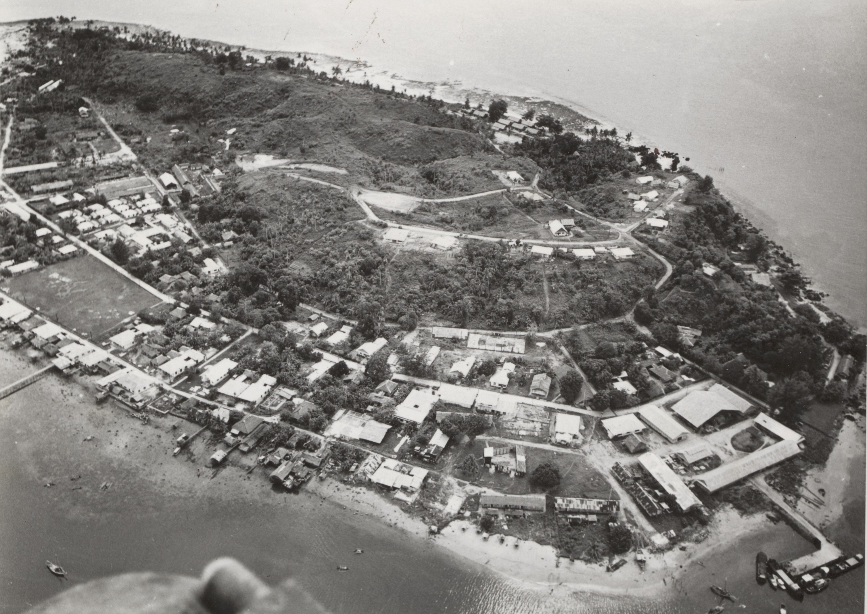
Doom Island ( or ''Pulau Dum'', pronounced "Dom") is a small island in Southwest Papua, Indonesia. It is administratively part of the city of Sorong, specifically the Sorong Islands District. The island served as an administrative center of Dutch East Indies administration in Papua, and continued to become the core of Sorong for some time before the city developed across the strait on the mainland of Papua. Geography and administration The island is located around away from mainland Sorong. It has a perimeter of around . The island is part of two administrative villages (''kelurahan''): West and East Doom. The two villages also include other small islands close to Sorong. As of mid 2021, the two villages have a combined population of 9,855. History Prior to European colonization, the island had been part of the Sultanate of Tidore. The island's name came from the local Moi people, meaning "island with many fruit trees". First appearing in Dutch records by 1863 through a study ... [...More Info...] [...Related Items...] OR: [Wikipedia] [Google] [Baidu] |
Sorong Regency
Sorong Regency () is a regency of the Southwest Papua province of Indonesia. It covers an area of 13,075.28 km2, and had a population of 70,619 at the 2010 Census,Biro Pusat Statistik, Jakarta, 2011. and 118,679 at the 2020 Census;Badan Pusat Statistik, Jakarta, 2021. the official estimate as of mid-2024 was 129,669 (comprising 67,118 males and 62,551 females).Badan Pusat Statistik, Jakarta, 28 February 2025, ''Kabupaten Sorong Dalam Angka 2025'' (Katalog-BPS 1102001.9107) Its administrative centre is the town of Aimas. Sorong Regency surrounds Sorong City (''Kota'') on the landward side; the city is administratively independent of the Regency and is not included in the above statistics; Sorong City has an airport, Sorong Airport, which also serves the Regency. Geography Sorong Regency is one of the regencies which is administratively included in the territory of the new Southwest Papua Province. Sorong Regency is located at 00° 33' 42” - 01° 35' 29" South Latitude and ... [...More Info...] [...Related Items...] OR: [Wikipedia] [Google] [Baidu] |
Western New Guinea
Western New Guinea, also known as Papua, Indonesian New Guinea, and Indonesian Papua, is the western half of the island of New Guinea, formerly Dutch and granted to Indonesia in 1962. Given the island is alternatively named Papua, the region is also called West Papua (). It is one of the seven geographical units of Indonesia in ISO 3166-2:ID. Lying to the west of Papua New Guinea and geographically a part of the Australian continent, the territory is almost entirely in the Southern Hemisphere and includes the Biak and Raja Ampat archipelagoes. The region is predominantly covered with rainforest where traditional peoples live, including the Dani of the Baliem Valley. A large proportion of the population live in or near coastal areas. The largest city is Jayapura. The island of New Guinea has been populated for tens of thousands of years. European traders began frequenting the region around the late 16th century due to spice trade. In the end, the Dutch Empire emerged ... [...More Info...] [...Related Items...] OR: [Wikipedia] [Google] [Baidu] |
List Of Regencies And Cities Of Indonesia
Regency (Indonesia), Regencies () and City status in Indonesia#Kota, cities (''kota'') are the second-level subdivisions of Indonesia, administrative subdivision in Indonesia, immediately below the Provinces of Indonesia, provinces, and above the Districts of Indonesia, districts. Regencies are roughly equivalent to American County (United States), counties, although Lists of populated places in the United States, most cities in the United States are below the counties. Following the implementation of decentralization beginning on 1 January 2001, regencies and city municipalities became the key administrative units responsible for providing most governmental services. Each of regencies and cities has their own local government and legislative body. The difference between a regency and a city lies in demography, size, and economy. Generally, a regency comprises a rural area larger than a city, but also often includes various towns. A city usually has non-agricultural economic acti ... [...More Info...] [...Related Items...] OR: [Wikipedia] [Google] [Baidu] |
Trans-Papua Highway
The Trans-Papua Highway (Indonesian language, Indonesian: ''Jalan Raya Trans-Papua'') refers to 12 road segments, some under construction, across Western New Guinea in Indonesia, located in the island of New Guinea. The roads stretch from Sorong (city), Sorong to Merauke with a total length of . As of March 2017, of roads had been completed and construction on all the roads was predicted to finish in 2018, but construction was delayed in late 2018 due to armed conflict. The completed road segments include 884 out of Indonesia's 1,068 km border road with Papua New Guinea. As of May 2017, the remaining parts of the road, including 7,000 meters of bridges, were planned to be completed in 2017 and 2018, although not all of the road has been layered by asphalt. As of October 2020, the road was only 200–300 km from completion. Road segments In West Papua and Southwest Papua There are 4 road segments in West Papua: *Sorong-Manokwari *Manokwari-Bintuni-Aroba-Teluk Arguni *F ... [...More Info...] [...Related Items...] OR: [Wikipedia] [Google] [Baidu] |
Port Of Sorong
Port of Sorong is a seaport in western New Guinea. This port contains both passenger and container terminal linking the Bird's Head Peninsula with other regions of Indonesia. This port is located at Sudirman Road, Sorong District, in Sorong Sorong is the largest city and the capital of the Indonesian province of Southwest Papua. The city is located on the western tip of the island of New Guinea with its only land borders being with Sorong Regency. It is the gateway to Indonesia ... and operated by PT Pelabuhan Indonesia IV. References S Sorong {{port-stub ... [...More Info...] [...Related Items...] OR: [Wikipedia] [Google] [Baidu] |
Dutch New Guinea
Dutch New Guinea or Netherlands New Guinea (, ) was the western half of the island of New Guinea that was a part of the Dutch East Indies until 1949, later an overseas territory of the Kingdom of the Netherlands from 1949 to 1962. It contained what are now Indonesia's six easternmost provinces, Central Papua, Highland Papua, Papua, South Papua, Southwest Papua, and West Papua, which were administered as a single province prior to 2003 under the name ''Irian Jaya'', and now comprise the Papua region of the country. During the Indonesian Revolution, the Dutch launched to capture territory from the Indonesian Republic. However, the harsh methods of the Dutch had drawn international disapproval. With international opinion shifting towards support of the Indonesian Republic, the Dutch managed in 1949 to negotiate for the separation of Dutch New Guinea from the broader Indonesian settlement, with the fate of the disputed territory to be decided by the close of 1950. However, the ... [...More Info...] [...Related Items...] OR: [Wikipedia] [Google] [Baidu] |
Raja Ampat Islands
Raja Ampat (), or the Four Kings, is an archipelago located off of the northwest tip of Bird's Head Peninsula (on the island of New Guinea), Southwest Papua , Southwest Papua province, Indonesia. It comprises over 1,500 small islands, cays, and shoals around the four main islands of Misool, Salawati, Batanta, and Waigeo, and the smaller island of Kofiau. The Raja Ampat archipelago straddles the equator and forms part of Coral Triangle, the Coral Triangle, an area of Southeast Asian seas containing the richest marine biodiversity on earth. The Coral Triangle itself is an approximate area west-southwest of the Philippines, east-northeast and southeast of the island of Borneo, and north, east and west of the island of New Guinea, including the seas in between. Thousands of species of marine organisms, from the tiniest cleaner shrimp and camouflaged pygmy seahorses to the majestic cetaceans and whale sharks, thrive in these waters. Administratively, the archipelago is part of the prov ... [...More Info...] [...Related Items...] OR: [Wikipedia] [Google] [Baidu] |
Bird's Head Peninsula
The Bird's Head Peninsula ( Indonesian: , , meaning Bird's Head in Indonesian and Dutch) or Doberai Peninsula (''Semenanjung Doberai'') is a large peninsula that makes up the northwest portion of the island of New Guinea, comprising the Indonesian provinces of Southwest Papua and West Papua. It is often referred to as The Vogelkop, and is so named because its shape looks like a bird's head on the island of New Guinea. The peninsula at the opposite end of the island (in Papua New Guinea) is called the Bird's Tail Peninsula. The peninsula just to the south is called the Bomberai Peninsula. Location and geography The Bird's Head Peninsula is at the northwestern end of the island of New Guinea. It is bounded by Cenderawasih Bay to the east, Bintuni Bay to the south, and the Dampier Strait to the west. Across the strait is Waigeo, an island in the Raja Ampat archipelago. Batanta island lies just off the peninsula’s northwest tip. Another peninsula, Bomberai Peninsula, l ... [...More Info...] [...Related Items...] OR: [Wikipedia] [Google] [Baidu] |
Battle Of Sansapor
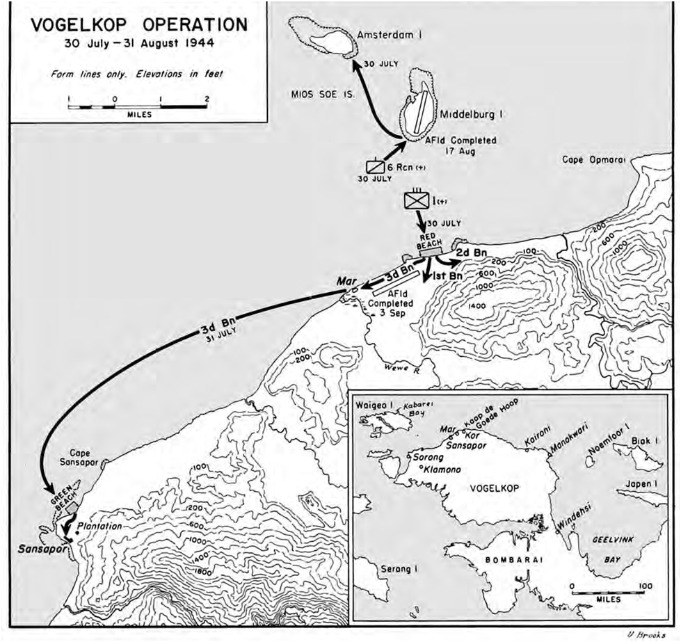
The Battle of Sansapor (Operation Globetrotter) was an amphibious landing and subsequent operations around Sansapor, Dutch New Guinea on the Vogelkop Peninsula during World War II. Naval force Admiral William Fechteler's Attack Force (Task Force 77) was to have a D-Day groupment comprising 11 destroyers, 5 APDs, 16 LCIs, 3 rocket LCIs, 8 LSTs, 4 PCs, and 1 ATF. A Covering Force (Task Force 78), consisting of 1 heavy cruiser, 2 light cruisers, and 9 destroyers under the command of Admiral Russell Berkey, was to be available for support fire if needed. In preparation for Operation Typhoon (code name for the US Army landings on the Vogelkop Peninsula), on 17 June 1944, S-47, under Lieutenant Lloyd V. Young, sailed from the Admiralty Islands for Waigeo, with the mission to insert elements of the Alamo Scouts, Allied Intelligence Bureau agents, terrain experts of the Fifth Air Force, and hydrographic survey men of the VII Amphibious Force. The reconnaissance force landed nea ... [...More Info...] [...Related Items...] OR: [Wikipedia] [Google] [Baidu] |


