|
Sooke Flowline
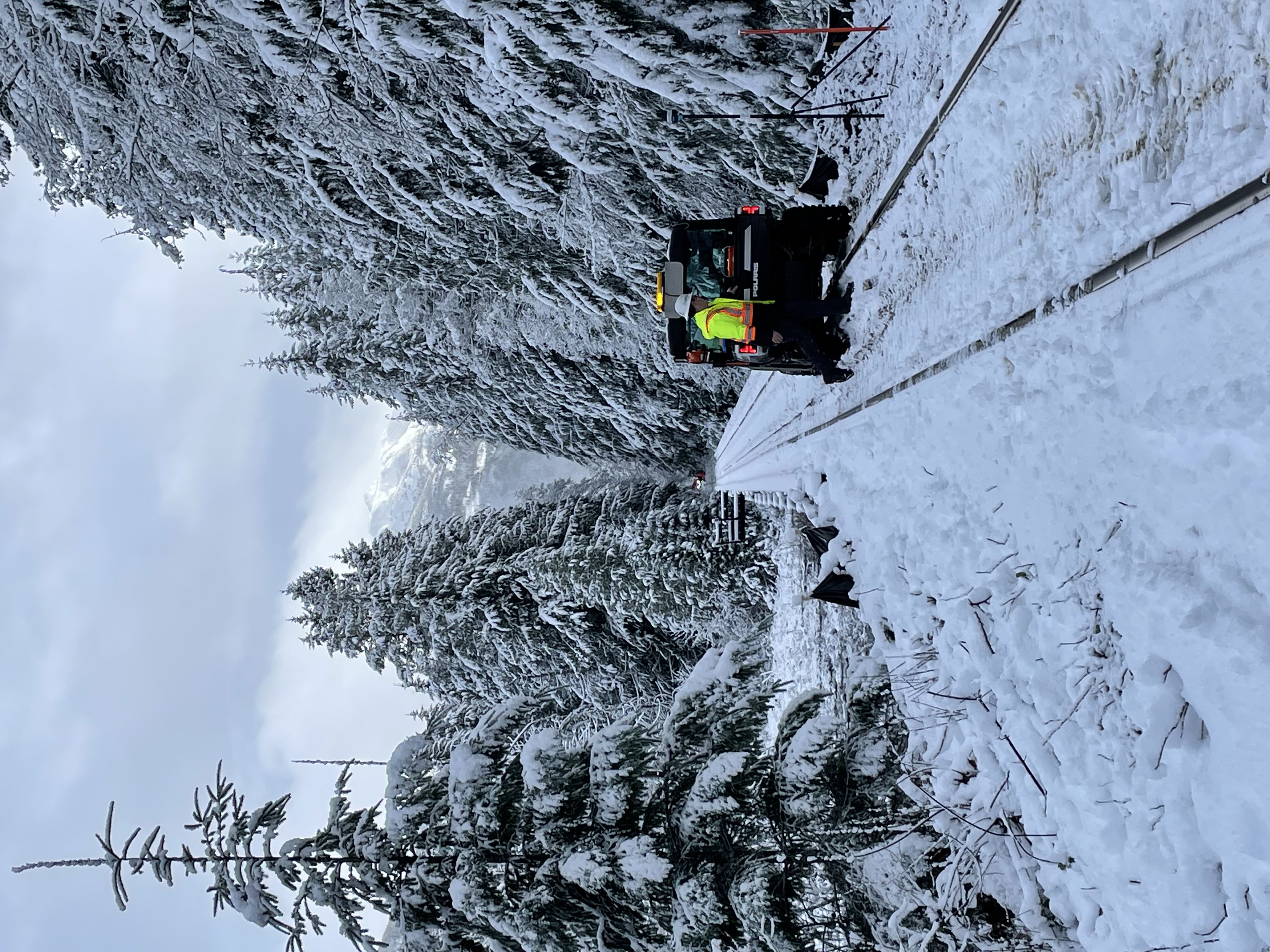
The Sooke Flowline is an abandoned concrete aqueduct (water supply), aqueduct that snakes through the Sooke Hills from Sooke Lake to the Humpback Reservoir, near Mount Wells Regional Park, in British Columbia, Canada. From this reservoir, a buried, riveted steel pressure main transported water to Victoria, British Columbia, Victoria. Between 1994 and 2007, this main was replaced, since it was long past its useful life. The flowline was vital to the continued growth of the city of Victoria, as it provided a reliable water supply. While the flowline remains, Victoria's water supply is now carried via Kapoor Tunnel. Leigh Hodgetts, CRD Waterworks superintendent, reported that the westernmost section of the flowline is still used to carry Sooke's water supply, via a 16-inch interconnecting pipe feeding the Sooke distribution system from Charters Creek to Sooke River Road. Elk Lake (British Columbia), Elk Lake used to be the water supply for Victoria, and when the Colquitz River w ... [...More Info...] [...Related Items...] OR: [Wikipedia] [Google] [Baidu] |
Mount Wells Regional Park
Mount Wells is a small regional park located northwest of the City of Langford, British Columbia, Langford and in the nearby vicinity of Goldstream Provincial Park and the Sooke Hills Regional Park Reserve. The parking lot is located at Humpback Lake, a former reservoir. The terminus of the decommissioned Sooke Flowline is also located here where the water from Sooke Lake would empty. Hiking The park features one trail which leads to the summit. The trail takes about 45 minutes to reach the summit which provides a panoramic view of the region. Across the valley stands Mount McDonald (Vancouver Island), Mount McDonald in the Sooke Hills Regional Park Reserve which is closed to all public access. Rock Climbing The side of the mountain facing the Humpback Valley is a popular climbing destination due to its steep cliffs. On a hot summer day, numerous vehicles can be seen parked along Humpback Road where climbers follow various deer trails to the cliffs. References E ... [...More Info...] [...Related Items...] OR: [Wikipedia] [Google] [Baidu] |
Galloping Goose Regional Trail
The Galloping Goose Regional Trail is a rail trail between Victoria, British Columbia, Canada, and the ghost town of Leechtown, north of Sooke, where it meets the old Sooke Flowline. Maintained by the Capital Regional District (CRD), the trail forms part of the Trans-Canada Trail, and intersects the Lochside Regional Trail. The section from Harbour Road in Esquimalt to the Veterans Memorial Parkway in Langford is also part of the Vancouver Island Trail. The trail is a popular route both for commuting and recreation, including within urban areas of Victoria (Vic West and Burnside-Gorge). It is frequented by people walking, running, cycling, rollerblading, skateboarding and (in places) riding horses. It connects up with many other trails and parks in the area. The trail was created in 1987 on the former right-of-way of the Canadian National Railway, and runs through the communities of Sooke, Metchosin, Colwood, Langford, View Royal, Saanich, and Victoria as well as ... [...More Info...] [...Related Items...] OR: [Wikipedia] [Google] [Baidu] |
Lubbe Powerhouse
The Goldstream Powerhouse is a decommissioned hydroelectric plant located near Goldstream Provincial Park in Langford, near Victoria, British Columbia. This plant provided electricity to Victoria for 60 years and is one of the little-known and ingenious chapters in the history of Victoria. This plant was one of the first hydro plants of this type on the west coast of North America. The structure is over a century old and is unsafe to inhabit. It is within the boundaries of the watershed lands owned by the CRD and is inaccessible to the public due to its proximity to a drinking water reservoir. Overview In 1897, Esquimalt Waterworks Company (EWWC) and British Columbia Electric Railway (BCER) came to an agreement to generate power by using the water from the high elevation reservoirs to generate electricity. The water would be run through Pelton waterwheels, where the water would then flow into the Japan Gulch Reservoir and subsequently be used for domestic purposes. T ... [...More Info...] [...Related Items...] OR: [Wikipedia] [Google] [Baidu] |
British Columbia Highway 14
British Columbia Highway 14, named the West Coast (Sooke) Highway is the southernmost numbered route in the province of British Columbia. An east–west highway on the southwestern coast of Vancouver Island in the Capital Regional District, it is sometimes known as ''West Coast Road'', as well as ''Sooke Road'', Sooke, British Columbia, Sooke being one of the largest communities that the highway passes through. Highway 14 first opened in 1953, extending west from Colwood, British Columbia, Colwood, a suburb of Victoria, British Columbia, Victoria, to the coastal community of Jordan River, British Columbia, Jordan River, and was extended all the way west to the remote community of Port Renfrew, British Columbia, Port Renfrew by 1975. The highway's eastern terminus was relocated to northern Langford, British Columbia, Langford in 2002. Outside of urban areas the route has exceptionally winding, curving and hilly stretches. Some of the sharper corners have oversized, freeway-style, ... [...More Info...] [...Related Items...] OR: [Wikipedia] [Google] [Baidu] |
Oak Bay, British Columbia
Oak Bay is a municipality incorporated in 1906 that is located on the southern tip of Vancouver Island, in the Canadian province of British Columbia. It is one of thirteen member municipalities of the Capital Regional District, and is bordered to the west by the city of Victoria and to the north by the district of Saanich. It is an eastern residential suburb of Victoria. History Oak Bay is part of the traditional territories of the Coast Salish people of the Songhees First Nation. The people that came and went in the millennia before are unknown. Evidence of their ancient settlements has been found along local shores, including Willows Beach, where an ancient Lkwungen seaport known as Sitchanalth was centred around the mouth of the river commonly known as Bowker Creek. Sitchanalth is hypothesized to have been destroyed by the great Tsunami of 930 AD. Much of this neighbourhood is built upon an Indigenous burial ground. Oak Bay takes its name from the Garry oak tree, ... [...More Info...] [...Related Items...] OR: [Wikipedia] [Google] [Baidu] |
Southern Railway Of Vancouver Island
The Island Corridor, previously the Esquimalt & Nanaimo Railway (E&N Railway), is a railway operation on Vancouver Island. It is owned by the Island Corridor Foundation, a registered charity. The railway line is in length from Victoria, British Columbia, Victoria to Courtenay, British Columbia, Courtenay, known as the Victoria Subdivision, with a branch line from Parksville, British Columbia, Parksville to Port Alberni, known as the Port Alberni Subdivision, of , for a total of mainline track. In 2006, the Island Corridor Foundation acquired the railway's ownership from RailAmerica and Canadian Pacific Railway. Passenger service has been "temporarily suspended" since 2011 due to poor infrastructure condition that resulted from deferred maintenance. History Vancouver Island joining Canada The history of an island railway and a functioning island railway in perpetuity started with the Colony of British Columbia (1866–1871), colony of Vancouver Island joining British Columb ... [...More Info...] [...Related Items...] OR: [Wikipedia] [Google] [Baidu] |
View Royal, British Columbia
View Royal is a town in Greater Victoria and a member municipality of the Capital Regional District of British Columbia, Canada. View Royal has a population of 11,575 residents. With over of parkland, View Royal includes Thetis, McKenzie, Pike, and Prior Lakes and portions of Esquimalt Harbour and Portage Inlet. History View Royal's history is closely linked to the entire region. The Esquimalt First Nation, a Coast Salish indigenous peoples, have occupied View Royal since time immemorial. It began when early inhabitants of today's Esquimalt Harbour crossed an isthmus, now Portage Park, to harvest seafood in Portage Inlet. European settlement began in the 1850s by Kenneth Mackenzie who established a farm known as Craigflower Manor. In the mid-19th century, Dr. John Helmcken, Vancouver Island's first doctor and later speaker of the British Columbia Legislative Assembly, paid the Hudson's Bay Company $5 per acre for hundreds of acres of land between Esquimalt Harbour an ... [...More Info...] [...Related Items...] OR: [Wikipedia] [Google] [Baidu] |
Pressure Measurement
Pressure measurement is the measurement of an applied force by a fluid (liquid or gas) on a surface. Pressure is typically measured in units of force per unit of surface area. Many techniques have been developed for the measurement of pressure and vacuum. Instruments used to measure and display pressure mechanically are called pressure gauges, vacuum gauges or compound gauges (vacuum & pressure). The widely used Bourdon gauge is a mechanical device, which both measures and indicates and is probably the best known type of gauge. A vacuum gauge is used to measure pressures lower than the ambient atmospheric pressure, which is set as the zero point, in negative values (for instance, −1 bar or −760 mmHg equals total vacuum). Most gauges measure pressure relative to atmospheric pressure as the zero point, so this form of reading is simply referred to as "gauge pressure". However, anything greater than total vacuum is technically a form of pressure. For very low pres ... [...More Info...] [...Related Items...] OR: [Wikipedia] [Google] [Baidu] |
Creosote
Creosote is a category of carbonaceous chemicals formed by the distillation of various tars and pyrolysis of plant-derived material, such as wood, or fossil fuel. They are typically used as preservatives or antiseptics. Some creosote types were used historically as a treatment for components of seagoing and outdoor wood structures to prevent rot (e.g., bridgework and railroad ties, see image). Samples may be found commonly inside chimney flues, where the coal or wood burns under variable conditions, producing soot and tarry smoke. Creosotes are the principal chemicals responsible for the stability, scent, and flavor characteristic of smoked meat; the name is derived . The two main kinds recognized in industry are coal-tar creosote and wood-tar creosote. The coal-tar variety, having stronger and more toxic properties, has chiefly been used as a preservative for wood; coal-tar creosote was also formerly used as an escharotic, to burn malignant skin tissue, and in dentistry ... [...More Info...] [...Related Items...] OR: [Wikipedia] [Google] [Baidu] |
Woodstave
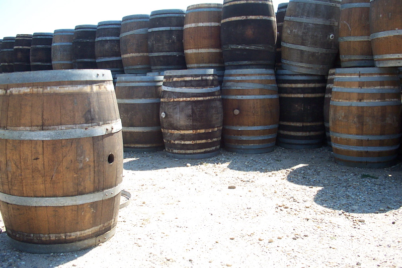
] A stave is a narrow length of wood with a slightly bevelled edge to form the sides of barrels, tanks, tubs, vats and pipelines, originally handmade by coopers. They have been used in the construction of large holding tanks and penstocks at hydro power developments. They are also used in the construction of certain musical instruments with rounded bodies or backs. See also * Rubicon Hydroelectric Scheme, which has wood stave penstocks on operating power stations *Lake Margaret Power Station The Lake Margaret Power Stations comprise two hydroelectric power stations located in Western Tasmania, Australia. The power stations are part of the King Yolande Power Scheme and are owned and operated by Hydro Tasmania. Officially the Upper ..., which had a wood stave penstock replaced in 2010 References Structural engineering Woodworking {{civil-engineering-stub ... [...More Info...] [...Related Items...] OR: [Wikipedia] [Google] [Baidu] |
Reinforced Concrete
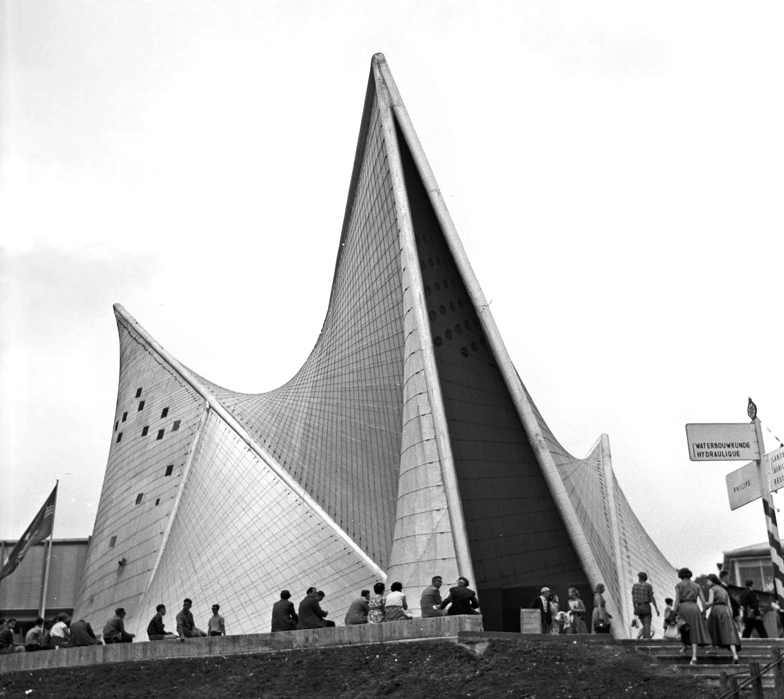
Reinforced concrete, also called ferroconcrete or ferro-concrete, is a composite material in which concrete's relatively low tensile strength and ductility are compensated for by the inclusion of reinforcement having higher tensile strength or ductility. The reinforcement is usually, though not necessarily, steel reinforcing bars (known as rebar) and is usually embedded passively in the concrete before the concrete sets. However, post-tensioning is also employed as a technique to reinforce the concrete. In terms of volume used annually, it is one of the most common engineering materials. In corrosion engineering terms, when designed correctly, the alkalinity of the concrete protects the steel rebar from corrosion. Description Reinforcing schemes are generally designed to resist tensile stresses in particular regions of the concrete that might cause unacceptable cracking and/or structural failure. Modern reinforced concrete can contain varied reinforcing materials made o ... [...More Info...] [...Related Items...] OR: [Wikipedia] [Google] [Baidu] |


