|
Some Gritstone Climbs
''Some Gritstone Climbs'' is a rock climbing guidebook written by British lawyer John Laycock (1887–1960). The book's subtitle, included uniquely on the frontispiece, is ''Some Shorter Climbs (in Derbyshire and Elsewhere)''. It was published in Manchester in 1913 by the Refuge Printing Department (then an insurance company). Although focusing on rock climbing in the Peak District, it covers several adjacent cliffs outside this region, and despite its title, referring to the Millstone Grit (or gritstone) geology of many of the cliffs, it includes several cliffs consisting of other rock types, including mountain limestone and red sandstone. It is regarded as the first-ever published rock climbing guidebook for the Peak District National Park. ''Some Gritstone Climbs'' is one of the earliest guidebooks to rock climbing in the United Kingdom: ''Climbing in the British Isles'' by Walter Parry Haskett Smith was published in 1894 and the climbing guide ''The Climbs on Lliwedd'' ... [...More Info...] [...Related Items...] OR: [Wikipedia] [Google] [Baidu] |
John Laycock
Christopher John Laycock (1887 – 3 December 1960) was a British lawyer, the founder of one of Singapore's earliest law firms, Laycock and Ong. He was also one of the founders of the Singapore Progressive Party. Early life Laycock grew up in Manchester, England, and was an influential figure in the early development of rock climbing on the gritstone edges of the Peak District of Derbyshire along with his close friends Siegfried Herford, also of Manchester, and Stanley Jeffcoat of Buxton. In 1903 Laycock became a founder member of the Manchester-based Rucksack Club which included many other local climbing enthusiasts, including Charles Pilkington of the glass manufacturing dynasty. Laycock, Herford and Jeffcoat climbed numerous new routes on many of the fine escarpments of Derbyshire, Staffordshire and Yorkshire in the years leading up to the First World War, and these were faithfully recorded in Laycock's guidebook '' Some Gritstone Climbs'', the first published guidebo ... [...More Info...] [...Related Items...] OR: [Wikipedia] [Google] [Baidu] |
Almscliffe Crag
Almscliffe Crag, or Almscliff Crag, also known as Great Almscliff Crag to distinguish from Little Almscliff, north west, is a Millstone Grit outcrop at the top of a small hill near the village of North Rigton, between Leeds and Harrogate in North Yorkshire, England. The crag lies on the boundary of the civil parishes of North Rigton and Stainburn. The crag was formed due to the softer adjacent strata of shale and mudstone eroding at a faster rate than the hard wearing millstone. The crag is a Site of Special Scientific Interest. Rock climbing The crag is one of the best climbing locations in the area. The crag was featured in the first rock climbing guide to the Peak District, 'Some Gritstone Climbs', published in 1913 and written by John Laycock. Some classic climbs include Parsons' Chimney (HS 4b), Black Wall Eliminate (E2 5c), and Wall of Horrors (E3 5c). It is also a popular destination for walkers. As a film location Almscliffe Crag has proved popular as a filmi ... [...More Info...] [...Related Items...] OR: [Wikipedia] [Google] [Baidu] |
Harboro' Rocks
Harboro' Rocks (or Harborough Rocks) is a dolomitic limestone hill near the village of Brassington in the Derbyshire Peak District. The summit is above sea level with views across to Carsington Water. Harboro' Cave is a natural cavern in the rocks where archaeologists have found evidence of human occupants since the Ice Age. Satirist author Daniel Defoe reported in his book ''Tour thro' the whole Island of Great Britain'' (published in 1726) that a poor family of seven was living in the cave. Defoe described how the father was a lead miner and was "lean as a skeleton, pale as a dead corps" but that they "seemed to live very pleasantly". The cave is a protected Scheduled Monument. There is a settlement site and chambered cairns nearby. The Golconda lead mine, on the north east side of the hill, was part of the Gell family's Griffe Grange mining liberty, which ran from the summit of Harboro' Rocks to Via Gellia. The mine dates back to the 1700s and the mine shaft is over deep. ... [...More Info...] [...Related Items...] OR: [Wikipedia] [Google] [Baidu] |
Cromford
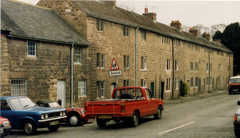
Cromford is a village and civil parish in Derbyshire, England, in the valley of the River Derwent between Wirksworth and Matlock. It is north of Derby, south of Matlock and south of Matlock Bath. It is first mentioned in the 11th-century Domesday Book as ''Crumforde'', a berewick (supporting farm) of Wirksworth, and this remained the case throughout the Middle Ages. The population at the 2011 Census was 1,433. It is principally known for its historical connection with Richard Arkwright and the nearby Cromford Mill, which he built outside the village in 1771. Cromford is in the Derwent Valley Mills World Heritage Site. The Cromford mill complex, owned and being restored by the Arkwright Society, was declared by Historic England as "one of the country’s 100 irreplaceable sites". It is also the centrepiece of the Derwent Valley Mills UNESCO World Heritage Site. In 2018, the ''Cromford Mills Creative Cluster and World Heritage Site Gateway Project'' was listed as a fina ... [...More Info...] [...Related Items...] OR: [Wikipedia] [Google] [Baidu] |
Robin Hood's Stride
Robin Hood's Stride (also known as Mock Beggar's Mansion) is a rock formation on the Limestone Way in Derbyshire close to the village of Elton. The nearest town is Bakewell, to the north. The popular tourist spot can be accessed via the Limestone Way just off the B5056 between Haddon Hall and Winster, or from the unclassified road from Alport to Elton using either the Limestone Way, a concessionary footpath or Access Land. Both options have limited parking at the side of the road. It consists of gritstone boulders deeply seamed by water flows. Limited short climbing is possible; nearby Cratcliffe Tor provides more serious routes. The two "pinnacles" are Weasel pinnacle (eastern end; Diff) and Inaccessible pinnacle (west; V Diff). An ancient road, possibly prehistoric or Roman, the Derbyshire Portway (also known as Old Manchester Lane and The Chariot Way) passed close to the outcrop. Nearby is Nine Stones Close, a four-stone circle, and, at Cratcliffe Tor, a rock shelter known a ... [...More Info...] [...Related Items...] OR: [Wikipedia] [Google] [Baidu] |
Glossop
Glossop is a market town in the Borough of High Peak, Derbyshire, England. It is located east of Manchester, north-west of Sheffield and north of the county town, Matlock. Glossop lies near Derbyshire's borders with Cheshire, Greater Manchester, South Yorkshire and West Yorkshire. It is between above sea level and is bounded by the Peak District National Park to the south, east and north. Historically, the name ''Glossop'' refers to the small hamlet that gave its name to an ancient parish recorded in the Domesday Book of 1086 and then the manor given by William I of England to William Peverel. A municipal borough was created in 1866, which encompassed less than half of the manor's territory.The Ancient Parish of Glossop Retrieved 18 June 2008 The area now known as Glossop approximates to the villages that u ... [...More Info...] [...Related Items...] OR: [Wikipedia] [Google] [Baidu] |
Combs, Derbyshire
Combs is a small village in Derbyshire, England, in the civil parish of Chapel-en-le-Frith and the Peak District National Park. The village is bounded to the east, west and south by gritstone edges and moorland, the highest of which is Black Edge (). To the north the embankment of the Buxton to Stockport railway separates it from Combs Reservoir. To the east is Castle Naze, a prehistoric settlement site. The village has a pub, the Beehive Inn, and infant school An infant school is a term used primarily in England and Wales, for the education of children between the ages of four and seven years. It is usually a small school serving a particular area. It is sometimes a department in a larger primary schoo .... Combs resident Herbert Frood developed a vehicle brake pad and in 1897 founded the company Ferodo. The village was also home to journalists and authors Crichton Porteous and Peggy Bellhouse. Old Brook House and its barn, close to the Beehive public house, is a liste ... [...More Info...] [...Related Items...] OR: [Wikipedia] [Google] [Baidu] |
Combs Moss
Combs Moss is a plateau-topped hill between Chapel-en-le-Frith and Buxton in Derbyshire, in the Peak District. The summit, Combs Head, is above sea level. The moorland plateau is flanked by Combs Edge and the Goyt Valley to the west, the village of Combs to the north, Black Edge and Dove Holes to the east and Buxton to the south. The Midshires Way long-distance footpath follows a Roman Road across the southwestern end of Combs Moss. Much of Combs Moss is a privately owned grouse moor, with a shooting hut and grouse butts. Following the Countryside and Rights of Way Act 2000, this area became "Open Access" land for the public. Castle Naze is the site of a prehistoric hillfort at the northwest edge of Combs Moss, overlooking Combs Reservoir (a designated Site of Special Scientific Interest). The fort is over in extent with a triangular layout. There is a substantial defensive double rampant on the southeast side and protective rock edges on the other sides. The is a cle ... [...More Info...] [...Related Items...] OR: [Wikipedia] [Google] [Baidu] |
Brassington
Brassington is a village and civil parish in the Derbyshire Dales district of Derbyshire, 16 miles north west of Derby. The parish had a population of 573 at the 2011 census. The name, spelled ''Branzingtune'' in the Domesday Book, is thought to mean "Brand's people's place". Most of the houses in the village are built of local limestone, and most are 200 or 300 years old; there are 20th-century houses at the south end of the village. The oldest dated house, named Tudor House since the late 19th century, was built in 1615. It is located on Town Street () and was an inn until 1820, when it was bought by the parish and was used as a workhouse until 1848. There were 15 inmates at the 1841 census, but the number rose considerably in 1845, when the Brassington Poor Law Union was wound up and Brassington joined the new Ashbourne Union. The Brassington workhouse, augmented by the nearby George and Dragon pub, served the new union while a new workhouse was built in Ashbourne. The work ... [...More Info...] [...Related Items...] OR: [Wikipedia] [Google] [Baidu] |
Bosley Cloud
The Cloud or Bosley Cloud is a prominent hill on the border between Cheshire and Staffordshire a couple of miles west of the Peak District National Park boundary. At in height, it is one of the highest hills in the area. Its heather-covered summit plateau is crowned by a trig point from which there are extensive views over Congleton, Biddulph, Macclesfield, Holmes Chapel and the Greater Manchester area. The Cloud is at the northern apex of a triangle formed by the broken ridge which runs along the border between Cheshire and Staffordshire and the hills stretching south through Biddulph Moor into Staffordshire. To its north, the River Dane wraps around its lower slopes whilst the A523 road runs to its east through the village of Bosley in Southeast Cheshire. Geology The summit and upper slopes are formed from the coarse and pebbly Chatsworth Grit, a thick sandstone which forms a part of the Millstone Grit and which dates from the Namurian stage of the Carboniferous perio ... [...More Info...] [...Related Items...] OR: [Wikipedia] [Google] [Baidu] |
Pennine Way
The Pennine Way is a National Trail in England, with a small section in Scotland. The trail stretches for from Edale, in the northern Derbyshire Peak District, north through the Yorkshire Dales and Northumberland National Park and ends at Kirk Yetholm, just inside the Scottish border. The path runs along the Pennine hills, sometimes described as the "backbone of England". Although not the United Kingdom's longest National Trail (this distinction belongs to the South West Coast Path), it is according to The Ramblers "one of Britain's best known and toughest". History The path was the idea of the journalist and rambler Tom Stephenson, inspired by similar trails in the United States of America, particularly the Appalachian Trail. Stephenson proposed the concept in an article for the ''Daily Herald'' in 1935, and lobbied Parliament for the creation of an official trail. The walk was planned to end at Wooler but it was decided that Kirk Yetholm would be the finishing point. The ... [...More Info...] [...Related Items...] OR: [Wikipedia] [Google] [Baidu] |
Blackstone Edge
Blackstone Edge ( ) is a gritstone escarpment at 472 m (1,549 feet) above sea level in the Pennine hills surrounded by moorland on the boundary between Greater Manchester and West Yorkshire in England. History Crossing the escarpment is Blackstone Edge Long Causeway, also known as Blackstone Edge Roman Road, a partially paved road on the Greater Manchester side, becoming a holloway through peat as it runs into Yorkshire. The Blackstone Edge Long Causeway was originally thought to be of Roman origin until investigations by James Maxim, who proposed the theory that it was actually a 1735 turnpike or packhorse route. This theory was widely accepted until 2012 when investigations by Archaeological Services WYAS led them to conclude that "The archaeological surface evidence...suggests that the route of the road is unlikely to have originated as part of a turnpike scheme as probable medieval and post-medieval features, including a packhorse road, appear to overlie the substantia ... [...More Info...] [...Related Items...] OR: [Wikipedia] [Google] [Baidu] |


