|
Skinners Row
Christchurch Place () is a street in central Dublin, Ireland, formerly known as Skinners Row or Skinner's Row, it formed one of the main thoroughfares in medieval Dublin. History The street runs along the southern edge of Christ Church Cathedral. It was previously known as Skinners or Skinner's Row, named for the traders working on leather and hides that once occupied the street. It was lined by a number of historically important but now demolished buildings. Before the Wide Streets Commission, the street was apparently as narrow as 17 feet and was described by Sir John Gilbert as "a narrow and sombre alley". Where it met Castle Street, there was a pillory, and at the junction with High Street, there was the now-lost High Market Cross. It also met Fishamble Street at a short stretch which was known as Booth Street. One of the key buildings of Skinner's Row was the Tholsel, which stood on the junction of Skinner's Row, Nicholas Street and High Street. This building dated fr ... [...More Info...] [...Related Items...] OR: [Wikipedia] [Google] [Baidu] |
Dublin
Dublin is the capital and largest city of Republic of Ireland, Ireland. Situated on Dublin Bay at the mouth of the River Liffey, it is in the Provinces of Ireland, province of Leinster, and is bordered on the south by the Dublin Mountains, part of the Wicklow Mountains range. Dublin is the largest city by population on the island of Ireland; at the 2022 census of Ireland, 2022 census, the city council area had a population of 592,713, while the city including suburbs had a population of 1,263,219, County Dublin had a population of 1,501,500. Various definitions of a metropolitan Greater Dublin Area exist. A settlement was established in the area by the Gaels during or before the 7th century, followed by the Vikings. As the Kingdom of Dublin grew, it became Ireland's principal settlement by the 12th century Anglo-Norman invasion of Ireland. The city expanded rapidly from the 17th century and was briefly the second largest in the British Empire and sixth largest in Western Europ ... [...More Info...] [...Related Items...] OR: [Wikipedia] [Google] [Baidu] |
Dublin 2
Dublin 2, also rendered as D2 and D02, is a historic List of Dublin postal districts, postal district on the Southside, Dublin, southside of Dublin, Ireland. In the 1960s, this central district became a focus for office development. More recently, it became a focus for urban residential development. The district saw some of the heaviest fighting during Ireland's Easter Rising. Area profile Dublin 2 lies entirely within the Dublin Bay South (Dáil constituency), Dublin Bay South constituency of the Irish parliament, the Dáil Éireann, Dáil. The postcode consists of most of the southern city centre and its outer edges. It is the most affluent of the four postcodes that make up the bulk of inner city Dublin. The others being D1, D7, and D8. It is also among the most affluent of all 22 traditional Dublin postal districts and is one of the most affluent in the country. Notable places D2 includes Merrion Square, Trinity College Dublin, Trinity College, Temple Bar, Dublin, Temple ... [...More Info...] [...Related Items...] OR: [Wikipedia] [Google] [Baidu] |
Christ Church Cathedral, Dublin
Christ Church Cathedral, more formally The Cathedral of the Holy Trinity (Irish: ''Ardeaglais Theampall Chríost''), is the cathedral of the Diocese of Dublin and Glendalough, United Dioceses of Dublin and Glendalough and the cathedral of the ecclesiastical province of the Province of Dublin (Church of Ireland), United Provinces of Dublin and Cashel in the (Anglican) Church of Ireland. It is situated in Dublin, Republic of Ireland, Ireland, and is the elder of the capital city's two Middle Ages, medieval cathedrals, the other being St Patrick's Cathedral, Dublin, St Patrick's Cathedral. The cathedral was founded in the early 11th century under the Viking king Sitric Silkenbeard. It was rebuilt in stone in the late 12th century under the Norman potentate Richard de Clare, 2nd Earl of Pembroke, Strongbow, and considerably enlarged in the early 13th century, using Somerset stones and craftsmen. A partial collapse in the 16th century left it in poor shape and the building was extens ... [...More Info...] [...Related Items...] OR: [Wikipedia] [Google] [Baidu] |
Wide Streets Commission
The Wide Streets Commission (officially the Commissioners for making Wide and Convenient Ways, Streets and Passages) was established by an Act of Parliament in 1758, at the request of Dublin Corporation, as a body to govern standards on the layout of streets, bridges, buildings and other architectural and civic considerations in Dublin. Other improvement commissioners in Dublin in the same era were the Pipe Water Committee for drinking water, the Paving Board for footpaths, public lighting and sewerage, and the Ballast Board for Dublin Port. The various improvement commissioners were abolished when with the last of their functions being absorbed into Dublin Corporation in 1851. History The Wide Streets Commission was established in 1758. Over the following decades, the commission reshaped the old medieval city of Dublin, and created a network of main thoroughfares by wholesale demolition or widening of old streets or the creation of entirely new ones. One of the first projec ... [...More Info...] [...Related Items...] OR: [Wikipedia] [Google] [Baidu] |
Pillory
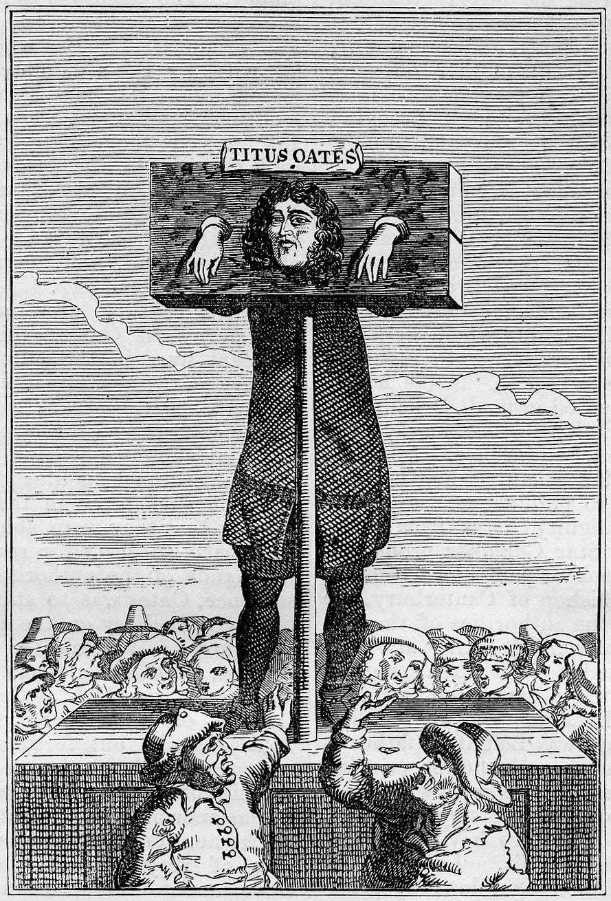
The pillory is a device made of a wooden or metal framework erected on a post, with holes for securing the head and hands, used during the medieval and renaissance periods for punishment by public humiliation and often further physical abuse. The pillory is related to the stocks. Etymology The word is documented in English since 1274 (attested in Anglo-Latin from ), and stems from Old French (1168; French language, modern French , see below), itself from medieval Latin , of uncertain origin, perhaps a diminutive of Latin 'pillar, stone barrier'. Description Rather like the lesser punishment called the stocks, the pillory consisted of hinged wooden boards forming holes through which the head or various limbs were inserted; then the boards were locked together to secure the captive. Pillories were set up to hold people in marketplaces, crossroads, and other public places. They were often placed on platforms to increase public visibility of the person; often a placard deta ... [...More Info...] [...Related Items...] OR: [Wikipedia] [Google] [Baidu] |
Fishamble Street
Fishamble Street (; ) is a street in Dublin, Ireland within the old city walls. Location The street joins Wood Quay at the Fish Slip near Fyan's Castle. It originally ran from Castle Street to Essex Quay until the creation of Lord Edward Street in 1886. History It is mentioned in the 14th century as ''Vicus Piscariorum'', ''Viscus Piscariæ'', and as Fish Street. In 1577, Stanihurst named it St John's Street. In the fifteenth century, it was referred to as "the Fishamyls". John Estrete, the eminent judge and statesman, owned a house here in 1483, which he sold to Philip Fleming two years later. In 1610, some editions of Speed's map call it Fish Shambles. During the 1950s it was for a time officially considered part of Moore Street, though in practice it retained its separate identity. The street was known as the official fish market for Dublin until the end of the 17th century when the city markets were moved to the north bank of the Liffey. (''" Shambles"'' were meat ... [...More Info...] [...Related Items...] OR: [Wikipedia] [Google] [Baidu] |
The Tholsel, Dublin
The Tholsel was an important building in Dublin, Ireland which combined the function of civic hall, guildhall, court, gaol and even for a period acted as parliament house from 1641-48. In its final form, it was located on Skinners Row within the old city walls of Dublin, Ireland. It existed in various forms from after the Norman invasion of Ireland until it was finally demolished around 1809 and was one of the most important and imposing buildings in medieval Dublin. It was a secular and commercial focal point within the city walls situated at a major crossroads close to Dublin Castle, St Patrick's Cathedral and Christchurch Cathedral. It was the one of several Tholsel, tholsels which were constructed in the major cities and towns of medieval Ireland and the Dublin tholsel also housed the first public clock in Ireland on its tower from 1466. History Early history There are mentions of the tholsel as far back as 1311 being called the 'new' tholsel, indicating that an earlier bui ... [...More Info...] [...Related Items...] OR: [Wikipedia] [Google] [Baidu] |


