|
Sintang
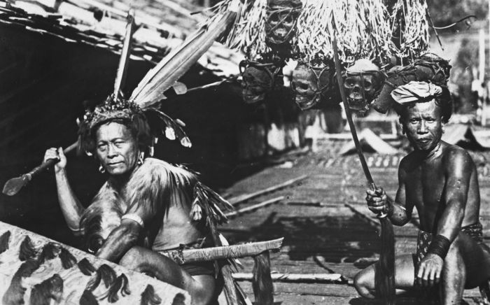
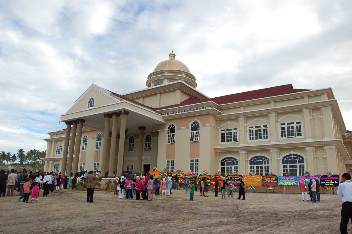
Sintang Regency is a regency of West Kalimantan province of Indonesia. It covers an area of 21,638.2 km2, and had a population of 364,759 at the 2010 Census, 395,890 at the 2015 Census and 421,306 at the 2020 Census. It is one among few Indonesian regencies that has land border to other countries. It is also the second largest regency in the province by land area after Landak Regency. The regency was former site of Sintang Kingdom, a Hindu kingdom that later converted to Islam, which was a regional power in interior of Borneo island. The regency seat is located at large town of Sintang, which is among biggest settlement in Borneo interior alongside Putussibau and Puruk Cahu. History Somewhere between 45000-39000 B.C Sintang would be inhabited by humans. The area would change hands serval times From the Majapahit to the Bruneian Sultanate when the Dutch arrived at Borneo in 1776 the area would shortly be occupied by the Dutch The Area was occupied by the Empire of Japan in 194 ... [...More Info...] [...Related Items...] OR: [Wikipedia] [Google] [Baidu] |
West Kalimantan
West Kalimantan ( id, Kalimantan Barat) is a province of Indonesia. It is one of five Indonesian provinces comprising Kalimantan, the Indonesian part of the island of Borneo. Its capital city is Pontianak. The province has an area of 147,307 km2, and had a population of 4,395,983 at the 2010 CensusBiro Pusat Statistik, Jakarta, 2011. and 5,414,390 at the 2020 Census. Ethnic groups include the Dayak, Malay, Chinese, Javanese, Bugis, and Madurese. The borders of West Kalimantan roughly trace the mountain ranges surrounding the vast watershed of the Kapuas River, which drains most of the province. The province shares land borders with Central Kalimantan to the southeast, East Kalimantan to the east, and the Malaysian territory of Sarawak to the north. West Kalimantan is an area that could be dubbed "The Province of a Thousand Rivers". The nickname is aligned with the geographical conditions that have hundreds of large and small rivers that which can be and often are ... [...More Info...] [...Related Items...] OR: [Wikipedia] [Google] [Baidu] |
List Of Regencies And Cities Of Indonesia
Regencies (''kabupaten'') and cities (''kota'') are the second-level administrative subdivision in Indonesia, immediately below the provinces, and above the districts. Regencies are roughly equivalent to American counties, although most cities in the United States are below the counties. Following the implementation of decentralization beginning on 1 January 2001, regencies and city municipalities became the key administrative units responsible for providing most governmental services. Each of regencies and cities has their own local government and legislative body. The difference between a regency and a city lies in demography, size, and economy. Generally, a regency comprises a rural area larger than a city, but also often includes various towns. A city usually has non-agricultural economic activities. A regency is headed by a regent (''bupati''), while a city is headed by a mayor (''wali kota''). All regents, mayors, and members of legislatures are directly elected via el ... [...More Info...] [...Related Items...] OR: [Wikipedia] [Google] [Baidu] |
Landak Regency
Landak Regency is a regency of West Kalimantan province, Indonesia. It was created in 1999 from the northeastern part of Pontianak Regency. It covers 9,909.10 km2 and had a population of 329,649 at the 2010 Census and 397,610 at the 2020 Census. The principal town lies at Ngabang. Landak is also one of the four regencies in West Kalimantan whose population is predominantly Catholic, the others being Sanggau, Sekadau, and Sintang. Administrative Districts Landak Regency consists of thirteen districts (''kecamatan''), tabulated below with their areas and their populations at the 2010 Census and the 2020 Census.Badan Pusat Statistik, Jakarta, 2020. The table also includes the number of administrative villages (rural ''desa'' and urban ''kelurahan'') in each district and its post code. Climate Ngabang, the seat of the regency has a tropical rainforest climate A tropical rainforest climate, humid tropical climate or equatorial climate is a tropical climate sub-type ... [...More Info...] [...Related Items...] OR: [Wikipedia] [Google] [Baidu] |
Telephone Numbers In Indonesia
Telephone numbers in Indonesia have different systems for land lines and mobile phones: land lines use area codes, while mobile phones do not. For land line area codes, the digit "0" is added in front when dialing domestic long distance from within Indonesia, but is always omitted when calling from abroad. Instead, callers would use the Indonesian country code +62, followed by the area code, without the "0". Domestic phone numbers in large cities have 8 digits, and in other areas 7 digits. Mobile phone numbers have a total of 10 to 12 digits for postpaid depending on the operator, whereas prepaid services get 11 to 13 digits determined by the operator. Until October 1999, East Timor was included in the Indonesian telephone numbering plan, using the area codes 0390 (for Dili) and 0399 (for Baucau). To make a phone call to Indonesia from abroad, the following formats are used: For calls to landlines, callers dial +62, followed by the area code and subscriber's number, omitting t ... [...More Info...] [...Related Items...] OR: [Wikipedia] [Google] [Baidu] |
Kapuas River
The Kapuas River (or Kapoeas River) is a river in the Indonesian part of Borneo island, at the geographic center of Maritime Southeast Asia. At in length, it is the longest river in the island of Borneo and the longest river of IndonesiaMacKinnon, p. 133 and one of the world's longest island rivers. It originates in the Müller mountain range at the center of the island and flows west into the South China Sea creating an extended marshy delta. The delta is located west-southwest of Pontianak, the capital of the West Kalimantan province.Kapuas River Encyclopædia Britannica on-line This Kapuas River should be distinguished from another Kapuas River, which starts on the other side of the same mountain ra ... [...More Info...] [...Related Items...] OR: [Wikipedia] [Google] [Baidu] |
Melawi Regency
Melawi Regency is a regency of West Kalimantan province of Indonesia. It was created in 2003 from part of Sintang Regency. It covers an area of 10,640.8 km2, and had a population of 178,645 at the 2010 Census, 195,667 at the 2015 Census and 228,270 at the 2020 Census. The principal town lies at Nanga Pinoh. Administrative Districts Melawi Regency consists of eleven districts A district is a type of administrative division that, in some countries, is managed by the local government. Across the world, areas known as "districts" vary greatly in size, spanning regions or county, counties, several municipality, municipa ... (''kecamatan''), tabulated below with their areas and their populations at the 2010 Census and the 2020 Census.Badan Pusat Statistik, Jakarta, 2020. The table also includes the number of administrative villages (rural ''desa'' and urban ''keluraham'') in each district, its post code and their administrative centres: Note: (a) the figures in this column are ... [...More Info...] [...Related Items...] OR: [Wikipedia] [Google] [Baidu] |
Regency Seat
A regency seat ( id, Ibu kota kabupaten) is an capital or seat of government of a regency in Indonesia. It is roughly equivalent of county seat in the United States or county town in the United Kingdom. Legally, regency seats are not administrative subdivisions of Indonesia and have no official boundaries. A regency seat may occupy an entire district (such as Sigli in Pidie Regency, Ngawi (town) in Ngawi Regency), a part of district (such as Sarilamak Sarilamak is a town in Lima Puluh Kota Regency, of West Sumatra province of Indonesia and it is the administrative seat (capital) of Lima Puluh Kota Regency. Populated places in West Sumatra Regency seats of West Sumatra {{WSumatra-g ... in Harau district, Lima Puluh Kota Regency), or several districts (such as Ungaran, which consists of West Ungaran district and East Ungaran district in Semarang Regency). References Capitals {{Indonesia-geo-stub ... [...More Info...] [...Related Items...] OR: [Wikipedia] [Google] [Baidu] |
Time In Indonesia
The Indonesian Archipelago geographically stretches across four time zones from UTC+06:00 in Aceh to UTC+09:00 in Papua. However, the Indonesian government recognises only three time zones in its territory, namely: *Western Indonesia Time (WIB) — seven hours ahead ( UTC+07:00) of the Coordinated Universal Time (UTC); *Central Indonesia Time (WITA) — eight hours ahead ( UTC+08:00) of UTC; *Eastern Indonesia Time (WIT) — nine hours ahead ( UTC+09:00) of UTC. The boundary between the Western and Central time zones was established as a line running north between Java and Bali through the provincial boundaries of West and Central Kalimantan. The border between the Central and Eastern time zones runs north from the eastern tip of Indonesian Timor to the eastern tip of Sulawesi. Daylight saving time (DST) is no longer observed anywhere in Indonesia. Current usage In Indonesia, the keeping of standard time is divided into three time zones: These time zones were first obs ... [...More Info...] [...Related Items...] OR: [Wikipedia] [Google] [Baidu] |
Provinces Of Indonesia
A province is almost always an administrative division within a country or state. The term derives from the ancient Roman ''provincia'', which was the major territorial and administrative unit of the Roman Empire's territorial possessions outside Italy. The term ''province'' has since been adopted by many countries. In some countries with no actual provinces, "the provinces" is a metaphorical term meaning "outside the capital city". While some provinces were produced artificially by colonial powers, others were formed around local groups with their own ethnic identities. Many have their own powers independent of central or federal authority, especially in Canada and Pakistan. In other countries, like China or France, provinces are the creation of central government, with very little autonomy. Etymology The English word ''province'' is attested since about 1330 and derives from the 13th-century Old French , which itself comes from the Latin word , which referred to the sphere o ... [...More Info...] [...Related Items...] OR: [Wikipedia] [Google] [Baidu] |
Kalimantan
Kalimantan () is the Indonesian portion of the island of Borneo. It constitutes 73% of the island's area. The non-Indonesian parts of Borneo are Brunei and East Malaysia. In Indonesia, "Kalimantan" refers to the whole island of Borneo. In 2019, President of Indonesia Joko Widodo proposed that Indonesia's capital be moved to Kalimantan, and in January 2022 Indonesian legislature approved the proposal. The shift is expected to take up to 10 years. Etymology The name ''Kalimantan'' is derived from the Sanskrit word ''Kalamanthana'', which means "burning weather island", or island with a very hot temperature, referring to its hot and humid tropical climate. It consists of the two words '' kal ' ("time, season, period") and ''manthan ' ("boiling, churning, burning"). The indigenous people of the eastern region of Borneo referred to their island ... [...More Info...] [...Related Items...] OR: [Wikipedia] [Google] [Baidu] |
Human Development Index
The Human Development Index (HDI) is a statistic composite index of life expectancy, Education Index, education (mean years of schooling completed and expected years of schooling upon entering the Educational system, education system), and per capita income indicators, which is used to rank countries into four tiers of Human development (humanity), human development. A country scores a higher level of HDI when the life expectancy at birth, lifespan is higher, the education level is higher, and the gross national income GNI (PPP) per capita is higher. It was developed by Pakistani economist Mahbub ul Haq and was further used to measure a country's development by the United Nations Development Programme (UNDP)'s Human Development Report Office. The 2010 Human Development Report introduced an List of countries by inequality-adjusted HDI, Inequality-adjusted Human Development Index (IHDI). While the simple HDI remains useful, it stated that "the IHDI is the actual level of ... [...More Info...] [...Related Items...] OR: [Wikipedia] [Google] [Baidu] |


