|
Sindhupalchok
Sindhupalchok District (or Sindhupalchok, ) is a part of Bagmati Province and one of the seventy-seven districts of Nepal, with an area of . The district's headquarters is in Chautara. In 2006, 336,478 people resided in 79 village development committees; in 2011 there were 287,798.Household and population by districts, Central Bureau of Statistics (CBS) Nepal Geography The climatic zones found in the district comprise:Demographics At the time of the , Sindhupalchowk District had a population of 287,798. As their |
Bagmati Province
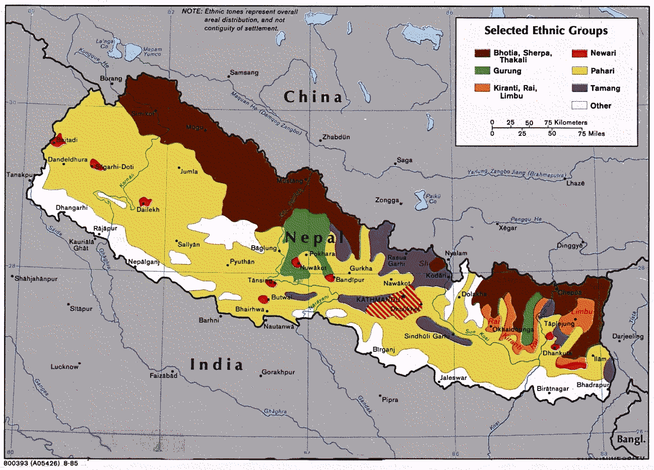
Bagmati Province (, ''Bāgmatī pradēśa'') is one of the seven Provinces of Nepal, provinces of Nepal established by the constitution of Nepal. Bagmati is Nepal's second-most populous province and fifth largest province by area. It is bordered by Tibet Autonomous Region of China to the north, Gandaki Province to the west, Koshi Province to the east, Madhesh Province and the Indian state of Bihar to the south. With Hetauda as its provincial headquarters, the province is also the home to the country's capital Kathmandu, is mostly hilly and mountainous, and hosts mountain peaks including Gaurishankar, Langtang, Himalayas, Jugal, and Ganesh Himal, Ganesh. Being the second most populous province of Nepal, it possesses rich cultural diversity with resident communities and castes including Thami (Thangmi) (Shneiderman, 2009, 2015; Turin, 1998), Newar people, Newar, Tamang people, Tamang,Sherpa people, Sherpa, Tharu people, Tharu, Chepang people, Chepang, Jirel people, Jirel, Brahmin, ... [...More Info...] [...Related Items...] OR: [Wikipedia] [Google] [Baidu] |
Chautara
Chautara Sangachokgadhi is a municipality in Sindhupalchowk District in Bagmati Province of central Nepal. The municipality was established on 18 May 2014 by merging Pipaldanda, Chautara, Kubhinde, Sanusiruwari Village Development Committees as Chautara Municipality. Later on 2017 it was expended again merging Sangachok, Thulo Sirubari, Kadambas, Irkhu, Batase and Syaule Village Development Committees to form Chautara Sangachowkgadi Municipality. It is now divided to 14 wards. This is the district headquarters of the Sindhupalchowk District. The municipality stands at an elevation of approximately 1,600 m above sea level. Religious and cultural festivities form a major part of the lives of people residing in Chautara. There are people of various religious beliefs, Hinduism, Buddhism and Christianity as well, giving Chautara a cosmopolitan culture. Nepali is the most commonly spoken language in the municipality. Likewise, Newari and other languages such as Tamang are also ... [...More Info...] [...Related Items...] OR: [Wikipedia] [Google] [Baidu] |
Thangmi Language
Thangmi, also called Thāmī, Thangmi Kham, Thangmi Wakhe, and Thani, is a Tibeto-Burman languages, Sino-Tibetan language spoken in central-eastern Nepal and northeastern India by the Thami, Thami people. The Thami refer to their language as ''Thangmi Kham'' or ''Thangmi Wakhe'' while the rest of Nepal refers to it as ''Thāmī''. The majority of these speakers, however, live in Nepal in their traditional homeland of Dolakha District, Dolakhā District. In India, the Thami population is concentrated mostly in Darjeeling. The Thangmi language is written using the Devanagari script. Thangmi has been extensively documented by Mark Turin. Distribution Thangmi is spoken in Bagmati Province, mainly in the region of Dolakha District, Dolakha; villages on Sailung Khola (The northern Salient (geography), panhandle of the Ramechhap District; mainly in Gokulganga Rural Municipality, Gokulganga); eastern regions of Sindhupalchok District, Sindhupalchowk District; and by some elders among the ... [...More Info...] [...Related Items...] OR: [Wikipedia] [Google] [Baidu] |
Newar Language
Newar (; , ) is a Sino-Tibetan languages, Sino-Tibetan language spoken by the Newar people, the indigenous inhabitants of Nepal Mandala, which consists of the Kathmandu Valley and surrounding regions in Nepal. The language is known officially in Nepal as Nepal Bhasa, a name that has been historically used for the language. The term "Newari" is also used to refer to the language, although the Indic ''-i'' suffix is considered inappropriate by some Newar speakers. The language served as the official language of Nepal during the Malla dynasty (Nepal), Malla dynasty since the 14th century till the end of dynasty in 1769 during which the language was referred as "Nepal Bhasa", a term which literally means "Nepalese Language". However, the language is not the same as Nepali language, Nepali, an Indo-Aryan languages, Indo-Aryan language and the current official language of Nepal, which only got the name Nepali in the 1930s. Newar literature, Literature in Newar is one of the oldest i ... [...More Info...] [...Related Items...] OR: [Wikipedia] [Google] [Baidu] |
Districts Of Nepal
Districts in Nepal are second level of administrative divisions after provinces. Districts are subdivided into municipalities and rural municipalities. There are seven provinces and 77 districts in Nepal. After the 2015 reform of administrative divisions, Nawalparasi District and Rukum District were respectively divided into Parasi District and Nawalpur District, and Eastern Rukum District and Western Rukum District. District officials District official include: * Chief District Officer, an official under Ministry of Home Affairs is appointed by the government as the highest administrative officer in a district. The C.D.O is responsible for proper inspection of all the departments in a district such as health, education, security and all other government offices. * District Coordination Committee acts as an executive to the District Assembly. The DCC coordinates with the Provincial Assembly to establish coordination between the Provincial Assembly and rural muni ... [...More Info...] [...Related Items...] OR: [Wikipedia] [Google] [Baidu] |
Tamang Language
Tamangic language is spoken mainly in Tamangsaling Land in Nepal, Sikkim, West Bengal (Darjeeling) and North-Eastern India. It comprises Eastern Tamang, Northwestern Tamang, Southwestern Tamang, Eastern Gorkha Tamang, and Western Tamang. Lexical similarity between Eastern Tamang (which is regarded as the most prominent) and other Tamang languages varies between 81% and 63%. For comparison, the lexical similarity between Spanish and Portuguese is estimated at 89%. Ethnologue report for Spanish Dialects ''Ethnologue'' divides Tamang into the following varieties due to mutual unintelligibility. *Eastern Tamang: 759,000 in Nepal (2000 WCD). Population total all countries: 773,000. Sub-dialects are as follows. **Outer-Eastern Tamang (Sailung Tamang) **Central-Eastern Tamang (Temal Tamang) **Southwestern Tamang (Kath-Bhotiya, Lama Bhote, Murmi, Rongba, Sain, Tamang Gyoi, Tamang Gyot, Tamang Lengmo, Tamang Tam) *Western Tamang: 323,000 (2000 WCD). Sub-dialects are as follows. ** ... [...More Info...] [...Related Items...] OR: [Wikipedia] [Google] [Baidu] |
Geography Of Nepal
Nepal measures about along its Himalayan axis by across. It has an area of . Nepal is landlocked by China's Tibet Autonomous Region to the north and India on other three sides. West Bengal's narrow ''Siliguri Corridor'' separate Nepal and Bangladesh. To the east are Bhutan and India. Nepal has a very high degree of geographic diversity and can be divided into three main regions: Terai, Hilly, and Himal. The Terai region, covering 17% of Nepal's area, is a lowland region with some hill ranges and is culturally more similar to parts of India. The Hilly region, encompassing 68% of the country's area, consists of mountainous terrain without snow and is inhabited by various indigenous ethnic groups. The Himal region, covering 15% of Nepal's area, contains snow and is home to several high mountain ranges, including Mount Everest, the world's highest peak. Nepal, with elevations ranging from less than 100 meters to over 8,000 meters, has eight climate zones from tropical to perpe ... [...More Info...] [...Related Items...] OR: [Wikipedia] [Google] [Baidu] |
Provincial Assembly (Nepal)
The Provincial Assembly (; ''Pradesh Sabha'') is the unicameral legislative assembly for a Provinces of Nepal, federal province of Nepal. According to Article 176 of the Constitution of Nepal 2015, following the Dissolution of parliament, dissolution of the provincial assembly all the members forming the Provincial Assembly are elected. The term for the Provincial Assembly is five years, except when dissolved earlier. Candidates for each constituency are chosen by the List of political parties in Nepal, political parties or stand as independents. Each constituency elects one member under the first-past-the-post system of election. Since Nepal uses a parallel voting system, voters cast another ballot to elect members through the party-list proportional representation. The current constitution specifies that 60 percent of the members should be elected from the first-past-the-post system and 40 percent through the party-list proportional representation system. Women should account ... [...More Info...] [...Related Items...] OR: [Wikipedia] [Google] [Baidu] |
List Of Districts Of Nepal
Districts in Nepal are second level of administrative divisions after Provinces of Nepal, provinces. Districts are subdivided into List of cities in Nepal, municipalities and List of gaupalikas of Nepal, rural municipalities. There are seven provinces and 77 districts in Nepal. After the 2015 reform of administrative divisions, Nawalparasi District and Rukum District were respectively divided into Parasi District and Nawalpur District, and Eastern Rukum District and Western Rukum District. District officials District official include: * Chief District Officer, an official under Ministry of Home Affairs (Nepal), Ministry of Home Affairs is appointed by the government as the highest administrative officer in a district. The C.D.O is responsible for proper inspection of all the departments in a district such as health, education, security and all other government offices. * District Coordination Committee acts as an executive to the Jilla Sabha, District Assembly. The DCC coordin ... [...More Info...] [...Related Items...] OR: [Wikipedia] [Google] [Baidu] |
2011 Nepal Census
Nepal conducted a widespread national census in 2011 by the Nepal Central Bureau of Statistics. Working in cooperation with the 58 municipalities and the 3,915 Village Development Committees at a district level, they recorded data from all the municipalities and villages of each district. The data included statistics on population size, households, sex and age distribution, place of birth, residence characteristics, literacy, marital status, religion, language spoken, caste/ethnic group, economically active population, education, number of children, employment status, and occupation. *Total population in 2011: 26,494,504 *Increase since last census in 2001: 3,343,081 *Annual population growth rate (exponential growth): 1.35 * ... [...More Info...] [...Related Items...] OR: [Wikipedia] [Google] [Baidu] |
First Language
A first language (L1), native language, native tongue, or mother tongue is the first language a person has been exposed to from birth or within the critical period hypothesis, critical period. In some countries, the term ''native language'' or ''mother tongue'' refers to the language of one's ethnic group rather than the individual's actual first language. Generally, to state a language as a mother tongue, one must have full native fluency in that language. The first language of a child is part of that child's personal, social and cultural identity. Another impact of the first language is that it brings about the reflection and learning of successful social patterns of acting and speaking. Research suggests that while a non-native speaker may develop fluency in a targeted language after about two years of immersion, it can take between five and seven years for that child to be on the same working level as their native speaking counterparts. On 17 November 1999, UNESCO design ... [...More Info...] [...Related Items...] OR: [Wikipedia] [Google] [Baidu] |
Sherpa Language
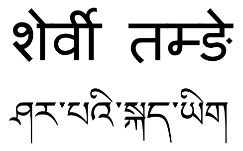
Sherpa (also Sharpa, Sherwa, or Xiaerba) is a Tibetic language spoken in Nepal and the Indian state of Sikkim, mainly by the Sherpa. The majority speakers of the Sherpa language live in the Khumbu region of Nepal, spanning from the Chinese (Tibetan) border in the east to the Bhotekosi River in the west. About 127,000 speakers live in Nepal (2021 census), some 16,000 in Sikkim, India (2011), and some 800 in the Tibetan Autonomous Region (1994). Sherpa is a subject-object-verb (SOV) language. Sherpa is predominantly a spoken language, although it is occasionally written using either the Devanagari or Tibetan script. Classification Sherpa belongs to the Tibetic branch of the Tibeto-Burman family. It is closely related to Central Tibetan, Jirel, Humla, Mugom, Dolpo, Lo-ke, Nubri, Tsum, Langtang, Kyirong, Yolmo, Gyalsumdo, Kagate, Lhomi, Walung, and Tokpe Gola. Literary Tibetan ''LT''- becomes /lh/ and ''SR-'' becomes /ʈ/. There are five closely related dialect ... [...More Info...] [...Related Items...] OR: [Wikipedia] [Google] [Baidu] |


