|
Sindh Valley
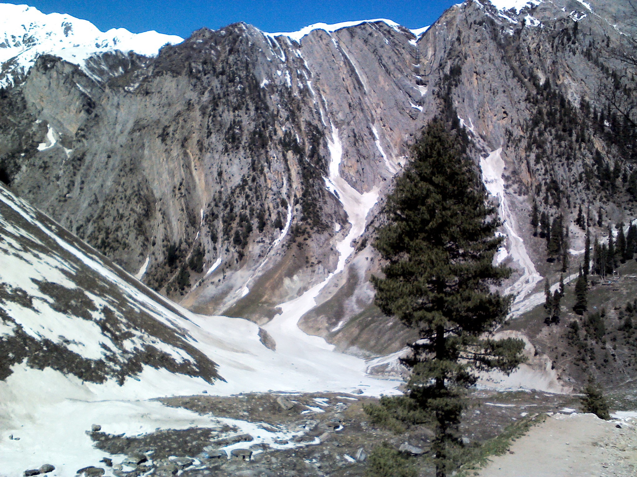
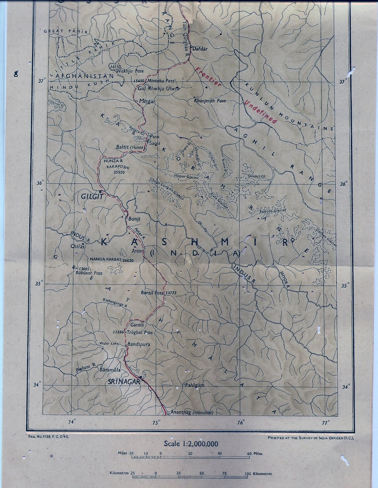
The Sind Valley is a Himalayan sub-valley of the Kashmir Valley in the Indian union territory of Jammu and Kashmir. The entrance of the Sind Valley lies northeast of Srinagar the capital of Jammu and Kashmir. It is a long gorge valley with an average width of . History The Sind Valley had a strategic importance on the ancient Silk Road. It worked as a bridge between India, China and Central Asia along with Srinagar-Skardu Route. First Hinduism and Buddhism and then Islam spread in Kashmir through this route. The Sind Valley still connects Ladakh with the rest of India through a National Highway NH 1D, though it remains closed during winter due to heavy snowfall at Zojila. Geography The Sind Valley is situated within the jurisdiction of Kangan tehsil, of Ganderbal district. It is bordered by the Kashmir Valley in the west, Zojila in the east, Gurez Valley of the Kishanganga River in the north and the Lidder Valley in the south. It has a length of and reaches a ... [...More Info...] [...Related Items...] OR: [Wikipedia] [Google] [Baidu] |
Manigam
Manigam is situated in Anantnag tehsil and located 1 kilometer from Seer Hamdan in the Anantnag district in the Indian Union Territory of Jammu and Kashmir. It is one of 105 villages in the Anantnag Block of Khovripora along with villages like Akad, Salia, Brar and Hutmarah. The village is situated on a small plateau and it acts as connecting link between Seer Hamdan and Aishmuqam and also with Hapatnar. The main occupation of the people is farming. Many people travel to other parts of country for selling shawls during winter season and some are working in the private sector. One Common Service center in Manigam providing all digital services to citizens. It is because of this center this village is a digital village. Demographics Kashmiri is the Local language in Manigam. Other languages spoken are Urdu Urdu (; , , ) is an Indo-Aryan languages, Indo-Aryan language spoken chiefly in South Asia. It is the Languages of Pakistan, national language and ''lingua franca'' ... [...More Info...] [...Related Items...] OR: [Wikipedia] [Google] [Baidu] |
Ladakh
Ladakh () is a region administered by India as a union territory and constitutes an eastern portion of the larger Kashmir region that has been the subject of a Kashmir#Kashmir dispute, dispute between India and Pakistan since 1947 and India and China since 1959.The application of the term "administered" to the various regions of Kashmir and a mention of the Kashmir dispute is supported by the WP:TERTIARY, tertiary sources (a) through (e), reflecting WP:DUE, due weight in the coverage. Although "controlled" and "held" are also applied neutrally to the names of the disputants or to the regions administered by them, as evidenced in sources (h) through (i) below, "held" is also considered politicised usage, as is the term "occupied", (see (j) below). (a) (subscription required) Quote: "Kashmir, region of the northwestern Indian subcontinent ... has been the subject of dispute between India and Pakistan since the partition of the Indian subcontinent in 1947. The northern and wester ... [...More Info...] [...Related Items...] OR: [Wikipedia] [Google] [Baidu] |
Sonamarg
Sonamarg or Sonmarg (), known as Sonamarag (; ) in Kashmiri, is a hill station located in the Ganderbal District of Jammu and Kashmir, India. It is located about 62 kilometers from Ganderbal Town and northeast of the capital city, Srinagar. History Sonamarg had historical significance as a gateway on the ancient Silk Road, connecting Kashmir with Tibet. Today, the hill station is a popular tourist destination amongst fishers and hikers, and following the Kargil War with neighbouring Pakistan in 1999, it serves as a strategically important point for the Indian Army. On 25 May 2024, a section of a glacier near Thajiwas Glacier collapsed, leading to two tourists falling into a snow cavity created by the break, killing one. On 2 June 2024, a section of Thajiwas Glacier collapsed, trapping three tourists who were rescued, and killing one laborer. Geography The hill station is situated in the Kashmir Valley, at an altitude of Combined with the alpine meadows that bloom ... [...More Info...] [...Related Items...] OR: [Wikipedia] [Google] [Baidu] |
Alpine Meadow
Alpine tundra is a type of natural region or biome that does not contain trees because it is at high elevation, with an associated harsh climate. As the latitude of a location approaches the poles, the threshold elevation for alpine tundra gets lower until it reaches sea level and merges with polar tundra. The high elevation causes an adverse climate, which is too cold and windy to support tree growth. Alpine tundra transitions to sub-alpine forests below the tree line; stunted forests occurring at the forest-tundra ecotone are known as ''krummholz''. With increasing elevation it ends at the snow line where snow and ice persist through summer. Alpine tundra occurs in mountains worldwide. The flora of the alpine tundra is characterized by dwarf shrubs close to the ground. The cold climate of the alpine tundra is caused by adiabatic cooling of air, and is similar to polar climate. Geography Alpine tundra occurs at high enough altitude at any latitude. Portions of montane gr ... [...More Info...] [...Related Items...] OR: [Wikipedia] [Google] [Baidu] |
Machoi Glacier
The Machoi Glacier is a 9 kilometer long glacier in the Himalayan Range in Jammu and Kashmir and Ladakh, India. Geography It is situated 30 kilometer west from Drass, Ladakh, India and 8 kilometers east from Sonamarg on the southern side of NH 1D at Zojila. It lies at an average elevation of 4800 meters. The highest peak named after the glacier is the Machoi Peak that lies at the eastern end of the glacier, at an elevation of 5458 meters. The glacier is the source of the Sind River that flows westwards, and the Dras river that flows eastwards. Machoi, like many other Himalayan glaciers has been melting at alarming rates due to Global warming Present-day climate change includes both global warming—the ongoing increase in global average temperature—and its wider effects on Earth's climate system. Climate change in a broader sense also includes previous long-term changes .... References Glaciers of Jammu and Kashmir Glaciers of Ladakh ... [...More Info...] [...Related Items...] OR: [Wikipedia] [Google] [Baidu] |
Dras
Dras (also spelt Drass, ISO transliteration: '), also known locally in Shina as Himababs, Hembabs, or Humas, is a town and hill station in Kargil district of the union territory of Ladakh in India. It is on the NH 1 between Zoji La pass and Kargil town. A tourist hub for its high-altitude trekking routes and tourist sites, it is often called "The Gateway to Ladakh". The government's official spelling of the town's name is "Drass". Etymology Traditionally, Dras is known as ''Hem-babs'', which means "snow land"; the word "Hem" means snow. The average temperature of Dras in winter is -20 degrees Celsius. Geography Dras is often called "The Gateway to Ladakh". It is at a height of Dras lies in the centre of the valley of the same name (Dras valley). Dras is 140 km from Srinagar and 63 km from Sonmarg. Kargil town is 58 km from Dras on the national highway NH 1 from Srinagar to Leh. History In the princely state of Jammu and Kashmir (1846–1947), Dras ... [...More Info...] [...Related Items...] OR: [Wikipedia] [Google] [Baidu] |
Nallah Sindh
The Sind River or the Sindh River is a river in the Ganderbal district of the union territory of Jammu and Kashmir, India. It is a major tributary of the Jhelum River and is long. Geography The Sind River forms the Sind Valley. The source of the river lies in the Machoi Glacier at an elevation of , east of the Amarnath temple and south of the Zoji La. It flows through Panjtarni (a camping site of Amarnath yatra) southwards up to Domail where it joins a tributary which doubles its flow from the Kolhoi Glacier. It then flows mostly westwards along the NH 1D and is fed by many glacial streams on its way to Ganderbal town. At Kichpora Preng it is fed by the Wangath river which flows down from the Gangabal Lake, which is considered the source of the river per tradition. The major tributaries of the river are: the Amarnath stream, Kolhoi Grar, Shitkadi Nallah, Gund Nallah, Surfraw Nallah and Wangath Nallah. Surfraw Nallah is a big Nallah which joins the Sind river at S ... [...More Info...] [...Related Items...] OR: [Wikipedia] [Google] [Baidu] |
Gangabal Lake
Gangabal Lake (), also called Haramukh Ganga, is an alpine high-altitude oligotrophic lake situated at the foot of Mount Harmukh in Ganderbal district of Jammu and Kashmir, India. The lake has a maximum length of and a maximum width of . It is fed by precipitation, glaciers, and springs, and is home to many species of fish, including the brown trout. Water from the lake flows into the nearby Nundkol Lake and then into Sind River, of which it is considered the source per tradition, via Wangath Nallah. This lake is considered sacred in Hinduism as one of the abodes of Shiva, and Kashmiri Hindus perform an annual pilgrimage to the lake called the ''Harmukh-Gangabal Yatra''. History Gangabal has been mentioned in several ancient Hindu Sanskrit texts, where it is referred to as ''Uttaramanasa'' and ''Uttara ganga'' (). It is mentioned in the Mahabharata as a place of pilgrimage, along with the ''Kalodaka'' or ''Nandikunda'' lake ( Nundkol). The Vishnu Smriti mentions the lake a ... [...More Info...] [...Related Items...] OR: [Wikipedia] [Google] [Baidu] |
Lidder Valley
The Lidder Valley or Liddar ValleyKaul, Manmohan N., ''Glacial and Fluvial Geomorphology of Western Himalaya,'' South Asia Books, 1990, p. 23, is a Himalayan sub-valley that forms the southeastern corner of Anantnag district in Indian-administered Kashmir. The Lidder River flows down the valley. The entrance to the valley lies 7 km northeast from Anantnag town and 62 km southeast from Srinagar, the summer capital of Jammu and Kashmir. It is a 40-km-long gorge valley with an average width of 3 km. Geography The Lidder Valley is situated within the jurisdiction of Pahalgam tehsil, of Anantnag district. It is bordered by Kashmir Valley to the west, and Sind Valley to the north, and covers a length of 40 km. It has a maximum width of 5 km. The Lidder basin is surrounded on the south and southeast by the Pir Panjal Range, on the north by the Sind Valley and on the northeast by the Zaskar Range. The Lidder drainage basin has an area of 1134 km2. [...More Info...] [...Related Items...] OR: [Wikipedia] [Google] [Baidu] |
Kishanganga River
The Neelum River, or Kishanganga River, is a river in the Kashmir region in the Indian subcontinent. It originates in the Ganderbal district of Indian-administered Kashmir, flows through the Neelam Valley into Pakistani-administered Kashmir, where parts of its course fall along the Line of Control, before merging with the Jhelum River near the city of Muzaffarabad. Name of the river The river has traditionally been known as the Kishanganga River (Hindi: किशनगंगा नदी, Urdu: دریائے کِشن گنگا) and is still known as such in India; after the partition of India in 1947, the river was renamed the Neelum River (Urdu: دریائے نیلم, Hindi: नीलम नदी) in Pakistan in 1956. Basin ''Shardadesh'' is a name for the drainage basin of the Kishanganga River. Course The Kishanganga River originates from Krishansar lake in the vicinity of Sonamarg, an area of Ganderbal district in the Indian union territory of Jammu and Kashmir, an ... [...More Info...] [...Related Items...] OR: [Wikipedia] [Google] [Baidu] |
Gurez Valley
Gurez, or Gurais (''Guráai'' in the local Shina language), is a valley located in the high Himalayas of Jammu and Kashmir, India. It is located to the north of the Kashmir Valley, separated from it by the great Himalayan range, and is situated about from Bandipore and from Srinagar. At about above sea level, the valley is surrounded by snow-capped mountains. The fauna include the Himalayan brown bear and the snow leopard. The Kishanganga River flows through the valley. The valley lies near the Line of Control, which separates it from the Astore and Neelum districts of Pakistan-administered Kashmir. It is very close to the Burzil Pass, which leads into Astore, and the inhabitants are ethnic Dards/ Shins. They speak the Shina language and have the same styles of dress and culture as their kinsmen in Pakistani-administered Gilgit-Baltistan. Dawar is the central township in the area. The population of the area is estimated to be about 30,000, and is scattered among fifteen ... [...More Info...] [...Related Items...] OR: [Wikipedia] [Google] [Baidu] |
Sind River11
Sindh ( ; ; , ; abbr. SD, historically romanized as Sind or Scinde) is a province of Pakistan. Located in the southeastern region of the country, Sindh is the third-largest province of Pakistan by land area and the second-largest province by population after Punjab. It is bordered by the Pakistani provinces of Balochistan to the west and north-west and Punjab to the north. It shares an International border with the Indian states of Gujarat and Rajasthan to the east; it is also bounded by the Arabian Sea to the south. Sindh's landscape consists mostly of alluvial plains flanking the Indus River, the Thar Desert in the eastern portion of the province along the international border with India, and the Kirthar Mountains in the western portion of the province. The economy of Sindh is the second largest in Pakistan after the province of Punjab; its provincial capital Karachi is the most populous city in the country as well as its main financial hub. Sindh is home to a large ... [...More Info...] [...Related Items...] OR: [Wikipedia] [Google] [Baidu] |


