|
Shybalyn
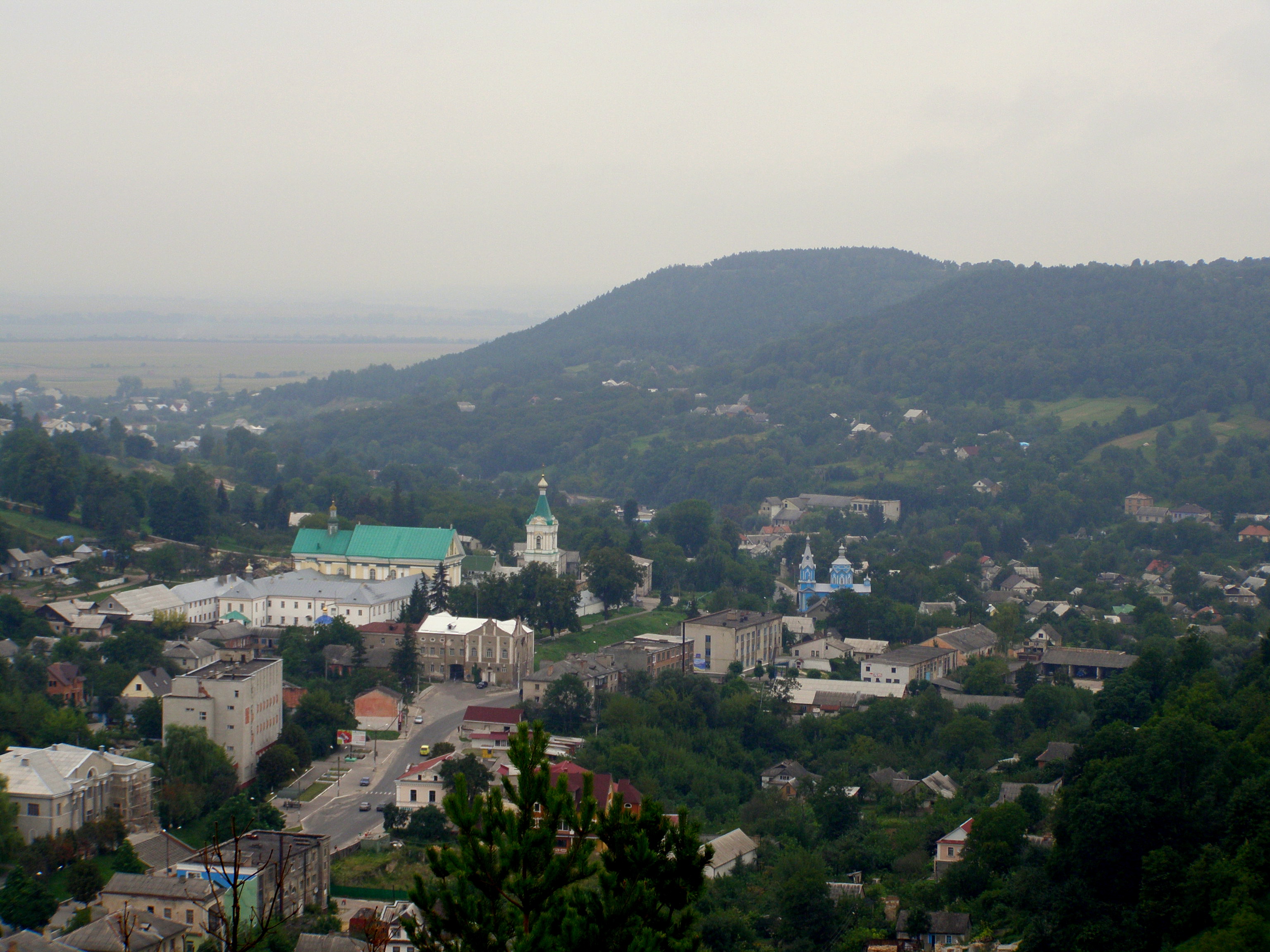
Shybalyn (, , , ) is a large village of 1359 people in Ternopil Raion of Ternopil Oblast, Ukraine. It belongs to Berezhany urban hromada, one of the hromadas of Ukraine. Shybalyn is a major village 10 km east of Berezhany on the Berezhany-Kozova-Ternopil highway. Until 18 July 2020, Shybalyn belonged to Berezhany Raion and was the second largest village in the raion (behind Naraiv). The raion was abolished in July 2020 as part of the administrative reform of Ukraine, which reduced the number of raions of Ternopil Oblast to three. The area of Berezhany Raion was merged into Ternopil Raion. It is one of the oldest villages in the area. The name comes from the Ukrainian/Polish word "shyba," window-glass. The first historic mention of the village dates to 1451. Shybalyn lays within the historic region of Halychyna, in the western part of Podillya Upland. Shybalyn is situated along the deep valley of river Tsenivka (tributary of Zolota Lypa) with high hills on both sides. The ... [...More Info...] [...Related Items...] OR: [Wikipedia] [Google] [Baidu] |
Berezhany Urban Hromada
Berezhany urban hromada () is a hromada of Ukraine, in Ternopil Raion of Ternopil Oblast. Its administrative center is Berezhany. It has a population of Until 18 July 2020, the hromada belonged to the City of regional significance (Ukraine), city of oblast significance of Berezhany. As part of the administrative reform of Ukraine, which reduced the number of raions of Ternopil Oblast to three, the city was merged into Ternopil Raion. Settlements In addition to the city of Berezhany, the hromada includes 20 villages: Head *Rostyslav Bortnyk — the mayor of Berezhany, the head of the hromada References External links Berezhany city community Gromada.info. {{Berezhany Hromada Berezhany urban hromada, 2018 establishments in Ukraine ... [...More Info...] [...Related Items...] OR: [Wikipedia] [Google] [Baidu] |
Berezhany
Berezhany ( ; ; ; , ''Bzhezhani''/''Bzhizhani'') is a small List of cities in Ukraine, city in Ternopil Raion, Ternopil Oblast, western Ukraine. It lies about from the administrative center of the oblast, Ternopil. Berezhany hosts the administration of Berezhany urban hromada, one of the hromadas of Ukraine. Population: History The first written mention of Berezhany dates from 1374, when the village was granted by the Governor of Galicia and Lodomeria Vladislaus II of Opole, Vladislaus II to Ruthenian nobility, Ruthenian boyar Vas'ko Teptukhovych. Shortly afterwards, in the 14th century it became a part of Poland and became the property of a noble family from Buchach — members House of Buczacki, later Sieniawa. As Mikołaj Sieniawski, a notable Polish military commander and politician envisioned a seat of his family there, on March 19, 1530, King Sigismund I the Old, Sigismund I of Poland granted the village a city charter modelled on the Magdeburg Law. The document, among ... [...More Info...] [...Related Items...] OR: [Wikipedia] [Google] [Baidu] |
Berezhany Raion
Berezhany Raion () was a Raions of Ukraine, raion (district) in the westernmost corner of Ternopil Oblast (oblasts of Ukraine, province) in western Ukraine, area traditionally known as Galicia (Central Europe), Halychyna (''Galicia''). The administrative center was the city of Berezhany, some away from Ternopil and away from Lviv. Berezhany was separately incorporated as a City of regional significance (Ukraine), city of oblast significance and did not belong to the raion. The Zolota Lypa river, a tributary of the Dniester tributary crossed the district from the north to the south. The river forms a large lake north of Berezhany. The raion was abolished on 18 July 2020 as part of the administrative reform of Ukraine, which reduced the number of raions of Ternopil Oblast to three. The area of Berezhany Raion was merged into Ternopil Raion. The last estimate of the raion population was The area of the raion was . There were 54 villages and 1 town (Berezhany) in the raion. At the ... [...More Info...] [...Related Items...] OR: [Wikipedia] [Google] [Baidu] |
Flag Of Shybalyn
A flag is a piece of textile, fabric (most often rectangular) with distinctive colours and design. It is used as a symbol, a signalling device, or for decoration. The term ''flag'' is also used to refer to the graphic design employed, and flags have evolved into a general tool for rudimentary signalling and identification, especially in environments where communication is challenging (such as the Maritime flag, maritime environment, where Flag semaphore, semaphore is used). Many flags fall into groups of similar designs called flag families. The study of flags is known as "vexillology" from the Latin , meaning "flag" or "banner". National flags are patriotic symbols with widely varied interpretations that often include strong military associations because of their original and ongoing use for that purpose. Flags are also used in messaging, advertising, or for decorative purposes. Some military units are called "flags" after their use of flags. A ''flag'' (Arabic: ) is equival ... [...More Info...] [...Related Items...] OR: [Wikipedia] [Google] [Baidu] |
Ternopil Raion
Ternopil Raion () is a raion in Ternopil Oblast, western Ukraine. Its administrative center is Ternopil. It has a population of On 18 July 2020, as part of the administrative reform of Ukraine, the number of raions of Ternopil Oblast was reduced to three, and the area of Ternopil Raion was significantly expanded. Six abolished raions, Berezhany, Kozova, Pidhaitsi, Pidvolochysk, Terebovlia, and Zboriv Raions, a part of one more abolished raion, Zbarazh Raion, as well as Berezhany Municipality and the city of Ternopil, which was previously incorporated as a city of oblast significance and did not belong to the raion, were merged into Ternopil Raion. The January 2020 estimate of the raion population was Subdivisions Current After the reform in July 2020, the raion consisted of 25 hromadas: * Baikivtsi rural hromada with the administration in the selo of Baikivtsi, retained from Ternopil Raion; * Bila rural hromada with the administration in the selo of Bila, retained f ... [...More Info...] [...Related Items...] OR: [Wikipedia] [Google] [Baidu] |
Ternopil Oblast
Ternopil Oblast (), also referred to as Ternopilshchyna () or Ternopillia (), is an Oblasts of Ukraine, oblast (province) of Ukraine. Its Capital (political), administrative center is Ternopil, through which flows the Seret (river), Seret, a tributary of the Dniester. Population: One of the natural wonders of the region are its cave complexes.Tell about Ukraine. Ternopil Oblast . 24 Kanal (youtube). Although Ternopil Oblast is among the smallest regions in Ukraine, over 100 caves have been discovered there. Scientists believe these are only 20% of all possible caves in the region. The biggest cave is Optymistychna Cave. Measuring in total length, it is the longest cave in Eurasia and the list of longest caves, fifth-longest in the world. [...More Info...] [...Related Items...] OR: [Wikipedia] [Google] [Baidu] |
Hromada
In Ukraine, a hromada () is the main type of municipality and the third level Administrative divisions of Ukraine, local self-government in Ukraine. The current hromadas were established by the Cabinet of ministers of Ukraine, Government of Ukraine on 12 June 2020. A municipality is designated ''urban hromada'' if its administration is located in a city; ''settlement hromada'' if it is located in a settlement (''selyshche''), and ''rural hromada'' if it is located in a village (Village#Ukraine, ''selo'') or a ''selyshche''. Hromadas are grouped to form Raions of Ukraine, raions (districts); groups of raions form Oblasts of Ukraine, oblasts (regions). Optionally, a municipality may be divided into Starosta okruh, starosta okruhs (similar to Civil parish, civil parishes in Great Britain or Frazione, frazioni in Italy), which are the lowest level of local government in Ukraine. Similar terms exist in Poland (''gromada'') and in Belarus (''hramada''). The literal translation of th ... [...More Info...] [...Related Items...] OR: [Wikipedia] [Google] [Baidu] |
Naraiv
Naraiv, also Narayiv, Narajiv (; ; ; ) is a selo in Ternopil Raion of Ternopil Oblast, Ukraine. It hosts the administration of Naraiv rural hromada, one of the hromadas of Ukraine. Naraiv is within Eastern Galicia, former Austrian empire (until 1918). In the past it was a town. The first historical mention dates to 1445. Naraiv is situated along the small river of Naraivka, a tributary of Zolota Lypa in a picturesque natural surrounding of vast beech and hornbeam forests and fertile rolling hills (western part of Podolian Upland, ethno-geographic area of Galician Opillya). Until 18 July 2020, Naraiv belonged to Berezhany Raion. The raion was abolished in July 2020 as part of the administrative reform of Ukraine, which reduced the number of raions of Ternopil Oblast to three. The area of Berezhany Raion was merged into Ternopil Raion. Naraiv was the largest rural locality (of 1,799 people) in the raion. Naraiv lies on the road between Berezhany and Peremyshlyany, right in t ... [...More Info...] [...Related Items...] OR: [Wikipedia] [Google] [Baidu] |
Halychyna
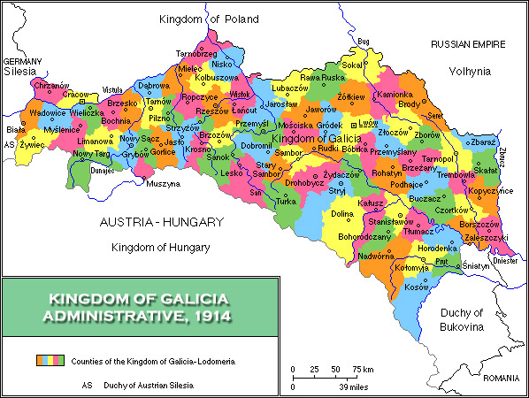
Galicia ( ;"Galicia" '''' also known by the variant name Galizia; , ; , ; ; see below) is a historical and geographic region spanning what is now southeastern and western , ... [...More Info...] [...Related Items...] OR: [Wikipedia] [Google] [Baidu] |
Podillya Upland
The Podolian Upland (Podolian Plateau) or Podillia Upland (, ''Podilska vysochyna'') is a highland area in southwestern Ukraine, on the left (northeast) bank of the Dniester River, with small portions in its western extent stretching into eastern Poland. The region lies roughly between the Southern Bug and Dniester Rivers, with the Western Bug also originating in the northwest of the highlands. The average altitude of the Podolian Upland is over with the maximum being a hill known as Kamula Mountain, at . The surface is characterized by a combination of wide flat interfluves and deep canyon-like valleys (so called dales) dissected into separate natural sub-regions: *Wooded elevated hills ** Roztochia ** Opillia ** Holohory ** Voronyaky ** Kremenets Hills (Mountains) ** *Flat treeless plateaus ** Ternopil Plateau ** Upper Bug Plateau ** North-Podolian Plateau The Podolian Upland and the Volhynian Upland are sometimes grouped together as the Volhynian-Podolian Upland. Gall ... [...More Info...] [...Related Items...] OR: [Wikipedia] [Google] [Baidu] |
Zolota Lypa
Zolota Lypa (, ) is a river in Western Ukraine. It flows through the Ternopil Raion, Ternopil and Chortkiv Raions, forming the Berezhany Lake north of the city of Berezhany. It is a left tributary of Dniester, belonging to the Black Sea basin.The name means "golden Tilia, linden tree" and has the same meaning in all Slavic languages. The river with the opposite meaning Hnyla Lypa ("rotten linden tree) flows parallel 30 km west from Berezhany. External links Zolota Lypa River in the Internet Encyclopedia of Ukraine, vol. 5 (1993) Rivers of Lviv Oblast Rivers of Ternopil Oblast {{Chortkiv-geo-stub ... [...More Info...] [...Related Items...] OR: [Wikipedia] [Google] [Baidu] |


