|
Shibuya-ku
is a special ward in Tokyo, Japan. A major commercial center, Shibuya houses one of the busiest railway stations in the world, Shibuya Station. As of January 1, 2024, Shibuya Ward has an estimated population of 230,609 in 142,443 households and a population density of . The total area is . Notable neighborhoods and districts of Shibuya include Harajuku, Ebisu, Omotesandō, Yoyogi and Sendagaya. Shibuya came into the possession of the Shibuya clan in the early 1160s, after which the area was named. The branch of the clan that ruled this area was defeated by the Later Hōjō clan on January 13, 1524, during the Sengoku period, and the area then came under their control. During the Edo period, Shibuya, particularly Maruyamachō on Dōgenzaka, prospered as a town on Oyama Road (present-day Route 246), and in the Meiji era, as a Hanamachi. Shibuya emerged as a railway terminus during the expansion of the railway network beginning in the 19th century, and was incorporated as a ... [...More Info...] [...Related Items...] OR: [Wikipedia] [Google] [Baidu] |
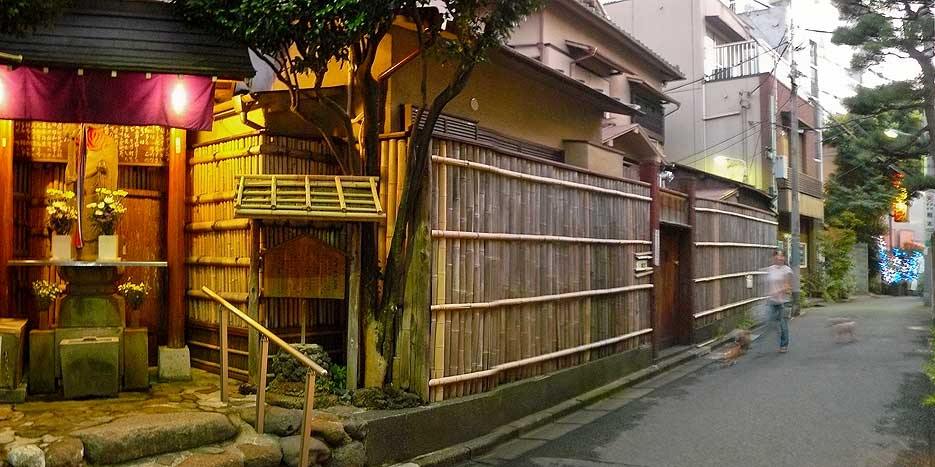
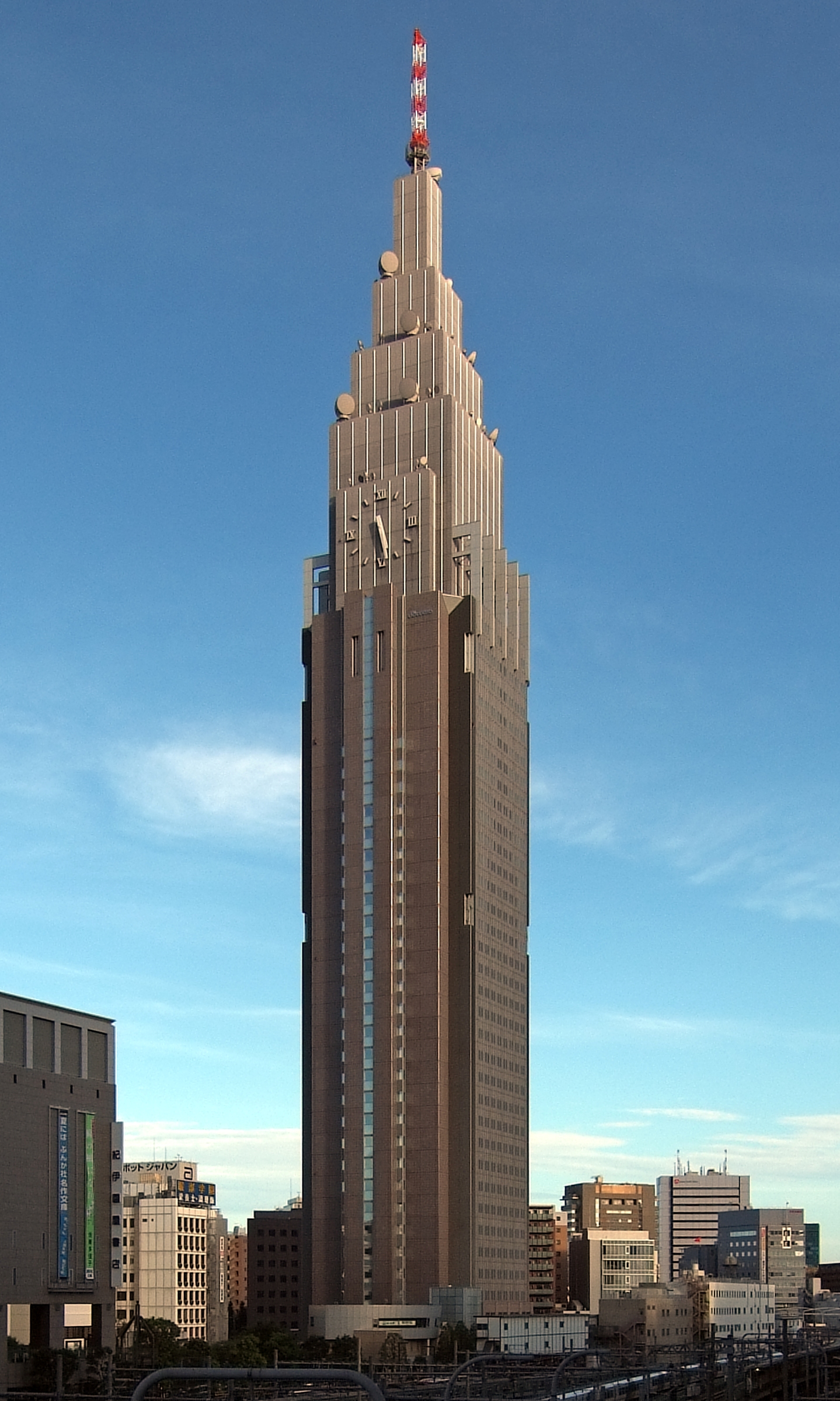
Yoyogi
is a neighbourhood in the northern part of Shibuya, Tokyo, Japan. Geography The area encompassed by Yoyogi is typically defined two ways: * Only the five Yoyogi . * The former , corresponding roughly to the area south of Japan National Route 20, National Route 20 (Kōshū-kaidō), east of Tokyo Route 420, north of the districts of Uehara and Tomigaya, and west of Meiji Shrine. This larger definition of Yoyogi is generally used by residents and government to deliver services such as police, fire, and postal delivery. Characteristics Yoyogi is composed of ten districts. * : Home of the ''juku'' chain Yoyogi Seminar as well as other college preparatory schools and technical institutions. There are also several businesses catering to those who use Yoyogi Station. * : The Nishi-Shinjuku skyscraper district is directly north of this area. There are numerous offices and shops due to the proximity to the south exit of Shinjuku Station. * : This area was once called Yamaya-chō (山� ... [...More Info...] [...Related Items...] OR: [Wikipedia] [Google] [Baidu] |
Ebisu, Shibuya
is the southernmost part of Shibuya ward in Tokyo, Japan, and a major district of the ward. It was developed on the site of a Yebisu, former brewery, which it is named after, and is home to Yebisu Garden Place. It has a high concentration of bars and restaurants. Geography and transportation Ebisu is a major district and neighborhood of the Special wards of Tokyo#List of special wards, special ward of Shibuya. It is the southernmost part of Shibuya, north of Meguro ward. Ebisu is accessed by the JR Yamanote Line and Tokyo Metro Hibiya Line via Ebisu Station (Tokyo), Ebisu Station. History Ebisu was founded around 1928 as a community developed around the Japan Beer Brewery Company (now Sapporo Brewery, Sapporo Breweries Limited) facilities which began brewing Sapporo Brewery#Brands, Yebisu Beer in 1890. After the breweries were moved to Chiba Prefecture, Chiba in 1988, the area underwent a List of development projects in Tokyo, major urban development resulting in the co ... [...More Info...] [...Related Items...] OR: [Wikipedia] [Google] [Baidu] |
Japan National Route 246
is a major highway on the island of Honshū in Japan. It originates in Chiyoda, Tokyo and terminates in Numazu, Shizuoka. In and near Tokyo, it parallels the routes of the Dai-ichi Keihin, Dai-ni Keihin, and Tōmei Expressways, the Tōkyū Den-en-toshi Line, Odakyu Odawara Line, Gotemba Line, and other transportation systems. Along its course, National Route 246 passes from Chiyoda through Minato, Shibuya, Meguro, Setagaya in Tokyo (called or in part of this section), and into Kanagawa Prefecture, entering Kawasaki ( Takatsu and Miyamae), Yokohama ( Tsuzuki, Aoba and Midori), Machida (Tokyo), Yamato, Atsugi, Isehara, Matsuda and Yamakita (called or in part of this section). In Shizuoka Prefecture, it passes through Susono, Oyama, and Nagaizumi en route to its terminus in Numazu. Part of the route – running through Shibuya is a Special wards of Tokyo, special ward in Tokyo, Japan. A major commercial center, Shibuya houses one of the busiest railw ... [...More Info...] [...Related Items...] OR: [Wikipedia] [Google] [Baidu] |
Tokyo
Tokyo, officially the Tokyo Metropolis, is the capital of Japan, capital and List of cities in Japan, most populous city in Japan. With a population of over 14 million in the city proper in 2023, it is List of largest cities, one of the most populous urban areas in the world. The Greater Tokyo Area, which includes Tokyo and parts of six neighboring Prefectures of Japan, prefectures, is the most populous metropolitan area in the world, with 41 million residents . Lying at the head of Tokyo Bay, Tokyo is part of the Kantō region, on the central coast of Honshu, Japan's largest island. It is Japan's economic center and the seat of the Government of Japan, Japanese government and the Emperor of Japan. The Tokyo Metropolitan Government administers Tokyo's central Special wards of Tokyo, 23 special wards, which formerly made up Tokyo City; various commuter towns and suburbs in Western Tokyo, its western area; and two outlying island chains, the Tokyo Islands. Although most of the w ... [...More Info...] [...Related Items...] OR: [Wikipedia] [Google] [Baidu] |
Special Wards Of Tokyo
The of Tokyo are a special form of Municipalities of Japan, municipalities in Japan under the 1947 Local Autonomy Act, Local Autonomy Law. They are city-level wards: primary subdivisions of a prefecture with municipal autonomy largely comparable to other forms of municipalities. With a land area of , it is about three-quarters the size of Singapore. As of 2024, it has a population of almost 10 million, with a density of about . Although the autonomy law today allows for special wards to be established in other prefectures, to date they exist only in Tokyo, which consists of 23 special wards and 39 other, ordinary municipalities (cities of Japan, cities, list of towns in Japan, towns, and list of villages in Japan, villages). The special wards of Tokyo occupy the land that was once the core Tokyo City in its 1936 borders before it was abolished under the Tōjō Cabinet in 1943 to become directly ruled by the Tokyo Metropolitan Government, prefectural government, then renamed to " ... [...More Info...] [...Related Items...] OR: [Wikipedia] [Google] [Baidu] |
Sendagaya
is an area within Shibuya ward, one of the 23 special wards of Tokyo. Introduction Sendagaya is nestled in an urban green area in Shibuya ward between Shinjuku ward and Shinjuku Gyo-en (Shinjuku Imperial Gardens) to the north (an area in Sendagaya, 6-chōme, is actually located within the gardens). The National Stadium, also known as Olympic Stadium, Tokyo is located immediately to the east, bordering Sendagaya 2-chome. Meiji Shrine and Yoyogi Station are found to the west. Jingumae and Harajuku are directly south. Many important cultural and sporting venues are located in and around Sendagaya. Sendagaya is a mix of old, new, and incredibly futuristic designs. From Sendagaya Station, the main station in Sendagaya, bustling Shinjuku is a tranquil 10-minute walk away along the Imperial Gardens' western wall. Sendagaya Entrance to the gardens is 2 minutes away from Sendagaya Station. Sendagaya, particularly 3-chōme, is home to dozens of clothing and accessory design wor ... [...More Info...] [...Related Items...] OR: [Wikipedia] [Google] [Baidu] |
Later Hōjō Clan
The was one of the most powerful samurai families in Japan in the Sengoku period and held domains primarily in the Kantō region. Their last name was simply , but were called "Later Hōjō" to differentiate between the earlier Hōjō clan who had the same name and '' mon'', even though it was not their official family name. History The history of the family is written in the ''Hōjō Godaiki''. The clan is traditionally reckoned to be started by Ise Shinkurō, who came from a branch of the prestigious Ise clan, descendants of Taira no Toshitsugu, a family in the direct service of the Ashikaga shoguns, as close advisors and '' Shugo'' (Governor) of Yamashiro Province (Ise Sadamichi since 1493). During the Imagawa clan succession crisis in 1476, Shinkurō whose sister was married to Imagawa Yoshitada, Shugo (Governor) of Suruga Province, became associated with the Imagawa clan. At the death of Yoshitada in battle, Shinkurō went down to Suruga Province to support his nephew ... [...More Info...] [...Related Items...] OR: [Wikipedia] [Google] [Baidu] |
Sengoku Period
The was the period in History of Japan, Japanese history in which civil wars and social upheavals took place almost continuously in the 15th and 16th centuries. The Kyōtoku incident (1454), Ōnin War (1467), or (1493) are generally chosen as the period's start date, but there are many competing historiographies for its end date, ranging from 1568, the date of Oda Nobunaga#Ise campaign, Omi campaign, and march to Kyoto, Oda Nobunaga's march on Kyoto, to the suppression of the Shimabara Rebellion in 1638, deep into what was traditionally considered the Edo period. Regardless of the dates chosen, the Sengoku period overlaps substantially with the Muromachi period (1336–1573). This period was characterized by the overthrow of a superior power by a subordinate one. The Ashikaga shogunate, the ''de facto'' central government, declined and the , a local power, seized wider political influence. The people rebelled against the feudal lords in revolts known as . The period saw a break ... [...More Info...] [...Related Items...] OR: [Wikipedia] [Google] [Baidu] |
Maruyamachō, Shibuya
is a district of Shibuya, Tokyo, Japan. As of October 2020, the population of this district is 2,062. The postal code for Maruyamachō is 150–0044. The nightclub Womb, which featured in the 2006 Alejandro González Iñárritu film Babel, is located here. Geography Maruyamachō borders Shōtō in the north, Dōgenzaka is a district of Shibuya, Tokyo, Japan. As of October 2020, the population of this district is 591. The postal code for Dōgenzaka is 150–0043. Local landmarks here include Shibuya 109, Bunkamura and the Statue of Hachikō. Geography Dō ... to the east, Nanpeidaichō to the south, and Shinsenchō to the west. Education operates public elementary and junior high schools. All of Maruyamacho is zoned to Jinnan Elementary School ( 神南小学校), and Shoto Junior High School ( 松濤中学校). - Has junior high school zoning References Neighborhoods of Tokyo Shibuya {{Tokyo-geo-stub ... [...More Info...] [...Related Items...] OR: [Wikipedia] [Google] [Baidu] |
Edo Period
The , also known as the , is the period between 1600 or 1603 and 1868 in the history of Japan, when the country was under the rule of the Tokugawa shogunate and some 300 regional ''daimyo'', or feudal lords. Emerging from the chaos of the Sengoku period, the Edo period was characterized by prolonged peace and stability, urbanization and economic growth, strict social order, Isolationism, isolationist foreign policies, and popular enjoyment of Japanese art, arts and Culture of Japan, culture. In 1600, Tokugawa Ieyasu prevailed at the Battle of Sekigahara and established hegemony over most of Japan, and in 1603 was given the title ''shogun'' by Emperor Go-Yōzei. Ieyasu resigned two years later in favor of his son Tokugawa Hidetada, Hidetada, but maintained power, and defeated the primary rival to his authority, Toyotomi Hideyori, at the Siege of Osaka in 1615 before his death the next year. Peace generally prevailed from this point on, making samurai largely redundant. Tokugawa sh ... [...More Info...] [...Related Items...] OR: [Wikipedia] [Google] [Baidu] |
Dōgenzaka
is a district of Shibuya, Tokyo, Japan. As of October 2020, the population of this district is 591. The postal code for Dōgenzaka is 150–0043. Local landmarks here include Shibuya 109, Bunkamura and the Statue of Hachikō. Geography Dōgenzaka borders Udagawachō in the north, Sakuragaokachō to the south, and Nanpeidaichō to the west. Education operates public elementary and junior high schools. All of Dogenzaka (1 and 2-chome The Japanese addressing system is used to identify a specific location in Japan. When written in Japanese characters, addresses start with the largest geographical entity and proceed to the most specific one. The Japanese system is complex, th ...) is zoned to Jinnan Elementary School ( 神南小学校), and Shoto Junior High School ( 松濤中学校). - Has junior high school zoning References {{Authority control Neighborhoods of Tokyo Shibuya ... [...More Info...] [...Related Items...] OR: [Wikipedia] [Google] [Baidu] |


