|
Sevinç, Odunpazarı
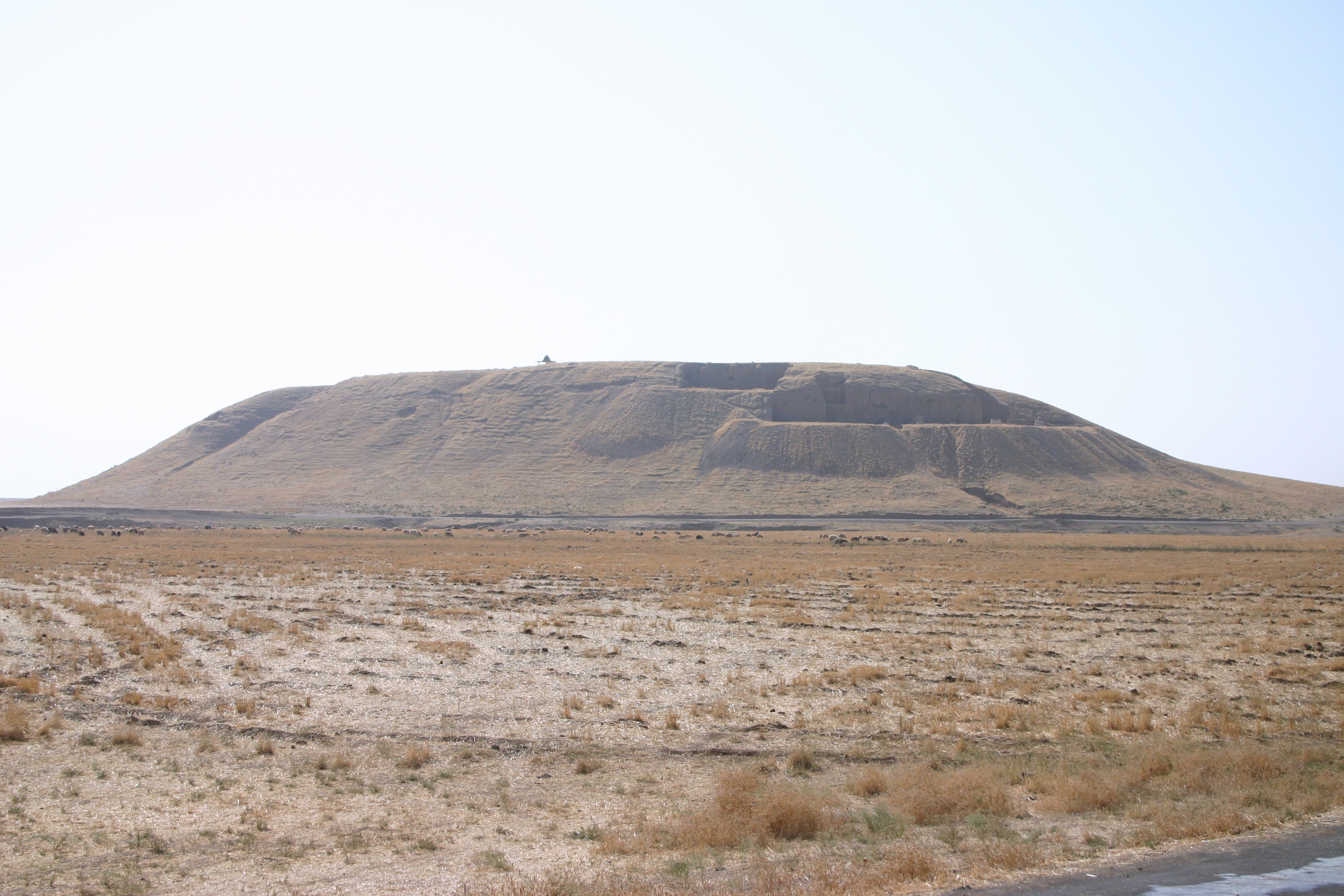
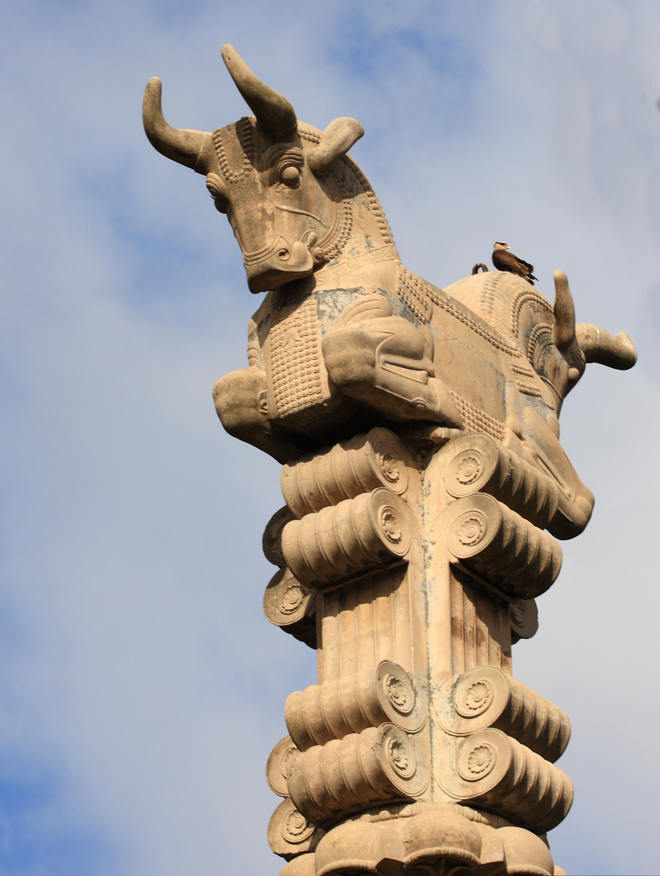
Sevinç is a mahalle of the municipality and district of Odunpazarı, Eskişehir Province, Turkey. As of 2022, its population is 1,197. Sevinç is located about 15 km east of Eskişehir Eskişehir ( , ; from 'old' and 'city') is a city in northwestern Turkey and the capital of the Eskişehir Province. The urban population of the city is 821 315 (Odunpazari + Tebebasi), with a metropolitan population of 921 630. The city is l ..., on the south side of the Porsuk Çayı. There is an archaeological tell immediately above the village, and the remains of two column capitals that probably date from the early Byzantine period have been found in Sevinç. References Neighbourhoods in Odunpazarı District {{Kütahya-geo-stub ... [...More Info...] [...Related Items...] OR: [Wikipedia] [Google] [Baidu] |
Mahalle
is an Arabic word variously translated as district, quarter, ward, or neighborhood in many parts of the Arab world, the Balkans, Western Asia, the Indian subcontinent, and nearby nations. History Historically, mahallas were autonomous social institutions built around familial ties and Islamic rituals. Today it is popularly recognised also by non-Muslims as a neighbourhood in large cities and towns. Mahallas lie at the intersection of private family life and the public sphere. Important community-level management functions are performed through mahalle solidarity, such as religious ceremonies, life-cycle rituals, resource management and conflict resolution. It is an official administrative unit in many Middle Eastern countries. The word was brought to the Balkans through Ottoman Turkish ''mahalle'', but it originates in Arabic محلة (''mähallä''), from the root meaning "to settle", "to occupy". In September 2017, a Turkish-based association referred to the historical mahalle ... [...More Info...] [...Related Items...] OR: [Wikipedia] [Google] [Baidu] |
Odunpazarı
Odunpazarı (literally "firewood market" in Turkish language, Turkish) is a municipality and Districts of Turkey, district of Eskişehir Province, Turkey. Its area is 1,120 km², and its population is 422,423 (2022), 47% of the provincial population. Odunpazarı District covers the southern part of Greater Eskişehir, including the historic center, and the adjacent countryside. In 2008 the district Odunpazarı was created from part of the former central district of Eskişehir, along with the district Tepebaşı, Eskişehir, Tepebaşı. At the 2013 Turkish local government reorganisation, the rural part of the district was integrated into the municipality, the villages becoming neighbourhoods. Historic buildings *Alaeddin Mosque (Eskişehir), Alaeddin Mosque *Kurşunlu Mosque and Complex Museums in Odunpazarı *Eskişehir Meerschaum Museum *Museum of Independence, Eskişehir *Museum of Modern Glass Art, Eskişehir *Tayfun Talipoğlu Typewriter Museum *Yılmaz Büyükerşen Wax ... [...More Info...] [...Related Items...] OR: [Wikipedia] [Google] [Baidu] |
Eskişehir Province
Eskişehir Province () is a Provinces of Turkey, province and Metropolitan municipalities in Turkey, metropolitan municipality in northwestern Turkey. Its area is 13,960 km2, and its population is 906,617 (2022). Its adjacent provinces are Bilecik Province, Bilecik to the northwest, Kütahya Province, Kütahya to the west, Afyon Province, Afyon to the southwest, Konya Province, Konya to the south, Ankara Province, Ankara to the east, and Bolu Province, Bolu to the north. The provincial capital is Eskişehir. Most of the province is laid down in Central Anatolia Region. Northern parts of Mihalıççık district and ones of Mihalgazi and Sarıcakaya are located in the Black Sea Region, Turkey, Black Sea Region and one of them belong to the Aegean Region. Eskişehir is an old and culturally developed province of Turkey. Eskişehir has 3 universities, Eskişehir Osmangazi University, Eskişehir Technical University and Anadolu University, which is the largest university in Turkey ... [...More Info...] [...Related Items...] OR: [Wikipedia] [Google] [Baidu] |
Turkey
Turkey, officially the Republic of Türkiye, is a country mainly located in Anatolia in West Asia, with a relatively small part called East Thrace in Southeast Europe. It borders the Black Sea to the north; Georgia (country), Georgia, Armenia, Azerbaijan, and Iran to the east; Iraq, Syria, and the Mediterranean Sea to the south; and the Aegean Sea, Greece, and Bulgaria to the west. Turkey is home to over 85 million people; most are ethnic Turkish people, Turks, while ethnic Kurds in Turkey, Kurds are the Minorities in Turkey, largest ethnic minority. Officially Secularism in Turkey, a secular state, Turkey has Islam in Turkey, a Muslim-majority population. Ankara is Turkey's capital and second-largest city. Istanbul is its largest city and economic center. Other major cities include İzmir, Bursa, and Antalya. First inhabited by modern humans during the Late Paleolithic, present-day Turkey was home to List of ancient peoples of Anatolia, various ancient peoples. The Hattians ... [...More Info...] [...Related Items...] OR: [Wikipedia] [Google] [Baidu] |
TÜİK
Turkish Statistical Institute (commonly known as TurkStat; or TÜİK) is the Turkish government agency commissioned with producing official statistics on Turkey, its population, resources, economy, society, and culture. It was founded in 1926 and headquartered in Ankara. Formerly named as the State Institute of Statistics (Devlet İstatistik Enstitüsü (DİE)), the institute was renamed as the Turkish Statistical Institute on November 18, 2005. See also * List of Turkish provinces by life expectancy References External linksOfficial website of the institute National statistical services Statistical Organizations established in 1926 Organizations based in Ankara {{Sci-org-stub ... [...More Info...] [...Related Items...] OR: [Wikipedia] [Google] [Baidu] |
Eskişehir
Eskişehir ( , ; from 'old' and 'city') is a city in northwestern Turkey and the capital of the Eskişehir Province. The urban population of the city is 821 315 (Odunpazari + Tebebasi), with a metropolitan population of 921 630. The city is located on the banks of the Porsuk River, 792 m above sea level, where it overlooks the fertile Phrygian Valley. In the nearby hills one can find hot springs. The city is to the west of Ankara, to the southeast of Istanbul and to the northeast of Kütahya. It is located in the vicinity of the ancient city of Dorylaeum. Known as a college town, university town, it houses Eskişehir Technical University, Eskişehir Osmangazi University, and Anadolu University. The province covers an area of . Etymology The name can be literally translated as 'Old City' in Turkish language, Turkish. The name has been documented in Ottoman records since the late 15th century. History The city was founded by the Phrygians in at least 1000 Anno Domini, ... [...More Info...] [...Related Items...] OR: [Wikipedia] [Google] [Baidu] |
Porsuk Çayı
The Porsuk River also Kocasu-Porsuk River (), ancient Tembris, is a river in Turkey, that flows for . The city of Eskişehir is located on the banks of this river. The river is dammed by the Porsuk dam, forming large reservoirs. The Porsuk flows into the Sakarya River near the town of Polatlı, ancient Gordium Gordion ( Phrygian: ; ; or ; ) was the capital city of ancient Phrygia. It was located at the site of modern Yassıhüyük, about southwest of Ankara (capital of Turkey), in the immediate vicinity of Polatlı district. Gordion's location at .... See also * List of rivers of Turkey References * Rivers of Turkey Landforms of Eskişehir Province {{Turkey-river-stub ... [...More Info...] [...Related Items...] OR: [Wikipedia] [Google] [Baidu] |
Tell (archaeology)
In archaeology, a tell (from , ', 'mound' or 'small hill') is an artificial topographical feature, a mound consisting of the accumulated and stratified debris of a succession of consecutive settlements at the same site, the refuse of generations of people who built and inhabited them and natural sediment. Tells are most commonly associated with the ancient Near East but are also found elsewhere, such as in Southern Europe, Southern and parts of Central Europe, from Greece and Bulgaria to Hungary and Spain,, see map. and in North Africa. Within the Near East they are concentrated in less arid regions, including Upper Mesopotamia, the Southern Levant, Anatolia and Iran, which had more continuous settlement. Eurasian tells date to the Neolithic, the Chalcolithic and the Bronze and Iron Ages. In the Southern Levant the time of the tells ended with the conquest by Alexander the Great, which ushered in the Hellenistic period with its own, different settlement-building patterns. Many t ... [...More Info...] [...Related Items...] OR: [Wikipedia] [Google] [Baidu] |
Capital (architecture)
In architecture, the capital () or chapiter forms the topmost member of a column (or a pilaster). It mediates between the column and the load thrusting down upon it, broadening the area of the column's supporting surface. The capital, projecting on each side as it rises to support the abacus, joins the usually square abacus and the usually circular shaft of the column. The capital may be convex, as in the Doric order; concave, as in the inverted bell of the Corinthian order; or scrolling out, as in the Ionic order. These form the three principal types on which all capitals in the classical tradition are based. The Composite order was formalized in the 16th century following Roman Imperial examples such as the Arch of Titus in Rome. It adds Ionic volutes to Corinthian acanthus leaves. From the highly visible position it occupies in all colonnaded monumental buildings, the capital is often selected for ornamentation; and is often the clearest indicator of the architec ... [...More Info...] [...Related Items...] OR: [Wikipedia] [Google] [Baidu] |


