|
Serampore
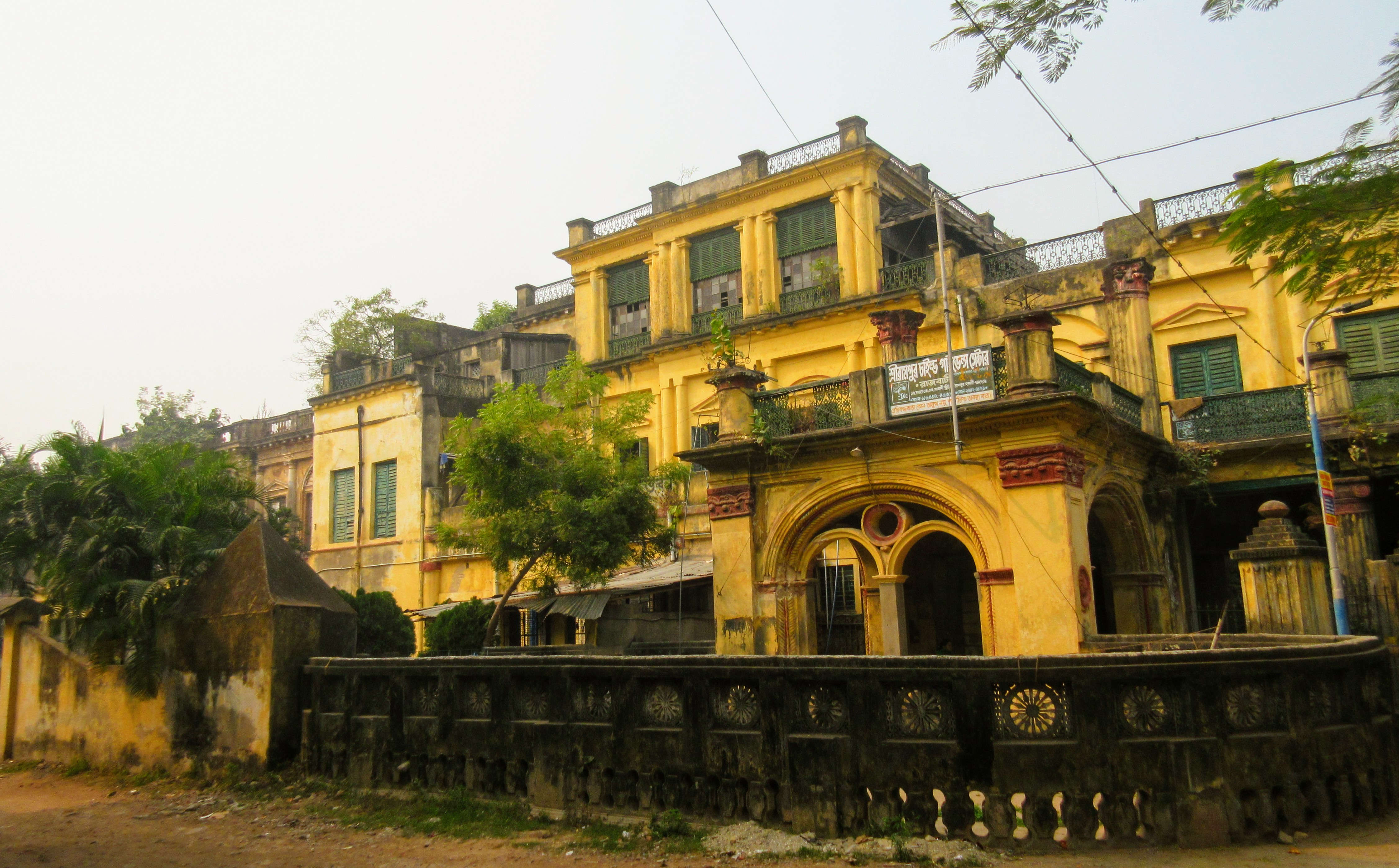
Serampore (also called Serampur, Srirampur, Srirampore, Shreerampur, Shreerampore, Shrirampur or Shrirampore) is a city in Hooghly district in the Indian state of West Bengal. It is the headquarters of the Srirampore subdivision. It is a part of the area covered by Kolkata Metropolitan Development Authority (KMDA). It is a pre-colonial city on the west bank of the Hooghly River. It was part of Danish India under the name Frederiknagore from 1755 to 1845. Geography Location Serampore is located at . The area consists of flat alluvium, alluvial plains, that form a part of the Gangetic Delta. This belt is highly industrialised. Police stations Serampore police station has jurisdiction over Serampore and Baidyabati Municipal areas, and parts of Sreerampur Uttarpara CD Block. Serampore Women police station has been set up. Urbanisation Srirampore subdivision is the most urbanized of the subdivisions in Hooghly district. 73.13% of the population in the subdivision is urban and ... [...More Info...] [...Related Items...] OR: [Wikipedia] [Google] [Baidu] |
Srirampore Subdivision
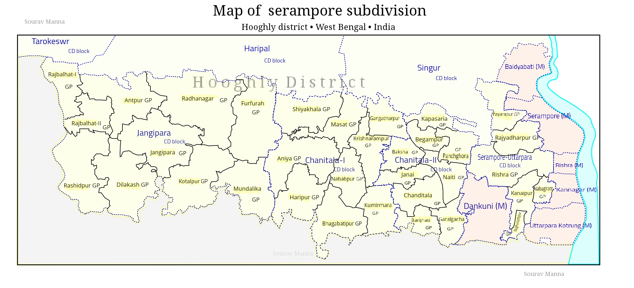
Srirampore subdivision is an administrative subdivision of the Hooghly district in the state of West Bengal, India. Overview Srirampore subdivision is the most urbanised, with the highest density of population, of all the subdivisions of Hooghly district. Urbanisation started with industrialisation of the Hooghly Flats, the narrow strip of land along the Hooghly River, Hooghly and spread inland covering a large portion of Hooghly-Damodar Plain, the agriculturally rich alluvium, alluvial plains lying between the Hooghly and the Damodar River, Damodar. The entire area is a part of the Ganges Delta, Gangetic Delta. The Hooghly is a tidal river and has a high west bank. The spread of urbanisation obviously affected the livelihood of the people, with a high proportion of workers being engaged in non-agricultural pursuits. Subdivisions The Hooghly district is divided into the following administrative subdivisions: Administrative units file:Subdivision of Hooghly District.jpg, 40 ... [...More Info...] [...Related Items...] OR: [Wikipedia] [Google] [Baidu] |
Serampore Municipality
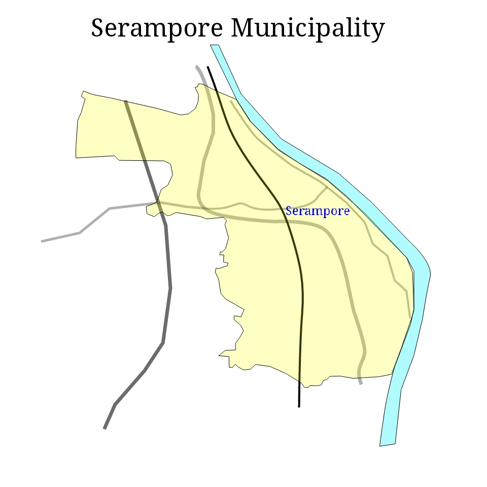
Serampore Municipality is the civic body that governs Serampore and its surrounding areas ( Mahesh, Tin Bazar, Battala and partly Chatra) in Srirampore subdivision of Hooghly district, West Bengal, India. History Serampore is the first town in Bengal to voluntarily adopt the Municipal Act of 1850 Sec XX16. It is not clear when Serampore Municipality was established. Serampore is a pre-colonial town on the west bank of the Hooghly. It was part of Danish India, when it was called Fredericksnagore, from 1755 to 1845. Geography Serampore Municipality covers an area of 17.60 km2 and has a total population of 183,339 (2011). In 1981, 29.44% of the total population formed main workers and 70.56% were non-workers in Serampore Municipality and 54.25% of the total main workers were industrial workers. This may be interpreted as follows: although industrial activities are prominent in the municipal areas of the region, the major portion of the population is commuters and migrants ... [...More Info...] [...Related Items...] OR: [Wikipedia] [Google] [Baidu] |
Disruptive Editing
Disruption, disruptive, or disrupted may refer to: Business *Creative disruption, disruption concept in a creative context, introduced in 1992 by TBWA's chairman Jean-Marie Dru *Disruptive innovation, Clayton Christensen's theory of industry disruption by new technology or products Psychology and sociology *Disruptive behavior disorders, a class of mental health disorders *Disruptive physician, a physician whose obnoxious behaviour upsets patients or other staff *Social disruption, a radical alteration, transformation, dysfunction or breakdown of social life Arts and Entertainment *''The Disruption'', a 1996 EP by Cursive discography#EPs, Cursive *The Disruption (Succession), "The Disruption" (''Succession''), TV episode Other uses *Cell disruption is a method or process in cell biology for releasing biological molecules from inside a cell *''Disrupted: My Misadventure in the Start Up Bubble'', a 2016 book by Daniel Lyons *Disruption (adoption) is also the term for the cancellat ... [...More Info...] [...Related Items...] OR: [Wikipedia] [Google] [Baidu] |
Literacy Rate
Literacy is the ability to read and write, while illiteracy refers to an inability to read and write. Some researchers suggest that the study of "literacy" as a concept can be divided into two periods: the period before 1950, when literacy was understood solely as alphabetical literacy (word and letter recognition); and the period after 1950, when literacy slowly began to be considered as a wider concept and process, including the social and cultural aspects of reading, writing, and functional literacy. Definition The range of definitions of literacy used by Non-governmental organization, NGOs, think tanks, and advocacy groups since the 1990s suggests that this shift in understanding from "discrete skill" to "social practice" is both ongoing and uneven. Some definitions remain fairly closely aligned with the traditional "ability to read and write" connotation, whereas others take a broader view: * The 2003 National Assessment of Adult Literacy (USA) included "quantitativ ... [...More Info...] [...Related Items...] OR: [Wikipedia] [Google] [Baidu] |
Baidyabati
Baidyabati is a city and a municipality of Hooghly district in the State of West Bengal in India. It is under Serampore police station of Srirampore subdivision. It is a part of the area covered by Kolkata Metropolitan Development Authority (KMDA). Geography Location Baidyabati is located at . Demographics As per 2011 Census of India, Baidyabati had a total population of 121,110 of which 62,885 (52%) were males and 58,625 (48%) were females. The population below 6 years was 9,017. The total number of literates in Baidyabati was 98,928 (88.26% of the population over 6 years). Languages India census, Baidyabati had a population of 108,231. Males constitute 52% of the population and females 48%. Baidyabati has an average literacy rate of 79%, higher than the national average of 59.5%; with 54% of the males and 46% of females literate. 8% of the population is under 6 years of age. Kolkata Urban Agglomeration The following Municipalities and Census Towns in Hooghly district wer ... [...More Info...] [...Related Items...] OR: [Wikipedia] [Google] [Baidu] |
Danish India
Danish India () was the name given to the forts and Factory (trading post), factories of Denmark (Denmark–Norway before 1814) in the Indian subcontinent, forming part of the Danish overseas colonies. Denmark–Norway held colonial possessions in India for more than 200 years, including the town of Tharangambadi in present-day Tamil Nadu state, Serampore in present-day West Bengal, and the Nicobar Islands, currently part of India's union territory of the Andaman and Nicobar Islands. The Danish and Norwegian presence in India was of little significance to the major European powers as they presented neither a military nor a mercantile threat. Dano-Norwegian ventures in India, as elsewhere, were typically undercapitalized and never able to dominate or monopolize trade routes in the same way that British, French, and Portuguese ventures could. Despite these disadvantages, the Danish-Norway concerns managed to cling to their colonial holdings and, at times, to carve out a valuable ... [...More Info...] [...Related Items...] OR: [Wikipedia] [Google] [Baidu] |
Hooghly River
The Hooghly River (, also spelled ''Hoogli'' or ''Hugli'') is the westernmost distributary of the Ganges, situated in West Bengal, India. It is known in its upper reaches as the Bhagirathi. The Bhagirathi splits off from the main branch of the Ganges at Giria, India, Giria. A short distance west, it meets the man-made Farakka Feeder Canal, which massively increases its flow. The river then flows south to join the Jalangi River, Jalangi at Nabadwip, where it becomes the Hooghly proper. The Hooghly continues southwards, passing through the metropolis of Kolkata. Thereafter, it empties into the Bay of Bengal. Its tributaries include the Ajay River, Ajay, Damodar River, Damodar, Rupnarayan River, Rupnarayan, and Haldi River, Haldi. The Hooghly has religious significance as Hinduism, Hindus consider the river sacred. It also plays a major role in the agriculture, industry, and climate of the state. Course The vast majority of the water that flows into the Hooghly River is provided ... [...More Info...] [...Related Items...] OR: [Wikipedia] [Google] [Baidu] |
Kolkata Metropolitan Development Authority
Kolkata Metropolitan Development Authority (KMDA) is the statutory planning and development authority for the Kolkata metropolitan area in the Indian state of West Bengal West Bengal (; Bengali language, Bengali: , , abbr. WB) is a States and union territories of India, state in the East India, eastern portion of India. It is situated along the Bay of Bengal, along with a population of over 91 million inhabi .... The organisation was known as Calcutta Metropolitan Development Authority (CMDA) and retains its previous logo. KMDA is functioning under the administrative control of Department of Urban Development and Municipal Affairs of Government of West Bengal. Functions KMDA's role is multi-disciplinary: it is the agency of city planning, it sculpts new areas and townships, it develops physical infrastructure as well as provide basic services like water, drainage, waste management. KMDA is also the Technical Secretariat to Kolkata Metropolitan Planning Committee (K ... [...More Info...] [...Related Items...] OR: [Wikipedia] [Google] [Baidu] |
Indian State
India is a federal union comprising 28 states and 8 union territories, for a total of 36 subnational entities. The states and union territories are further subdivided into 800 districts and smaller administrative divisions by the respective subnational government. The states of India are self-governing administrative divisions, each having a state government. The governing powers of the states are shared between the state government and the union government. On the other hand, the union territories are directly governed by the union government. History 1876–1919 The British Raj was a very complex political entity consisting of various imperial divisions and states and territories of varying autonomy. At the time of its establishment in 1876, it was made up of 584 constituent states and the directly ruled territories of the Crown. The entire empire was divided into provinces and agencies. A province consisted of territory under the direct rule of the Empe ... [...More Info...] [...Related Items...] OR: [Wikipedia] [Google] [Baidu] |
Champdani (Vidhan Sabha Constituency)
Champdani Assembly constituency is an assembly constituency in Hooghly district in the Indian state of West Bengal. Overview As per orders of the Delimitation Commission, No. 187 Champdani Assembly constituency is composed of the following: Champdani Municipality, Baidyabati Municipality, Ward Nos. 1 & 2 and 20 to 24 of Serampore Municipality and Payarapur gram panchayat of Sreerampur-Uttarpara community development block. Champdani Assembly constituency is part of No. 27 Sreerampur (Lok Sabha constituency). Members of the Legislative Assembly Election Result 2021 In 2021 West Bengal Assembly Election All Indian Trinamool Congress candidate and Ex Chairman of Baidyabati Municipality Arindam Guin (Bubai) defeated his nearest rival Dilip Singh of Bharatiya Janta Party by 30,078 votes. 2016 In the 2016 election, Abdul Mannan of Indian National Congress (supported by Left Front) defeated his nearest rival Muzaffar Khan Trinamool Congress. He later on be ... [...More Info...] [...Related Items...] OR: [Wikipedia] [Google] [Baidu] |
Sreerampur (Vidhan Sabha Constituency)
Serampore Assembly constituency is an assembly constituency in Hooghly district in the Indian state of West Bengal. Overview As per orders of the Delimitation Commission, No. 186 Sreerampur Assembly constituency is composed of the following: Ward Nos. 3 to 19 and 25 of Serampore Municipality, Rishra Municipality, Rajyadharpur and Rishra gram panchayats of Sreerampur Uttarpara community development block. Sreerampur Assembly constituency is part of No. 27 Srerampur (Lok Sabha constituency). Members of the Legislative Assembly Election results 2021 In 2021 West Bengal Assembly Election All Indian Trinamool Congress candidate Sudipta Roy defeated his nearest rival Kabir Sankar Bose of Bharatiya Janta Party by 23433 votes 2016 In the 2016 election, Sudipto Roy of Trinamool Congress defeated his nearest rival Subhankar Sarkar of Congress. .# Swing calculated on Congress+Trinamool Congress vote percentages taken together in 2006. Intervening by ele ... [...More Info...] [...Related Items...] OR: [Wikipedia] [Google] [Baidu] |


