|
Senegalia Rugata
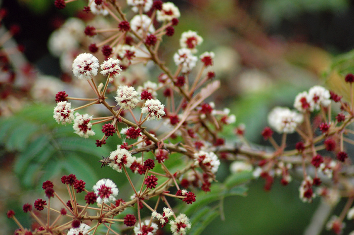
''Senegalia rugata'' is a spiny climbing shrub native to China and tropical Asia, common in the warm plains of central India, central and south India. It is renowned as a raw material for shampoo, and the leaves and young shoots are often eaten. Archaeobotanical evidence shows its use for hair care in the pre-Harrapan levels of Banawali, some 45004300 years ago. Description A woody climber, shrub, or small tree up to tall, with numerous spines. Leaves are bipinnate. Cream to pale-yellow flowers, though buds are red to purplish-red and when the flowers are open they appear cream. The seed pods are distinctive. When fresh, they are smooth, thick, and fleshy; however, when they dry, they become wrinkled, blackish, and very hard. Distribution The species is native to Asia, including China. Countries and regions to which it is native include: Papua New Guinea (Eastern New Guinea); Indonesia (Western New Guinea, West Papua, Kai Islands, Sulawesi, Lesser Sunda Islands, Nusa Tenggara ... [...More Info...] [...Related Items...] OR: [Wikipedia] [Google] [Baidu] |
Jean-Baptiste Lamarck
Jean-Baptiste Pierre Antoine de Monet, chevalier de Lamarck (1 August 1744 – 18 December 1829), often known simply as Lamarck (; ), was a French naturalist, biologist, academic, and soldier. He was an early proponent of the idea that biological evolution occurred and proceeded in accordance with Naturalism (philosophy), natural laws. Lamarck fought in the Seven Years' War against Prussia, and was awarded a commission for bravery on the battlefield. Posted to Monaco, Lamarck became interested in natural history and resolved to study medicine.#Packard, Packard (1901), p. 15. He retired from the army after being injured in 1766, and returned to his medical studies. Lamarck developed a particular interest in botany, and later, after he published the three-volume work ''Flore françoise'' (1778), he gained membership of the French Academy of Sciences in 1779. Lamarck became involved in the Jardin des Plantes and was appointed to the Chair of Botany in 1788. When the French Nationa ... [...More Info...] [...Related Items...] OR: [Wikipedia] [Google] [Baidu] |
João De Loureiro
João de Loureiro (1717, Lisbon – 18 October 1791) was a Portuguese people, Portuguese Jesuit missionary and botanist. Biography After receiving admission to the Jesuit Order, João de Loureiro served as a missionary in Goa, capital of Portuguese India (3 years) and Portuguese Macau, Macau (4 years). In 1742 he traveled to Đàng Trong (known to the Europeans as Cochinchina), remaining there for 35 years. Here he worked as a mathematician and naturalist for the king of Đàng Trong, acquiring knowledge on the properties and uses of native medicinal plants. In 1777, he journeyed to Guangzhou, Canton, in Bengal, returning to Lisbon four years later. During this period, Captain Thomas Riddel gave Loureiro the books ''Systema Naturae'', ''Genera Plantarum'' and ''Philosophia Botanica'' by Carl Linnaeus, which greatly influenced the Portuguese botanist. João de Loureiro stayed in Vietnam forty years inventorying indigenous herbal remedies. His local garden contained 1,000 unique ... [...More Info...] [...Related Items...] OR: [Wikipedia] [Google] [Baidu] |
Sulawesi
Sulawesi ( ), also known as Celebes ( ), is an island in Indonesia. One of the four Greater Sunda Islands, and the List of islands by area, world's 11th-largest island, it is situated east of Borneo, west of the Maluku Islands, and south of Mindanao and the Sulu Archipelago. Within Indonesia, only Sumatra, Borneo, and New Guinea, Papua are larger in territory, and only Java and Sumatra are more populous. The landmass of Sulawesi includes four peninsulas: the northern Minahasa Peninsula, the East Peninsula, Sulawesi, East Peninsula, the South Peninsula, Sulawesi, South Peninsula, and the Southeast Peninsula, Sulawesi, Southeast Peninsula. Three gulfs separate these peninsulas: the Gulf of Tomini between the northern Minahasa and East peninsulas, the Tolo Gulf between the East and Southeast peninsulas, and the Bone Gulf between the South and Southeast peninsulas. The Strait of Makassar runs along the western side of the island and separates the island from Borneo. Etymology The n ... [...More Info...] [...Related Items...] OR: [Wikipedia] [Google] [Baidu] |
Kai Islands
The Kai Islands (also Kei Islands) of Indonesia are a group of islands in the southeastern part of the Maluku Islands, located in the province of Maluku (province), Maluku. The Moluccas have been known as the Spice Islands due to regionally specific plants such as nutmeg, mace (spice), mace, and cloves that originally intrigued the European nations of the 16th century. The coastal zone of the islands are identified as a site of highest marine biodiversity importance in the Coral Triangle. Geography The Kai Islands are a part of the Wallacea, the group of Indonesian islands that are separated by deep water from both the Asian and Australia (continent), Australian continental shelf, continental shelves, and were never linked to either continent. As a result, the Kai Islands have few native mammals and are a part of the Banda Sea Islands moist deciduous forests ecoregion. Kai Besar in particular is mountainous and densely forested. Kai is famous for the beauty of its beaches, n ... [...More Info...] [...Related Items...] OR: [Wikipedia] [Google] [Baidu] |
Western New Guinea
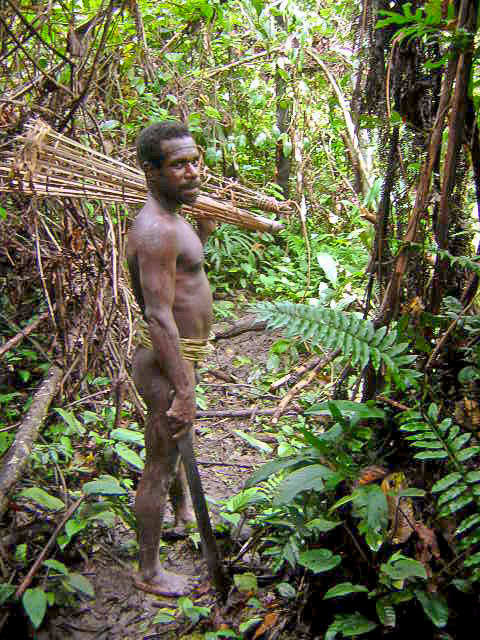
Western New Guinea, also known as Papua, Indonesian New Guinea, and Indonesian Papua, is the western half of the island of New Guinea, formerly Dutch and granted to Indonesia in 1962. Given the island is alternatively named Papua, the region is also called West Papua (). It is one of the seven geographical units of Indonesia in ISO 3166-2:ID. Lying to the west of Papua New Guinea and geographically a part of the Australian continent, the territory is almost entirely in the Southern Hemisphere and includes the Biak and Raja Ampat archipelagoes. The region is predominantly covered with rainforest where traditional peoples live, including the Dani of the Baliem Valley. A large proportion of the population live in or near coastal areas. The largest city is Jayapura. The island of New Guinea has been populated for tens of thousands of years. European traders began frequenting the region around the late 16th century due to spice trade. In the end, the Dutch Empire emerged ... [...More Info...] [...Related Items...] OR: [Wikipedia] [Google] [Baidu] |
Eastern New Guinea
Papua New Guinea, officially the Independent State of Papua New Guinea, is an island country in Oceania that comprises the eastern half of the island of New Guinea and offshore islands in Melanesia, a region of the southwestern Pacific Ocean north of Australia. It has a land border with Indonesia to the west and neighbours Australia to the south and the Solomon Islands to the east. Its capital, on its southern coast, is Port Moresby. The country is the world's third largest island country, with an area of . The nation was split in the 1880s between German New Guinea in the North and the British Territory of Papua in the South, the latter of which was ceded to Australia in 1902. All of present-day Papua New Guinea came under Australian control following World War I, with the legally distinct Territory of New Guinea being established out of the former German colony as a League of Nations mandate. The nation was the site of fierce fighting during the New Guinea campaign of World ... [...More Info...] [...Related Items...] OR: [Wikipedia] [Google] [Baidu] |
China
China, officially the People's Republic of China (PRC), is a country in East Asia. With population of China, a population exceeding 1.4 billion, it is the list of countries by population (United Nations), second-most populous country after India, representing 17.4% of the world population. China spans the equivalent of five time zones and Borders of China, borders fourteen countries by land across an area of nearly , making it the list of countries and dependencies by area, third-largest country by land area. The country is divided into 33 Province-level divisions of China, province-level divisions: 22 provinces of China, provinces, 5 autonomous regions of China, autonomous regions, 4 direct-administered municipalities of China, municipalities, and 2 semi-autonomous special administrative regions. Beijing is the country's capital, while Shanghai is List of cities in China by population, its most populous city by urban area and largest financial center. Considered one of six ... [...More Info...] [...Related Items...] OR: [Wikipedia] [Google] [Baidu] |
Banawali
Banawali is an archaeological site belonging to the Indus Valley Civilization period in Fatehabad district, Haryana, India and is located about 120 km northeast of Kalibangan and 16 km from Fatehabad. Banawali, which is earlier called Vanavali, is on the left banks of dried up Sarasvati River. Comparing to Kalibangan, which was a town established in lower middle valley of dried up Sarasvathi River, Banawali was built over upper middle valley of Sarasvati River.fatehabad.nic.in Excavation This site was excavated by R.S. Bisht (ASI) in 1974. The excavations revealed the following sequence of cultures: * Period I: Pre-Harappan (Kalibangan)(c.2500-2300 BCE) ** Period IA: Pre-defence Phase ** Period IB: Defence Phase ** Period IC: Transitional Phase (Proto-Harappan) * Period II: Mature Harappan (c.2300-1700 BCE) * Period III: Post-Harappan (Banawali-Bara)(c.1700-1500/1450 BCE) Period I (c. 2500-2300 BCE) Well-planned houses constructed out of kiln burnt and molded brick ... [...More Info...] [...Related Items...] OR: [Wikipedia] [Google] [Baidu] |
Central India
Central India refers to a geographical region of India that generally includes the states of Chhattisgarh and Madhya Pradesh. The Central Zonal Council, established by the Government of India, includes these states as well as Uttar Pradesh and Uttarakhand to the north. The inclusion of Uttarakhand extends the region to the Himalayan border with Tibet/China. Other definitions Another approach, historically more usual, is to base "Central India" on a north-south axis, making it the part of India that is south of North India and north of South India; the definition of North India also varies hugely, but that of South India is generally agreed. This definition includes either some or all of the Deccan, in particular Maharashtra, and may or may not include some of the Indo-Gangetic Plain to the north. If Maharashtra is included "Central India" includes a good part of the western coast, including Mumbai, but the eastern coast is never included, as Odisha stretches down to me ... [...More Info...] [...Related Items...] OR: [Wikipedia] [Google] [Baidu] |
Shikakai (Senegalia Rugata) Seed Pods
''Senegalia rugata'' is a spiny climbing shrub native to China and tropical Asia, common in the warm plains of central and south India. It is renowned as a raw material for shampoo, and the leaves and young shoots are often eaten. Archaeobotanical evidence shows its use for hair care in the pre-Harrapan levels of Banawali, some 45004300 years ago. Description A woody climber, shrub, or small tree up to tall, with numerous spines. Leaves are bipinnate. Cream to pale-yellow flowers, though buds are red to purplish-red and when the flowers are open they appear cream. The seed pods are distinctive. When fresh, they are smooth, thick, and fleshy; however, when they dry, they become wrinkled, blackish, and very hard. Distribution The species is native to Asia, including China. Countries and regions to which it is native include: Papua New Guinea (Eastern New Guinea); Indonesia ( West Papua, Kai Islands, Sulawesi, Nusa Tenggara, Maluku, Jawa, Sumatera); Philippines; Malaysia (Pe ... [...More Info...] [...Related Items...] OR: [Wikipedia] [Google] [Baidu] |
Francisco Manuel Blanco
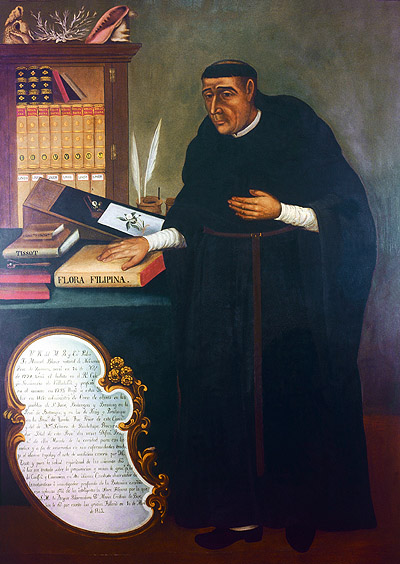
Manuel María Blanco Ramos known as Manuel Blanco (1779 – 1845) was a Spanish friar and botanist. Biography Born in Navianos de Alba, Castilla y León, Spain, Blanco was a member of the Augustinian order of friars. His first assignment was in Angat in the province of Bulacan in the Philippines. He subsequently had a variety different assignments. Towards the end of his life, he became the delegate of his order in Manila, traveling throughout the archipelago. He is the author of one of the first comprehensive flora of the Philippines, ''Flora de Filipinas. Según el sistema de Linneo'' (Flora of the Philippines according to the system of Linnaeus) which followed after the work done by Georg Joseph Kamel. The first two editions (Manila, 1837 and 1845) were unillustrated. Celestine Fernandez Villar (1838-1907), together with others including Antonio Llanos, published an illustrated posthumous edition from 1877 to 1883, printed by C. Verdaguer of Barcelona. Blanco died in Ma ... [...More Info...] [...Related Items...] OR: [Wikipedia] [Google] [Baidu] |


