|
Semboku, Akita
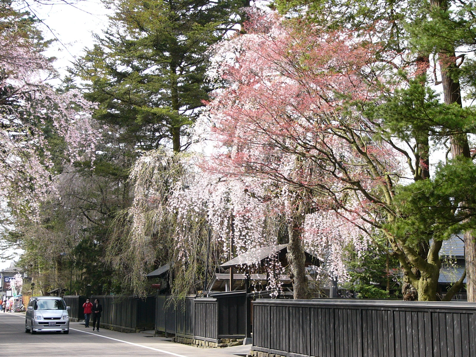
270px, Kakunodate is a city located in Akita Prefecture, Japan. , the city had an estimated population of 24,045 in 10,398 households, and a population density of 22 persons per km2. The total area of the city is . Geography Semboku is located in the mountains of east-central Akita Prefecture, bordering on Iwate Prefecture and the Ōu Mountains on the east. Lake Tazawa, the deepest lake in Japan, is located in the center of the city borders. Parts of the city are within the borders of the Towada-Hachimantai National Park. Neighboring municipalities Akita Prefecture * Akita * Daisen * Kazuno * Kitaakita Iwate Prefecture * Hachimantai * Nishiwaga * Shizukuishi Climate Semboku has a Humid continental climate (Köppen climate classification ''Dfa'') with large seasonal temperature differences, with warm to hot (and often humid) summers and cold (sometimes severely cold) winters. Precipitation is significant throughout the year, but is heaviest from August to October. The averag ... [...More Info...] [...Related Items...] OR: [Wikipedia] [Google] [Baidu] |
Cities Of Japan
A is a local Public administration, administrative unit in Japan. Cities are ranked on the same level as and , with the difference that they are not a component of . Like other contemporary administrative units, they are defined by the Local Autonomy Law of 1947. City status Article 8 of the Local Autonomy Law sets the following conditions for a municipality to be designated as a city: *Population must generally be 50,000 or greater (原則として人口5万人以上) *At least 60% of households must be established in a central urban area (中心市街地の戸数が全戸数の6割以上) *At least 60% of households must be employed in commerce, industry or other urban occupations (商工業等の都市的業態に従事する世帯人口が全人口の6割以上) *Any other conditions set by prefectural ordinance must be satisfied (他に当該都道府県の条例で定める要件を満たしていること) The designation is approved by the prefectural governor and t ... [...More Info...] [...Related Items...] OR: [Wikipedia] [Google] [Baidu] |
Ōu Mountains
The are a mountain range in the Tōhoku region of Honshū, Japan. It is the longest range in Japan and stretches south from the Natsudomari Peninsula of Aomori Prefecture to the Nasu volcanoes at the northern boundary of the Kantō region. Though long, the range is only about wide. The highest point in the range is Mount Iwate, . The range includes several widely known mountains: Hakkōda Mountains, Mount Iwate, Mount Zaō, Mount Azuma, Mount Yakeishi, and Mount Adatara. Naming These mountains previously formed the boundary between historical provinces of Mutsu (陸奥国) and Dewa (出羽国). The ''kanji'' for the name of the mountain range was created from one ''kanji'' of the two provinces, 奥 and 羽, respectively. Geology The Ōu Mountains began to form in the Pliocene. They sit over the middle of the inner arc of the Northeastern Japan Arc. This is the result of the Pacific plate subducting under the Okhotsk plate. A chain of Quaternary The Quat ... [...More Info...] [...Related Items...] OR: [Wikipedia] [Google] [Baidu] |
Dewa Province
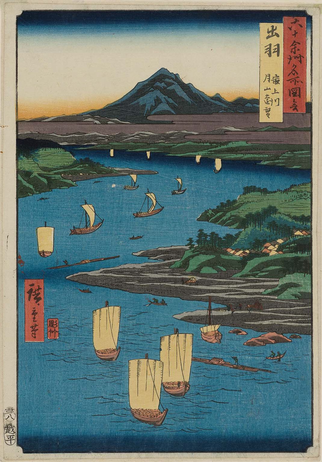
was a province of Japan comprising modern-day Yamagata Prefecture and Akita Prefecture, except for the city of Kazuno and the town of Kosaka. Dewa bordered on Mutsu and Echigō Provinces. Its abbreviated form name was . History Early period Prior to the Asuka period, Dewa was inhabited by Ainu or Emishi tribes, and was effectively outside of the control of the imperial dynasty. Abe no Hirafu conquered the native Emishi tribes at what are now the cities of Akita and Noshiro in 658 and established a fort on the Mogami River. In 708 AD was created within Echigō Province. The area of Dewa District was roughly that of the modern Shōnai area of Yamagata Prefecture, and was gradually extended to the north as the Japanese pushed back the indigenous people of northern Honshū. Dewa District was promoted to the status of a province () in 712 AD, and gained Okitama and Mogami Districts, formerly part of Mutsu Province. A number of military expeditions were sent to the area, ... [...More Info...] [...Related Items...] OR: [Wikipedia] [Google] [Baidu] |
Kakunodate, Akita
was a town located in Senboku District, Akita Prefecture, Japan. In 2003, the town had an estimated population of 14,138 and a density of 90.26 persons per km2. The total area was 156.63 km2. On September 20, 2005, Kakunodate, along with the town of Tazawako, and the village of Nishiki (all from Senboku District), was merged to create the city of Semboku. The town is famed for its well-preserved samurai houses and the proliferation of cherry trees. It is a popular destination for hanami, or cherry blossom viewing. It is sometimes referred as 'the little Kyoto of Tōhoku' (みちのくの小京都 ''Michinoku no sho-Kyōto''). There are the ruins of Kakunodate Castle, and Kakunodate Matsuri is an Important Intangible Folk Cultural Property. This city also hosts a "fire and snow" festival featuring kamakura snow domes each winter. See also *Groups of Traditional Buildings is a Japanese category of historic preservation introduced by a 1975 amendment of the law w ... [...More Info...] [...Related Items...] OR: [Wikipedia] [Google] [Baidu] |
Japan Meteorological Agency
The Japan Meteorological Agency (JMA; ''気象庁, Kishō-chō'') is a division of the Ministry of Land, Infrastructure, Transport and Tourism dedicated to the Scientific, scientific observation and research of natural phenomena. Headquartered in Minato, Tokyo the government agency, agency collects data on meteorology, hydrology, seismology, volcanology, and other related fields. The JMA is responsible for collecting and disseminating weather data and Forecasting, forecasts to the public, as well as providing specialized information for aviation and Marine weather forecasting, marine sectors. Additionally, the JMA issues warnings for volcanic eruptions and is integral to the nationwide Earthquake Early Warning (Japan), Earthquake Early Warning (EEW) system. As one of the Regional Specialized Meteorological Centers designated by the World Meteorological Organization (WMO), the JMA also Forecasting, forecasts, Tropical cyclone naming, names, and distributes warnings for tropical ... [...More Info...] [...Related Items...] OR: [Wikipedia] [Google] [Baidu] |
Tazawako, Akita
was a town located in Senboku District, Akita Prefecture, Japan. Population In 2003, the town had an estimated population of 12,471 and a density of 18.56 persons per km2. The total area was 672.06 km2. History On September 20, 2005, Tazawako, along with the town of Kakunodate, and the village of Nishiki (all from Senboku District), was merged to create the city of Semboku. Attractions Eponymous Lake Tazawa is the deepest lake in Japan at 423 meters. The town has several popular onsen. Access The area is served by Tazawako Station, which is served by the Akita Shinkansen The is a Mini-shinkansen rail line in Japan. Serving the Kantō and Tōhoku Regions of the country, it links Tokyo and Akita in Akita prefecture. From Tokyo to Morioka in Iwate prefecture, it operates on the Tōhoku Shinkansen tracks. From ... and the Tazawako Line. References External links Official Website(English) (Japanese) Dissolved municipalities of Akita Prefecture ... [...More Info...] [...Related Items...] OR: [Wikipedia] [Google] [Baidu] |
Shizukuishi, Iwate
is a Towns of Japan, town located in Iwate Prefecture, Japan. , the town had an estimated population of 16,263 in 6354 households, and a population density of 27 persons per km2. The total area of the town is . Geography Shizukuishi is located in the Ōu Mountains of west-central Iwate Prefecture, bordering Akita Prefecture to the west. Mount Iwate (2038 m), an active volcano, lies just to the north of Shizukuishi and dominates the landscape. The Ōu Mountains form the boundary to the west as well with Akita Komagatake, another active volcano, just across the border in Akita Prefecture. The downtown area is located where the Shizukuishi River, Shizukuishi and Kakkonda Rivers meet. Gosho Lake was created in 1981 with the completion of Gosho Dam. Neighboring municipalities Akita Prefecture *Semboku, Akita, Semboku Iwate Prefecture *Hachimantai, Iwate, Hachimantai *Hanamaki, Iwate, Hanamaki *Morioka, Iwate, Morioka *Nishiwaga, Iwate, Nishiwaga *Shiwa, Iwate, Shiwa *Takizawa, Iwa ... [...More Info...] [...Related Items...] OR: [Wikipedia] [Google] [Baidu] |
Nishiwaga, Iwate
is a town in Iwate Prefecture, Japan. , the town had an estimated population of 5,468 in 2279 households, and a population density of 9 persons per km². The total area of the town is . The total area was . Geography Nishiwaga is located in the far southwestern corner of Iwate Prefecture, in the river valley of the Waga River, surrounded by the 1000-meter peaks of the Ōu Mountains on three sides. The area is noted for its extremely heavy snowfall in winter. The Yuda Dam is located in Nishiwaga and the Yuda Onsenkyō Prefectural Natural Park is located completely within its borders. Neighboring municipalities Akita Prefecture * Daisen * Higashinaruse * Misato * Semboku * Yokote Iwate Prefecture * Hanamaki * Kitakami * Ōshū * Shizukuishi Climate Nishiwaga has a humid continental climate (Köppen ''Dfa'') characterized by mild summers and cold winters with heavy snowfall. The average annual temperature in Nishiwaga is 8.9 °C. The average annual rainfall is 1561 mm ... [...More Info...] [...Related Items...] OR: [Wikipedia] [Google] [Baidu] |
Hachimantai, Iwate
is a Cities of Japan, city located in Iwate Prefecture, Japan. , the city had an estimated population of 25,076, and a population density of 29 persons per km2 in 10,531 households. The total area of the city is . Geography Hachimantai is located in the Ōu Mountains of far northwest Iwate Prefecture, bordered by Aomori Prefecture to the north and Akita Prefecture to the west. The headwaters of the Yoneshiro River are in Hachimanai. Part of Mount Hachimantai and Mount Iwate are within its borders. Parts of the city are within the borders of the Towada-Hachimantai National Park. Mount Iwate, the highest mountain in Iwate Prefecture, is on the border of Hachimantai with Shizukuishi and Takizawa. Neighboring municipalities Akita Prefecture *Kazuno, Akita, Kazuno *Semboku, Akita, Semboku Aomori Prefecture *Takko, Aomori, Takko Iwate Prefecture *Ichinohe, Iwate, Ichinohe *Iwate, Iwate, Iwate *Morioka, Iwate, Morioka *Ninohe, Iwate, Ninohe *Shizukuishi, Iwate, Shizukuishi *Takizawa, I ... [...More Info...] [...Related Items...] OR: [Wikipedia] [Google] [Baidu] |
Kitaakita, Akita
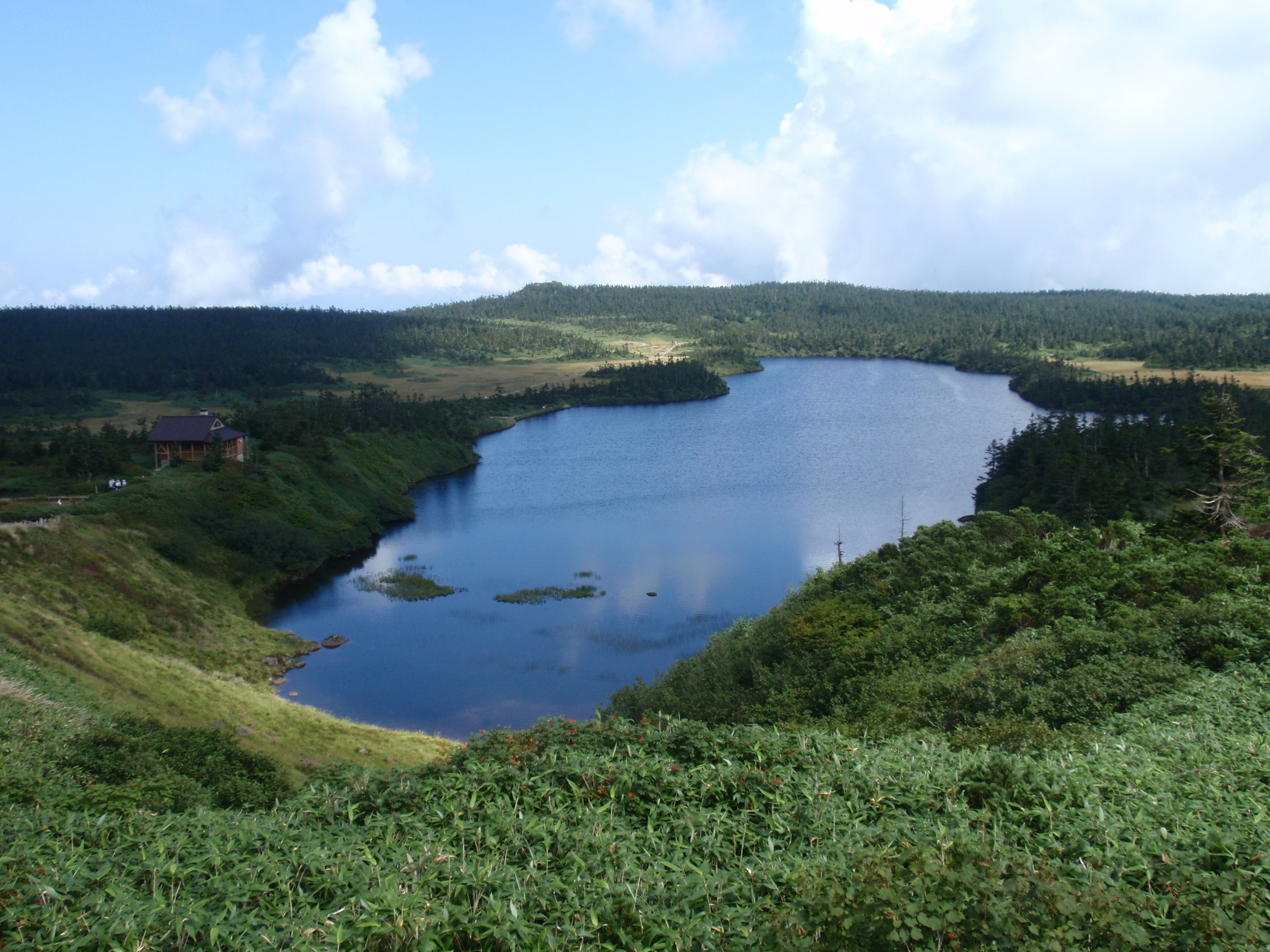
270px, Lake Shimiko is a city located in Akita Prefecture, Japan. , the city had an estimated population of 29,201, and a population density of 120 persons per km2. and a population density of 25 persons per km2. The total area of the city is . Geography Kitaakita is located in the mountains of north-central Akita Prefecture, about 80 kilometers northeast of the prefectural capital of Akita city. It accounts for about 10% of the total area of Akita Prefecture. The city is bordered by the Ōu Mountains on the east. The main urban area is centered around the Takanosu Basin in the middle reaches of the Yoneshiro River, and river basins such as the Ani River and the Koani River, which are tributaries of the Yoneshiro River. The Yoneshiro River originates from the Ōu Mountains, which form the border of the city to the east and south. Much of the city is forest and parts of the city are within the borders of the Towada-Hachimantai National Park. Due to its inland location, the ... [...More Info...] [...Related Items...] OR: [Wikipedia] [Google] [Baidu] |
Kazuno, Akita
is a cities of Japan, city located in Akita Prefecture, Japan. , the city had an estimated population of 28,329 in 12,570 households, and a population density of 40 persons per km2. The total area of the city is . Geography Kazuno is located in the far northeast corner of Akita Prefecture. The urban center is located in the Hanawa Basin, which is part of the basin of the Yoneshiro River. Outside the Hanawa Basin, it is mountainous and heavily forested, with numerous rivers and waterfalls with the Ōu Mountains and Iwate Prefecture on the east. The area has many onsen, hot springs. Much of the city is within the borders of the Towada-Hachimantai National Park, although the city does not border on Lake Towada self. Due to its inland location, the difference between the annual maximum temperature and the annual minimum temperature is very large and the city is noted for its Snow country (Japan), heavy snowfall in winter. Neighboring municipalities Akita Prefecture * Kitaakita, Aki ... [...More Info...] [...Related Items...] OR: [Wikipedia] [Google] [Baidu] |
Daisen, Akita
file:Pond in the Ikeda-shi Garden-1.jpg, 270px, Ikeda family gardens file:払田柵外柵南門.JPG, 270px, IHotta-no-saku ruins is a Cities of Japan, city in Akita Prefecture, Japan. , the city had an estimated population of 76,277 in 31,544 households, and a population density of 88 persons per km2. The total area of the city is . The city was created in 2005 by the merger of eight municipalities in the Omagari Semboku region. It is the venue for the National Fireworks Competition (Omagari Fireworks) and is known as the city of fireworks. Geography Daisen is located in the flatlands of central Akita Prefecture. The area of the city is greater than the total metropolitan area of Tokyo. Daisen is bounded by the Ōu Mountains in the east, the Dewa Mountains in the center of the prefecture in the west, the former town of Kakumagawa, Akita, Kakumagawa between the Omono River and the Yokote River in the south, and the area slightly south of the summit of Mount Oishi in the north. The ... [...More Info...] [...Related Items...] OR: [Wikipedia] [Google] [Baidu] |


