|
Seetal Alps
The Seetal Alps () are a mountain range in the Lavanttal Alps, Lavanttal or Noric Alps in Austria south of the River Mur (river), Mur between Scheifling and Zeltweg. Their highest peak is the Zirbitzkogel (2,396 m). Topography The Seetal Alps are bounded to the north by the Mur valley, to the east by the Obdach Saddle, to the south by the Klippitztörl and to the west by the Neumarkt Saddle. The majority of the range lies within the Austrian state of Styria, only from the Klippitztörl does it extend into Carinthia (state), Carinthia. The most important summits, from north to south, are: *Weißeck (1,743 m) *Brandriegel (1,721 m) *Hohe Ranach (1,981 m) *Erslstand (2,124 m) *Wenzelalpe (2,151 m) *Kreiskogel (2,306 m) with the very difficult Lukas-Max ''klettersteig'' at www.bergsteigen.com [...More Info...] [...Related Items...] OR: [Wikipedia] [Google] [Baidu] |
Styria
Styria ( ; ; ; ) is an Austrian Federal states of Austria, state in the southeast of the country. With an area of approximately , Styria is Austria's second largest state, after Lower Austria. It is bordered to the south by Slovenia, and clockwise, from the southwest, by the other Austrian states of Carinthia, Salzburg (federal state), Salzburg, Upper Austria, Lower Austria, and Burgenland. The state's capital is Graz, the second largest city in Austria after only Vienna. Name The March of Styria derived its name from the original seat of its ruling Otakars, Otakar dynasty: Steyr, in today's Upper Austria, which in turn derives its name from the namesake river of Steyr, stemming from the Celtic Stiria. In the native German the area is still called "Steiermark", while in English the Latin name "Styria" is used. Until the late 19th century however, the German name "Steyer", a slightly modernized spelling of Steyr, was also common. The ancient link between the city of Steyr and S ... [...More Info...] [...Related Items...] OR: [Wikipedia] [Google] [Baidu] |
Klettersteig
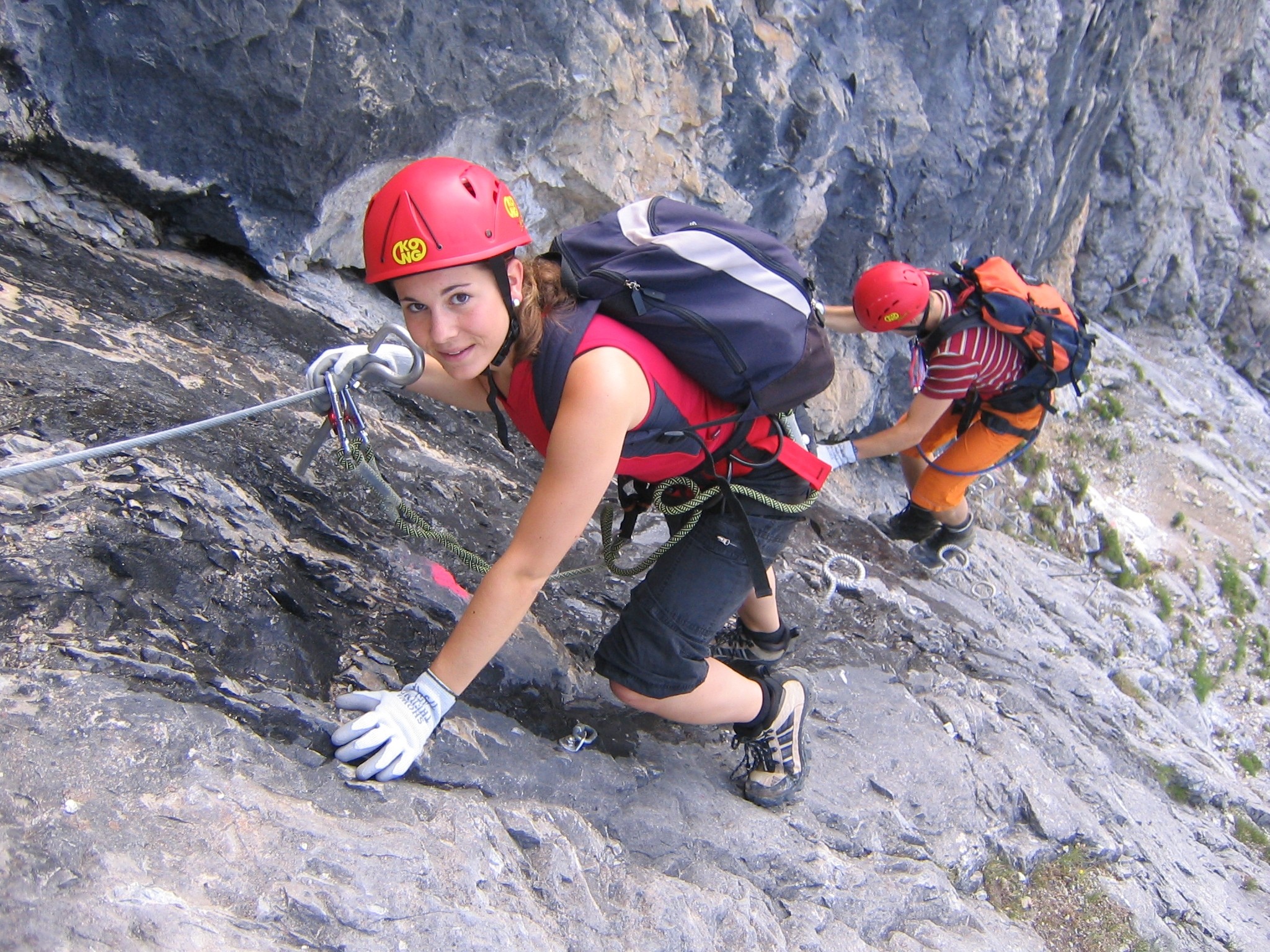
A via ferrata (Italian for "iron path", plural ''vie ferrate'' or in English ''via ferratas'') is a protected climbing route found in the Alps and certain other Alpine locations. The protection includes steel fixtures such as cables and railings to arrest the effect of any fall, which the climber can either hold onto or clip into using climbing protection. Some via ferratas can also include steel fixtures that provide aid in overcoming the obstacles encountered, including steel ladders and steel steps. Description A via ferrata is a climbing route in the mountains that employs steel cables, rungs, or ladders, fixed to the rock to which the climbers affix a harness with two leashes, which allows the climbers to secure themselves to the metal fixture and limit any fall. The cable and other fixtures, such as iron rungs (stemples), pegs, carved steps, and ladders and bridges, provide both footings and handholds, as well. This allows climbing on otherwise dangerous routes without ... [...More Info...] [...Related Items...] OR: [Wikipedia] [Google] [Baidu] |
Mountain Ranges Of Europe
Europe is traditionally defined as one of seven continents. Physiographically, it is the northwestern peninsula of the larger landmass known as Eurasia (or the larger Afro-Eurasia); Asia occupies the centre and east of this continuous landmass. Europe's eastern frontier is usually delineated by the Ural Mountains in Russia, which is the largest country by land area in the continent. The southeast boundary with Asia is not universally defined, but the modern definition is generally the Ural River or, less commonly, the Emba River. The boundary continues to the Caspian Sea, the crest of the Caucasus Mountains (or, less commonly, the river Kura in the Caucasus), and on to the Black Sea. The Bosporus, the Sea of Marmara, and the Dardanelles conclude the Asian boundary. The Mediterranean Sea to the south separates Europe from Africa. The western boundary is the Atlantic Ocean. Iceland is usually included in Europe because it is over twice as close to mainland Europe as mainland N ... [...More Info...] [...Related Items...] OR: [Wikipedia] [Google] [Baidu] |
Seetal Alps
The Seetal Alps () are a mountain range in the Lavanttal Alps, Lavanttal or Noric Alps in Austria south of the River Mur (river), Mur between Scheifling and Zeltweg. Their highest peak is the Zirbitzkogel (2,396 m). Topography The Seetal Alps are bounded to the north by the Mur valley, to the east by the Obdach Saddle, to the south by the Klippitztörl and to the west by the Neumarkt Saddle. The majority of the range lies within the Austrian state of Styria, only from the Klippitztörl does it extend into Carinthia (state), Carinthia. The most important summits, from north to south, are: *Weißeck (1,743 m) *Brandriegel (1,721 m) *Hohe Ranach (1,981 m) *Erslstand (2,124 m) *Wenzelalpe (2,151 m) *Kreiskogel (2,306 m) with the very difficult Lukas-Max ''klettersteig'' at www.bergsteigen.com [...More Info...] [...Related Items...] OR: [Wikipedia] [Google] [Baidu] |
Obdach (Gemeinde)
Obdach () is a municipality in the district of Murtal in Styria, Austria. Geography The municipality covers an area of 159.24 km² and is located in the valley of the Granitzenbach north of the Obdach Saddle the transition from the Upper Murtal to the Lavanttal. The municipal area extends from the valley to the west to the Seetal Alps with the highest peak, the Zirbitzkogel (2396 m). Neighbourhoods and outlying communities The municipal area includes the following 18 villages (Population 01-01-2021): The municipality consists of six cadastral municipalities (area as of 2015): The village is located in the judicial district of Judenburg. History Obdach was first mentioned in a document in 1190 as "Obdah". The name goes back to the Old High German ''obadah'' (protective roof). It is likely that there was a refreshment stop on the land lot for travelers on their way to Carinthia. In 1324 Obdach was elevated to a market and also had a high court. Obdach was a regiona ... [...More Info...] [...Related Items...] OR: [Wikipedia] [Google] [Baidu] |
Mühlen (Styria)
Mühlen is a municipality in the district of Murau in Styria, Austria Austria, formally the Republic of Austria, is a landlocked country in Central Europe, lying in the Eastern Alps. It is a federation of nine Federal states of Austria, states, of which the capital Vienna is the List of largest cities in Aust .... Geography Mühlen lies about 28 km southeast of Murau. References Cities and towns in Murau District {{Styria-geo-stub ... [...More Info...] [...Related Items...] OR: [Wikipedia] [Google] [Baidu] |
Judenburg
Judenburg (; ) is a historic town in Styria, Austria. It is the administrative centre of the Murtal District, Murtal district, which was created on 1 January 2012 from the former Judenburg (district), Judenburg District and former Knittelfeld District. Until 31 December 2011, it was the capital of the Judenburg District. On 1 January 2015, the adjoining municipalities of Oberweg and Reifling were merged into Judenburg. Geography It is located in the Upper Styrian region, on the western end of the Aichfeld sedimentary basin, basin, stretching along the Mur (river), Mur River from Judenburg down to Knittelfeld in the east. The broad valley is bound by the Niedere Tauern range in the north and the Noric Alps (Lavant (river), Lavanttal Alps) in the south. The municipal area also comprises the cadastral community, cadastral communities of Tiefenbach and Waltersdorf, a former municipality incorporated in 1963. The municipal area includes the following ten villages (populations as o ... [...More Info...] [...Related Items...] OR: [Wikipedia] [Google] [Baidu] |
Austrian Bundesheer
The Austrian Armed Forces () are the combined military forces of Austria. The military consists of 16,000 active-duty personnel and 125,600 reservists. The military budget is 1.0% of national GDP (including pensions) or €3.317 billion (2023,without pensions). History Interwar In 1918, the Republic of German-Austria established a military known as the ("People's Defence"). ''Volkswehr'' forces took part in military confrontations with Royal Yugoslav Army troops which occupied parts of Carinthia that Austria claimed as its own. In 1920, after the Republic of German-Austria transitioned into the First Austrian Republic, the new regime changed the military's name to the ("Federal Army"), which it has been known by ever since. In 1938, officers led by Alfred Jansa developed a military operation plan to defend against a potential invasion by Nazi Germany, which ultimately went unused due to a lack of political willpower when Austria was annexed by the Germans in ... [...More Info...] [...Related Items...] OR: [Wikipedia] [Google] [Baidu] |
Military Training Area
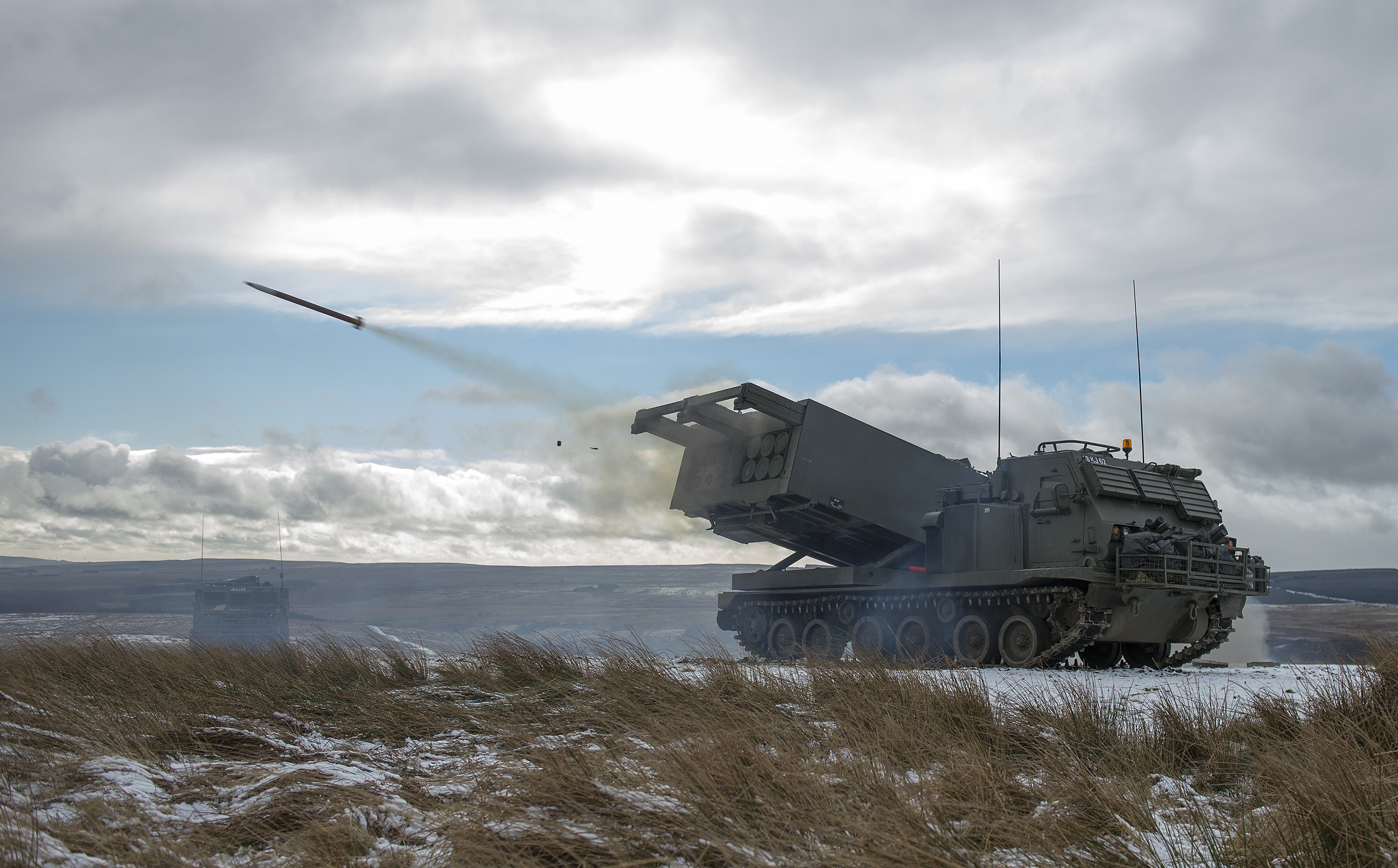
A military training area, training area (Australia, Ireland, and the United Kingdom) or training centre (Canada) is land set aside specifically to enable military forces to train and exercise for combat. Training areas are usually out of bounds to the general public, but some have limited access when not in use. As well as their military function, they often serve as important wildlife refuges. They are distinct from proving grounds which are designed for purposes such as testing weaponry or equipment. Description Military training areas are important because they enable troops to train more realistically and in greater numbers over a wide area without unduly inconveniencing the public or putting others at risk. They are particularly important for all arms training where the different elements of armed forces come together to cooperate and coordinate their fire and movement. Training areas often incorporate a variety of terrain types, including forests, heathland, waterbodies a ... [...More Info...] [...Related Items...] OR: [Wikipedia] [Google] [Baidu] |
Tree Line
The tree line is the edge of a habitat at which trees are capable of growing and beyond which they are not. It is found at high elevations and high latitudes. Beyond the tree line, trees cannot tolerate the environmental conditions (usually low temperatures, extreme snowpack, or associated lack of available moisture). The tree line is sometimes distinguished from a lower timberline, which is the line below which trees form a forest with a closed Canopy (biology), canopy. At the tree line, tree growth is often sparse, stunted, and deformed by wind and cold. This is sometimes known as (German for "crooked wood"). The tree line often appears well-defined, but it can be a more gradual transition. Trees grow shorter and often at lower densities as they approach the tree line, above which they are unable to grow at all. Given a certain latitude, the tree line is approximately 300 to 1000 meters below the permanent snow line and roughly parallel to it. Causes Due to their vertical s ... [...More Info...] [...Related Items...] OR: [Wikipedia] [Google] [Baidu] |
Ski Area
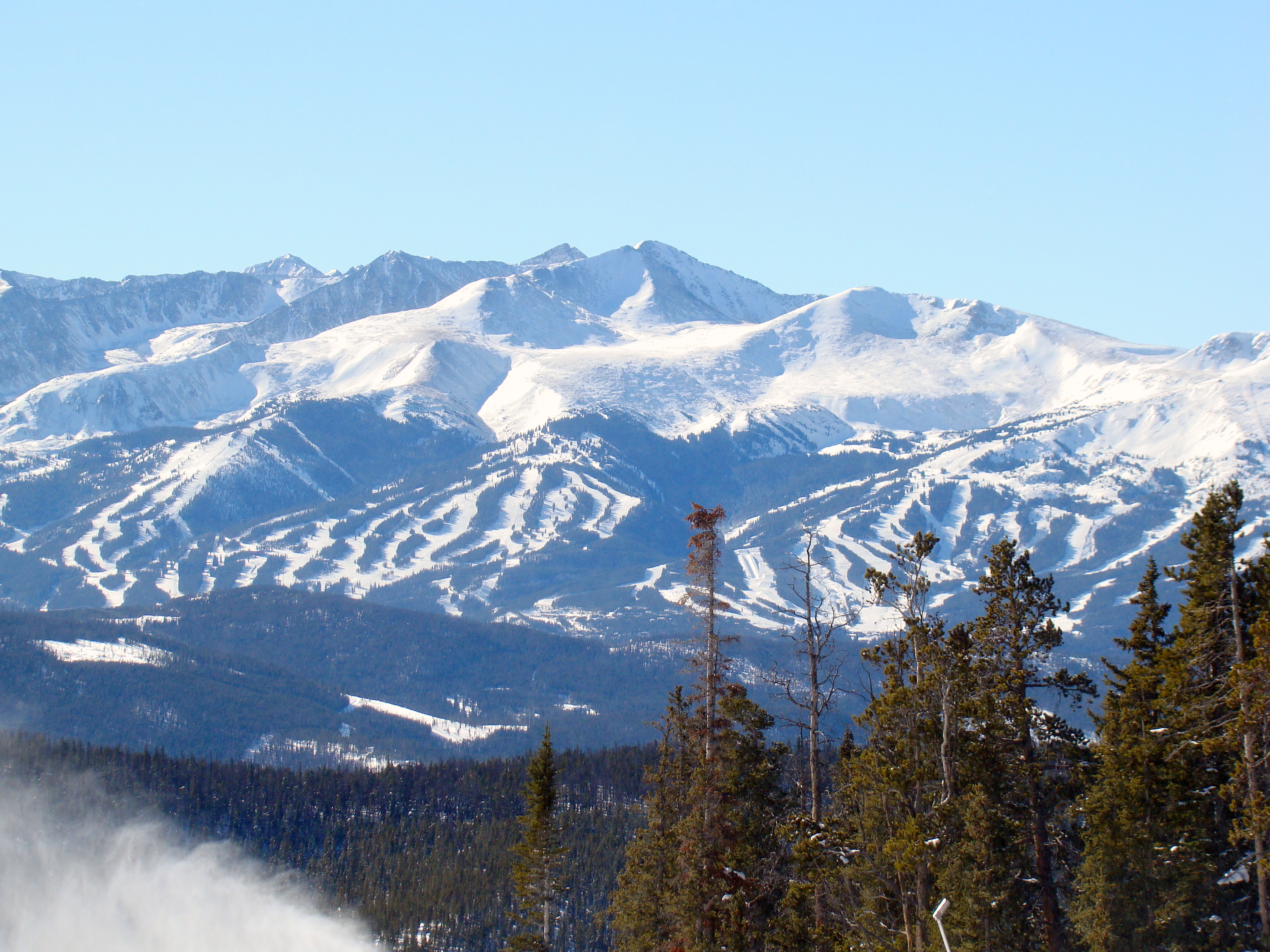
A ski area is the terrain and supporting infrastructure where skiing and other snow sports take place. Such sports include alpine and cross-country skiing, snow boarding, tubing, sledding, etc. Ski areas may stand alone or be part of a ski resort. Scope of activities The US Forest Service defines a ski area as: "a site and associated facilities that has been primarily developed for alpine or Nordic skiing and other snow sports, but may also include, in appropriate circumstances, facilities necessary for other seasonal or year-round natural resource-based recreation activities, provided that a preponderance of revenue generated by the ski area derives from the sale of alpine and Nordic ski area passes and lift tickets, revenue from alpine, Nordic, and other snow sport instruction, and gross revenue from ancillary facilities that support alpine or Nordic skiing and other snow sports." Notable examples Ski areas can extend over several municipalities (ex: La Plagne in France, ... [...More Info...] [...Related Items...] OR: [Wikipedia] [Google] [Baidu] |
Neumarkt Saddle
Neumarkt (German for "new market") may refer to several places: Austria * Neumarkt am Wallersee, in Salzburg * , in the Jennersdorf District, Burgenland * Neumarkt an der Ybbs, in Lower Austria * Neumarkt im Hausruckkreis, in the Hausruckviertel, Upper Austria * Neumarkt im Mühlkreis, in the Mühlviertel, Upper Austria * Neumarkt in Steiermark, in Styria Czech Republic * ''Neumarkt'', the German name of Úterý in Plzeň Germany * Cologne Neumarkt, location of the Neumarkt station, one of the major squares in Cologne, North Rhine-Westphalia * Dresden Neumarkt, a historically important square in Dresden, Saxony * Neumarkt (district), in Bavaria * Neumarkt in der Oberpfalz, in Bavaria * Neumarkt-Sankt Veit, in Bavaria Italy * Neumarkt, South Tyrol, a municipality in South Tyrol Poland * ''Neumarkt am Dohnst'', the German name of Nowy Targ in Lesser Poland * ''Neumarkt in Schlesien'', the German name of Środa Śląska in Lower Silesia Romania * ''Neumarkt am Mieresch'', ... [...More Info...] [...Related Items...] OR: [Wikipedia] [Google] [Baidu] |


