|
Schöllijoch
The Schöllijoch (el. 3343 m.) is a high mountain pass in the Pennine Alps, connecting Gruben/Meiden and St. Niklaus (Mattertal) in the canton of Valais in Switzerland. The path has been recently equipped and is accessible to experienced hikers. The path to traverse the Schöllijoch uses fixed ladders, ropes, and rungs. The pass lies between the Barrhorn on the north and the Brunegghorn on the south. See also * List of mountain passes in Switzerland This is a list of mountain passes in Switzerland. They are generally situated in the Jura Mountains or in the Swiss Alps. Pass roads Trails Railway See also * List of highest road passes in Switzerland * List of highest paved roads in Sw ... References External links * Description of itinerary Mountain passes of Valais Mountain passes of the Alps {{Valais-geo-stub ... [...More Info...] [...Related Items...] OR: [Wikipedia] [Google] [Baidu] |
List Of Mountain Passes In Switzerland
This is a list of mountain passes in Switzerland. They are generally situated in the Jura Mountains or in the Swiss Alps. Pass roads Trails Railway See also * List of highest road passes in Switzerland * List of highest paved roads in Switzerland * List of mountains of Switzerland External links Map with all drivable passes in Switzerland {{DEFAULTSORT:Mountain passes in Switzerland Mountain passes of Switzerland, Lists of landforms of Switzerland Lists of mountain passes, Switzerland Switzerland transport-related lists ... [...More Info...] [...Related Items...] OR: [Wikipedia] [Google] [Baidu] |
Switzerland
Switzerland, officially the Swiss Confederation, is a landlocked country located in west-central Europe. It is bordered by Italy to the south, France to the west, Germany to the north, and Austria and Liechtenstein to the east. Switzerland is geographically divided among the Swiss Plateau, the Swiss Alps, Alps and the Jura Mountains, Jura; the Alps occupy the greater part of the territory, whereas most of the country's Demographics of Switzerland, 9 million people are concentrated on the plateau, which hosts List of cities in Switzerland, its largest cities and economic centres, including Zurich, Geneva, and Lausanne. Switzerland is a federal republic composed of Cantons of Switzerland, 26 cantons, with federal authorities based in Bern. It has four main linguistic and cultural regions: German, French, Italian and Romansh language, Romansh. Although most Swiss are German-speaking, national identity is fairly cohesive, being rooted in a common historical background, shared ... [...More Info...] [...Related Items...] OR: [Wikipedia] [Google] [Baidu] |
Alps
The Alps () are some of the highest and most extensive mountain ranges in Europe, stretching approximately across eight Alpine countries (from west to east): Monaco, France, Switzerland, Italy, Liechtenstein, Germany, Austria and Slovenia. The Alpine arch extends from Nice on the western Mediterranean Sea, Mediterranean to Trieste on the Adriatic Sea, Adriatic and Vienna at the beginning of the Pannonian Basin. The mountains were formed over tens of millions of years as the African and Eurasian tectonic plates collided. Extreme shortening caused by the event resulted in marine sedimentary rocks rising by thrust fault, thrusting and Fold (geology), folding into high mountain peaks such as Mont Blanc and the Matterhorn. Mont Blanc spans the French–Italian border, and at is the highest mountain in the Alps. The Alpine region area contains 82 peaks higher than List of Alpine four-thousanders, . The altitude and size of the range affect the climate in Europe; in the mountain ... [...More Info...] [...Related Items...] OR: [Wikipedia] [Google] [Baidu] |
Pennine Alps
The Pennine Alps (, , , ), sometimes referred to as the Valais Alps (which are just the Northern Swiss part of the Pennine Alps), are a mountain range in the western part of the Alps. They are located in Italy (the Aosta Valley and Piedmont) and Switzerland (Valais). The Pennine Alps are amongst the three highest major subranges of the Alps, together with the Bernese Alps and the Graian Alps that include the Mont Blanc massif. Geography The Italian side is drained by the rivers Dora Baltea, Sesia and Toce, tributaries of the Po. The Swiss side is drained by the Rhône. The Great St Bernard Tunnel, under the Great St Bernard Pass, leads from Martigny, Switzerland to Aosta. Morphology The main chain ( watershed between the Mediterranean Sea and the Adriatic Sea) runs from west to east on the border between Italy (south) and Switzerland (north). From Mont Vélan, the first high summit east of St Bernard Pass, the chain rarely goes below 3000 metres and contains many ... [...More Info...] [...Related Items...] OR: [Wikipedia] [Google] [Baidu] |
Swiss Alps
The Alps, Alpine region of Switzerland, conventionally referred to as the Swiss Alps, represents a major natural feature of the country and is, along with the Swiss Plateau and the Swiss portion of the Jura Mountains, one of its three main Physical geography, physiographic regions. The Swiss Alps extend over both the Western Alps and the Eastern Alps, encompassing an area sometimes called Central Alps. While the northern ranges from the Bernese Alps to the Appenzell Alps are entirely in Switzerland, the southern ranges from the Mont Blanc massif to the Bernina Range, Bernina massif are shared with other countries such as France, Italy, Austria and Liechtenstein. The Swiss Alps comprise almost all the highest mountains of the Alps, such as Dufourspitze (4,634 m), the Dom (mountain), Dom (4,545 m), the Liskamm (4,527 m), the Weisshorn (4,506 m) and the Matterhorn (4,478 m). The other following major summits can be found in this list of mountains of Switzerland. Since the Middle Age ... [...More Info...] [...Related Items...] OR: [Wikipedia] [Google] [Baidu] |
Gruben/Meiden
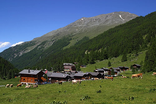
Gruben/Meiden (1,818 m) is a village in the Swiss Alps, located in the canton of Valais. It is situated in the upper Turtmanntal and is traversed by the Turtmanna river. It belongs to the municipality of Oberems and is the main settlement in the valley south of the town of Oberems. The village is inhabited in summer only. References *Swisstopo topographic maps External linksGruben/Meiden on Wanderland.ch Villages in Valais {{Valais-geo-stub ... [...More Info...] [...Related Items...] OR: [Wikipedia] [Google] [Baidu] |
Mattertal
The Matter Valley (German: Mattertal, or sometimes ''Nikolaital'') is located in southwestern Switzerland, south of the Rhone valley in the canton of Valais. The village of Zermatt is the most important settlement of the valley, which is surrounded by many four-thousanders, including the Matterhorn. Geography Located in the Pennine Alps, the Matter Valley is drained by the Matter Vispa, a tributary of the Rhone. The valley itself ends at Stalden where it meets the Saas Valley. The resulting Visp Valley continues for a few kilometres until it reaches the town of Visp on the young river Rhone. The valley starts between the high summits south of Zermatt (Monte Rosa, Matterhorn) on the border with Italy. The upper side is glaciated, the second largest glacier of the Alps, the Gorner Glacier lies at the foot of Monte Rosa (4,634 m), while the Zmutt Glacier lies at the foot of the Matterhorn (4,478 m). Around the village of Randa are located the Weisshorn (4,505 m) and the Dom ... [...More Info...] [...Related Items...] OR: [Wikipedia] [Google] [Baidu] |
Cantons Of Switzerland
The 26 cantons of Switzerland are the Federated state, member states of the Switzerland, Swiss Confederation. The nucleus of the Swiss Confederacy in the form of the first three confederate allies used to be referred to as the . Two important periods in the development of the Old Swiss Confederacy are summarized by the terms ('Eight Cantons'; from 1353 to 1481) and ('Thirteen Cantons', from 1513 to 1798).rendered "the 'confederacy of eight'" and "the 'Thirteen-Canton Confederation'", respectively, in: Each canton of the Old Swiss Confederacy, formerly also ('lieu/locality', from before 1450), or ('estate', from ), was a fully sovereignty, sovereign state with its own border controls, army, and currency from at least the Treaty of Westphalia (1648) until the establishment of the Swiss federal state in 1848, with a brief period of centralised government during the Helvetic Republic (1798–1803). The term has been widely used since the 19th century. "" The number of canton ... [...More Info...] [...Related Items...] OR: [Wikipedia] [Google] [Baidu] |
Valais
Valais ( , ; ), more formally, the Canton of Valais or Wallis, is one of the cantons of Switzerland, 26 cantons forming the Switzerland, Swiss Confederation. It is composed of thirteen districts and its capital and largest city is Sion, Switzerland, Sion. Valais is situated in the southwestern part of the country. It borders the cantons of Canton of Vaud, Vaud and Canton of Bern, Bern to the north, the cantons of Canton of Uri, Uri and Ticino to the east, as well as Italy to the south and France to the west. It is one of the three large southern Alps, Alpine cantons, along with Ticino and Grisons. It is a bilingual canton, French and German being its two official languages. Traditionally, the canton is divided into Lower, Central, and Upper Valais, the latter region constituting the German-speaking minority. Valais is essentially coextensive with the valley of the Rhône from its headwaters to Lake Geneva, separating the Pennine Alps from the Bernese Alps, the two largest mount ... [...More Info...] [...Related Items...] OR: [Wikipedia] [Google] [Baidu] |
Barrhorn
The Barrhorn is a mountain in the Pennine Alps The Pennine Alps (, , , ), sometimes referred to as the Valais Alps (which are just the Northern Swiss part of the Pennine Alps), are a mountain range in the western part of the Alps. They are located in Italy (the Aosta Valley and Piedmont) an .... Access roads and normal climbing route The only access road is from the north, from the Turtmann village in the Rhona valley. From there, take direction to Gruben, and after passing it drive up to Vorder Sänntum at 1900 m. You will come to the point where the public road ends up, there is a formal parking that costs 4 CHF per day. From the car parking to the summit you may get in less than 5 hours, and from the Turtmann hut to the summit in about 3 hours. You do not need any special equipment, this is a simple walk up. References External links Barrhornin Mountains for Everybody. Mountains of the Alps Alpine three-thousanders Mountains of Valais Mountains of Switzerlan ... [...More Info...] [...Related Items...] OR: [Wikipedia] [Google] [Baidu] |
Brunegghorn
The Brunegghorn is a mountain of the Pennine Alps, overlooking the Mattertal in the canton of Valais. It is part of the Weisshorn The Weisshorn (German language, German, lit. ''white peak/mountain'') is a major mountain, peak of Switzerland and the Alps, culminating at above sea level. It is part of the Pennine Alps and is located between the valleys of Anniviers and Mat ... group. On the west side of the mountain flows the Brunegg Glacier. References External links Brunegghorn on Summitpost Mountains of the Alps Alpine three-thousanders Mountains of Switzerland Mountains of Valais Three-thousanders of Switzerland {{Valais-geo-stub ... [...More Info...] [...Related Items...] OR: [Wikipedia] [Google] [Baidu] |
Mountain Passes Of Valais
A mountain is an elevated portion of the Earth's crust, generally with steep sides that show significant exposed bedrock. Although definitions vary, a mountain may differ from a plateau in having a limited summit area, and is usually higher than a hill, typically rising at least above the surrounding land. A few mountains are isolated summits, but most occur in mountain ranges. Mountains are formed through tectonic forces, erosion, or volcanism, which act on time scales of up to tens of millions of years. Once mountain building ceases, mountains are slowly leveled through the action of weathering, through slumping and other forms of mass wasting, as well as through erosion by rivers and glaciers. High elevations on mountains produce colder climates than at sea level at similar latitude. These colder climates strongly affect the ecosystems of mountains: different elevations have different plants and animals. Because of the less hospitable terrain and climate, mountains t ... [...More Info...] [...Related Items...] OR: [Wikipedia] [Google] [Baidu] |


