|
Schwarzbach (Blies)
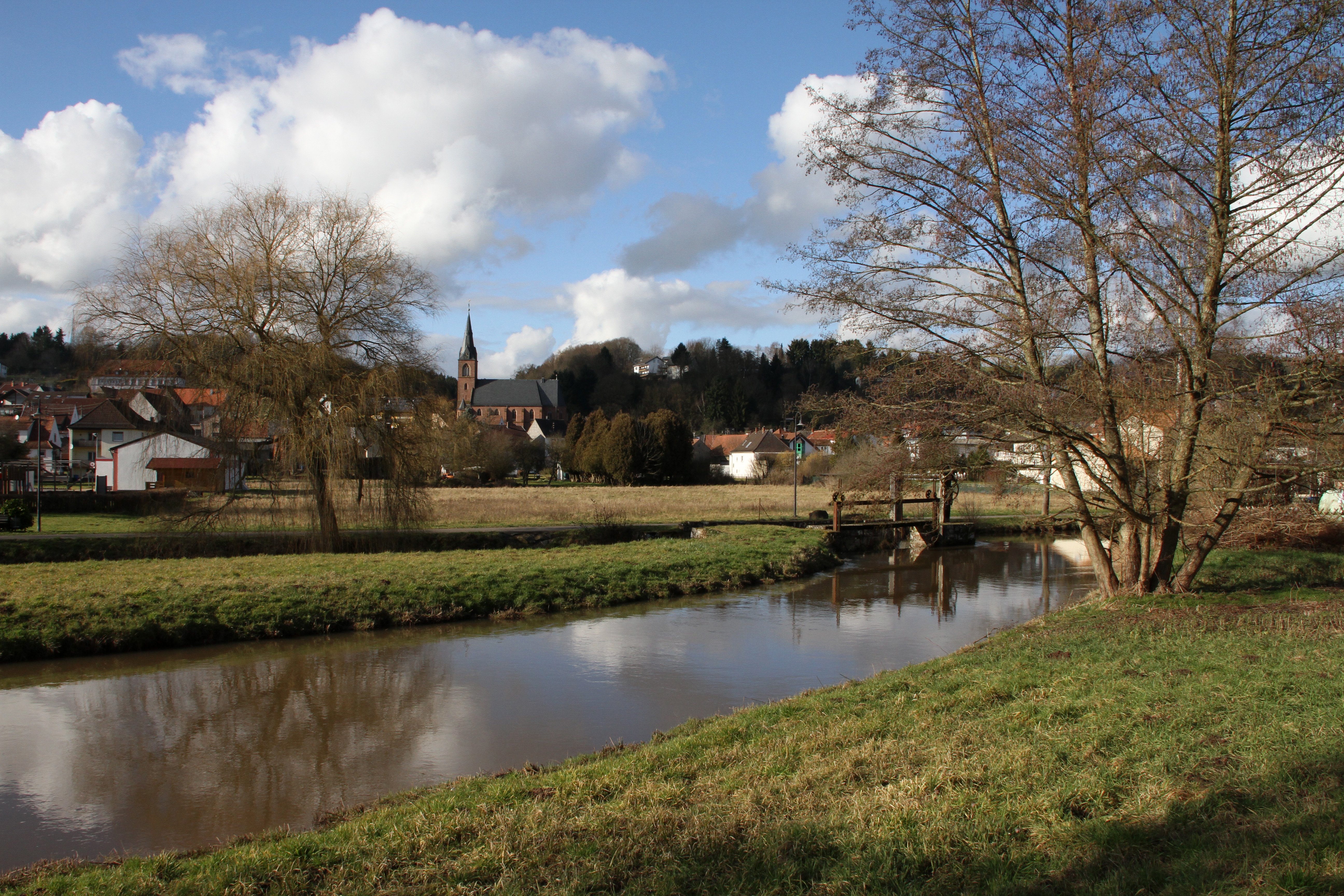
The Schwarzbach () is a river in southwestern Germany, left tributary of the Blies. Its source is in the Palatinate Forest, near Trippstadt. It flows through the states Rhineland-Palatinate and Saarland. Towns along its course are Waldfischbach-Burgalben, Contwig and Zweibrücken. After , it flows into the Blies in Homburg-Einöd. Tributaries and course The two headwaters of the Schwarzbach, the first of which is also known as ''Burgalb'', rise on western side of the watershed in the middle of the Palatinate Forest, just south of the hamlet Johanniskreuz, at an altitude of about 500 m. One spring is located on the southern slope of the 528 m high Mount Steinberg. The other spring is three kilometers away, on the southwest side of the high Mount Eschkopf. The two headwaters meet after about . The river then flows past Leimen into the Schwarzbach valley. It takes up the and the from the right and the from the left, before reaching the Clausensee rese ... [...More Info...] [...Related Items...] OR: [Wikipedia] [Google] [Baidu] |
Zweibrücken
Zweibrücken (; ; , ; literally translated as "Two Bridges") is a town in Rhineland-Palatinate, Germany, on the Schwarzbach (Blies), Schwarzbach River. Name The name ''Zweibrücken'' means 'two bridges'; older forms of the name include Middle High German ''Zweinbrücken'', Latin ''Geminus Pons'' and ''Bipontum'', and French language, French ''Deux-Ponts'', all with the same meaning. History The town was the capital of the former Imperial State of Palatine Zweibrücken owned by the House of Wittelsbach. The ducal castle is now occupied by the high court of the Palatinate (''Oberlandesgericht''). There is a fine Gothic architecture, Gothic Protestant church, Alexander's church, founded in 1493 and rebuilt in 1955. From the end of the 12th century, Zweibrücken was the seat of the County of Zweibrücken, the counts being descended from Henry I, youngest son of Simon I, Count of Saarbrücken (d. 1182). The line became extinct on the death of Count Eberhard II (1394), who in 13 ... [...More Info...] [...Related Items...] OR: [Wikipedia] [Google] [Baidu] |
Johanniskreuz
Johanniskreuz is a tiny hamlet (place), hamlet in the middle of the Palatine Forest in Germany and belongs to the municipality of Trippstadt in the Kaiserslautern (district), district of Kaiserslautern in the state of Rhineland-Palatinate. Geography Location Johanniskreuz lies in a saddle (landform), saddle at about , north of the midpoint of the central massif of the Palatine Forest, the Frankenweide, whose surrounding peaks are only a little higher. The Frankenweide, across which the Palatine Watershed runs, is bounded to the west, north and east in the area of Johanniskreuz by the valleys of streams that rise near the hamlet. Immediately west of Johanniskreuz is the source of the Moosalb (Schwarzbach), Moosalb, a tributary of the Schwarzbach (Blies), Schwarzbach, which itself rises one kilometre southwest of Johanniskreuz. The waters of these streams initially flow westwards through the Blies and Saar (river), Saar rivers into the river Moselle and then on to the Rhine. A ... [...More Info...] [...Related Items...] OR: [Wikipedia] [Google] [Baidu] |
List Of Rivers Of Saarland
A list of rivers of Saarland, Germany: B *Bickenalb *Bist (river), Bist *Blies *Bos (Nahe), Bos E *Ellbach (Saar), Ellbach *Erbach (Blies), Erbach F *Franzenbach G *Gailbach (Blies), Gailbach *Glan (Nahe), Glan H *Hetschenbach *Holzbach (Hochwald), Holzbach I *Ill (Saarland), Ill K *Köllerbach (Saar), Köllerbach L *Lambsbach *Leukbach *Löster M *Mandelbach (Blies), Mandelbach *Moselle *Mutterbach (Blies), Mutterbach N *Nahe (Rhine), Nahe *Nied O *Oster (Blies), Oster P *Prims R *Rohrbach (Saar), Rohrbach *Rossel (Saar), Rossel S *Saar (river), Saar *Schwarzbach (Blies), Schwarzbach T *Theel *Todbach W *Wadrill *Würzbach {{DEFAULTSORT:Rivers of Saarland Rivers of Saarland, Saarland-related lists Lists of rivers of Germany, Saar ... [...More Info...] [...Related Items...] OR: [Wikipedia] [Google] [Baidu] |
Heidelsburg
The Heidelsburg, also called the Bunenstein, is an old fortification in the West Palatinate, western Palatine Forest in the German state of Rhineland-Palatinate that goes back at least to the days of the Roman Empire. Today only the remains of two gates, together with their steps, the castle walls and a cistern have survived. Geography The castle ruins lie 3 kilometres southeast of Waldfischbach-Burgalben on a rocky ridge of the ''Drei-Sommer-Berg'' at a height of 340 metres above Normalnull, sea level (NN) above the valley of Schwarzbachtal.Landesvermessungsamt Rheinland-Pfalz: ''Topographic map, 1 : 25,000 series, with walks – Waldfischbach-Burgalben, Rodalben''. 3rd edn., 1999 The Heidelsburg cannot be accessed by car, but there is a waymarked forest walk starting at the ''Galgenberghaus'' ("Gallows Hill House") car park near Waldfischbach-Burgalben (approximately 4 km, duration about one hour), Several well-signed paths of varying difficulty and length run ... [...More Info...] [...Related Items...] OR: [Wikipedia] [Google] [Baidu] |
Pirmasens
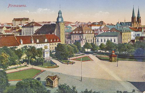
Pirmasens (; (also ''Bermesens'' or ''Bärmasens'')) is an independent town in Rhineland-Palatinate, Germany, near the border with France. It was famous for the manufacture of shoes. The surrounding rural district was called ''Landkreis Pirmasens'' from 1818 until 1997, when it was renamed to ''Südwestpfalz''. History Early years The first mention of "Pirminiseusna", a colony of Hornbach Abbey, dates from 860. The name derives from St. Pirminius, the founder of the monastery. During the period it was under rule of the Prince-Bishopric of Metz, Bishopric of Metz. It was passed to Diocese of Speyer in last the quarter of the 11th century, then was captured by County of Nassau-Saarbrücken#County of Saarbrücken, County of Saarbrücken in 1100. In 1182, the County of Saarbrücken was divided by Simon II and Henry I, who were sons of Simon I. Pirmasens was given to Henry I and his dominion was named as County of Zweibrücken. He built Lemberg Castle to protect his dominion in 1198 ... [...More Info...] [...Related Items...] OR: [Wikipedia] [Google] [Baidu] |
Holiday Route
A scenic route, tourist road, tourist drive, scenic byway, or holiday road is a specially designated road or waterway that travels through an area of natural or cultural beauty. It often passes by Scenic viewpoint, scenic viewpoints. The designation is usually determined by a governmental body, such as a Department of Transportation or a Ministry of Transport. Tourist highway A tourist highway, tourist route, or holiday route is a road that is marketing, marketed as being particularly suited for tourists. Tourist highways may be formed when existing roads are promoted with traffic signs and advertising material. Some tourist highways such as the Blue Ridge Parkway are built especially for tourism purposes. Others may be roadways enjoyed by local citizens in areas of unique or exceptional natural beauty, such as the Lake District. Still others, such as the Lincoln Highway in Illinois are former main roads, only designated as "scenic" after most traffic bypasses them (termed scenic ... [...More Info...] [...Related Items...] OR: [Wikipedia] [Google] [Baidu] |
German Shoe Road
The German Shoe Road () is one of several tourist-oriented, themed routes in southern Rheinhessen and in the West Palatinate in the German state of Rhineland-Palatinate. It is a circular route of more than 300 km largely running within the Palatine Forest-North Vosges Biosphere Reserve often on scenic secondary roads. Route The German Shoe Road includes the following way stations: Alzey, Wendelsheim, Nack, Bechenheim, Nieder-Wiesen, Kriegsfeld, Unterthierwasen, Bastenhaus- Dannenfels, Marienthal, Falkenstein, Enkenbach-Alsenborn, Hochspeyer, Johanniskreuz, Hauenstein, Dahn, Busenberg, Fischbach, Eppenbrunn, Trulben, Pirmasens, Walshausen, Rieschweiler-Mühlbach, Wallhalben, Mittelbrunn, Landstuhl, Miesenbach, Altenglan, Aschbach, Lauterecken, Meisenheim, Fürfeld, Wonsheim, Wendelsheim, Alzey Near Pirmasens the German Shoe Road divides into various branches that link e.g. Rodalben and Waldfischbach-Burgalben as well as Lemberg. History The German Shoe Roa ... [...More Info...] [...Related Items...] OR: [Wikipedia] [Google] [Baidu] |
Saar (river)
The Saar (; ) is a river in northeastern France and western Germany, and a right tributary of the Moselle. It rises in the Vosges mountains on the border of Alsace and Lorraine and flows northwards into the Moselle near Trier. It has two headstreams (the ''Sarre Rouge'' and ''Sarre Blanche'', which join in Lorquin), that both start near Mont Donon, the highest peak of the northern Vosges. After (129 kilometres; 80 miles in France and on the French-German border, and 117 kilometres; 73 miles in Germany) the Saar flows into the Moselle at Konz (Rhineland-Palatinate) between Trier and the Luxembourg border. It has a catchment area of . The Saar flows through the following departments of France, states of Germany and towns: *Moselle (F): Abreschviller (Sarre Rouge), Lorquin, Sarrebourg, Fénétrange *Bas-Rhin (F): Sarre-Union *Moselle (F): Sarralbe, Sarreguemines *Saarland (D): Saarbrücken, Völklingen, Wadgassen, Bous, Saarlouis, Dillingen, Merzig *Rh ... [...More Info...] [...Related Items...] OR: [Wikipedia] [Google] [Baidu] |
Homburg, Saarland
Homburg (; , ; ) is a town in Saarland, Germany and the administrative seat of the Saarpfalz district. With a population of 43,029 inhabitants (2022), it is the third largest town in the state. The city offers over 30,000 workplaces. The medical department of the University of Saarland is situated here. The city is also home to the Karlsberg beer brewery. Major employers include Robert Bosch GmbH, Schaeffler Group and Michelin. Geography Homburg is located in the northern part of the Saarpfalz district, bordering Rhineland-Palatinate. It is 16 km from Neunkirchen and 36 km from Saarbrücken. The city districts are situated in the Blies valley or on its tributaries Erbach, Lambsbach and Schwarzbach. Homburg is composed of Homburg center and nine city districts: Beeden, Bruchhof-Sanddorf, Einöd, Erbach, Jägersburg, Kirrberg, Reiskirchen, Schwarzenbach and Wörschweiler. Einöd includes: Einöd, Ingweiler and Schwarzenacker; Jägersburg includes Jäg ... [...More Info...] [...Related Items...] OR: [Wikipedia] [Google] [Baidu] |
Dellfeld
Dellfeld is a municipality in Südwestpfalz district, in Rhineland-Palatinate, western Germany Germany, officially the Federal Republic of Germany, is a country in Central Europe. It lies between the Baltic Sea and the North Sea to the north and the Alps to the south. Its sixteen States of Germany, constituent states have a total popu .... References Municipalities in Rhineland-Palatinate Südwestpfalz {{Südwestpfalz-geo-stub ... [...More Info...] [...Related Items...] OR: [Wikipedia] [Google] [Baidu] |
Rieschweiler-Mühlbach
Rieschweiler-Mühlbach is a municipality in Südwestpfalz district, in Rhineland-Palatinate, western Germany Germany, officially the Federal Republic of Germany, is a country in Central Europe. It lies between the Baltic Sea and the North Sea to the north and the Alps to the south. Its sixteen States of Germany, constituent states have a total popu .... References Municipalities in Rhineland-Palatinate Südwestpfalz {{Südwestpfalz-geo-stub ... [...More Info...] [...Related Items...] OR: [Wikipedia] [Google] [Baidu] |
Thaleischweiler-Fröschen
Thaleischweiler-Fröschen is a municipality in the Südwestpfalz district, in Rhineland-Palatinate, Germany. It is situated on the western edge of the Palatinate forest, approximately north of Pirmasens. Thaleischweiler-Fröschen is the seat of the ''Verbandsgemeinde A (; plural ) is a low-level administrative division, administrative unit in the Germany, German States of Germany, federal states of Brandenburg, Rhineland-Palatinate and Saxony-Anhalt. A is typically composed of a small group of Municipalitie ...'' ("collective municipality") Thaleischweiler-Wallhalben. References Palatinate Forest Südwestpfalz {{Südwestpfalz-geo-stub ... [...More Info...] [...Related Items...] OR: [Wikipedia] [Google] [Baidu] |


