|
Schwamendingen Mitte
Schwamendingen Mitte (Schwamendingen centre) is a quarter in the Schwamendingen, district 12 in Zürich, located in the Glatt Valley (German: ''Glattal''). Schwamendingen and Oerlikon (Zürich), Oerlikon became independent municipalities in 1872. These were incorporated into the city of Zürich in 1934, together with Seebach (Zürich), Seebach, Affoltern (Zürich), Affoltern, Witikon, Höngg, Altstetten (Zürich), Altstetten and Albisrieden. After 1934 Schwamendingen was divided into the quarters Schwamendingen Mitte, Saatlen and Hirzenbach. The quarter has a population of 10,322 distributed over an area of . References [...More Info...] [...Related Items...] OR: [Wikipedia] [Google] [Baidu] |
Affoltern (Zürich)
Affoltern is a quarter in district 11 (Zürich), district 11 in Zürich, located in the Glatt Valley (German: ''Glattal''). History and demographics Affoltern was first mentioned in 870 as ''Affaltrahe'', and in the 9th century it was reigned by the St. Gallen Abbey, in the 12th/13th century by the House of Regensberg who built their ancestral seat ''Alt-Regensberg Castle, Altburg'' nearby, followed in 1468 by the city of Zürich as part of the ''Obervogtei Regensberg'' ending in 1798. Affoltern was then after a municipality of its own, having been incorporated into the city Zürich in 1934. As today, Affoltern consists of the former settlements (''Fraktionen'') Ober- und Unter-Affoltern. The quarter has a population of 22'972 (2010) distributed on an area of 6.04 km2, and is separated by the Käferberg from the inner city. Culture The bath/lido Strandbad Katzensee is very popular. Transportation Zürich Affoltern railway station is a stop of the S-Bahn Zürich ... [...More Info...] [...Related Items...] OR: [Wikipedia] [Google] [Baidu] |
Hirzenbach
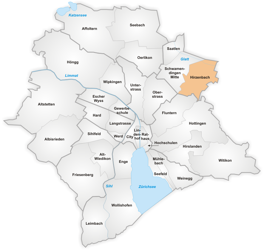
Hirzenbach is a quarter in the district 12 of Zürich, located in the Glatt Valley (German: ''Glattal''). It was part of Schwamendingen Schwamendingen is a district in the Switzerland, Swiss city of Zürich. Formerly an independent community, it was incorporated into Zurich in 1934 to build district number 12. The district comprises the quarters Schwamendingen Mitte, Saatlen a ... municipality that was amalgamated into Zürich in 1934. The quarter has a population of 11,265 distributed on an area of . References District 12 of Zurich {{Zürich-geo-stub ... [...More Info...] [...Related Items...] OR: [Wikipedia] [Google] [Baidu] |
Saatlen
Saatlen is a quarter in the district 12 of Zürich, located in the Glatt Valley (German: ''Glattal''). It was formerly a part of Schwamendingen Schwamendingen is a district in the Switzerland, Swiss city of Zürich. Formerly an independent community, it was incorporated into Zurich in 1934 to build district number 12. The district comprises the quarters Schwamendingen Mitte, Saatlen a ... municipality, which was incorporated into Zürich in 1934. The quarter has a population of 6,727 distributed on an area of 1.13 km². District 12 of Zurich {{Zürich-geo-stub ... [...More Info...] [...Related Items...] OR: [Wikipedia] [Google] [Baidu] |
Albisrieden
Albisrieden is a quarter in the district 9 (Zürich), district 9 in Zürich. It was formerly a municipality of its own, having been incorporated into Zürich in 1934. The quarter has a population of 17,226 distributed on an area of . Churches Albisrieden has two Evangelical Reformed Churches that are part of the Canton of Zürich. The :de:Alte Kirche Albisrieden, Alte Kirche Albisrieden was built between 1816 and 1818, stands in centre of the village and was constructed according to plans by Hans Conrad Stadler (1788–1846). The Neue Kirche Albisrieden was built between 1949 and 1951 and is located 800 meters from the Alte Kirche. This church was constructed according to plans by the architect Hans Martin von Meyenburg (1915–1995). :de:St. Konrad (Zürich-Albisrieden), St. Konrad is Albisrieden's Roman Catholic church, was constructed between 1953 and 1955 according to plans by the architects Ferdinand Pfammatter und Walter Rieger. District 9 of Zurich Former ... [...More Info...] [...Related Items...] OR: [Wikipedia] [Google] [Baidu] |
Altstetten (Zürich)
Altstetten is a quarter in district 9 (Zurich), district 9 of the city of Zurich in Switzerland. It was formerly a municipality in its own right, but was incorporated into Zurich in 1934. History Altstetten is first mentioned in 1249, at which time a distinction was made between ''in Altstettin superiori'' and ''in villa Altstetin Inferiori''. Excavations have found remains probably from the late Bronze Age (1000-800 BC), together with those of a Roman villa. In 1847, the Swiss Northern Railway opened Switzerland's first domestic railway line between Zurich and Baden, Aargau, Baden. The line passed through Altstetten, and a station was provided. Over time, the line became the principal rail route between Zurich and northern and western Switzerland. In 1864, a second line, to Zug via Affoltern am Albis, made a junction with the first just west of Altstetten railway station. In 1907, the Swiss Federal Railway, who had taken over both lines, opened a workshop in Altstetten. In 1900 ... [...More Info...] [...Related Items...] OR: [Wikipedia] [Google] [Baidu] |
Höngg
Höngg is a quarter in district 10 in Zürich. It was formerly a municipality of its own, having been incorporated into Zürich in 1934. The quarter has a population of 21,186, distributed across an area of 6.98 km2. Höngg is renowned for its funfairs, such as the Wümmetfest and the Räbeliechtli Umzug. The Protestant church Alte Kirche Höngg is the main church of Höngg. Sport SV Höngg is the quarter's football team. Werdinsel Werdinsel, also known as Limmatauen Werdhölzli, is an island and protected area in the Limmat The Limmat is a river in Switzerland. The river commences at the outfall of Lake Zurich, in the southern part of the city of Zurich. From Zurich it flows in a northwesterly direction, continuing a further 35 km until it reaches the river A ..., to the west of the Europabrücke. Gallery External links A drone flying north over the Reformed church, Meierhofplatz, and looking east down Am Wasser and the Limmat [...More Info...] [...Related Items...] OR: [Wikipedia] [Google] [Baidu] |
Witikon
Witikon is a quarter in the district 7 in Zürich Zurich (; ) is the list of cities in Switzerland, largest city in Switzerland and the capital of the canton of Zurich. It is in north-central Switzerland, at the northwestern tip of Lake Zurich. , the municipality had 448,664 inhabitants. The .... It was formerly a municipality of its own, having been incorporated into Zürich in 1934. The quarter has a population of 9,864 distributed on an area of . Witikon is located between the southwestern flank of the Adlisberg and the western flank of the Öschbrig. References External links District 7 of Zurich Former municipalities of the canton of Zürich {{Zürich-geo-stub ... [...More Info...] [...Related Items...] OR: [Wikipedia] [Google] [Baidu] |
Seebach (Zürich)
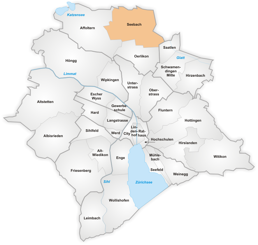
Seebach () is a quarter in the district 11 (Zürich), district 11 of Zürich, located in the Glatt Valley (German: ''Glattal''). It was formerly a municipality in its own right, but was incorporated into the city of Zürich in 1934. In contrast to the inner-city neighborhoods, Zürich-Seebach is known as an area with a vast number of immigrants, in particular from Turkey, Albania, Syria, Eritrea, Bosnia and Herzegovina, Bosnia and Sri Lanka. The area is also known for some social housing projects. Areas with similar ethnic compositions exist in suburban areas around Zürich as well, like Schlieren, Switzerland, Schlieren or Dietikon where immigrants form the majority of the population. The quarter has a population of 19,879 distributed on an area of . Transportation Zürich Seebach railway station is a stop on service S6 (ZVV), S6 of the Zürich S-Bahn, which provides a half-hourly connection to Zürich Oerlikon railway station, Zürich Oerlikon and Zürich Hauptbahnhof rai ... [...More Info...] [...Related Items...] OR: [Wikipedia] [Google] [Baidu] |
Zürich - Schwamendingen - Schwamendingerplatz-Winterthurerstrasse IMG 4910
Zurich (; ) is the largest city in Switzerland and the capital of the canton of Zurich. It is in north-central Switzerland, at the northwestern tip of Lake Zurich. , the municipality had 448,664 inhabitants. The urban area was home to 1.45 million people (2020), while the Zurich metropolitan area had a total population of 2.1 million (2020). Zurich is a hub for railways, roads, and air traffic. Both Zurich Airport and Zurich's main railway station are the largest and busiest in the country. Permanently settled for over 2,000 years, Zurich was founded by the Romans, who called it '. However, early settlements have been found dating back more than 6,400 years (although this only indicates human presence in the area and not the presence of a town that early). During the Middle Ages, Zurich gained the independent and privileged status of imperial immediacy and, in 1519, became a primary centre of the Protestant Reformation in Europe under the leadership of Huldrych Zwingli. Th ... [...More Info...] [...Related Items...] OR: [Wikipedia] [Google] [Baidu] |
Oerlikon (Zürich)
Oerlikon is a quarter in the northern part of the city of Zürich, Switzerland. A formerly independent municipality, Oerlikon was merged with Zürich in 1934 and forms today, together with Affoltern (Zürich), Affoltern and Seebach (Zürich), Seebach, the city district 11 (Zürich), district 11. History The name Oerlikon goes back to the Alemannic settlement founder Orilo. Oerlikon was mentioned for the first time in the year 946 (other source: 942) as ''Orlinchowa''. At that time the town consisted of no more than one dozen houses. Later on it was part of the municipality of Schwamendingen, where the inhabitants of Oerlikon went to school and attended church. In 1855 the line from Oerlikon to Winterthur via Wallisellen was established by the ''Schweizerische Nordostbahn'' (NOB). The following year the line was extended to Zürich Hauptbahnhof through the Wipkingen Tunnel. Lines from Wallisellen to Uster (1856) and Oerlikon to Bülach via Glattbrugg (1865) followed. The open ... [...More Info...] [...Related Items...] OR: [Wikipedia] [Google] [Baidu] |
Glatt Valley
The Glatt Valley (German: ''Glattal'' or ''Glatttal'') is a region and a river valley in the canton of Zürich in Switzerland. Geography The Glatt (Rhine), Glatt is a tributary to the Rhine in the Zürcher Unterland area of the canton of Zurich. It is long and flows out from the Greifensee (lake), Greifensee through its river valley A valley is an elongated low area often running between hills or mountains and typically containing a river or stream running from one end to the other. Most valleys are formed by erosion of the land surface by rivers or streams over a ..., discharging into the Rhine by Rheinsfelden. The Region Glatttal comprises, among other communities in the districts of Uster (district), Uster, Dielsdorf (district), Dielsdorf and Bülach (district), Bülach, the suburban cities and municipalities of Bassersdorf, Bülach, Dietlikon, Dübendorf, Fällanden, Glattfelden, Höri, Kloten, Oberglatt, Opfikon-Glattbrugg, Rümlang, Schwerzenbach, Wallisell ... [...More Info...] [...Related Items...] OR: [Wikipedia] [Google] [Baidu] |


