|
Schnapper Rock, New Zealand
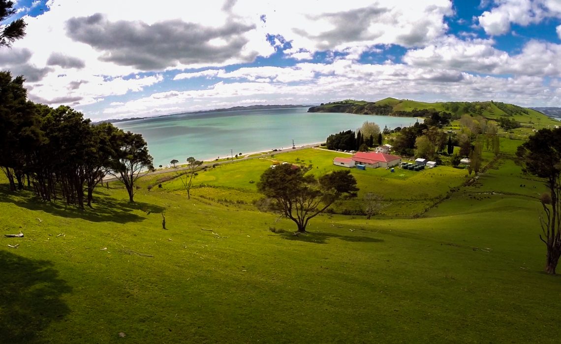
Schnapper Rock is a suburb of Auckland, New Zealand, on the North Shore. The suburb is governed by Auckland Council. The area was known for a gum digging hut used by early European settlers in the mid-19th century. North Shore Memorial Park was opened area in 1974, and the area developed into suburban housing in the early 2000s. Etymology The name refers to the solid rock landing place used by early colonial residents of Auckland who travelled along Lucas Creek. The name schnapper is a variation of snapper, which people believed was the correct spelling in the mid-19th century, and refers to the good fishing found in the area. Geography Schnapper Rock is an area of the northwestern North Shore in Auckland, New Zealand. It is located on the eastern bank of the upper reaches of the Lucas Creek, an estuarial arm of the Upper Waitematā Harbour. The creek forms the suburb's western border, while Albany Highway acts as the suburb's border to the east. Te Wharau Creek is a t ... [...More Info...] [...Related Items...] OR: [Wikipedia] [Google] [Baidu] |
Auckland
Auckland ( ; ) is a large metropolitan city in the North Island of New Zealand. It has an urban population of about It is located in the greater Auckland Region, the area governed by Auckland Council, which includes outlying rural areas and the islands of the Hauraki Gulf, and which has a total population of as of It is the List of cities in New Zealand, most populous city of New Zealand and the List of cities in Oceania by population, fifth-largest city in Oceania. The city lies between the Hauraki Gulf to the east, the Hunua Ranges to the south-east, the Manukau Harbour to the south-west, and the Waitākere Ranges and smaller ranges to the west and north-west. The surrounding hills are covered in rainforest and the landscape is dotted with 53 volcanic centres that make up the Auckland Volcanic Field. The central part of the urban area occupies a narrow isthmus between the Manukau Harbour on the Tasman Sea and the Waitematā Harbour on the Pacific Ocean. Auckland is one of ... [...More Info...] [...Related Items...] OR: [Wikipedia] [Google] [Baidu] |
Waitemata Group
The Waitemata Group is an Early Miocene group (geology), geologic group that is exposed in and around the Auckland Region of New Zealand, between the Whangarei Harbour in the North and the Raglan, New Zealand, Raglan Harbour in the South. The Group is predominantly composed of deep water sandstone and mudstone (flysch). The sandstone dominated units form the cliffs around the Waitemata Harbour and rare more resistant conglomerates underlie some of Auckland's prominent ridges. Sub-units and deposition The Waitemata Group was deposited within fault controlled basins. These were bounded to the North and South by up faulted Mesozoic basement sedimentary rocks and volcanic rocks to the East and West. The sedimentary source for the Group's sandstone is a mix of these basement sediments of the Stratigraphy of New Zealand, Waipapa Terrane and the mostly intermediate volcanic rocks. The maximum water depth of the Waitemata Group basin was 2,000 m. The basal strata (Kawau Subgroup) are ... [...More Info...] [...Related Items...] OR: [Wikipedia] [Google] [Baidu] |
Ngāti Whātua O Kaipara
Ngāti Whātua o Kaipara (also known as Ngāti Whātua o Kaipara ki te Tonga) is a Māori iwi (tribe) and hapū (sub-tribe) of New Zealand, which is part of the larger Ngāti Whātua iwi. The iwi's rohe is focused around the southern Kaipara Harbour in the Auckland Region of New Zealand. Ngāti Whātua have been present in the Kaipara Harbour since the arrival of the ''Māhuhu-ki-te-rangi'' Māori migration canoes, migratory waka, gradually moving towards the north. By the 17th century, Ngāti Whātua reestablished a presence in the southern Kaipara Harbour. Ngāti Whātua o Kaipara is a modern name, established in the late 20th century as a part of the Waitangi Tribunal settlement process to differentiate the hapū and whānau of the southern Kaipara Harbour from those living in Northland Region, Northland or the Auckland isthmus, Tāmaki isthmus of central Auckland. Since the signing of the Ngāti Whātua o Kaipara Claims Settlement Act 2013, Ngāti Whātua o Kaipara assets have ... [...More Info...] [...Related Items...] OR: [Wikipedia] [Google] [Baidu] |
Te Kawerau ā Maki
Te Kawerau ā Maki, Te Kawerau a Maki, or Te Kawerau-a-Maki is a Māori ''iwi'' (tribe) of the Auckland Region of New Zealand. Predominantly based in West Auckland (Hikurangi also known as Waitākere), it had 251 registered adult members as of June 2017. The iwi holds land for a new marae and papakāinga at Te Henga (Bethells Beach) that was returned in 2018; and land for a secondary marae at Te Onekiritea (Hobsonville Point) that was returned in 2015. It has no ''wharenui'' (meeting house) yet. History Te Kawerau ā Maki are the descendants of the '' rangatira'' (chief) Maki and his wife Rotu, who migrated with their family and followers from Kawhia to Tāmaki Makaurau (Auckland) in the early 1600s. Te Kawerau trace their ancestry from a number of Māori migration canoes, particularly the Tainui, but also Aotea, Tokomaru, Moekakara, Kahuitara and Kurahaupō. Tainui ancestors including Hoturoa and the tohunga Rakataura (Hape) are particularly important in Te Kawerau whaka ... [...More Info...] [...Related Items...] OR: [Wikipedia] [Google] [Baidu] |
Ngāti Manuhiri
Ngāti Manuhiri is a Māori iwi of the Mahurangi Peninsula area of New Zealand. They have an interest in the region from the Ōkura River in the south to Mangawhai in the north, and extending out to Great Barrier Island. They are descended from Manuhiri, one of the sons of Maki, founder of the Te Kawerau iwi. They have a marae near Leigh. The iwi is descended from the Moekākara and Tainui waka (arrival canoes). See also *List of Māori iwi This is a list of iwi (New Zealand Māori tribes). List of iwi This list includes groups recognised as iwi (tribes) in certain contexts. Many are also hapū (sub-tribes) of larger iwi. Moriori are included on this list. Although they are dist ... References External links Ngāti Manuhiri Settlement Trust {{Maori-stub ... [...More Info...] [...Related Items...] OR: [Wikipedia] [Google] [Baidu] |
Ngā Oho
Ngā Oho, also known as Ngā Ohomatakamokamo-o-Ohomairangi, is the name of a historical iwi (tribe) of Māori who settled in the Auckland Region. In the 17th century, Ngā Oho and two other tribes of shared heritage, Ngā Riki and Ngā Iwi, formed the Waiohua confederation of tribes. History The name Ngā Oho was one of the earlier tribal names used by Tāmaki Māori people, descended from the legendary ''Tainui'' tohunga/navigator Rakatāura (also known as Hape), and ''Te Arawa''. The name predates the migration canoes, and was the shared tribal identity of the members of the ''Tainui'' and '' Arawa'' canoes. Ngā Oho was used as a unifying name for Tainui peoples in Tāmaki Makaurau. By the 14th century, Ngā Oho had settled in the Waitākere Ranges area. Ngā Oho's rohe once spanned from Cape Rodney/Okakari Point near Leigh to Tauranga. The iwi is named either after one of two historical rangatira Ohomairangi, or Ohomatakamokamo. Ohomatakamokamo was an ariki who lived at ... [...More Info...] [...Related Items...] OR: [Wikipedia] [Google] [Baidu] |
Waka Kotahi
NZ Transport Agency Waka Kotahi (NZTA), superseded by is a New Zealand Crown entity tasked with promoting safe and functional transport by land, including the responsibility for driver and vehicle licensing, and administering the New Zealand state highway network. means 'one vessel' and is intended to convey the concept of "travelling together as one". History and leadership Formation The agency was established on 1 August 2008 by the Land Transport Management Amendment Act 2008, merging Transit New Zealand with Land Transport New Zealand. Leadership changes, 2008–2019 NZTA's board was criticised by the National Party-led opposition in July 2008 as being "stacked" with political appointees of the Labour Party-led government. A National Party-led government was formed after 2008 New Zealand general election, and a number of board members were reappointed or replaced. In January 2019, three members of the board of directors resigned, about six weeks after the resignat ... [...More Info...] [...Related Items...] OR: [Wikipedia] [Google] [Baidu] |
Ngāi Tai Ki Tāmaki
Ngāi Tai ki Tāmaki is a Māori people, Māori tribe that is based in the area around Clevedon, New Zealand, Clevedon, part of the Auckland region (''Tāmaki'' in the Māori language). It is one of the twelve members of the Hauraki Collective of tribes. The founding ancestors of Ngāi Tai ki Tāmaki came to New Zealand in the ''Tainui (canoe), Tainui'' migration canoe and left it when it was dragged across Portages of New Zealand#Te Tō Waka, Te Tō Waka, the portage from the Tāmaki River to the Manukau Harbour. Their descendants occupied parts of the Hauraki Gulf, including east Auckland as far inland as Ōtara, and Maungarei, as well as Clevedon, Maraetai and Howick, New Zealand, Howick. Te Irirangi Drive, a major highway in Manukau City, is named after one of their ''rangatira'' (chiefs), Tara Te Irirangi. Ngāi Tai has a marae at Umupuia Beach, between Maraetai and Clevedon. They also use the Ngāti Tamaoho marae at Karaka, New Zealand, Karaka. In 2015 the Crown sett ... [...More Info...] [...Related Items...] OR: [Wikipedia] [Google] [Baidu] |
Tainui (canoe)
''Tainui'' was one of the Māori migration canoes, great ocean-going canoes in which Polynesians migrated to New Zealand approximately 800 years ago. It was commanded by the chief Hoturoa, who had decided to leave Hawaiki because over-population had led to famine and warfare. The ship first reached New Zealand at Cape Runaway, Whangaparāoa in the Bay of Plenty and then skirted around the north coast of the North Island, finally landing at Kawhia in the western Waikato. The crew of the ''Tainui'' were the ancestors of the iwi that form the Tainui confederation. Crafting The Tainui waka (canoe), waka (canoe) was made from a great tree, at a place in Hawaiki known then as Maungaroa, on the spot where a stillborn child had been buried. According to Te Tāhuna Herangi the waka was named after the child who had been called Tainui. The canoe was made by Rakatāura, an expert boat builder in the tradition of Rātā (Māori mythology), Rātā, or according to Wirihana Aoterangi by R ... [...More Info...] [...Related Items...] OR: [Wikipedia] [Google] [Baidu] |
Tāmaki Māori
Tāmaki Māori are Māori ''iwi'' and ''hapū'' (tribes and sub-tribes) who have a strong connection to Tāmaki Makaurau (the Auckland Region), and whose rohe was traditionally within the region. Among Ngā Mana Whenua o Tāmaki Makaurau (the Māori tribes of Auckland), also known as the Tāmaki Collective, there are thirteen iwi and hapū, organised into three rōpū (collectives), however Tāmaki Māori can also refer to subtribes and historical iwi not included in this list. Ngāti Whātua Rōpū Ngāti Whātua descend from the '' Māhuhu-ki-te-rangi'' waka, which landed north of the Kaipara Harbour. The rōpū includes Ngāti Whātua o Kaipara, Ngāti Whātua Ōrākei and Te Rūnanga o Ngāti Whātua. Te Rūnanga o Ngāti Whātua is a Māori Trust Board formed in the mid 2000s to represent the interests of Ngāti Whātua iwi and hapū collectively, including those outside of Ngāti Whātua o Kaipara and Ngāti Whātua Ōrākei. The rūnanga represents Ngā Oho, Ngāi Tāhu ... [...More Info...] [...Related Items...] OR: [Wikipedia] [Google] [Baidu] |
Waka Kotahi NZ Transport Agency
NZ Transport Agency Waka Kotahi (NZTA), superseded by is a New Zealand Crown entity tasked with promoting safe and functional transport by land, including the responsibility for driver and vehicle licensing, and administering the New Zealand state highway network. means 'one vessel' and is intended to convey the concept of "travelling together as one". History and leadership Formation The agency was established on 1 August 2008 by the Land Transport Management Amendment Act 2008, merging Transit New Zealand with Land Transport New Zealand. Leadership changes, 2008–2019 NZTA's board was criticised by the National Party-led opposition in July 2008 as being "stacked" with political appointees of the Labour Party-led government. A National Party-led government was formed after 2008 New Zealand general election, and a number of board members were reappointed or replaced. In January 2019, three members of the board of directors resigned, about six weeks after the resignati ... [...More Info...] [...Related Items...] OR: [Wikipedia] [Google] [Baidu] |
Auckland Region
Auckland () is one of the 16 regions of New Zealand, which takes its name from the eponymous urban areas of New Zealand, urban area. The region encompasses the Auckland, Auckland metropolitan area, smaller towns, rural areas, and the islands of the Hauraki Gulf. Containing percent of the nation's residents, it has by far the largest population and economy of any region of New Zealand, but the second-smallest land area. On 1 November 2010, the Auckland region became a unitary authority administered by the Auckland Council, replacing the previous regional council and seven local councils. In the process, an area in its southeastern corner was transferred to the neighbouring Waikato region. Since then, the Auckland Council has introduced a system of local boards to divide the region for local government. Geography On the mainland, the region extends from the mouth of the Kaipara Harbour in the north across the southern stretches of the Northland Peninsula, through the Waitā ... [...More Info...] [...Related Items...] OR: [Wikipedia] [Google] [Baidu] |


