|
Schmale Heide
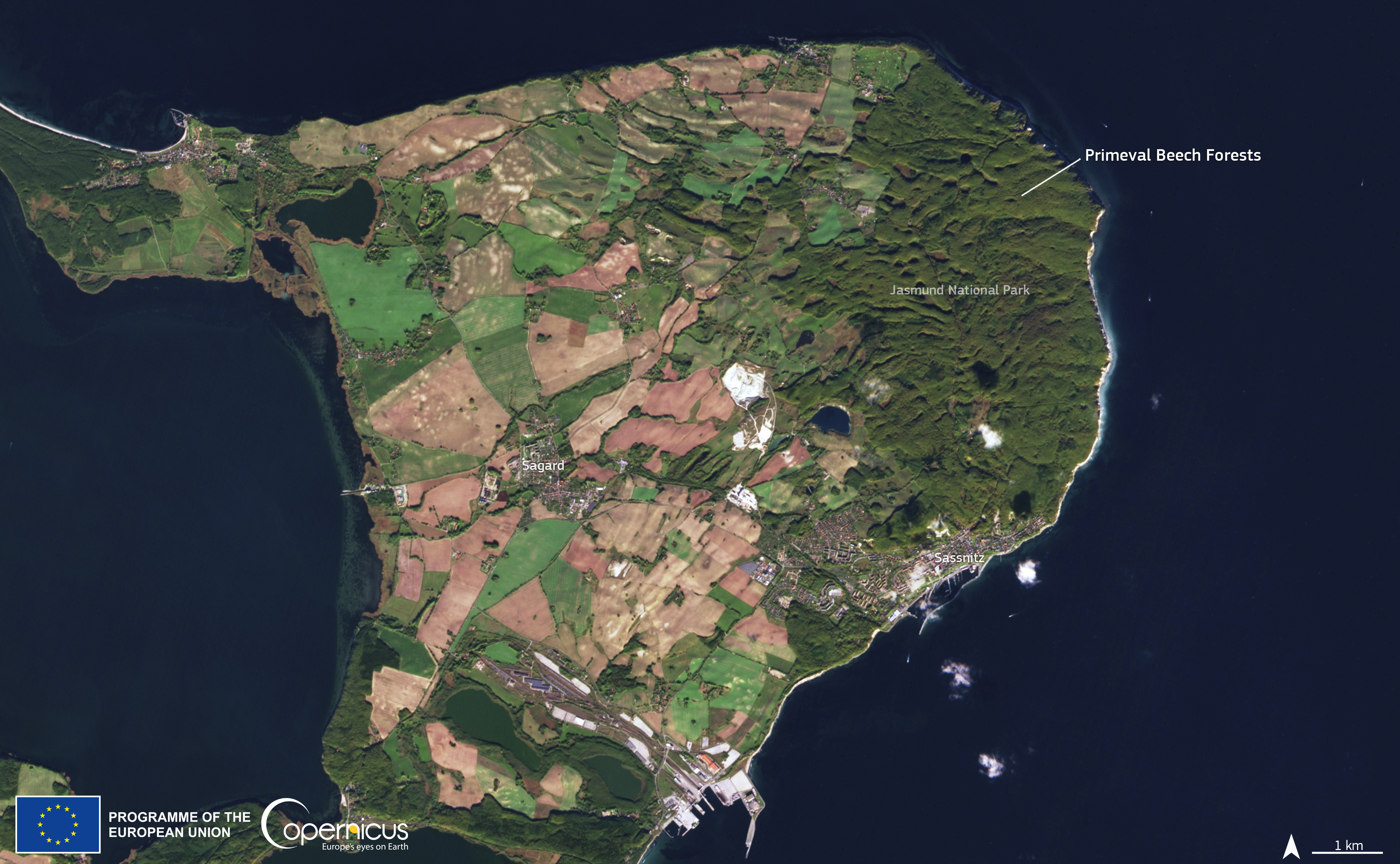
The Schmale Heide (literally "Narrow Heath") is a 9.5-kilometre-long and roughly 2-kilometre-wide bar between the Baltic seaside resort of Binz and the village of Neu Mukran near Sassnitz on the German island of Rügen. It lies in the municipality of Binz and is bounded to the northwest by the lagoon of the Kleiner Jasmunder Bodden and to the east by the bay of Prorer Wiek. Formation The shape of the heavily segmented coastline of Rügen was the result of interplay between variations in the mean sea level and rebound processes following the last ice age, the Weichselian glaciation. It is believed that the region of the present-day West Pomeranian Baltic Sea coast after the last ice age glacial advance (the North Rügen-East Usedom Step) has remained ice-free and largely part of the mainland for about 13,000 years. The level of the world's oceans was once lower than today due to the ice age. About 9,000 years ago, a meltwater lake, the Ancylus Lake, was formed, whose surface ... [...More Info...] [...Related Items...] OR: [Wikipedia] [Google] [Baidu] |
Prora WorldWind
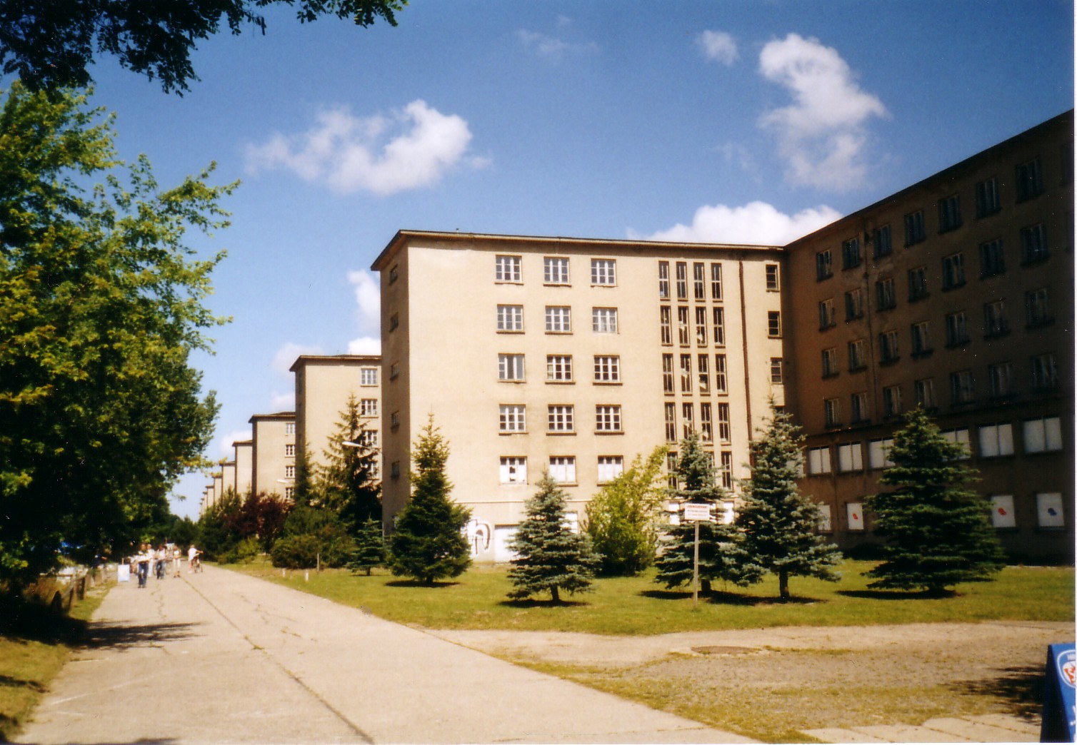
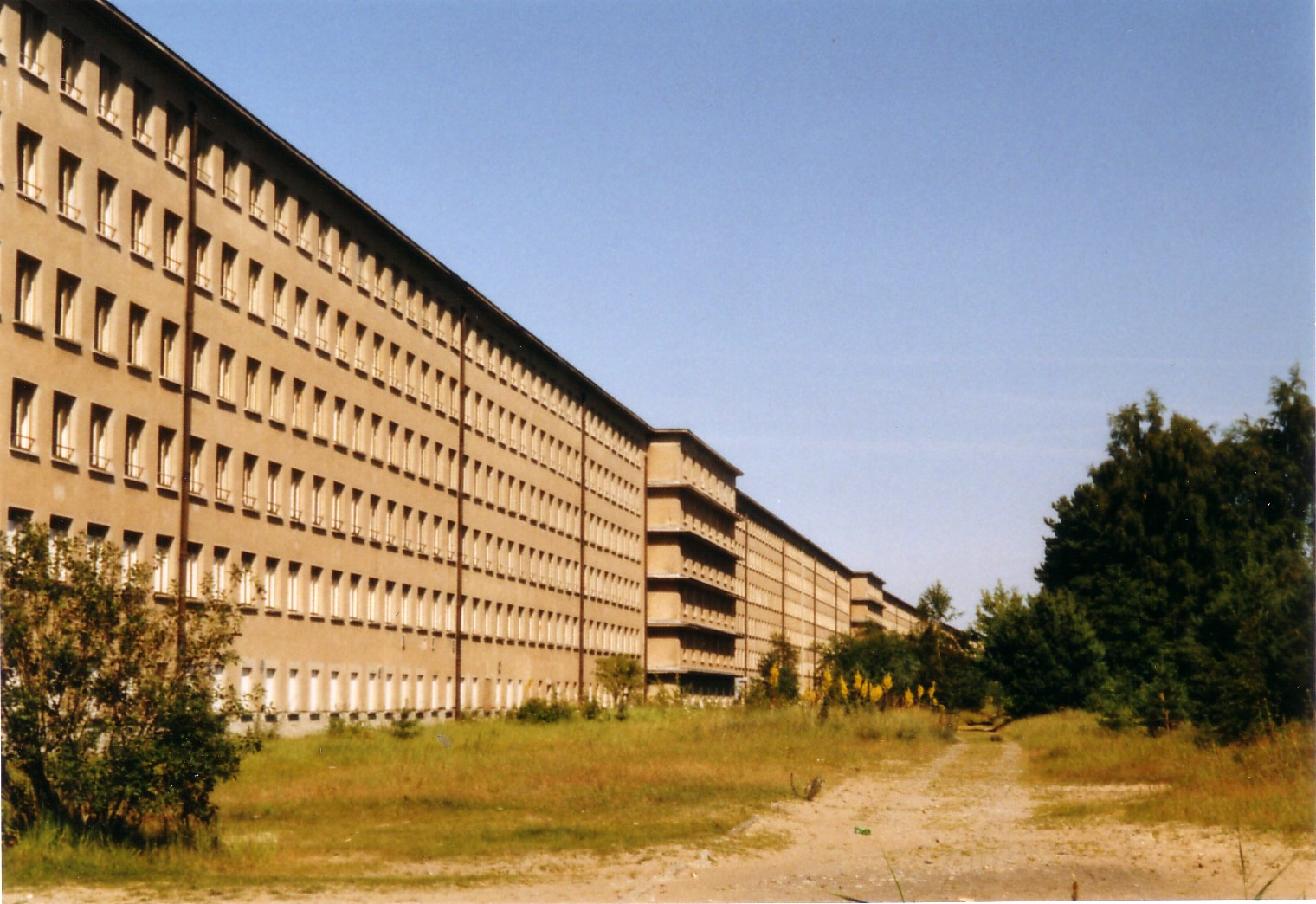
The Colossus of Prora, commonly known as simply "Prora", is a building complex in the municipality of Binz on the island of Rügen, Germany. It was built by Nazi Germany between 1936 and 1939 as part of the Strength Through Joy (Kraft durch Freude or KdF) project. It consisted of eight identical buildings and was in length parallel to the beach, with the surviving structures stretching . Although the buildings were planned as a holiday resort, construction was not completed, and they were not used for this purpose. Prora, as it was known, was however used largely by the Nazi Party for propaganda, with the supposed strength and power displayed in the construction effort of the complex likened by the party to that of themselves. After World War II, the complex found various military uses, first by the Soviet Army, then by the East German Volksarmee, and then by the German Bundeswehr. Today, it houses a large youth hostel, a hotel, and holiday apartments. Location Prora lies o ... [...More Info...] [...Related Items...] OR: [Wikipedia] [Google] [Baidu] |
Jasmund
Jasmund is a peninsula of the island of Rügen in Mecklenburg-Vorpommern, Germany. It is connected to the Wittow peninsula and to the Muttland main section of Rügen by the narrow land bridges Schaabe and Schmale Heide, respectively. Sassnitz Sassnitz (, before 1993 in ) is a town on the Jasmund peninsula, Rügen Island, in the state of Mecklenburg-Vorpommern, Germany. The population as of 2012 was 9,498. Sassnitz is a well-known seaside resort and port town, and is a gateway to th ..., Sagard and the Mukran international ferry terminal are on Jasmund. Jasmund is also famous for the Rügen Chalk cliffs within the Jasmund National Park, a nature reserve in the northeast of Rügen island. References Peninsulas of Mecklenburg-Western Pomerania Geography of Rügen {{VorpommernRügen-geo-stub ... [...More Info...] [...Related Items...] OR: [Wikipedia] [Google] [Baidu] |
Geography Of Rügen
Geography (from Ancient Greek ; combining 'Earth' and 'write', literally 'Earth writing') is the study of the lands, features, inhabitants, and phenomena of Earth. Geography is an all-encompassing discipline that seeks an understanding of Earth and world, its human and natural complexities—not merely where objects are, but also how they have changed and come to be. While geography is specific to Earth, many concepts can be applied more broadly to other Astronomical object, celestial bodies in the field of planetary science. Geography has been called "a bridge between natural science and social science disciplines." Origins of many of the concepts in geography can be traced to Greek Eratosthenes of Cyrene, who may have coined the term "geographia" (). The first recorded use of the word Geography (Ptolemy), γεωγραφία was as the title of a book by Greek scholar Claudius Ptolemy (100 – 170 AD). This work created the so-called "Ptolemaic tradition" of geography, w ... [...More Info...] [...Related Items...] OR: [Wikipedia] [Google] [Baidu] |
Prora
The Colossus of Prora, commonly known as simply "Prora", is a building complex in the municipality of Binz on the island of Rügen, Germany. It was built by Nazi Germany between 1936 and 1939 as part of the Strength Through Joy (Kraft durch Freude or KdF) project. It consisted of eight identical buildings and was in length parallel to the beach, with the surviving structures stretching . Although the buildings were planned as a holiday resort, construction was not completed, and they were not used for this purpose. Prora, as it was known, was however used largely by the Nazi Party for propaganda, with the supposed strength and power displayed in the construction effort of the complex likened by the party to that of themselves. After World War II, the complex found various military uses, first by the Soviet Army, then by the East German Volksarmee, and then by the German Bundeswehr. Today, it houses a large youth hostel, a hotel, and holiday apartments. Location Prora lies ... [...More Info...] [...Related Items...] OR: [Wikipedia] [Google] [Baidu] |
Strength Through Joy
NS Gemeinschaft ; KdF) was a German NSDAP-operated leisure organization in Nazi Germany. Richard Grunberger, ''The 12-Year Reich'', p. 197, It was part of the German Labour Front (), the national labour organization at that time. Set up in November 1933 as a tool to promote the advantages of Nazism to the German people and internationally, it was also used to ease the process of the rearmament of Germany. Through its structure of organized events and promotion of propaganda, it was also intended to prevent dissident and anti-state behavior. By 1939, it became the world's largest tourism operator. KdF was composed of several departments with their own specific goals, with each department organizing different leisure activities. It organized activities such as sporting events on factory floors, art exhibitions, discounted concerts and, most famously and popularly, subsidized holidays and cruise trips. One of its largest departments, although sometimes considered a separate organi ... [...More Info...] [...Related Items...] OR: [Wikipedia] [Google] [Baidu] |
Schaabe
The Schaabe is a bar (landform), bar, almost twelve kilometres long, on the German Baltic Sea island of Rügen. It joins the peninsulas of Jasmund and Wittow. Washed up and shaped by the sea, it forms a sickle-shaped shoreline on the bay of Tromper Wiek and separates the lagoons of the Großer Jasmunder Bodden and ''Breeger Bodden'' from the Baltic Sea, Baltic. The fine, washed up sand forms a giant natural bathing bay, that is bordered by the villages of Glowe and Juliusruh (a village in the municipality of Breege). Unlike the second largest bar on the island of Rügen, the Schmale Heide between Jasmund and the Granitz, which is dominated by the construction of the former Nazi "Strength Through Joy" resort of Prora and decades of military use and its associated infrastructure, the Schaabe between Glowe and Juliusruh is undeveloped apart from a managed forest, the only through road and its accompanying cycle path. Formation The Schaabe began to form about 4,500 years ago, wh ... [...More Info...] [...Related Items...] OR: [Wikipedia] [Google] [Baidu] |
European Mouflon
The European mouflon is a feral subspecies of the primitive Sheep, domestic sheep. It is found in Europe and western Asia. It is originally from western Asia. Description Male mouflon are known as rams and the females as ewes. The young animals are known as lambs. Appearance European mouflon have a body length of up to 120 cm, a shoulder height of 90 cm, a weight of 25 to 40 kg for ewes, 35 to 55 kg for the ram. The European mouflon has a smooth hairy coat, the rams are fox red-brown in the summer, usually with a whitish saddle patch, the ewes are brownish. Both sexes are darker in winter. The rams have helix-shaped horns up to 80 cm long; females have no horns on Sardinia, but on Corsica they have smaller horns that are slightly curved towards the rear. Senses As an animal whose ancestors used to live in open terrain above the tree line, the eyesight of the mouflon is well developed. Its laterally-located eyes allow the mouflon to scan a wi ... [...More Info...] [...Related Items...] OR: [Wikipedia] [Google] [Baidu] |
Stone Fields In The Schmale Heath And Extension
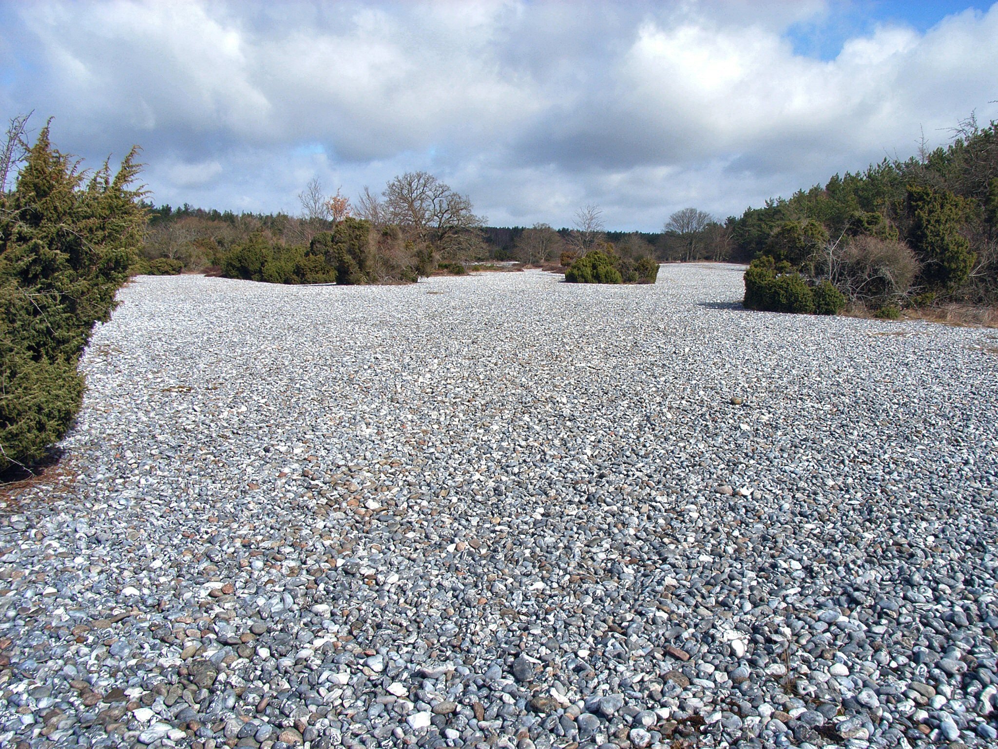
The Stone Fields in the Schmale Heath and Extension () is a nature reserve (Naturschutzgebiet), 199 hectares in area, on the German island of Rügen in Mecklenburg-Western Pomerania. It includes large flint fields (), a representative section of the Schmale Heide, Schmale Heath and a separate extension with near-natural coastal dunes. The reserve was created on 27 April 1935. Two extensions of the nature reserve area came into force in the years 1959 and 1990. The areas are located seven kilometres north of Binz between the Kleiner Jasmunder Bodden and the Baltic Sea. The reserve is assessed as in good condition. The high numbers of visiting tourists in the flint fields causes disturbances, though, to the fauna. The nature reserve is accessible via a footpath from Sassnitz#Town subdivisions, Neu Mukran. In 2009 the nature reserve areas were taken over by the German Federal Environment Foundation (''Deutsche Bundesstiftung Umwelt''). According to EU law, the nature res ... [...More Info...] [...Related Items...] OR: [Wikipedia] [Google] [Baidu] |
Feuersteinfelder Wiki
Flint fields () are large natural deposits of flint. They are found in numerous Jurassic and Cretaceous beds across the whole of Europe.''Breege'' at www.ruegenurlaub.de. Retrieved 19 Jun 2019 Such deposits may be found in -Lousberg, Kleinkems, , Osterberg bei Pfünz, , |
Chalk
Chalk is a soft, white, porous, sedimentary carbonate rock. It is a form of limestone composed of the mineral calcite and originally formed deep under the sea by the compression of microscopic plankton that had settled to the sea floor. Chalk is common throughout Western Europe, where deposits underlie parts of France, and steep cliffs are often seen where they meet the sea in places such as the Dover cliffs on the Kent coast of the English Channel. Chalk is mined for use in industry, such as for quicklime, bricks and builder's putty, and in agriculture, for raising pH in soils with high acidity. It is also used for " blackboard chalk" for writing and drawing on various types of surfaces, although these can also be manufactured from other carbonate-based minerals, or gypsum. Description Chalk is a fine-textured, earthy type of limestone distinguished by its light colour, softness, and high porosity. It is composed mostly of tiny fragments of the calcite shells or sk ... [...More Info...] [...Related Items...] OR: [Wikipedia] [Google] [Baidu] |
Paramoudra
Paramoudras, paramoudra flints, pot stones or potstones are flint nodules found mainly in parts of north-west Europe: Norfolk (United Kingdom), Ireland, Denmark, Spain and Germany. In Norfolk they are known as pot stones and can be found on the beach below Beeston Bump just outside Beeston Regis. In Ireland they are known as paramoudras. The term paramoudras was first used by Buckland in 1817 and is a corruption of a Gaelic name, probably padhramoudras "ugly Paddies" or peura muireach "sea pears". Pot stones are flint nodules with a hollow center and have the appearance of a doughnut (torus). They can be found in columns resembling a backbone. These flints are trace fossil A trace fossil, also called an ichnofossil (; ), is a fossil record of biological activity by lifeforms, but not the preserved remains of the organism itself. Trace fossils contrast with body fossils, which are the fossilized remains of part ...s of the burrows of an organism otherwise unknown ... [...More Info...] [...Related Items...] OR: [Wikipedia] [Google] [Baidu] |


