|
Sarıyar
Sarıyar is a neighbourhood in the municipality and district of Nallıhan, Ankara Province, Turkey. Its population is 501 (2022). Before the 2013 reorganisation, it was a town (''belde''). It is situated to the west of Sarıyar Dam reservoir and along the Sakarya River. The distance to Nallıhan is and to Ankara is . According to mayor's page, the name of the town ("yellow cliff") refers to the landscape around Sarıyar. During the dam construction years in 1950s, the population of the town increased because of services to construction. In 1983, Sarıyar was declared a seat of township. Nevertheless the population has dropped since then. At the present the main economic activity is agriculture and the main crops are vegetables and grapes. With picnic areas around the dam and the tomb of Taptuk Emre, a 13th-century dervish Dervish, Darvesh, or Darwīsh (from ) in Islam can refer broadly to members of a Sufi fraternity (''tariqah''), or more narrowly to a religious mendican ... [...More Info...] [...Related Items...] OR: [Wikipedia] [Google] [Baidu] |
Sarıyar Dam
Sarıyar Dam on the Sakarya River is north of the town of Sarıyar in the Nallıhan district of Ankara Province. It is west of the city of Ankara, the central Anatolian capital of Turkey. It is located upstream of Gökçekaya Dam on the Sakarya River, which runs into the Black Sea The Black Sea is a marginal sea, marginal Mediterranean sea (oceanography), mediterranean sea lying between Europe and Asia, east of the Balkans, south of the East European Plain, west of the Caucasus, and north of Anatolia. It is bound .... It was completed in 1956. The total power output from the hydroelectric facility is 160 MW (four facilities of 40 MW each). SourcesStructurae: Sariyar Dam [...More Info...] [...Related Items...] OR: [Wikipedia] [Google] [Baidu] |
Nallıhan
Nallıhan is a municipality and district of Ankara Province, Turkey. Its area is 2,079 km2, and its population 26,553 (2022). It is 157 km from the city of Ankara. Its elevation is 625 m. Nallıhan is one of many towns that claim to be the burial place of Taptuk Emre, who lived in the 12-13th century, and was the teacher of the popular folk poet and dervish Yunus Emre. Nallıhan ''Davutoğlan Bird Paradise'' attracts local and foreign tourists. Name Nallıhan is named after a caravanserai on the ancient Silk Road to the Orient next to the river ''Nallı''. There has been a settlement here for thousands of years. Today Silk farming, a tradition for centuries in Nallıhan, continues in many homes. Today, the town is known for its silk needlework, and local cuisine including stuffed vine-leaves, pilav, pumpkin dessert, gozleme (flat bread with cheese and potatoes filling), and many other types of more fine pastries such as baklava with locally grown walnut. The ... [...More Info...] [...Related Items...] OR: [Wikipedia] [Google] [Baidu] |
Sakarya River
The Sakarya (; ; ; ) is the third longest river in Turkey. It runs through the region known in ancient times as Phrygia. It was considered one of the principal rivers of Asia Minor (Anatolia) in Greek classical antiquity, and is mentioned in the ''Iliad'' and in ''Theogony''. Its name appears in different forms as Sagraphos, Sangaris, or Sagaris. In ''Geographica'', Strabo wrote during classical antiquity that the river had its sources on Mount Adoreus, near the town of Sangia in Phrygia, not far from the border with Galatia, and flowed in a very tortuous course: first in an eastern direction, then toward the north, then in a northwesterly direction and finally to the north through Bithynia into the Euxine (Black Sea). Pseudo-Plutarch wrote that a man named Sagaris often disdained the mysteries of the Mother of the Gods, frequently deriding her priests. She struck him with madness, and he flung himself into the river Xerobates, which from then on was called Sagaris. Part of ... [...More Info...] [...Related Items...] OR: [Wikipedia] [Google] [Baidu] |
Ankara Province
Ankara Province (, ) is a province and metropolitan municipality of Turkey with the capital city Ankara. Its area is 25,632 km2, and its population is 5,782,285 (2022). History The site of the modern city has been home to settlements by many historic Anatolian civilizations in antiquity and classical times, including Phrygians, Lydians, Persians and Alexander the Great, Romans, and Galatians. The city of Ankara became a fortified stronghold of the Byzantines; it fell to the Seljuk Turks and later the Ottoman Empire. It was finally chosen by Mustafa Kemal Atatürk and the Turkish National Movement as the site of the provisional government and the Turkish parliament in 1920, and in 1923 as the capital city of the newly established Republic of Turkey. Geography Ankara is mostly in the Central Anatolia region, and partly in the Black Sea region. Ankara has mountain forests to its north, and the dry plain of Konya to its south. The province is irrigated by the ... [...More Info...] [...Related Items...] OR: [Wikipedia] [Google] [Baidu] |
Turkey
Turkey, officially the Republic of Türkiye, is a country mainly located in Anatolia in West Asia, with a relatively small part called East Thrace in Southeast Europe. It borders the Black Sea to the north; Georgia (country), Georgia, Armenia, Azerbaijan, and Iran to the east; Iraq, Syria, and the Mediterranean Sea to the south; and the Aegean Sea, Greece, and Bulgaria to the west. Turkey is home to over 85 million people; most are ethnic Turkish people, Turks, while ethnic Kurds in Turkey, Kurds are the Minorities in Turkey, largest ethnic minority. Officially Secularism in Turkey, a secular state, Turkey has Islam in Turkey, a Muslim-majority population. Ankara is Turkey's capital and second-largest city. Istanbul is its largest city and economic center. Other major cities include İzmir, Bursa, and Antalya. First inhabited by modern humans during the Late Paleolithic, present-day Turkey was home to List of ancient peoples of Anatolia, various ancient peoples. The Hattians ... [...More Info...] [...Related Items...] OR: [Wikipedia] [Google] [Baidu] |
TÜİK
Turkish Statistical Institute (commonly known as TurkStat; or TÜİK) is the Turkish government agency commissioned with producing official statistics on Turkey, its population, resources, economy, society, and culture. It was founded in 1926 and headquartered in Ankara. Formerly named as the State Institute of Statistics (Devlet İstatistik Enstitüsü (DİE)), the institute was renamed as the Turkish Statistical Institute on November 18, 2005. See also * List of Turkish provinces by life expectancy References External linksOfficial website of the institute National statistical services Statistical Organizations established in 1926 Organizations based in Ankara {{Sci-org-stub ... [...More Info...] [...Related Items...] OR: [Wikipedia] [Google] [Baidu] |
2013 Turkish Local Government Reorganisation
Municipalities () are the basic units of local government in Turkey. According to the Turkish Statistical Institute the population of Turkey Turkey, officially the Republic of Türkiye, is a country mainly located in Anatolia in West Asia, with a relatively small part called East Thrace in Southeast Europe. It borders the Black Sea to the north; Georgia (country), Georgia, Armen ... was 76,667,864 as of 31 December 2013. The majority of the population live in settlements with municipalities. The number of municipalities in Turkey was 2,947 in 2009. But in 2013, most of the small town () municipalities were merged to district () municipalities by the Act 6360Law No. 6360 '' Offi ... [...More Info...] [...Related Items...] OR: [Wikipedia] [Google] [Baidu] |
Belde
Belde (literally "town", also known as ''kasaba'') means "large village with a municipality" in Turkish language, Turkish. All Turkish province centers and district centers have municipalities, but the Villages of Turkey, villages are usually too small to have municipalities. The population in some villages may exceed 2000 and in such villages a small municipality may be established depending on residents' choice. Such villages are called ''belde''. Up to 2014 the number of ''belde'' municipalities was about 1400. On 30 March 2014 by the act no. 6360 all villages (those with and without municipality) were included in the urban fabric of the district municipalities in 30 provinces. Thus ''belde'' municipalities in 30 provinces were abolished. The number of abolished ''belde'' municipalities is 1040. Presently, in 51 provinces, which are not in the scope of the act no 6360, there are still 394 ''belde'' municipalities. See also *2013 Turkish local government reorganisation *Metropo ... [...More Info...] [...Related Items...] OR: [Wikipedia] [Google] [Baidu] |
Official Gazette Of The Republic Of Turkey
''Official Gazette of the Republic of Türkiye'' () is the national and only official journal of Turkey that publishes the new legislation and other official announcements. It is referred to as ''Resmî Gazete'' in short. It has been published since 7 February 1921, approximately two years before the proclamation of the republic. The first fifteen issues of the newspaper were published once a week, the next three issues once every two weeks, the next three issues once a week. From 18 July 1921 to 10 September 1923, the newspaper was not published due to the Turkish War of Independence. Since Issue No. 763, which was released on 17 December 1927, it has been officially published under the name ''Türkiye Cumhuriyeti Resmî Gazete''. As of 1 December 1928, it started to be printed with the new Turkish alphabet The Turkish alphabet () is a Latin-script alphabet used for writing the Turkish language, consisting of 29 letters, seven of which ( Ç, Ğ, I, İ, Ö, Ş and Ü) h ... [...More Info...] [...Related Items...] OR: [Wikipedia] [Google] [Baidu] |
Ankara
Ankara is the capital city of Turkey and List of national capitals by area, the largest capital by area in the world. Located in the Central Anatolia Region, central part of Anatolia, the city has a population of 5,290,822 in its urban center (Etimesgut, Yenimahalle, Çankaya District, Çankaya, Keçiören, Altındağ, Pursaklar, Mamak, Ankara, Mamak, Gölbaşı, Ankara, Gölbaşı, Sincan, Ankara, Sincan) and 5,864,049 in Ankara Province (total of 25 districts). Ankara is Turkey's List of cities in Turkey, second-largest city by population after Istanbul, first by urban land area, and third by metro land area after Konya and Sivas. Ankara was historically known as Ancyra and Angora. Serving as the capital of the ancient Celts, Celtic state of Galatia (280–64 BC), and later of the Roman Empire, Roman province with the Galatia (Roman province), same name (25 BC–7th century), Ankara has various Hattians, Hattian, Hittites, Hittite, Lydian, Phrygian, Galatians (people ... [...More Info...] [...Related Items...] OR: [Wikipedia] [Google] [Baidu] |
Dervish
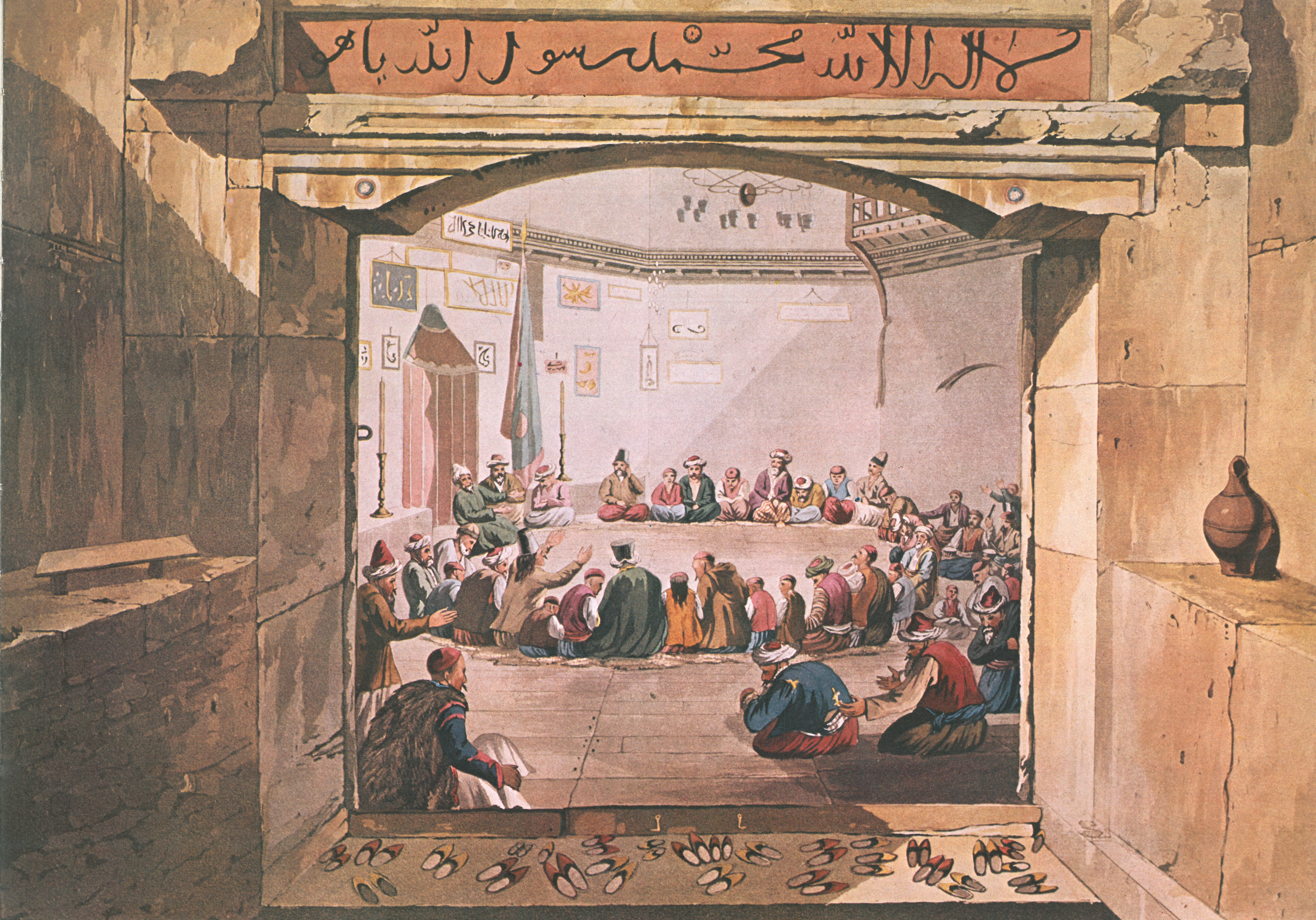
Dervish, Darvesh, or Darwīsh (from ) in Islam can refer broadly to members of a Sufi fraternity (''tariqah''), or more narrowly to a religious mendicant, who chose or accepted material poverty. The latter usage is found particularly in Persian and Turkish (''derviş'') as well as in Tamazight (''Aderwic''), corresponding to the Arabic term '' faqīr''. Their focus is on the universal values of love and service, deserting the illusions of ego (''nafs'') to reach God. In most Sufi orders, a dervish is known to practice ''dhikr'' through physical exertions or religious practices to attain the ecstatic trance to reach God. Their most popular practice is Sama, which is associated with the 13th-century mystic Rumi. In folklore and with adherents of Sufism, dervishes are often credited with the ability to perform miracles and ascribed supernatural powers. Historically, the term Dervish has also been used more loosely, as the designation of various Islamic political movements or mil ... [...More Info...] [...Related Items...] OR: [Wikipedia] [Google] [Baidu] |


