|
Sardarpur
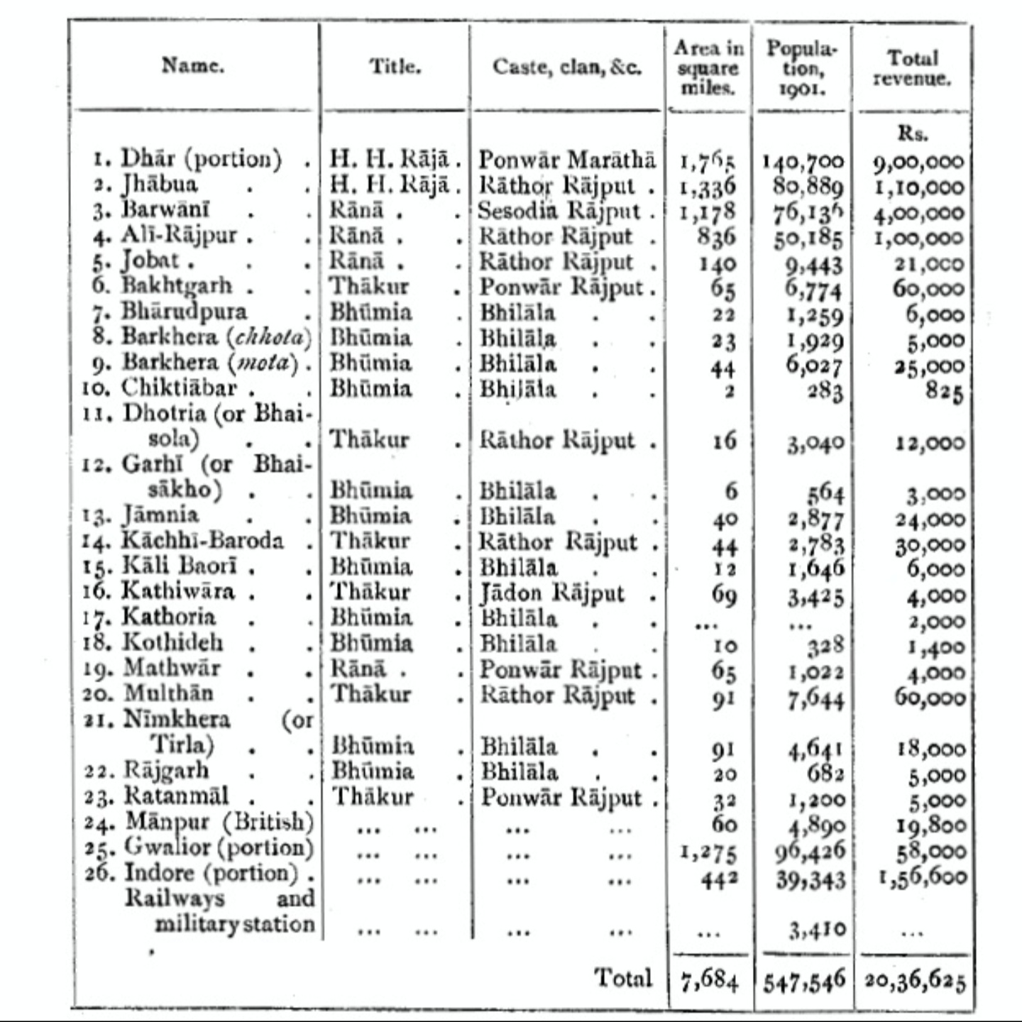
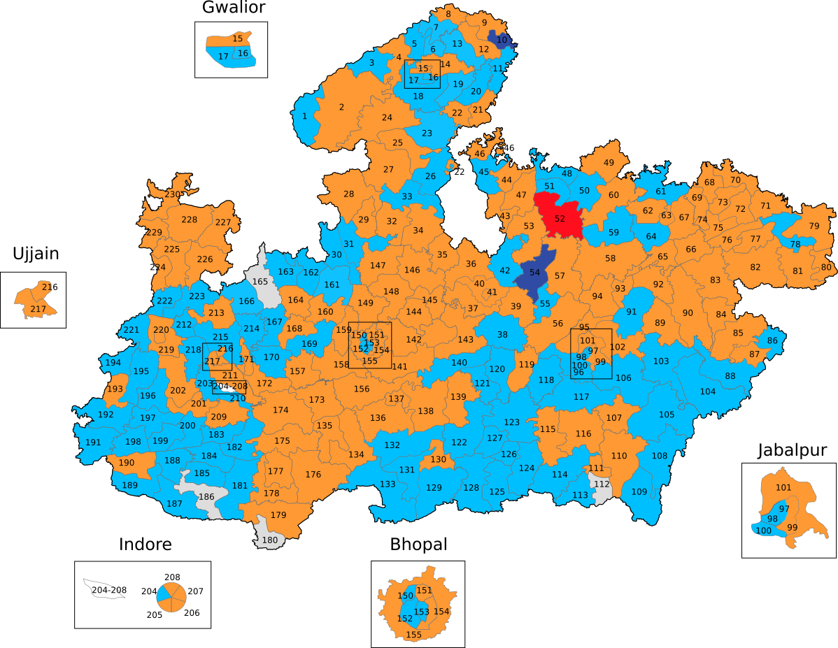
Sardarpur is a town and a nagar panchayat in Dhar district in the Indian state of Madhya Pradesh. It is a town on Mahi river on the Malwa plateau. There is an ancient Shivalinga situated at the bank of Mahi river at a place called Shree Jhineshwar Dham; Shri Mohankheda Jain Thirth and Bhopawar Jain Tirth are located nearby. It is one of the 230 Vidhan Sabha (Legislative Assembly) constituencies of Madhya Pradesh state in central India. History Sardarpur was a British station in Central India during the British Raj, and was within the state of Gwalior. It was the headquarters of the political agent for the Bhopawar agency, and of the Malwa Bhil corps, originally raised in 1837 and converted into a military police battalion by around 1900. Demographics India census A census is the procedure of systematically acquiring, recording and calculating information about the members of a given population. This term is used mostly in connection with national population and housing c ... [...More Info...] [...Related Items...] OR: [Wikipedia] [Google] [Baidu] |
Dhar District
Dhar district is a district of Madhya Pradesh state in central India. The historic town of Dhar is administrative headquarters of the district. The district has an area 8,153 km2. It is bounded by the districts of Ratlam to the north, Ujjain to the northeast, Indore to the east, Khargone (West Nimar) to the southeast, Barwani to the south, Jhabua and Alirajpur to the west. It is part of the Indore Division of Madhya Pradesh. The population of the district is 2,185,793 (2011 census), an increase of 25.60% from its 2001 population of 1,740,329. Pithampur is a large industrial area comes under Dhar District. Kukshi is the largest tehsil of the district. Geography The Vindhya Range runs east and west through the district. The northern part of the district lies on the Malwa plateau. The northwestern portion of the district lies in the watershed of the Mahi River and its tributaries, while the northeastern part of the district lies in the watershed of the Chambal River, which ... [...More Info...] [...Related Items...] OR: [Wikipedia] [Google] [Baidu] |
Bhopawar Agency
Bhopawar Agency was a sub-agency of the Central India Agency in British India with the headquarters at the town of Bhopawar, so the name. Bhopawar Agency was created in 1882 from a number of princely states in the Western Nimar and Southern Malwa regions of Central India belonging to the former Bhil Agency and Bhil Sub-agency with the capitals at Bhopawar and Manpur. The agency was named after Bhopawar, a village in Sardarpur tehsil, Dhar District of present-day Madhya Pradesh state. Manpur remained a strictly British territory. The other chief towns of this region were: Badnawar, Kukshi, Manawar and Sardarpur, Chadawad Estate, Dattigaon. The mighty Vindhya and Satpura ranges crossed the territory of the agency roughly from east to west, with the fertile valley of the Narmada River lying between them. The agency also included the "Bhil Country", inhabited by the Bhil people. History At the time of its 1882 establishment, the agency had a total area of , and its po ... [...More Info...] [...Related Items...] OR: [Wikipedia] [Google] [Baidu] |
Madhya Pradesh Vidhan Sabha
The Madhya Pradesh Vidhan Sabha or the Madhya Pradesh Legislative Assembly is the unicameral state legislature of Madhya Pradesh state in India. The seat of the Vidhan Sabha is at Bhopal, the capital of the state. It is housed in the ''Vidhan Bhavan'', an imposing building located at the center of the Capital Complex in the Arera Hill locality of Bhopal city. The term of the Vidhan Sabha is five years unless dissolved earlier. Presently, it comprises 230 members who are directly elected from single-seat constituencies.33 constituencies are reserved for the candidates belonging to the Scheduled castes and 45 are reserved for the candidates belonging to the Scheduled tribes History The history of the Madhya Pradesh legislature can be traced back to 1913, as the Central Provinces Legislative Council was formed on 8 November of this year. Later, the Government of India Act 1935 provided for the elected Central Provinces Legislative assembly. The first elections to the Cen ... [...More Info...] [...Related Items...] OR: [Wikipedia] [Google] [Baidu] |
Mahi River
The Mahi is a river in western India. It rises in Madhya Pradesh and, after flowing through the Vagad region of Rajasthan, enters Gujarat and flows into the Arabian Sea. It is one of the relatively few west-flowing rivers in India, alongside the endorheic Luni River, the Sabarmati River, the Tapi River and the Narmada River. Most peninsular rivers in India flow eastward into the Bay of Bengal or northward into the Ganges River. It has given its name to the Mahi Kantha agency of Bombay, and also to the mehwasis, marauding highlanders often mentioned in Arabian chronicles. The exact position of Mahi River origin is Minda Village, which is situated in Dhar district Madhya Pradesh. The Mahi river rises in the western Vindhya Range, just south of Sardarpur, and flows northward through Madhya Pradesh state. Turning northwest, it enters Rajasthan state and then turns southwest to flow through Gujarat state through the north of Vadodara city outskirts and enters the sea by a wi ... [...More Info...] [...Related Items...] OR: [Wikipedia] [Google] [Baidu] |
Malwa
Malwa is a historical region, historical list of regions in India, region of west-central India occupying a plateau of volcanic origin. Geologically, the Malwa Plateau generally refers to the volcanic plateau, volcanic upland north of the Vindhya Range. Politically and administratively, it is also synonymous with the former state of Madhya Bharat which was later merged with Madhya Pradesh. At present the historical Malwa region includes districts of western Madhya Pradesh and parts of south-eastern Rajasthan. Sometimes the definition of Malwa is extended to include the Nimar region south of the Vindhyas. The Malwa region had been a separate political unit from the time of the ancient Malava Kingdom. It has been ruled by several kingdoms and dynasties, including the Avanti (India), Avanti Kingdom, The Maurya Empire, Mauryans, the Malavas, the Gupta Empire, Guptas, the Paramaras, the Delhi Sultanate, the Malwa Sultanate, Malwa sultans, the Mughal Empire, Mughals and the Maratha E ... [...More Info...] [...Related Items...] OR: [Wikipedia] [Google] [Baidu] |
Malwa Bhil
Malwa is a historical region of west-central India occupying a plateau of volcanic origin. Geologically, the Malwa Plateau generally refers to the volcanic upland north of the Vindhya Range. Politically and administratively, it is also synonymous with the former state of Madhya Bharat which was later merged with Madhya Pradesh. At present the historical Malwa region includes districts of western Madhya Pradesh and parts of south-eastern Rajasthan. Sometimes the definition of Malwa is extended to include the Nimar region south of the Vindhyas. The Malwa region had been a separate political unit from the time of the ancient Malava Kingdom. It has been ruled by several kingdoms and dynasties, including the Avanti Kingdom, The Mauryans, the Malavas, the Guptas, the Paramaras, the Delhi Sultanate, the Malwa sultans, the Mughals and the Marathas. Malwa continued to be an administrative division until 1947, when the Malwa Agency of British India was merged into Madhya Bharat (also ... [...More Info...] [...Related Items...] OR: [Wikipedia] [Google] [Baidu] |
Gwalior
Gwalior() is a major city in the central Indian state of Madhya Pradesh; it lies in northern part of Madhya Pradesh and is one of the Counter-magnet cities. Located south of Delhi, the capital city of India, from Agra and from Bhopal, the state capital, Gwalior occupies a strategic location in the Gird region of India. The historic city and its fortress have been ruled by several historic Indian kingdoms. From the Kachchhapaghatas in the 10th century, Tomars in the 13th century, it was passed on to the Mughal Empire, then to the Maratha in 1754, and the Scindia dynasty of Maratha Empire in the 18th century. In April 2021, It was found that Gwalior had the best air quality index (AQI 152) amongst the 4 major cities in Madhya Pradesh. Besides being the administrative headquarters of Gwalior district and Gwalior division, Gwalior has many administrative offices of the Chambal division of northern Madhya Pradesh. Several administrative and judicial organisations, commi ... [...More Info...] [...Related Items...] OR: [Wikipedia] [Google] [Baidu] |
British Raj
The British Raj (; from Hindi language, Hindi ''rāj'': kingdom, realm, state, or empire) was the rule of the British The Crown, Crown on the Indian subcontinent; * * it is also called Crown rule in India, * * * * or Direct rule in India, * Quote: "Mill, who was himself employed by the British East India company from the age of seventeen until the British government assumed direct rule over India in 1858." * * and lasted from 1858 to 1947. * * The region under British control was commonly called India in contemporaneous usage and included areas directly administered by the United Kingdom of Great Britain and Ireland, United Kingdom, which were collectively called Presidencies and provinces of British India, British India, and areas ruled by indigenous rulers, but under British British paramountcy, paramountcy, called the princely states. The region was sometimes called the Indian Empire, though not officially. As ''India'', it was a founding member of the League of Nations, a ... [...More Info...] [...Related Items...] OR: [Wikipedia] [Google] [Baidu] |
Shree Jhineshwar Dham
Shree may refer to: * Sri, an honorific commonly used in the Indian subcontinent * Shree (Hindustani raga), the Hindustani classical music scale * Shree (Carnatic raga), the Carnatic music scale * Sri (Odissi raga), the Odissi classical music scale * ''Shree'' (2002 film), a Tamil film starring Suriya, Shruthika, and Gayatri Jayaraman * ''Shree'' (2013 film), a Hindi film starring Hussain Kuwajerwala, Paresh Ganatra and Anjali Patil * ''Shree'' (TV series), a Hindi supernatural soap opera * Shri, another name for the Hindu Goddess Lakshmi People *Shree Bose, an American scientist, winner of the inaugural Google Science Fair The Google Science Fair was a worldwide (excluding Cuba, Iran, North Korea, Sudan, Myanmar/Burma, Syria, Zimbabwe and any other U.S. sanctioned country) online science competition sponsored by Google, Lego, Virgin Galactic, National Geographic ... See also * * * Sri (other) {{disambiguation ... [...More Info...] [...Related Items...] OR: [Wikipedia] [Google] [Baidu] |
Lingam
A lingam ( sa, लिङ्ग , lit. "sign, symbol or mark"), sometimes referred to as linga or Shiva linga, is an abstract or aniconic representation of the Hindu god Shiva in Shaivism. It is typically the primary ''murti'' or devotional image in Hindu temples dedicated to Shiva, also found in smaller shrines, or as self-manifested natural objects. It is often represented within a disc-shaped platform, the '' yoni'' – its feminine counterpart, consisting of a flat element, horizontal compared to the vertical lingam, and designed to allow liquid offerings to drain away for collection. Together, they symbolize the merging of microcosmos and macrocosmos, the divine eternal process of creation and regeneration, and the union of the feminine and the masculine that recreates all of existence. The original meaning of ''lingam'' as "sign" is used in Shvetashvatara Upanishad, which says "Shiva, the Supreme Lord, has no liūga", liuga ( sa, लिऊग ) meaning he is t ... [...More Info...] [...Related Items...] OR: [Wikipedia] [Google] [Baidu] |
Plateau
In geology and physical geography, a plateau (; ; ), also called a high plain or a tableland, is an area of a highland consisting of flat terrain that is raised sharply above the surrounding area on at least one side. Often one or more sides have deep hills or escarpments. Plateaus can be formed by a number of processes, including upwelling of volcanic magma, extrusion of lava, and erosion by water and glaciers. Plateaus are classified according to their surrounding environment as intermontane, piedmont, or continental. A few plateaus may have a small flat top while others have wide ones. Formation Plateaus can be formed by a number of processes, including upwelling of volcanic magma, extrusion of lava, Plate tectonics movements and erosion by water and glaciers. Volcanic Volcanic plateaus are produced by volcanic activity. The Columbia Plateau in the north-western United States is an example. They may be formed by upwelling of volcanic magma or extrus ... [...More Info...] [...Related Items...] OR: [Wikipedia] [Google] [Baidu] |
WikiProject Indian Cities
A WikiProject, or Wikiproject, is a Wikimedia movement affinity group for contributors with shared goals. WikiProjects are prevalent within the largest wiki, Wikipedia, and exist to varying degrees within sister projects such as Wiktionary, Wikiquote, Wikidata, and Wikisource. They also exist in different languages, and translation of articles is a form of their collaboration. During the COVID-19 pandemic, CBS News noted the role of Wikipedia's WikiProject Medicine in maintaining the accuracy of articles related to the disease. Another WikiProject that has drawn attention is WikiProject Women Scientists, which was profiled by '' Smithsonian'' for its efforts to improve coverage of women scientists which the profile noted had "helped increase the number of female scientists on Wikipedia from around 1,600 to over 5,000". On Wikipedia Some Wikipedia WikiProjects are substantial enough to engage in cooperative activities with outside organizations relevant to the field at issue. ... [...More Info...] [...Related Items...] OR: [Wikipedia] [Google] [Baidu] |


