|
San Vicente (volcano)
San Vicente (also known as Chichontepec or Las Chiches) is a stratovolcano in central El Salvador. It is located next to the town of San Vicente (hence the name) and is the second highest volcano in El Salvador. In the indigenous language Nahuat, Chichontepec means ''the mountain of the two breasts'', because its double summit resembles a woman's bosom. The volcano has two craters, one located in each summit, although not exactly at the top. A dense jungle covers both summits. Numerous hot springs and fumaroles are found on the northern and western flanks of the volcano. To the northeast, at 820 metres in a ravine of 180 metres longitude, there are fumaroles—fountains of clear and muddy water or small volcanoes of mud. The last significant eruption occurred more than 1,700 years ago. The volcano may have had a very long history of repeated, and sometimes violent, eruptions, and at least once a large section of the volcano collapsed in a massive landslide. On August 9, 1995, ... [...More Info...] [...Related Items...] OR: [Wikipedia] [Google] [Baidu] |
Breast-shaped Hill
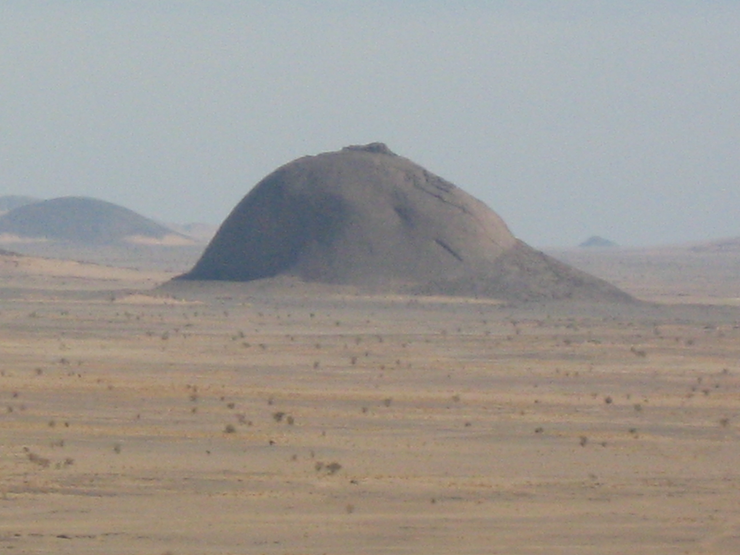
Some breast-shaped hills are named "wikt:pap#Etymology 2, pap", an archaic word for the breast or nipple of a woman, particularly those with a small hilltop protuberance. Such anthropomorphic geographic features are found in different parts of the world, and in some traditional cultures, they were once revered as the attributes of the Mother Goddess, such as the Paps of Anu, named after Anu (Irish goddess), Anu, an important female deity of pre-Christian Ireland. Overview The name ''Mamucium'' that gave origin to the name of the city of Manchester is thought to derive from a Celtic language name meaning "breast-shaped hill", referring to the sandstone bluff on which the fort stood; this later evolved into the name Manchester. ''Mamelon'' (from French "nipple") is a French name for a breast-shaped hillock. Mamelon (fort), Fort Mamelon was a famous hillock fortified by the Russians and captured by the French as part of the Siege of Sevastopol (1854–1855), Siege of Sevastopol du ... [...More Info...] [...Related Items...] OR: [Wikipedia] [Google] [Baidu] |
Hot Spring
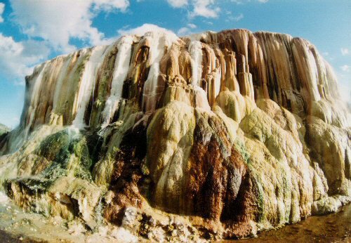
A hot spring, hydrothermal spring, or geothermal spring is a Spring (hydrology), spring produced by the emergence of Geothermal activity, geothermally heated groundwater onto the surface of the Earth. The groundwater is heated either by shallow bodies of magma (molten rock) or by circulation through fault (geology), faults to hot rock deep in the Earth's crust. Hot spring water often contains large amounts of dissolved minerals. The chemistry of hot springs ranges from acid sulfate springs with a pH as low as 0.8, to alkaline chloride springs saturated with silica, to bicarbonate springs saturated with carbon dioxide and carbonate minerals. Some springs also contain abundant dissolved iron. The minerals brought to the surface in hot springs often feed communities of extremophiles, microorganisms adapted to extreme conditions, and it is possible that life on Earth had its origin in hot springs. Humans have made use of hot springs for bathing, relaxation, or medical therapy for th ... [...More Info...] [...Related Items...] OR: [Wikipedia] [Google] [Baidu] |
Mountains Of El Salvador
A mountain is an elevated portion of the Earth's crust, generally with steep sides that show significant exposed bedrock. Although definitions vary, a mountain may differ from a plateau in having a limited summit area, and is usually higher than a hill, typically rising at least above the surrounding land. A few mountains are isolated summits, but most occur in mountain ranges. Mountains are formed through tectonic forces, erosion, or volcanism, which act on time scales of up to tens of millions of years. Once mountain building ceases, mountains are slowly leveled through the action of weathering, through slumping and other forms of mass wasting, as well as through erosion by rivers and glaciers. High elevations on mountains produce colder climates than at sea level at similar latitude. These colder climates strongly affect the ecosystems of mountains: different elevations have different plants and animals. Because of the less hospitable terrain and climate, mountains t ... [...More Info...] [...Related Items...] OR: [Wikipedia] [Google] [Baidu] |
List Of Stratovolcanoes
A list of stratovolcanoes follows below. Africa Cameroon * Mount Manengouba, Eboga stratovolcano * Little Mount Cameroon * Mount Cameroon * Mount Oku Democratic Republic of Congo * Mount Nyiragongo, Goma; designated as a Decade Volcano ** It contains an active lava lake inside its crater which overflowed due to cracks in 2002. * Mount Mikeno * Mount Karisimbi * Mount Bisoke * Mount Sabyinyo * Mount Kahuzi Eritrea * Alid Volcano * Dubbi Volcano * Nabro Volcano Ethiopia * Adwa (volcano), Adwa * Aluto * Borawli, Afar Region * Mount Chilalo * Dabbahu Volcano * Mount Fentale Kenya * Mount Kenya, which contains several volcanic plugs on its peak. * Mount Longonot Rwanda * Mount Bisoke, on the border between Rwanda and the Democratic Republic of the Congo. * Mount Gahinga, on the border between Rwanda and Uganda. * Mount Karisimbi, on the border between Rwanda and the Democratic Republic of the Congo. * Mount Muhabura, on the border between Rwanda and Uganda. * Mount ... [...More Info...] [...Related Items...] OR: [Wikipedia] [Google] [Baidu] |
List Of Volcanoes In El Salvador ...
This is a list of active and extinct volcanoes in El Salvador. Volcanoes See also * Central America Volcanic Arc * List of volcanoes in Guatemala * List of volcanoes in Honduras * List of volcanoes in Nicaragua References {{Central American volcanoes El Salvador Volcanoes A volcano is commonly defined as a vent or fissure in the crust of a planetary-mass object, such as Earth, that allows hot lava, volcanic ash, and gases to escape from a magma chamber below the surface. On Earth, volcanoes are most often fo ... [...More Info...] [...Related Items...] OR: [Wikipedia] [Google] [Baidu] |
Aviateca Flight 901
Aviateca Flight 901 was a scheduled international passenger flight which crashed into the San Vicente volcano in El Salvador on approach to the Comalapa International Airport on 9 August 1995. The accident killed all 65 passengers and crew on board and is the deadliest aviation disaster to occur in El Salvador. An investigation by the Civil Aviation Authority determined that pilot error and air traffic control error in bad weather contributed to the accident. Background Aviateca Flight 901 was operated by a Boeing 737-2H6 ( registration number: N125GU). The aircraft was the 1,114th Boeing 737 built and the airline acquired it in March 1995. At the time of the accident, the aircraft had logged 16,645 flight hours and 20,323 flight cycles (takeoffs and landings). The IATA flight number was GU901. The captain was 39-year-old Axel Byron Miranda Herrera and the first officer was 36-year-old Víctor Francisco Sandoval Salguero. Both pilots were retired pilots of the Guatemalan ... [...More Info...] [...Related Items...] OR: [Wikipedia] [Google] [Baidu] |
United States Geological Survey
The United States Geological Survey (USGS), founded as the Geological Survey, is an agency of the U.S. Department of the Interior whose work spans the disciplines of biology, geography, geology, and hydrology. The agency was founded on March 3, 1879, to study the landscape of the United States, its natural resources, and the natural hazards that threaten it. The agency also makes maps of planets and moons, based on data from U.S. space probes. The sole scientific agency of the U.S. Department of the Interior, USGS is a fact-finding research organization with no regulatory responsibility. It is headquartered in Reston, Virginia, with major offices near Lakewood, Colorado; at the Denver Federal Center; and in NASA Research Park in California. In 2009, it employed about 8,670 people. The current motto of the USGS, in use since August 1997, is "science for a changing world". The agency's previous slogan, adopted on its hundredth anniversary, was "Earth Science in the Pub ... [...More Info...] [...Related Items...] OR: [Wikipedia] [Google] [Baidu] |
Volcanic Landslide
A volcanic landslide or volcanogenic landslide is a type of mass wasting that takes place at volcanoes. Occurrences All volcanic edifices are susceptible to landslides, particularly stratovolcanoes and shield volcanoes where landslides are important processes. Volcanic landslides range in size from less than to more than . The largest volcanic landslides on Earth occur from submarine volcanoes and are several times larger than those that occur on land. Submarine landslides with volumes of have occurred in the Canary Islands within the last 43 million years, but the largest submarine landslides could have been up to in volume. Massive submarine landslides have also taken place in the Hawaiian Islands over the last several million years, the largest of which constitute significant portions of the islands from which they originated. Smaller landslides have also been identified at volcanoes on Mars and Venus. Martian landslides reach lengths of and more whereas the largest Venus ... [...More Info...] [...Related Items...] OR: [Wikipedia] [Google] [Baidu] |
Fumarole
A fumarole (or fumerole) is a vent in the surface of the Earth or another rocky planet from which hot volcanic gases and vapors are emitted, without any accompanying liquids or solids. Fumaroles are characteristic of the late stages of volcanic activity, but fumarole activity can also precede a volcanic eruption and has been used for eruption prediction. Most fumaroles die down within a few days or weeks of the end of an eruption, but a few are persistent, lasting for decades or longer. An area containing fumaroles is known as a fumarole field. The predominant vapor emitted by fumaroles is steam, formed by the circulation of groundwater through heated rock. This is typically accompanied by volcanic gases given off by magma cooling deep below the surface. These volcanic gases include sulfur compounds, such as various sulfur oxides and hydrogen sulfide, and sometimes hydrogen chloride, hydrogen fluoride, and other gases. A fumarole that emits significant sulfur compounds is some ... [...More Info...] [...Related Items...] OR: [Wikipedia] [Google] [Baidu] |
Volcanic Crater
A volcanic crater is an approximately circular depression in the ground caused by volcanic activity. It is typically a bowl-shaped feature containing one or more vents. During volcanic eruptions, molten magma and volcanic gases rise from an underground magma chamber, through a conduit, until they reach the crater's vent, from where the gases escape into the atmosphere and the magma is erupted as lava. A volcanic crater can be of large dimensions, and sometimes of great depth. During certain types of explosive eruptions, a volcano's magma chamber may empty enough for an area above it to subside, forming a type of larger depression known as a caldera. Geomorphology In most volcanoes, the crater is situated at the top of a mountain formed from the erupted volcanic deposits such as lava flows and tephra. Volcanoes that terminate in such a summit crater are usually of a conical form. Other volcanic craters may be found on the flanks of volcanoes, and these are commonly refe ... [...More Info...] [...Related Items...] OR: [Wikipedia] [Google] [Baidu] |
El Salvador
El Salvador, officially the Republic of El Salvador, is a country in Central America. It is bordered on the northeast by Honduras, on the northwest by Guatemala, and on the south by the Pacific Ocean. El Salvador's capital and largest city is San Salvador. The country's population in 2024 was estimated to be 6 million according to a government census. Among the Mesoamerican nations that historically controlled the region are the Maya peoples, Maya, and then the Cuzcatlan, Cuzcatlecs. Archaeological monuments also suggest an early Olmec presence around the first millennium BC. In the beginning of the 16th century, the Spanish conquest of El Salvador, Spanish Empire conquered the Central American territory, incorporating it into the Viceroyalty of New Spain ruled from Mexico City. However, the Viceroyalty of New Spain had little to no influence in the daily affairs of the isthmus, which was colonized in 1524. In 1609, the area was declared the Captaincy General of Guatemala by the ... [...More Info...] [...Related Items...] OR: [Wikipedia] [Google] [Baidu] |
Breast
The breasts are two prominences located on the upper ventral region of the torso among humans and other primates. Both sexes develop breasts from the same embryology, embryological tissues. The relative size and development of the breasts is a major secondary sex distinction between females and males. There is also considerable Bra size, variation in size between individuals. Permanent Breast development, breast growth during puberty is caused by estrogens in conjunction with the growth hormone. Female humans are the only mammals that permanently develop breasts at puberty; all other mammals develop their mammary tissue during the latter period of pregnancy. In females, the breast serves as the mammary gland, which produces and secretes milk to feed infants. Subcutaneous fat covers and envelops a network of lactiferous duct, ducts that converge on the nipple, and these tissue (biology), tissues give the breast its distinct size and globular shape. At the ends of the ducts are ... [...More Info...] [...Related Items...] OR: [Wikipedia] [Google] [Baidu] |


