|
San Luis Hills
The San Luis Hills are a group of small mountain ranges in Conejos and Costilla counties in the San Luis Valley in southern Colorado. The individual mountain ranges that make up the San Luis Hills include the Fairy Hills, the Brownie Hills, the Piñon Hills, and the South Piñon Hills. The San Luis Hills' highest point is Flat Top, elevation . Geographical setting Each of the separate mountain ranges includes flat-topped mesas and hills, and the ranges trend from the southwest to the northeast. Because the individual hills rise from the floor of the San Luis Valley, which is about in elevation, they appear more as hills than mountains, despite rising to eight or nine thousand feet above sea level. The Hills are all within the Sangre de Cristo National Heritage Area. Individual ranges Fairy Hills The Fairy Hills lie at . They are north of Colorado State Highway 142 and west of the Rio Grande in Conejos County. Brownie Hills The Brownie Hills lie at . They are north of Colorad ... [...More Info...] [...Related Items...] OR: [Wikipedia] [Google] [Baidu] |
Mountain Range
A mountain range or hill range is a series of mountains or hills arranged in a line and connected by high ground. A mountain system or mountain belt is a group of mountain ranges with similarity in form, structure, and alignment that have arisen from the same cause, usually an orogeny. Mountain ranges are formed by a variety of geological processes, but most of the significant ones on Earth are the result of plate tectonics. Mountain ranges are also found on many planetary mass objects in the Solar System and are likely a feature of most terrestrial planets. Mountain ranges are usually segmented by highlands or mountain passes and valleys. Individual mountains within the same mountain range do not necessarily have the same geologic structure or petrology. They may be a mix of different orogenic expressions and terranes, for example thrust sheets, uplifted blocks, fold mountains, and volcanic landforms resulting in a variety of rock types. Major ranges Most geolo ... [...More Info...] [...Related Items...] OR: [Wikipedia] [Google] [Baidu] |
Hinsdale Formation
The Hinsdale Formation is a geologic formation exposed in southwestern Colorado and northern New Mexico. It has a radiometric age of 4.4 to 26.8 million years, corresponding to the Neogene period. Description The Hinsdale Formation is a bimodal volcanic formation, containing silica-poor olivine basalt and high-silica rhyolite with only small quantities of volcanic rock of intermediate composition. The sequence reflects assimilation and fractional crystallization (AFC) of a primitive basalt magma. Total thickness is in excess of . The formation is the youngest volcanic formation of the San Juan volcanic field, and is separated from older units by a significant erosional surface. Radiometric ages range from 4.4 to 26.8 million years. The formation once formed an extensive thin veneer over the San Juan volcanic field before itself being eroded. The change to bimodal association coincided with the transition from Laramide compression to Rio Grande rift extension, a pattern seen ... [...More Info...] [...Related Items...] OR: [Wikipedia] [Google] [Baidu] |
Mountain Ranges Of Colorado
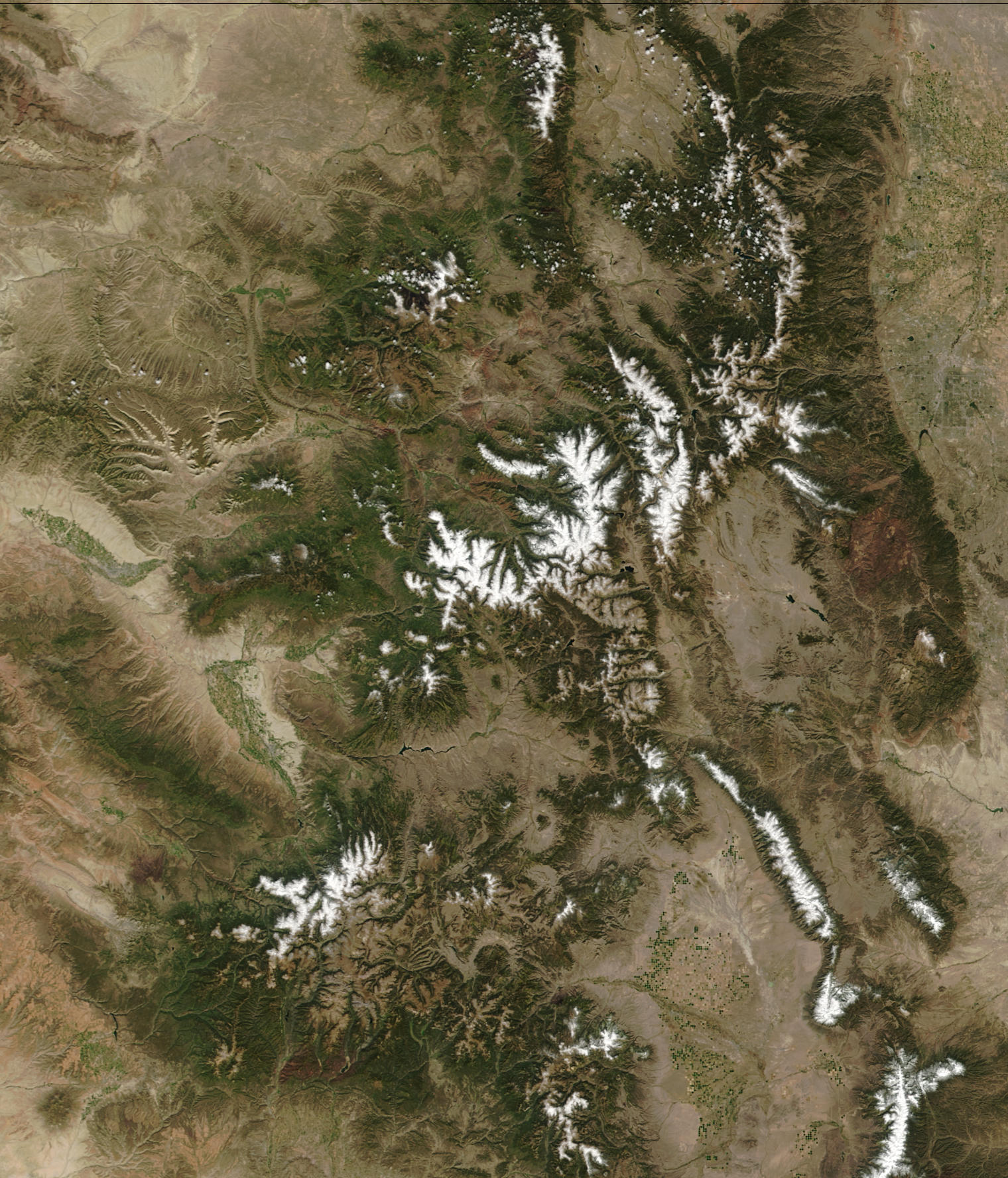
All the major mountain ranges in the state of Colorado, United States, are considered subranges of the Southern Rocky Mountains. As given in the table, topographic elevation is the vertical distance above the reference geoid, a mathematical model of the Earth's sea level as an equipotential gravitational surface. The topographic prominence of a summit is the elevation difference between that summit and the highest or key col to a higher summit. The topographic isolation of a summit is the minimum great-circle distance to a point of equal elevation. All elevations in this article include an elevation adjustment from the National Geodetic Vertical Datum of 1929 (NGVD 29) to the North American Vertical Datum of 1988 (NAVD 88). For further information, please see this United States National Geodetic Surveybr>note If an elevation or prominence is calculated as a range of values, the arithmetic mean is shown. __TOC__ Mountain ranges Gallery Image:Mount_Elbert_June_2006.jpg, ... [...More Info...] [...Related Items...] OR: [Wikipedia] [Google] [Baidu] |
Bouldering
Bouldering is a form of rock climbing that is performed on small rock formations or Climbing wall, artificial rock walls without the use of ropes or Climbing harness, harnesses. While bouldering can be done without any equipment, most climbers use climbing shoes to help secure footholds, Magnesium carbonate, chalk to keep their hands dry and to provide a firmer grip, and bouldering mats to prevent injuries from falls. Unlike free solo climbing, which is also performed without ropes, bouldering problems (the sequence of moves that a climber performs to complete the climb) are usually less than tall. Traverses, which are a form of boulder problem, require the climber to climb horizontally from one end to another. Indoor climbing, Artificial climbing walls allow boulderers to climb indoors in areas without natural boulders. Competition climbing, Bouldering competitions take place in both indoor and outdoor settings. The sport was originally a method of training for roped climbs a ... [...More Info...] [...Related Items...] OR: [Wikipedia] [Google] [Baidu] |
Mountaineering
Mountaineering, mountain climbing, or alpinism is a set of outdoor activities that involves ascending mountains. Mountaineering-related activities include traditional outdoor climbing, skiing, and traversing via ferratas that have become mountain sports, sports in their own right. Indoor climbing, sport climbing, and bouldering are also considered variants of mountaineering by some, but are part of a wide group of mountain sports. Unlike most sports, mountaineering lacks widely applied formal rules, regulations, and governance; mountaineers adhere to a large variety of techniques and philosophies (including grade (climbing), grading and climbing guidebook, guidebooks) when climbing mountains. Numerous local alpine clubs support mountaineers by hosting resources and social activities. A federation of alpine clubs, the International Climbing and Mountaineering Federation (UIAA), is the International Olympic Committee-recognized world organization for mountaineering and climbing. T ... [...More Info...] [...Related Items...] OR: [Wikipedia] [Google] [Baidu] |
Conejos Formation
Conejos is the Spanish term for "rabbits". It may refer to: *Conejos River *Conejos, Colorado *Conejos County, Colorado Conejos County (Spanish language, Spanish for "rabbits") is a county located in the U.S. state of Colorado. As of the 2020 United States census, 2020 census, the population was 7,461. The county seat is the Unincorporated area, unincorporated c ... See also * Conejo (other) {{geodis ... [...More Info...] [...Related Items...] OR: [Wikipedia] [Google] [Baidu] |
Dacite
Dacite () is a volcanic rock formed by rapid solidification of lava that is high in silica and low in alkali metal oxides. It has a fine-grained (aphanitic) to porphyritic texture and is intermediate in composition between andesite and rhyolite. It is composed predominantly of plagioclase feldspar and quartz. Dacite is relatively common, occurring in many tectonic settings. It is associated with andesite and rhyolite as part of the subalkaline tholeiitic and calc-alkaline magma series. Etymology The word ''dacite'' comes from Dacia, a province of the Roman Empire which lay between the Danube River and Carpathian Mountains (now modern Romania and Moldova) where the rock was first described. The term ''dacite'' was used for the first time in the scientific literature in the book ''Geologie Siebenbürgens'' (''The Geology of Transylvania'') by Austrian geologists Franz Ritter von Hauer and Guido Stache. Dacite was originally defined as a new rock type to separate calc-alkaline ... [...More Info...] [...Related Items...] OR: [Wikipedia] [Google] [Baidu] |
Andesite
Andesite () is a volcanic rock of intermediate composition. In a general sense, it is the intermediate type between silica-poor basalt and silica-rich rhyolite. It is fine-grained (aphanitic) to porphyritic in texture, and is composed predominantly of sodium-rich plagioclase plus pyroxene or hornblende. Andesite is the extrusive equivalent of plutonic diorite. Characteristic of subduction zones, andesite represents the dominant rock type in island arcs. The average composition of the continental crust is andesitic. Along with basalts, andesites are a component of the Geology of Mars, Martian crust. The name ''andesite'' is derived from the Andes mountain range, where this rock type is found in abundance. It was first applied by Christian Leopold von Buch in 1826. Description Andesite is an aphanitic (fine-grained) to porphyritic (coarse-grained) igneous rock that is intermediate in its content of silica and low in alkali metals. It has less than 20% quartz and 10% feldspa ... [...More Info...] [...Related Items...] OR: [Wikipedia] [Google] [Baidu] |
Oligocene
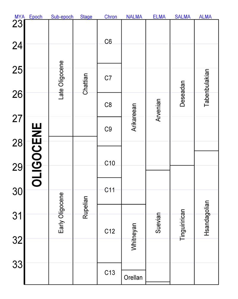
The Oligocene ( ) is a geologic epoch (geology), epoch of the Paleogene Geologic time scale, Period that extends from about 33.9 million to 23 million years before the present ( to ). As with other older geologic periods, the rock beds that define the epoch are well identified but the exact dates of the start and end of the epoch are slightly uncertain. The name Oligocene was coined in 1854 by the German paleontologist Heinrich Ernst Beyrich from his studies of marine beds in Belgium and Germany. The name comes from Ancient Greek (''olígos'') 'few' and (''kainós'') 'new', and refers to the sparsity of Neontology, extant forms of Mollusca, molluscs. The Oligocene is preceded by the Eocene Epoch and is followed by the Miocene Epoch. The Oligocene is the third and final epoch of the Paleogene Period. The Oligocene is often considered an important time of transition, a link between the archaic world of the tropical Eocene and the more modern ecosystems of the Miocene. Major chang ... [...More Info...] [...Related Items...] OR: [Wikipedia] [Google] [Baidu] |
Basalt
Basalt (; ) is an aphanite, aphanitic (fine-grained) extrusive igneous rock formed from the rapid cooling of low-viscosity lava rich in magnesium and iron (mafic lava) exposed at or very near the planetary surface, surface of a terrestrial planet, rocky planet or natural satellite, moon. More than 90% of all volcanic rock on Earth is basalt. Rapid-cooling, fine-grained basalt is chemically equivalent to slow-cooling, coarse-grained gabbro. The eruption of basalt lava is observed by geologists at about 20 volcanoes per year. Basalt is also an important rock type on other planetary bodies in the Solar System. For example, the bulk of the plains of volcanism on Venus, Venus, which cover ~80% of the surface, are basaltic; the lunar mare, lunar maria are plains of flood-basaltic lava flows; and basalt is a common rock on the surface of Mars. Molten basalt lava has a low viscosity due to its relatively low silica content (between 45% and 52%), resulting in rapidly moving lava flo ... [...More Info...] [...Related Items...] OR: [Wikipedia] [Google] [Baidu] |


