|
San Justo Dam
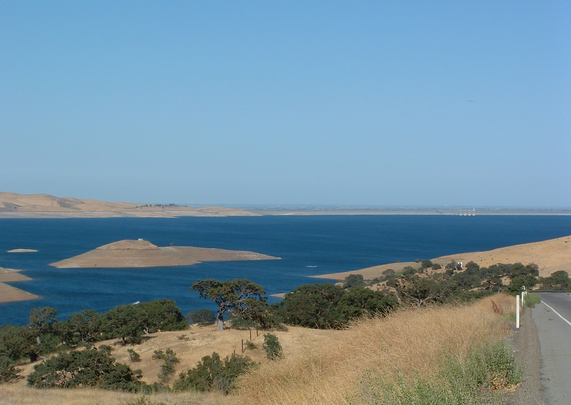
San Justo Dam is a dam and reservoir in San Benito County, California, about southwest of Hollister. The dam provides offstream water storage for the federal Central Valley Project via the Pacheco Conduit and Hollister Conduit fed by the San Luis Reservoir. Completed in January 1986, the dam is an earthfill structure high. Along with a companion dike structure high, it forms a reservoir with a capacity of about . San Justo Reservoir LOSEDwas closed in 2008, following a Zebra mussel infection and remains closed until further notice. See also * List of lakes in California There are more than 3,000 named lakes, reservoirs, and dry lakes in the U.S. state of California. Largest lakes In terms of area covered, the largest lake in California is the Salton Sea, a lake formed in 1905 which is now saline. It occup ... References External links * {{authority control Dams in California United States Bureau of Reclamation dams Reservoirs in San Benito County, ... [...More Info...] [...Related Items...] OR: [Wikipedia] [Google] [Baidu] |
San Benito County, California
San Benito County (; ''San Benito'', Spanish for " St. Benedict"), officially the County of San Benito, is a county located in the Central Coast region of California. Situated in the California Coast Ranges, the county had a population of 64,209, as of the 2020 United States census. The county seat is the city of Hollister. San Benito County is included in the San Jose- Sunnyvale- Santa Clara, CA Metropolitan Statistical Area, which is also included in the San Jose-San Francisco-Oakland, CA Combined Statistical Area. El Camino Real passes through the county and includes one mission in San Juan Bautista. History Before the arrival of the first European settlers, the San Benito County area was inhabited by the Mutsun sub-group of the Ohlone Native Americans. In 1772 Father Juan Crespí conducted a brief expedition into the area and named a small river which he found in honor of San Benito de Nursia (Saint Benedict), the patron saint of monasticism. The county was lat ... [...More Info...] [...Related Items...] OR: [Wikipedia] [Google] [Baidu] |
Hollister, California
Hollister is a city in and the county seat of San Benito County, located in the Central Coast region of California, United States. With a 2020 United States census population of 41,678, Hollister is one of the most populous cities in the Monterey Bay Area and a member of the Association of Monterey Bay Area Governments. The city is an agricultural town known primarily for its local Blenheim apricots, olive oil, vineyards, pomegranates, and chocolate. History The area of modern-day Hollister was historically inhabited by the Mutsun band of the Ohlone Indians. With the construction of Mission San Juan Bautista in 1797, the Ohlone went into the California mission system. The town of Hollister was founded on November 19, 1868, by William Welles Hollister on the grounds of the former Mexican land-grant Rancho San Justo. At the time, Hollister was located within Monterey County, until San Benito County was formed by the California Legislature in 1874 from portions ... [...More Info...] [...Related Items...] OR: [Wikipedia] [Google] [Baidu] |
Central Valley Project
The Central Valley Project (CVP) is a federal power and water management project in the U.S. state of California under the supervision of the United States Bureau of Reclamation (USBR). It was devised in 1933 in order to provide irrigation and municipal water to much of Central Valley (California), California's Central Valley—by regulating and storing water in reservoirs in the northern half of the state (once considered water-rich but suffering water-scarce conditions more than half the year in most years), and transporting it to the water-poor San Joaquin Valley and its surroundings by means of a series of canals, aqueducts and pump plants, some shared with the California State Water Project (SWP). Many CVP water users are represented by the Central Valley Project Water Association. In addition to water storage and regulation, the system has a hydroelectric power, hydroelectric capacity of over 2,000 megawatts, and provides recreation and flood control with its twenty dams a ... [...More Info...] [...Related Items...] OR: [Wikipedia] [Google] [Baidu] |
San Luis Reservoir
The San Luis Reservoir is an artificial lake on San Luis Creek (California), San Luis Creek in the eastern slopes of the Diablo Range of Merced County, California, approximately west of Los Banos, California, Los Banos on California State Route 152, State Route 152, which crosses Pacheco Pass and runs along its north shore. It is the List of largest reservoirs of California, fifth largest reservoir in California. The reservoir stores water taken from the San Joaquin-Sacramento River Delta. Water is pumped uphill into the reservoir from the O'Neill Forebay which is fed by the California Aqueduct and is released back into the forebay to continue downstream along the aqueduct as needed for farm irrigation and other uses. Depending on water levels, the reservoir is approximately long from north to south at its longest point, and five miles (8 km) wide. At the eastern end of the reservoir is the San Luis Dam, the fourth largest embankment dam in the United States, which allows ... [...More Info...] [...Related Items...] OR: [Wikipedia] [Google] [Baidu] |


