|
San Carlos Water
San Carlos Water is a bay/fjord on the west coast of East Falkland, facing onto the Falkland Sound. Name Despite its Spanish language, Spanish-sounding name, there is a wide discrepancy with the Spanish usage, for in Spanish "Estrecho de San Carlos" refers to all of the much larger Falkland Sound, which runs between the two main islands of West Falkland and East Falkland. The settlements of San Carlos, Falkland Islands, San Carlos and Port San Carlos on the Water, as well as San Carlos River (Falkland Islands), San Carlos River, all take their names from the ship ''San Carlos'', which visited in 1768. Description San Carlos Water is a fjord, fjord-like inlet at an angle of 45° to the Falkland Sound coastline, thereby offering shelter from the weather in the Sound (which is itself sheltered from the South Atlantic by bluffs in the north and an archipelago in the south). The inlet is 9.3 miles (15 km) in length and for about half of its length, is about 1.2 mi ... [...More Info...] [...Related Items...] OR: [Wikipedia] [Google] [Baidu] |
Bathymetry
Bathymetry (; ) is the study of underwater depth of ocean floors ('' seabed topography''), river floors, or lake floors. In other words, bathymetry is the underwater equivalent to hypsometry or topography. The first recorded evidence of water depth measurements are from Ancient Egypt over 3000 years ago. Bathymetry has various uses including the production of bathymetric charts to guide vessels and identify underwater hazards, the study of marine life near the floor of water bodies, coastline analysis and ocean dynamics, including predicting currents and tides. Bathymetric charts (not to be confused with '' hydrographic charts''), are typically produced to support safety of surface or sub-surface navigation, and usually show seafloor relief or terrain as contour lines (called '' depth contours'' or '' isobaths'') and selected depths ('' soundings''), and typically also provide surface navigational information. Bathymetric maps (a more general term where navigational safet ... [...More Info...] [...Related Items...] OR: [Wikipedia] [Google] [Baidu] |
Gentoo Penguin
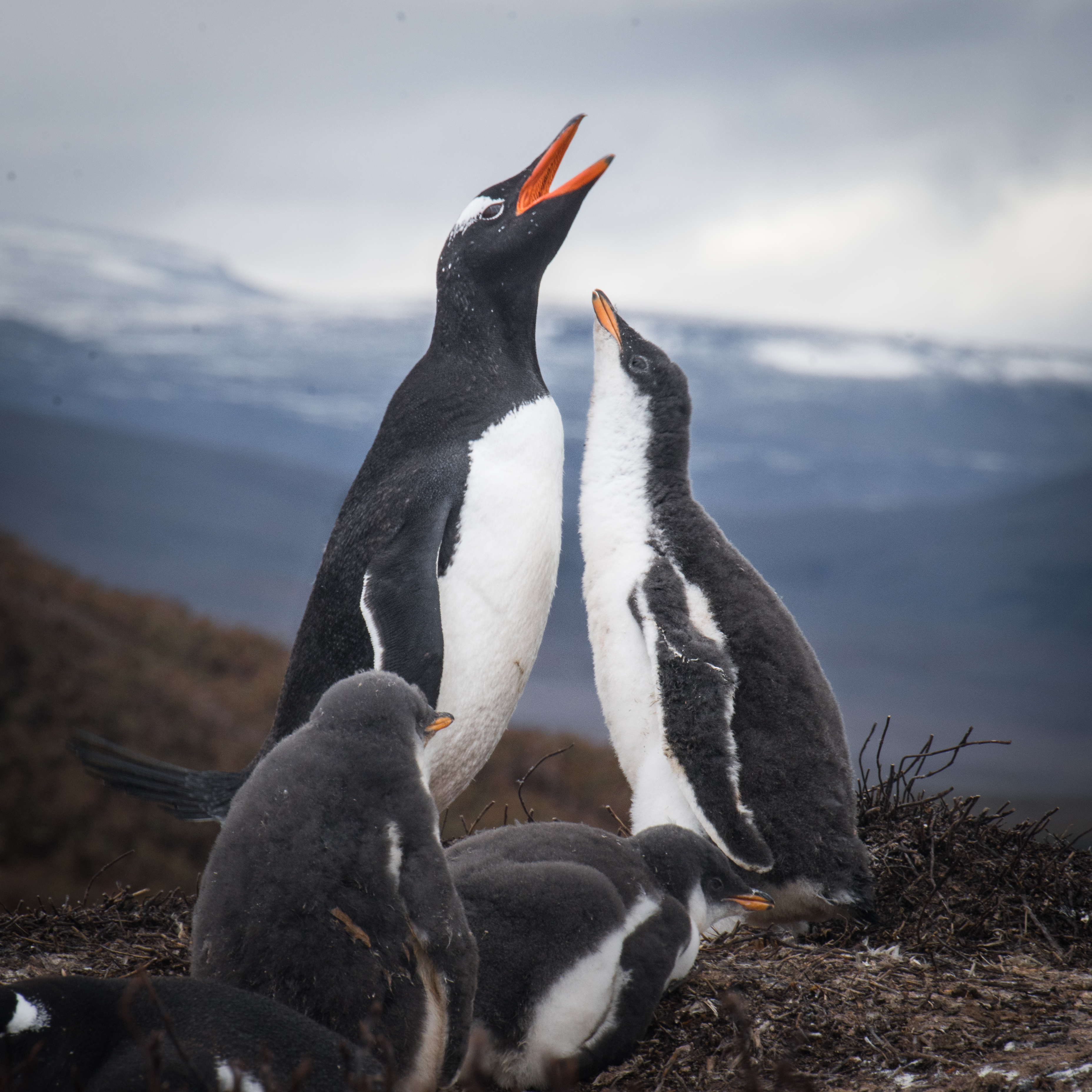
The gentoo penguin ( ) (''Pygoscelis papua'') is a penguin species (or possibly a species complex) in the genus ''Pygoscelis'', most closely related to the Adélie penguin (''P. adeliae'') and the chinstrap penguin (''P. antarcticus''). The earliest scientific description was made in 1781 by Johann Reinhold Forster with a type locality in the Falkland Islands. The species calls in a variety of ways, but the most frequently heard is a loud trumpeting, which the bird emits with its head thrown back. Names The application of "gentoo" to the penguin is unclear. '' Gentoo'' was an Anglo-Indian term to distinguish Hindus from Muslims. The English term may have originated from the Portuguese ''gentio'' ("pagan, gentile"). Some speculate that the white patch on the bird's head was thought to resemble a turban. It may also be a variation of another name for this bird, "Johnny penguin", with Johnny being the Spanish counterpart of and sounding vaguely like gentoo. The Johnny rook, a pr ... [...More Info...] [...Related Items...] OR: [Wikipedia] [Google] [Baidu] |
Grantham Sound
Grantham Sound () is a bay on East Falkland, Falkland Islands, which opens out into the Falkland Sound. At its landward end, it narrows and becomes Brenton Loch (sometimes included as a part of it). Mount Usborne overlooks it. Along with San Carlos Water, it is one of the proposed sites for the East Falkland terminal for the anticipated ferry to West Falkland West Falkland () is the second largest of the Falkland Islands in the South Atlantic. It is a hilly island, separated from East Falkland by the Falkland Sound. Its area is , 37% of the total area of the islands. Its coastline is long. Popula .... References East Falkland Straits of the Falkland Islands {{Falklands-geo-stub ... [...More Info...] [...Related Items...] OR: [Wikipedia] [Google] [Baidu] |
Battle Of San Carlos (1982)
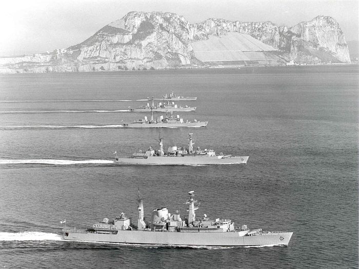
The Battle of San Carlos was a battle between aircraft and ships that lasted from 21 to 25 May 1982 during the British landings on the shores of San Carlos Water (which became known as "Bomb Alley") in the 1982 Falklands War (). Low-flying land-based Argentine jet aircraft made repeated attacks on ships of the British Task Force. It was the first time in history that a modern surface fleet armed with surface-to-air missiles and with air cover from carrier-based aircraft defended against full-scale air strikes. The British sustained losses and damage but were able to create and consolidate a beachhead and land troops. Background After the 1982 invasion of the Falkland Islands, Argentine invasion of the Falkland Islands the United Kingdom initiated Operation Corporate, sending a Task Force British logistics in the Falklands War, 12000 km south in order to retake the islands. Under the codename Operation Sutton the British forces planned amphibious landings around San Carlos, Fal ... [...More Info...] [...Related Items...] OR: [Wikipedia] [Google] [Baidu] |
Falklands War
The Falklands War () was a ten-week undeclared war between Argentina and the United Kingdom in 1982 over two British Overseas Territories, British dependent territories in the South Atlantic: the Falkland Islands and Falkland Islands Dependencies, its territorial dependency, South Georgia and the South Sandwich Islands. The conflict began on 2 April 1982, when 1982 invasion of the Falkland Islands, Argentina invaded and Occupation of the Falkland Islands, occupied the Falkland Islands, followed by the invasion of South Georgia the next day. On 5 April, the British government dispatched a British naval forces in the Falklands War, naval task force to engage the Argentine Navy and Argentine Air Force, Air Force before making an Amphibious warfare, amphibious assault on the islands. The conflict lasted 74 days and ended with an Argentine Argentinian surrender in the Falklands War, surrender on 14 June, returning the islands to British control. In total, 649&nbs ... [...More Info...] [...Related Items...] OR: [Wikipedia] [Google] [Baidu] |
Ajax Bay
Ajax Bay is a settlement on East Falkland, in the Falkland Islands. It is on the north west coast, on the shore of San Carlos Water, a few miles from Port San Carlos. It was mainly a refrigeration plant, and was developed by the Colonial Development Corporation in the 1950s, which was also responsible for developing Port Albemarle. It was supposed to freeze Falkland mutton, but this was found to be economically unviable. Many of the pre-fabricated houses were moved to Stanley. During the Falklands War, the first British bridgehead was established on San Carlos Water on 21 May 1982. Ajax Bay was one of three landing points, and codenamed "Red Beach" as part of Operation Sutton. The next day, the refrigeration plant became a field hospital A field hospital is a temporary hospital or mobile medical unit that takes care of casualties on-site before they can be safely transported to more permanent facilities. This term was initially used in military medicine (such as the M ... [...More Info...] [...Related Items...] OR: [Wikipedia] [Google] [Baidu] |
Chart Datum
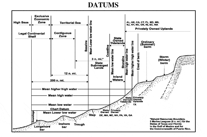
A chart datum is the water surface serving as origin (or coordinate surface) of depths displayed on a nautical chart and for reporting and predicting tide heights. A chart datum is generally derived from some tidal phase, in which case it is also known as a tidal datum. Common chart datums are ''lowest astronomical tide'' (LAT)Australian Bureau of MeteorologNational Tide Centre Glossary(retrieved 30 April 2013) and ''mean lower low water'' (MLLW). In non-tidal areas, e.g. the Baltic Sea, mean sea level (MSL) is used. A chart datum is a type of vertical datum and must not be confused with the horizontal datum for the chart. However, it is necessarily an equigeopotential (a water "level surface"): the chart datum is tilted across smaller to larger tidal range regions; in rivers, it is a sloping and undulating surface following the low stage. Definitions The following tidal phases are commonly used in the definition of chart datums. Lowest and highest astronomical tide ... [...More Info...] [...Related Items...] OR: [Wikipedia] [Google] [Baidu] |
Admiralty Chart
Admiralty charts are nautical charts issued by the United Kingdom Hydrographic Office (UKHO) and subject to Crown Copyright. Over 3,500 Standard Nautical Charts (SNCs) and 14,000 Electronic Navigational Charts (ENCs) are available with the Admiralty portfolio offering the widest official coverage of international shipping routes and ports, in varying detail. Admiralty charts have been produced by UKHO for over 200 years, with the primary aim of saving and protecting lives at sea. The core market for these charts includes over 40,000 defence and merchant ships globally. Today, their products are used by over 90% of ships trading internationally. History The British admiralty charts are compiled, drawn and issued by the Hydrographic Office. This department of the Admiralty was established under Earl Spencer by an order in council in 1795, consisting of the Hydrographer, Alexander Dalrymple, one assistant and a draughtsman. The initial remit was to organise the cha ... [...More Info...] [...Related Items...] OR: [Wikipedia] [Google] [Baidu] |
Archipelago
An archipelago ( ), sometimes called an island group or island chain, is a chain, cluster, or collection of islands. An archipelago may be in an ocean, a sea, or a smaller body of water. Example archipelagos include the Aegean Islands (the origin of the term), the Canadian Arctic Archipelago, the Stockholm Archipelago, the Malay Archipelago (which includes the Indonesian and Philippine Archipelagos), the Lucayan (Bahamian) Archipelago, the Japanese archipelago, and the Hawaiian Archipelago. Etymology The word ''archipelago'' is derived from the Italian ''arcipelago'', used as a proper name for the Aegean Sea, itself perhaps a deformation of the Greek Αιγαίον Πέλαγος. Later, usage shifted to refer to the Aegean Islands (since the sea has a large number of islands). The erudite paretymology, deriving the word from Ancient Greek ἄρχι-(''arkhi-'', "chief") and πέλαγος (''pélagos'', "sea"), proposed by Buondelmonti, can still be found. Geograph ... [...More Info...] [...Related Items...] OR: [Wikipedia] [Google] [Baidu] |
Fjord
In physical geography, a fjord (also spelled fiord in New Zealand English; ) is a long, narrow sea inlet with steep sides or cliffs, created by a glacier. Fjords exist on the coasts of Antarctica, the Arctic, and surrounding landmasses of the northern and southern hemispheres. Norway's coastline is estimated to be long with its nearly 1,200 fjords, but only long excluding the fjords. Formation A true fjord is formed when a glacier cuts a U-shaped valley by ice segregation and abrasion of the surrounding bedrock. According to the standard model, glaciers formed in pre-glacial valleys with a gently sloping valley floor. The work of the glacier then left an overdeepened U-shaped valley that ends abruptly at a valley or trough end. Such valleys are fjords when flooded by the ocean. Thresholds above sea level create freshwater lakes. Glacial melting is accompanied by the rebounding of Earth's crust as the ice load and eroded sediment is removed (also called isostasy or gla ... [...More Info...] [...Related Items...] OR: [Wikipedia] [Google] [Baidu] |
South Atlantic
The Atlantic Ocean is the second largest of the world's five oceanic divisions, with an area of about . It covers approximately 17% of Earth's surface and about 24% of its water surface area. During the Age of Discovery, it was known for separating the New World of the Americas (North America and South America) from the Old World of Afro-Eurasia (Africa, Asia, and Europe). Through its separation of Afro-Eurasia from the Americas, the Atlantic Ocean has played a central role in the development of human society, globalization, and the histories of many nations. While the Norse were the first known humans to cross the Atlantic, it was the expedition of Christopher Columbus in 1492 that proved to be the most consequential. Columbus's expedition ushered in an age of exploration and colonization of the Americas by European powers, most notably Portugal, Spain, France, and the United Kingdom. From the 16th to 19th centuries, the Atlantic Ocean was the center of both an epo ... [...More Info...] [...Related Items...] OR: [Wikipedia] [Google] [Baidu] |


