|
Samos Prefecture
Samos Prefecture () was a prefecture in Greece, consisting of the islands of Samos, Ikaria and the smaller islands of Fournoi Korseon. In 2011 the prefecture was abolished and the territory is now covered by the regional units of Samos and Ikaria. Its capital was the town of Vathy, on Samos. Provinces The provinces were: * Samos Province - Samos * Ikaria Province Ikaria () is one of the regional units of Greece. It is part of the region of North Aegean. The regional unit covers the island of Ikaria and the small archipelago Fournoi Korseon, in the Aegean Sea. Administration As a part of the 2011 Kallik ... - Agios Kirykos Municipalities See also *The Eupalinian aqueduct * List of settlements in Samos * List of settlements in the Ikaria regional unit References External links Prefecture of Samos [...More Info...] [...Related Items...] OR: [Wikipedia] [Google] [Baidu] |
Prefectures Of Greece
Until the Kallikratis reform in 2010, the prefectures () were the second-level administrative regions of Greece. They are now defunct, and have been approximately replaced by regional units. They are called departments in ISO 3166-2:GR and by the United Nations Group of Experts on Geographical Names. The prefectures were the second-degree organization of local government, grouped into 13 regions or (before 1987) 10 geographical departments, and in turn divided into provinces and comprising a number of communities and municipalities. The prefectures became self-governing entities in 1994, when the first prefectural-level elections took place. The prefects were previously appointed by the government. By 2010, their number had risen to 51, of which one, the Attica Prefecture, where more than a third of the country's population resided, was further subdivided into four prefecture-level administrations (νομαρχίες, sing. νομαρχία). In addition, there were three ... [...More Info...] [...Related Items...] OR: [Wikipedia] [Google] [Baidu] |
Provinces Of Greece
The provinces of Greece (, "eparchy") were sub-divisions of some the country's prefectures of Greece, prefectures. From 1887, the provinces were abolished as actual administrative units, but were retained for some state services, especially financial and educational services, as well as for electoral purposes. Before the Second World War, there were 139 provinces, and after the war, with the addition of the Dodecanese, Dodecanese Islands, their number grew to 148. According to the Article 7 of the Code of Prefectural Self-Government (Presidential Decree 30/1996), the provinces constituted a "particular administrative district" within the wider "administrative district" of the prefectures. The provinces were finally abolished after the 2006 Greek local elections, 2006 local elections, in line with Law 2539/1997, as part of the wide-ranging administrative reform known as the "Kapodistrias reform, Kapodistrias Project", and replaced by enlarged Municipalities and communities of G ... [...More Info...] [...Related Items...] OR: [Wikipedia] [Google] [Baidu] |
Geography Of The North Aegean
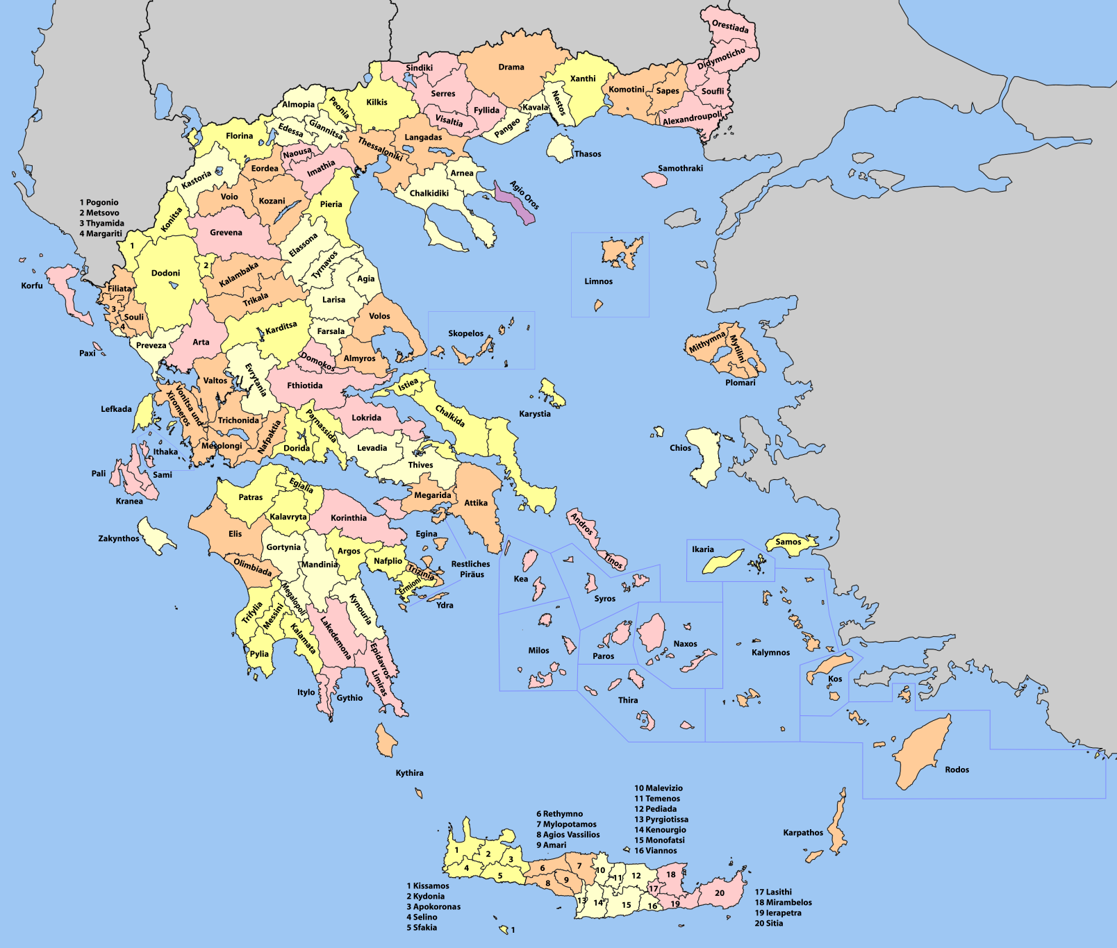
Geography (from Ancient Greek ; combining 'Earth' and 'write', literally 'Earth writing') is the study of the lands, features, inhabitants, and phenomena of Earth. Geography is an all-encompassing discipline that seeks an understanding of Earth and its human and natural complexities—not merely where objects are, but also how they have changed and come to be. While geography is specific to Earth, many concepts can be applied more broadly to other celestial bodies in the field of planetary science. Geography has been called "a bridge between natural science and social science disciplines." Origins of many of the concepts in geography can be traced to Greek Eratosthenes of Cyrene, who may have coined the term "geographia" (). The first recorded use of the word γεωγραφία was as the title of a book by Greek scholar Claudius Ptolemy (100 – 170 AD). This work created the so-called "Ptolemaic tradition" of geography, which included "Ptolemaic cartographic theory." ... [...More Info...] [...Related Items...] OR: [Wikipedia] [Google] [Baidu] |
List Of Settlements In The Ikaria Regional Unit ...
This is a list of settlements in the Ikaria regional unit, Greece. * Agios Kirykos * Agios Polykarpos * Arethousa * Chrysostomos * Dafni * Evdilos * Fournoi Korseon * Frantato * Karavostamo * Karkinagri * Manganitis * Perdiki * Raches By municipality {{Ikaria div Fournoi Korseon (no subdivisions) See also *List of towns and villages of Greece * Ikaria Ikaria, also spelled Icaria (; ), is a Greece, Greek island in the Aegean Sea, 10 nautical miles (19 km) southwest of Samos. Administratively, Ikaria forms a separate municipality within the Ikaria (regional unit), Ikaria regional unit, ... [...More Info...] [...Related Items...] OR: [Wikipedia] [Google] [Baidu] |
List Of Settlements In Samos ...
This is a list of settlements in the island of Samos, Greece. * Agioi Theodoroi * Agios Konstantinos * Ampelos * Chora * Drakaioi * Kallithea * Karlovasi * Kastania * Kokkari * Kontaiika * Kontakaiika * Kosmadaioi * Koumaiika * Koumaradaioi * Leka * Manolates * Marathokampos * Mavratzaioi * Mesogeio * Myloi * Mytilinioi * Neochori * Pagondas * Palaiokastro * Pandroso * Platanos * Pyrgos * Pythagoreio * Samos * Skouraiika * Spatharaioi * Stavrinides * Vathy * Vourliotes * Ydroussa See also *List of towns and villages in Greece References {{reflist Samos Samos (, also ; , ) is a Greek island in the eastern Aegean Sea, south of Chios, north of Patmos and the Dodecanese archipelago, and off the coast of western Turkey, from which it is separated by the Mycale Strait. It is also a separate reg ... [...More Info...] [...Related Items...] OR: [Wikipedia] [Google] [Baidu] |
Eupalinian Aqueduct
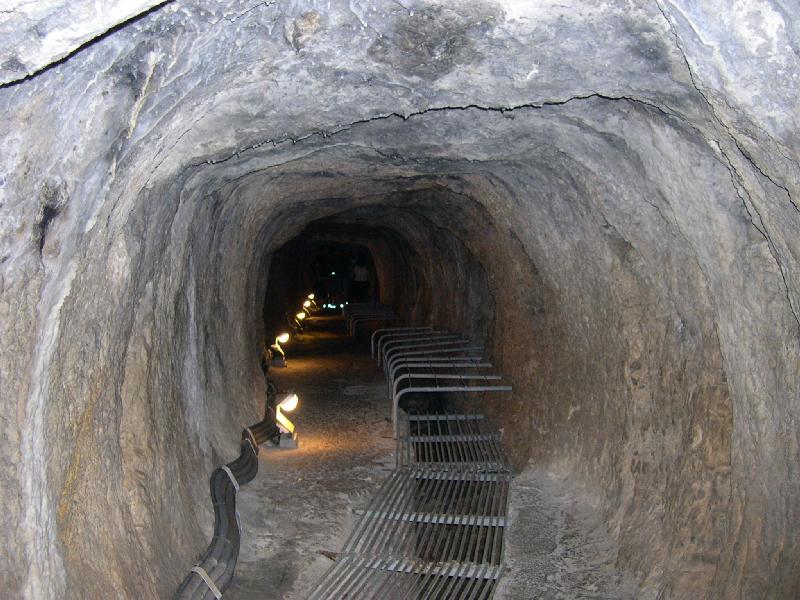
The Tunnel of Eupalinos or Eupalinian aqueduct () is a tunnel of length running through Mount Kastro in Samos, Greece, built in the 6th century BC to serve as an aqueduct. The tunnel is the second known tunnel in history which was excavated from both ends (, "having two openings"), and the first with a geometry-based approach in doing so. Today it is a popular tourist attraction. The tunnel is inscribed on the UNESCO World Heritage List along with the nearby Pythagoreion and Heraion of Samos, and it was designated as an International Historic Civil Engineering Landmark in 2017. Early history The Eupalinian aqueduct is described by Herodotus (''Histories'' 3.60): :I have dwelt longer upon the history of the Samians than I should otherwise have done, because they are responsible for three of the greatest building and engineering feats in the Greek world: the first is a tunnel nearly a mile long, eight feet wide and eight feet high, driven clean through the base of a hill nine ... [...More Info...] [...Related Items...] OR: [Wikipedia] [Google] [Baidu] |
Pythagoreio
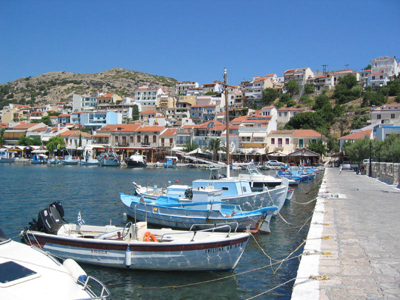
Pythagoreio () is a town and municipal unit on the island of Samos, North Aegean, Greece. Before the 2011 local government reform, Pythagoreio was a municipality. Since 2019, it is a municipal unit of East Samos. In 2021, the town's population was 7,515. It is the largest municipal unit in land area on Samos, at . It shares the island with the municipal units of Vathy, Karlovasi, and Marathokampos. The archaeological remains in the town, known collectively as Pythagoreion, has designated a joint UNESCO World Heritage Site with nearby Heraion. The seat of the municipality was the town of Pythagorio, formerly known as Tigani. The town was renamed in 1955 to honour the locally born mathematician and philosopher Pythagoras. The port of the town is considered to be the oldest man-made port of the Mediterranean Sea. History Pythagorio is built on the ancient city of Samos. Some ruins of the ancient city are today incorporated in modern houses of Pythagorio. The ancient city reach ... [...More Info...] [...Related Items...] OR: [Wikipedia] [Google] [Baidu] |
Marathokampos
Marathokampos () is a town, municipal unit, and a former municipality on the island of Samos, North Aegean, Greece Greece, officially the Hellenic Republic, is a country in Southeast Europe. Located on the southern tip of the Balkan peninsula, it shares land borders with Albania to the northwest, North Macedonia and Bulgaria to the north, and Turkey to th .... Since the 2019 local government reform it is part of the municipality West Samos, of which it is a municipal unit. The population is 2,401 (2021 census) and the land area is 87.250 km². It shares the island of Samos with the municipal units of Vathy, Pythagoreio, and Karlovasi. It is the smallest of the four in both land area and population. Communities The municipal unit contains five communities (κοινότητες, ''koinótites''). References External linksOfficial website Populated places in Samos {{NorthAegean-geo-stub ... [...More Info...] [...Related Items...] OR: [Wikipedia] [Google] [Baidu] |
Karlovasi
Karlovasi () is a town, a municipal unit, and a former municipality on the island of Samos, North Aegean, Greece. Since the 2019 local government reform it is part of the municipality West Samos, of which it is a municipal unit and the seat. It is located on the northwest side of the island and it is considered the commercial center of the island. According to the 2021 census, the population of the municipal unit was 10,220 inhabitants. Its land area is 100.330 km2. The municipal unit shares the island of Samos with the municipal units of Vathy, Pythagoreio, and Marathokampos. School of Sciences of University of the Aegean The School of Sciences of University of the Aegean is located in the town and currently there are three academic departments: * Department of Mathematics * Department of Information and Communication Systems Engineering * Department of Statistics and Actuarial - Financial Mathematics There are over 1,000 active students living in the town throughout ... [...More Info...] [...Related Items...] OR: [Wikipedia] [Google] [Baidu] |
Raches
Raches () is a village and a former municipality on the island of Ikaria, North Aegean, Greece. Since the 2011 local government reform it is part of the municipality Ikaria, of which it is a municipal unit. With a population of 2,282 inhabitants (2021 census) and a land area of 101.768 km2, it is the largest in area, smallest in population, and therefore the least densely populated of the three municipal units on Icaria. The other two municipal units are Agios Kirykos and Evdilos Evdilos (Greek: Εύδηλος) is a village and a former municipality in the central part of the island of Ikaria, North Aegean, Greece. Since the 2011 local government reform it is part of the municipality Ikaria, of which it is a municipal unit. .... References External links Ikaria info Populated places in Ikaria (regional unit) {{NorthAegean-geo-stub ... [...More Info...] [...Related Items...] OR: [Wikipedia] [Google] [Baidu] |
Evdilos
Evdilos (Greek: Εύδηλος) is a village and a former municipality in the central part of the island of Ikaria, North Aegean, Greece. Since the 2011 local government reform it is part of the municipality Ikaria, of which it is a municipal unit. 40 km northwest of Agios Kirykos Agios Kirykos () is a town and a former municipality on the island of Ikaria, North Aegean, Greece. Since the 2011 local government reform it is part of the municipality Ikaria Ikaria, also spelled Icaria (; ), is a Greece, Greek island in th .... Its name means visible and freely rendered open horizon. It is a new seaside settlement built after 1830 when piracy was completely stamped out on the island. Evdilos was the first capital of the island. Today it is the second port and the center of northern, central, and western Ikaria. Together with other settlements, it forms the municipal unit of Evdilos and had 2,996 permanent inhabitants at the 2021 census. The municipal unit has a land area of ... [...More Info...] [...Related Items...] OR: [Wikipedia] [Google] [Baidu] |
Icaria
Ikaria, also spelled Icaria (; ), is a Greek island in the Aegean Sea, 10 nautical miles (19 km) southwest of Samos. Administratively, Ikaria forms a separate municipality within the Ikaria regional unit, which is part of the North Aegean region. The principal town of the island and seat of the municipality is Agios Kirykos. The historic capitals of the island include Oenoe and Evdilos. According to tradition, it derives its name from Icarus, the son of Daedalus in Greek mythology, who was believed to have fallen into the sea nearby and to have been buried on the island. Geography and climate Ikaria is one of the middle islands of the northern Aegean, in area with of coastline and a population of 8,312 inhabitants. The topography is a contrast between verdant slopes and barren steep rocks. The island is mountainous for the most part. It is traversed by the Aetheras range, whose highest summit is . Most of its villages are nestled in the plains near the coast, w ... [...More Info...] [...Related Items...] OR: [Wikipedia] [Google] [Baidu] |


